Chisworth

Civil Parish in Derbyshire High Peak

England

Chisworth

Old Wayside Cross near Ludworth Moor Farm Robin Hood's Picking Rods or The Maiden Stones, the old base and stumps of two shafts of a wayside cross. Set beside a bridleway, part of the Cown Edge Way, north of Ludworth Moor Farm. On the former boundary of Ludworth and Chisworth Township, Beard, Thornsett, Ottersett and Whittle Township and Mellor Chapelry, all three in Glossop Parish until 1866. A Scheduled Monument, details <span class="nowrap"><a title="https://historicengland.org.uk/listing/the-list/list-entry/1008595" rel="nofollow ugc noopener" href="https://historicengland.org.uk/listing/the-list/list-entry/1008595">Link</a><img style="margin-left:2px;" alt="External link" title="External link - shift click to open in new window" src="https://s1.geograph.org.uk/img/external.png" width="10" height="10"/></span>. Reference also “Crosses of the Peak District” by Neville T Sharpe, Landmark Publishing Ltd.

Milestone Society National ID: DEHP_CHI01
Old Wayside Cross near Ludworth Moor Farm Credit: Mike Rayner

Chisworth is a civil parish located in the county of Derbyshire, England. It is situated in the High Peak district, in the East Midlands region of the country. The parish covers an area of approximately 2.5 square miles and is home to a population of around 500 residents.

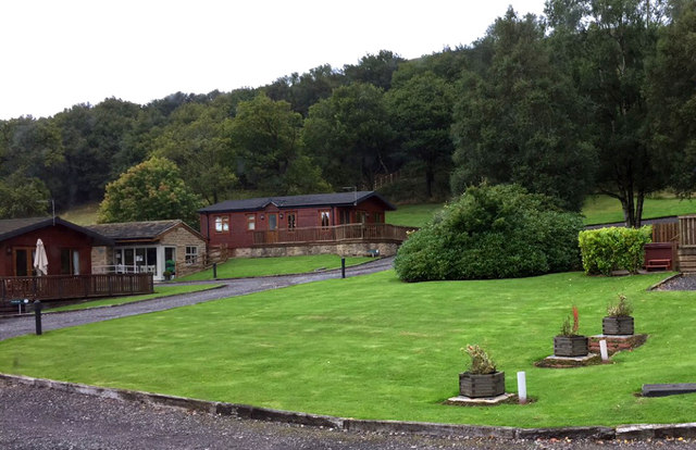
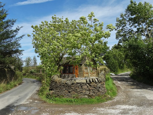
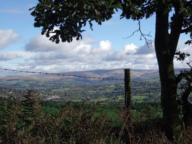
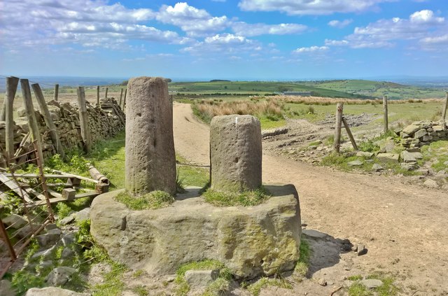
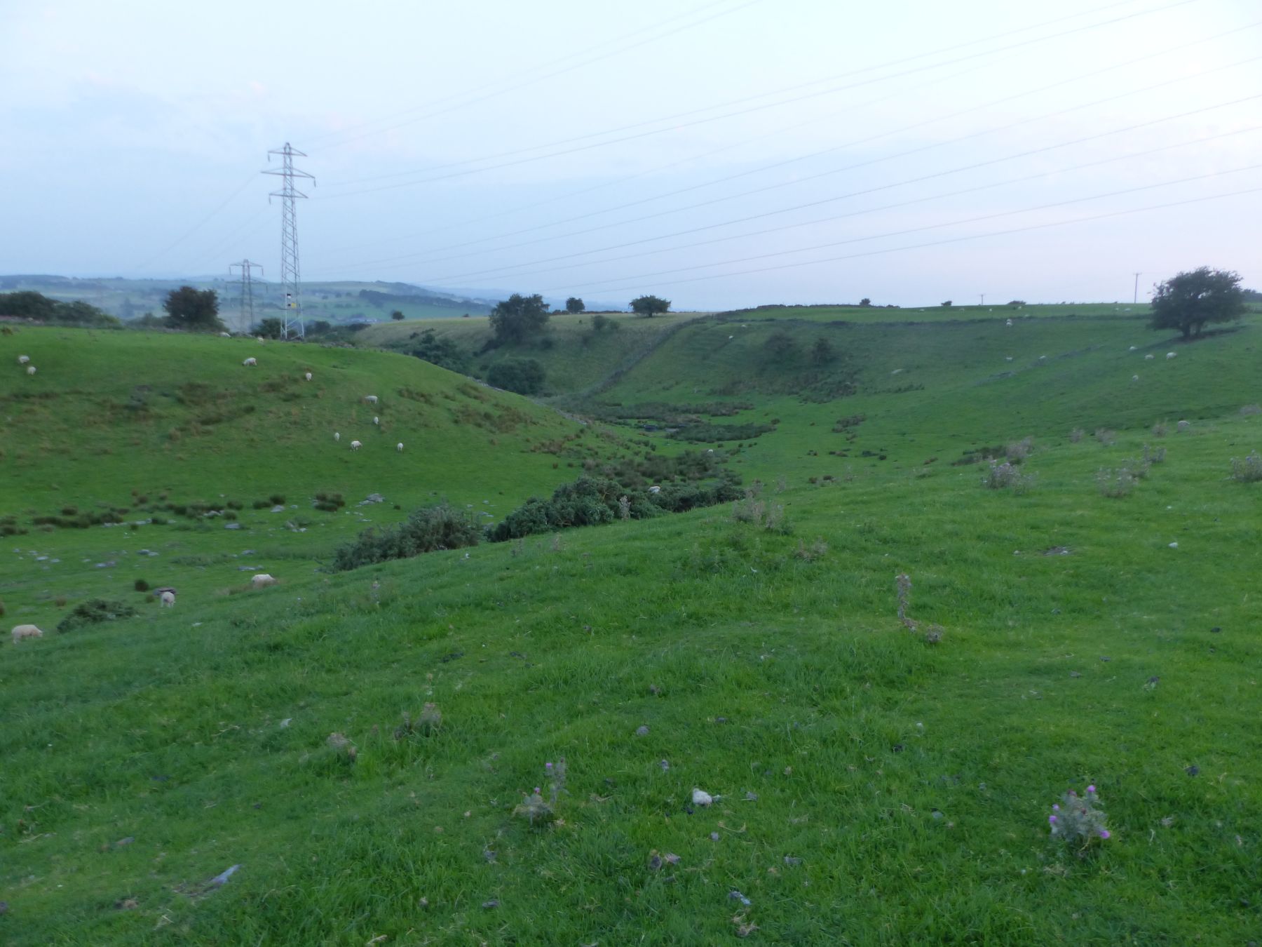
The village of Chisworth is nestled within the scenic Peak District National Park, offering residents and visitors stunning views of the surrounding countryside. The area is known for its picturesque landscapes, rolling hills, and quaint rural charm. It is a popular destination for outdoor enthusiasts, with ample opportunities for hiking, cycling, and exploring the natural beauty of the national park.

Chisworth has a rich history, with evidence of human activity in the area dating back to the Bronze Age. The village is dotted with historical landmarks, including St. Margaret's Church, a Grade II listed building that dates back to the 14th century. The church is a focal point of the community and provides a glimpse into the area's past.

Although Chisworth is a small village, it offers a range of amenities for its residents. These include a local pub, a primary school, and various community organizations. The village has a close-knit community spirit, with regular events and activities bringing people together.

Overall, Chisworth is a charming and idyllic civil parish nestled within the stunning landscapes of the Peak District. It offers a peaceful and picturesque setting for residents and visitors alike, with a rich history and a strong sense of community.

If you have any feedback on the listing, please let us know in the comments section below.

Chisworth Images

Images are sourced within 2km of 53.41824/-2.004586 or Grid Reference SJ9991. Thanks to Geograph Open Source API. All images are credited.

Old Wayside Cross near Ludworth Moor Farm Robin Hood's Picking Rods or The Maiden Stones, the old base and stumps of two shafts of a wayside cross. Set beside a bridleway, part of the Cown Edge Way, north of Ludworth Moor Farm. On the former boundary of Ludworth and Chisworth Township, Beard, Thornsett, Ottersett and Whittle Township and Mellor Chapelry, all three in Glossop Parish until 1866. A Scheduled Monument, details <span class="nowrap"><a title="https://historicengland.org.uk/listing/the-list/list-entry/1008595" rel="nofollow ugc noopener" href="https://historicengland.org.uk/listing/the-list/list-entry/1008595">Link</a><img style="margin-left:2px;" alt="External link" title="External link - shift click to open in new window" src="https://s1.geograph.org.uk/img/external.png" width="10" height="10"/></span>. Reference also “Crosses of the Peak District” by Neville T Sharpe, Landmark Publishing Ltd.

Milestone Society National ID: DEHP_CHI01
Old Wayside Cross near Ludworth Moor Farm
Robin Hood's Picking Rods or The Maiden Stones, the old base and stumps of two shafts of a wayside cross. Set beside a bridleway, part of the Cown Edge Way, north of Ludworth Moor Farm. On the former boundary of Ludworth and Chisworth Township, Beard, Thornsett, Ottersett and Whittle Township and Mellor Chapelry, all three in Glossop Parish until 1866. A Scheduled Monument, details LinkExternal link. Reference also “Crosses of the Peak District” by Neville T Sharpe, Landmark Publishing Ltd. Milestone Society National ID: DEHP_CHI01
Coombes Rocks
Coombes Rocks
Cown Edge Way High altitude rough grazing land used by cattle and sheep.
Cown Edge Way
High altitude rough grazing land used by cattle and sheep.
Holiday park, Charlesworth
On the edge
On the edge
Robin Hoods Picking Rods With unclear origins Robin Hoods Picking Rods have stood on this Derbyshire ground for many centuries, I would like to think a person  of the distant future standing on this same spot seeing a very similar view would have the same sense of time unending.
Robin Hoods Picking Rods
With unclear origins Robin Hoods Picking Rods have stood on this Derbyshire ground for many centuries, I would like to think a person of the distant future standing on this same spot seeing a very similar view would have the same sense of time unending.
Cown Edge Way This section of the footpath runs along a relatively flat strip of land about 200m wide between Coombes Rocks and Cown Edge.
Cown Edge Way
This section of the footpath runs along a relatively flat strip of land about 200m wide between Coombes Rocks and Cown Edge.
Road junction at Pistol Farm On Gun Road. The lane to the right leads to Far Slack Farm and Near Slack Farm too. At this junction there is a small modern cottage.
Road junction at Pistol Farm
On Gun Road. The lane to the right leads to Far Slack Farm and Near Slack Farm too. At this junction there is a small modern cottage.
The way to Near Slack Farm
Tumbledown buildings at Near Slack Farm
Path junction north east of Near Slack Farm
Far Cown Edge Farm Nestling to the east of Cown Edge in a late summer landscape.
Far Cown Edge Farm
Nestling to the east of Cown Edge in a late summer landscape.
Walking towards Cown Edge Plantation On Cown Edge Way
Walking towards Cown Edge Plantation
On Cown Edge Way
Sheep on Cown Edge With Manchester visible in the distance
Sheep on Cown Edge
With Manchester visible in the distance
View from Beacon Lane View from Beacon Lane looking over the River Etherow valley with the hills of the Dark Peak in the distance.
View from Beacon Lane
View from Beacon Lane looking over the River Etherow valley with the hills of the Dark Peak in the distance.
Cown Edge Sunny April, excellent views.
Cown Edge
Sunny April, excellent views.
Large new barn In what seems to be the middle of nowhere
Large new barn
In what seems to be the middle of nowhere
Robin Hood's Picking Rods But what were they? How old are they? Markers to indicate a boundary, the stumps of twin crosses?

We don't really know, but they're old, possibly even pre-Norman, see; <span class="nowrap"><a title="http://www.mellorarchaeology-2000-2010.org.uk/archaeology/finds/merciancrosses.htm" rel="nofollow ugc noopener" href="http://www.mellorarchaeology-2000-2010.org.uk/archaeology/finds/merciancrosses.htm">Link</a><img style="margin-left:2px;" alt="External link" title="External link - shift click to open in new window" src="https://s1.geograph.org.uk/img/external.png" width="10" height="10"/></span>
Robin Hood's Picking Rods
But what were they? How old are they? Markers to indicate a boundary, the stumps of twin crosses? We don't really know, but they're old, possibly even pre-Norman, see; LinkExternal link
Show me another place!

Chisworth is located at Grid Ref: SJ9991 (Lat: 53.41824, Lng: -2.004586)

Administrative County: Derbyshire

District: High Peak

Police Authority: Derbyshire

What 3 Words

///famines.dissolves.shark. Near Marple, Manchester

Related Wikis

Ludworth Intake

Ludworth Intake (grid reference SJ994911) is a 5.1-hectare (13-acre) geological Site of Special Scientific Interest at Ludworth on the border of Derbyshire...
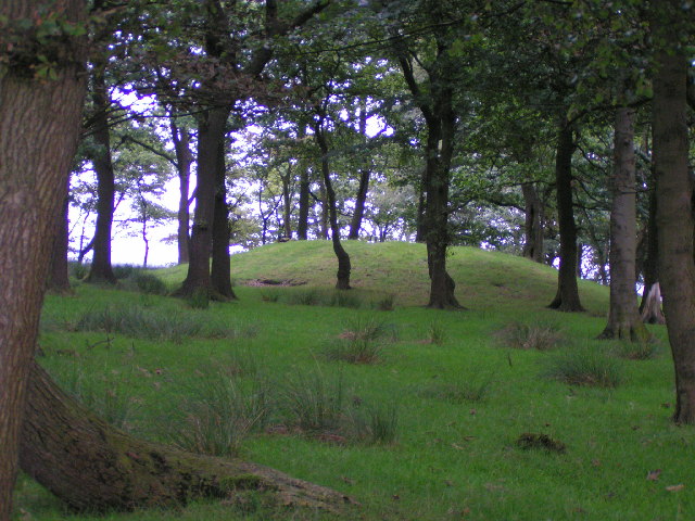
Brown Low

Brown Low is a bowl barrow most likely dating to the Bronze Age. An earth and stone mound survives east of Marple, Greater Manchester (grid reference SJ98829092...

Chisworth

Chisworth is a hamlet near Glossop, Derbyshire, England. It is 3 miles (4.8 km) south-west of Glossop town centre, on the south side of the Etherow valley...

Holehouse

Holehouse is a hamlet in Derbyshire, England. It is located 2 miles west of Glossop, on the A626 road close to Charlesworth.

Nearby Amenities

Located within 500m of 53.41824,-2.004586
Higher Chisworth
Alt Name: Chisworth
Is In: High Peak, Derbyshire, England, UK
Name Ur: ہائر چز ورتھ
Place: village
Source: npe
Lat/Long: 53.4220191/-2.0068844
Passing Place
Lat/Long: 53.4185167/-2.0067028
Passing Place
Lat/Long: 53.420068/-2.003911
Passing Place
Lat/Long: 53.420648/-2.00436
Barrier: stile
Lat/Long: 53.4219725/-2.0074636
Power: tower
Lat/Long: 53.4188828/-2.011228
Power: tower
Lat/Long: 53.4158477/-2.010765
Power: tower
Lat/Long: 53.4171113/-2.0107052
Power: tower
Lat/Long: 53.4183877/-2.0114861
Power: tower
Lat/Long: 53.4155619/-2.0102689
Ele: 281.3093262
Note: Possible parking on the grass verge
Lat/Long: 53.4149361/-2.0034396
Parking
Description: Layby
Lat/Long: 53.4148463/-2.0034734
Barrier: stile
Material: wood
Step Count: 2
Stile: stepover
Lat/Long: 53.4150131/-2.0050979
Barrier: stile
Material: wood
Step Count: 2
Stile: stepover
Lat/Long: 53.4147198/-2.0080908
The data included in this document is from www.openstreetmap.org. The data is made available under ODbL.

Have you been to Chisworth?

Leave your review of Chisworth below (or comments, questions and feedback).