Chiseldon

Civil Parish in Wiltshire

England

Chiseldon

A346 towards Swindon On a long Roman straight.
A346 towards Swindon Credit: Robin Webster

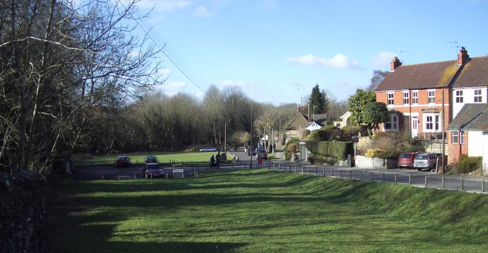
Chiseldon is a civil parish located in the county of Wiltshire, England. Situated approximately 6 miles southeast of Swindon, it covers an area of around 19 square kilometers and has a population of around 3,000 people.

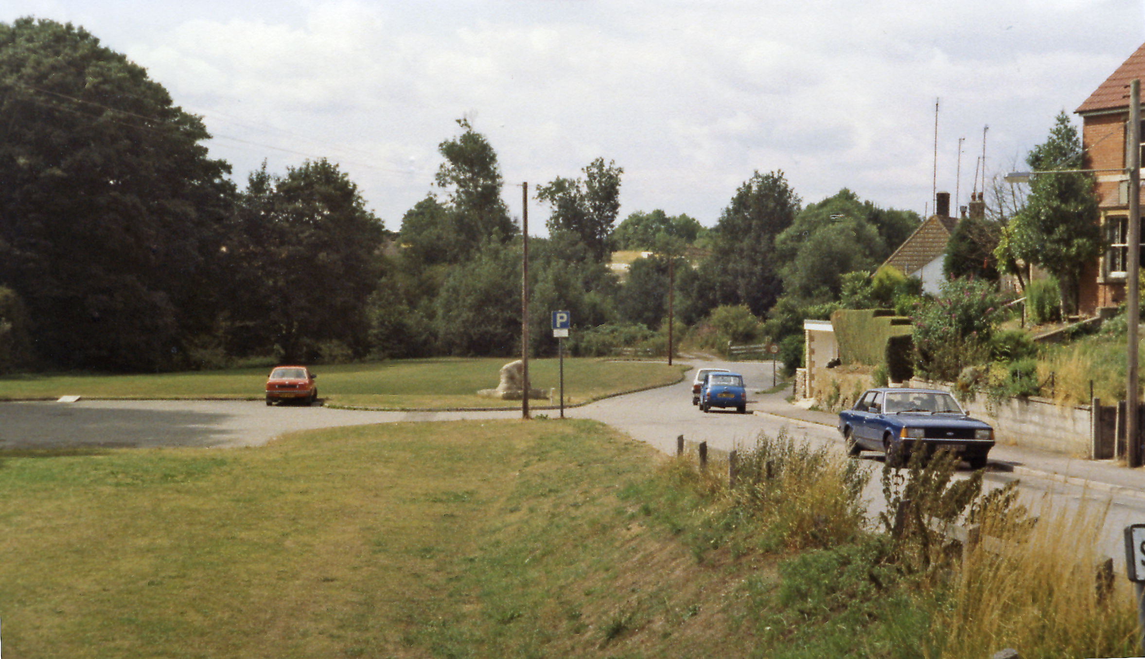
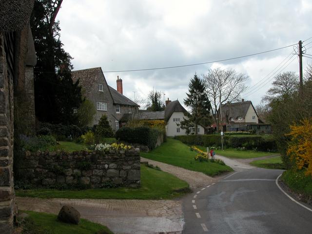
The parish is predominantly rural in nature, with a few scattered settlements and a number of farms. It is surrounded by picturesque countryside, characterized by rolling hills, meadows, and woodlands. The area benefits from the proximity to the Marlborough Downs, which offer stunning views and opportunities for outdoor activities such as hiking and cycling.

Chiseldon has a rich history, with evidence of human settlement dating back to the Iron Age. The village itself has a charming and traditional atmosphere, with a mix of old cottages and more modern houses. The parish church, dedicated to St. Mary, is a notable landmark, boasting a medieval tower and beautiful stained glass windows.

Despite its rural setting, Chiseldon benefits from good transport links. The M4 motorway runs just to the north of the parish, providing easy access to both London and Bristol. The nearby town of Swindon offers a range of amenities, including shops, schools, and leisure facilities.

Overall, Chiseldon is a peaceful and idyllic rural parish, offering a tranquil and picturesque setting for its residents, while still providing convenient access to nearby towns and cities.

If you have any feedback on the listing, please let us know in the comments section below.

Chiseldon Images

Images are sourced within 2km of 51.507775/-1.740075 or Grid Reference SU1878. Thanks to Geograph Open Source API. All images are credited.

A346 towards Swindon On a long Roman straight.
A346 towards Swindon
On a long Roman straight.
A346 Marlborough Road, Chiseldon Towards Swindon.
A346 Marlborough Road, Chiseldon
Towards Swindon.
Old Entrance to Chiseldon Camp The blocked up entrance to an area formerly the site of Chiseldon Camp, a military site in use from the first world war up to the 1960s. Not much remains, mostly a grid of old roads. 
More recently there was a caravan site here, but that has also gone. 
The signpost points the route of the Chiseldon & Marlborough Railway Path which comes past here.
Old Entrance to Chiseldon Camp
The blocked up entrance to an area formerly the site of Chiseldon Camp, a military site in use from the first world war up to the 1960s. Not much remains, mostly a grid of old roads. More recently there was a caravan site here, but that has also gone. The signpost points the route of the Chiseldon & Marlborough Railway Path which comes past here.
A346 past Chiseldon Camp On the course of an old Roman Road the A346 heads towards Swindon past the disused entrance road into a former caravan site and before that an old army camp dating from WW1 and closed in the 1960s.
A346 past Chiseldon Camp
On the course of an old Roman Road the A346 heads towards Swindon past the disused entrance road into a former caravan site and before that an old army camp dating from WW1 and closed in the 1960s.
All About Chiseldon Camp Beside the Railway Path is a visitor board about the extensive army camp on this site which was in use from 1914 to 1962. 
At one point up to 12,000 people were here, including the Army Cyclists Corps.
There is a picture of them lined up with their bicycles.
All About Chiseldon Camp
Beside the Railway Path is a visitor board about the extensive army camp on this site which was in use from 1914 to 1962. At one point up to 12,000 people were here, including the Army Cyclists Corps. There is a picture of them lined up with their bicycles.
On the edge of Chiseldon Camp Very little remains of the military camp which was here from 1914 to 1962.
A few old roads, and here and there some old brickwork like on the verge here.
In the background a modern shed still has an old railway wagon in the yard in front. The old railway line is behind the trees on the right.
On the edge of Chiseldon Camp
Very little remains of the military camp which was here from 1914 to 1962. A few old roads, and here and there some old brickwork like on the verge here. In the background a modern shed still has an old railway wagon in the yard in front. The old railway line is behind the trees on the right.
Public footpath towards Draycot Foliat
Plymouth Brethren Church, Chiseldon
Approaching Chiseldon House
Farmland, Chiseldon A comparatively flat arable landscape beneath the downland of Smeathe's Ridge.
Farmland, Chiseldon
A comparatively flat arable landscape beneath the downland of Smeathe's Ridge.
Farmland, Chiseldon An oak in beans to the west of Draycot Foliat.
Farmland, Chiseldon
An oak in beans to the west of Draycot Foliat.
Farmland, Chiseldon Barley, almost in flower, with a footpath to the east of Burderop Hackpen.
Farmland, Chiseldon
Barley, almost in flower, with a footpath to the east of Burderop Hackpen.
Farmland, Chiseldon A bridleway through wheat to the north of Draycot Foliat.  The mast on Whitefield Hill is seen in the background.
Farmland, Chiseldon
A bridleway through wheat to the north of Draycot Foliat. The mast on Whitefield Hill is seen in the background.
Pasture, Chiseldon Houses on Talavera Road are some of those built on the site of a former military base.
Pasture, Chiseldon
Houses on Talavera Road are some of those built on the site of a former military base.
The Patriots Arms, Chiseldon
New Road at the junction of Marlborough Road
Hodson Road, Chiseldon
Brimble Hill, Burderop
Show me another place!

Chiseldon is located at Grid Ref: SU1878 (Lat: 51.507775, Lng: -1.740075)

Unitary Authority: Swindon

Police Authority: Wiltshire

What 3 Words

///send.lance.crowds. Near Chiseldon, Wiltshire

Nearby Locations

Chiseldon

Related Wikis

Ridgeway View

Ridgeway View is a hamlet 1 mile (1.6 km) south of the village of Chiseldon near Swindon, in the county of Wiltshire, England. During World War I, a large...

Chiseldon House Hotel

Chiseldon House Hotel in Chiseldon, Wiltshire in England is a building of historical significance and is listed in the National Heritage Register. It was...

Chiseldon

Chiseldon is a village and civil parish in the Borough of Swindon, Wiltshire, England. It takes its name from the Old English cisel dene, or gravel valley...

Chiseldon railway station

Chiseldon railway station was on the Midland and South Western Junction Railway in Wiltshire. == History == The station opened on 27 July 1881 on the Swindon...

Draycot Foliat

Draycot Foliat is a hamlet in the civil parish of Chiseldon, in the Swindon district, in the ceremonial county of Wiltshire, England, on the back road...

Chiseldon Camp railway station

Chiseldon Camp Halt was a small railway station on the Midland and South Western Junction Railway line, south of Swindon in Wiltshire, England. == History... ==

Hodson, Wiltshire

Hodson is a hamlet in a small valley, in the parish of Chiseldon, Wiltshire, England. The hamlet lies about half a mile northwest of the edge of Chiseldon...

Burderop Park

Burderop Park is a Grade II* listed country manor house near Chiseldon, Wiltshire, England. The house was constructed in the early 17th century to a courtyard...

Nearby Amenities

Located within 500m of 51.507775,-1.740075
Baldwin's Barn
Historic Place: farm
Lat/Long: 51.5056003/-1.7343653
Power: pole
Transformer: distribution
Lat/Long: 51.5095085/-1.7341078
Power: pole
Lat/Long: 51.5104352/-1.7343901
Power: pole
Lat/Long: 51.5102257/-1.7343177
Power: pole
Lat/Long: 51.5098943/-1.7342238
Power: pole
Lat/Long: 51.5093601/-1.7345618
Power: pole
Lat/Long: 51.5095079/-1.7341501
Bus Stop
Ridgeway View
Bus: yes
Naptan AtcoCode: 4680SWA90886
Naptan Bearing: SE
Naptan CommonName: Ridgeway View
Naptan Indicator: SE-bound
Naptan NaptanCode: swimjtw
Naptan Verified: no
Public Transport: platform
Lat/Long: 51.5073927/-1.7332778
Bus Stop
Ridgeway View
Bus: yes
Naptan AtcoCode: 4680SWA90885
Naptan Bearing: NW
Naptan CommonName: Ridgeway View
Naptan Indicator: NW-bound
Naptan NaptanCode: swimjtp
Naptan Verified: no
Public Transport: platform
Lat/Long: 51.5073735/-1.7334187
The data included in this document is from www.openstreetmap.org. The data is made available under ODbL.

Have you been to Chiseldon?

Leave your review of Chiseldon below (or comments, questions and feedback).