Chiddingly

Civil Parish in Sussex Wealden

England

Chiddingly

Chiddingly Church With a spire of 128'.
Chiddingly Church Credit: Pauline Kennard

Chiddingly is a small civil parish located in the county of Sussex, England. It is situated approximately seven miles northeast of the market town of Lewes and about four miles west of Hailsham. The parish covers an area of around 1,500 acres and is surrounded by picturesque countryside, offering stunning views and a tranquil atmosphere.

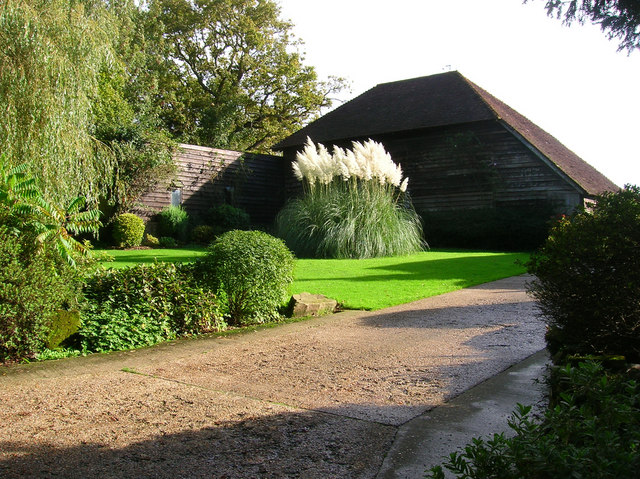
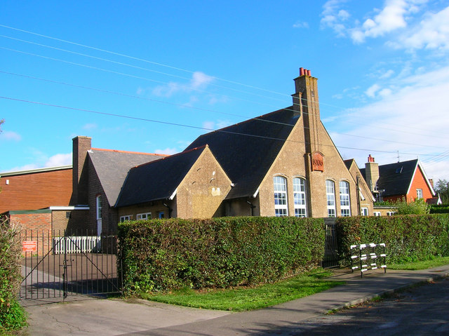
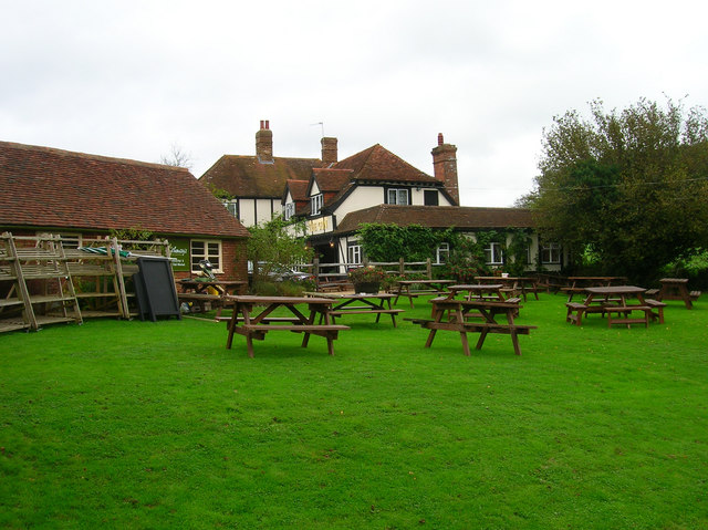
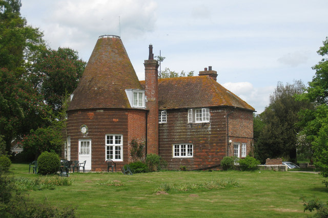
The village of Chiddingly itself is home to a population of around 1,000 residents. It features a mix of traditional and modern architecture, with a charming medieval church, St. Mary's, standing as a prominent landmark. The village also boasts a primary school, a village hall, and a local pub, providing essential services and a sense of community for its residents.

Agriculture plays a significant role in the local economy, with farming and horticulture being the primary industries. The fertile soil and favorable climate in the area make it ideal for cultivating crops and rearing livestock. Many of the surrounding fields are dedicated to farming activities, and the village often hosts agricultural events and fairs.

Chiddingly is known for its active community and hosts various events throughout the year, including a popular annual summer show. This event showcases the best of the local produce, crafts, and talents, attracting visitors from nearby towns and villages.

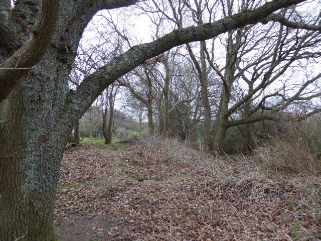
The parish is also surrounded by beautiful countryside, offering plenty of opportunities for outdoor activities such as walking, cycling, and horse riding. It is a popular destination for nature enthusiasts, with several designated nature reserves and wildlife habitats in the vicinity.

Overall, Chiddingly is a charming and vibrant village in Sussex, offering a peaceful and picturesque setting for its residents and visitors alike.

If you have any feedback on the listing, please let us know in the comments section below.

Chiddingly Images

Images are sourced within 2km of 50.906202/0.199964 or Grid Reference TQ5414. Thanks to Geograph Open Source API. All images are credited.

Chiddingly Church With a spire of 128'.
Chiddingly Church
With a spire of 128'.
Scrappers Hill Farm Viewed from fields north of Hamly Bridge
Scrappers Hill Farm
Viewed from fields north of Hamly Bridge
Eight Acre Wood Taken from Nash Street.
Eight Acre Wood
Taken from Nash Street.
Nash Street Wood Following the footpath that leads to Thunder Hill
Nash Street Wood
Following the footpath that leads to Thunder Hill
Barn, Nash Street Farm Taken from Nash Street.
Barn, Nash Street Farm
Taken from Nash Street.
Peacocks, Nash Street Farm My first peacock point too.
Peacocks, Nash Street Farm
My first peacock point too.
The Old Toll House, Muddles Green The lane in muddles Green is not a major artery so I am assuming this was for tolls to use the turnpike that is now the A22 a little to the south of this hamlet. At one point this was also a shoe shop.
The Old Toll House, Muddles Green
The lane in muddles Green is not a major artery so I am assuming this was for tolls to use the turnpike that is now the A22 a little to the south of this hamlet. At one point this was also a shoe shop.
Chiddingly County Primary School Located in the hamlet of Muddles Green which is within the parish of Chiddingly.
Chiddingly County Primary School
Located in the hamlet of Muddles Green which is within the parish of Chiddingly.
Hale Farm House, Hale Green 14th century farm house converted into a bed and breakfast.
Hale Farm House, Hale Green
14th century farm house converted into a bed and breakfast.
Coneyburrow Wood The orchard to the left behind the hedge is called Carey Wood but unfortunately not accessible.
Coneyburrow Wood
The orchard to the left behind the hedge is called Carey Wood but unfortunately not accessible.
Bull Bridge Carrying Chiddingly Road over a tributary of the Cuckmere. Bull River Farm is in the background.
Bull Bridge
Carrying Chiddingly Road over a tributary of the Cuckmere. Bull River Farm is in the background.
Oasthouses, Stream Farm The area also contains a mill and the site of a former ironworks. Unfortunately the bridleway that accesses it is currently shut due to a faulty bridge.
Oasthouses, Stream Farm
The area also contains a mill and the site of a former ironworks. Unfortunately the bridleway that accesses it is currently shut due to a faulty bridge.
Dern Lane Taking you to Waldron and Lions Green.
Dern Lane
Taking you to Waldron and Lions Green.
Wealden Landscape Looking from Smithlands Lane towards Mill and Forge Wood.
Wealden Landscape
Looking from Smithlands Lane towards Mill and Forge Wood.
Oast House, Holdens Farm The rather dreary day has obscured the view to Chiddingly church, whose spire can be viewed between the oast house and tree.
Oast House, Holdens Farm
The rather dreary day has obscured the view to Chiddingly church, whose spire can be viewed between the oast house and tree.
Price's Farm On Swansbrook Lane between Gun Hill and Cogger's Cross. The yellow flowers are children's windmills.
Price's Farm
On Swansbrook Lane between Gun Hill and Cogger's Cross. The yellow flowers are children's windmills.
The Gun, Gun Hill Both name of pub and hamlet indicate the site of a former Wealden foundry in the vicinity.
The Gun, Gun Hill
Both name of pub and hamlet indicate the site of a former Wealden foundry in the vicinity.
Hawthbush Farm The trees at the bottom of the field follow the course of a stream whilst Riverfield Shaw is to the right. The field is also suffering the after effects of the previous night's downpour.
Hawthbush Farm
The trees at the bottom of the field follow the course of a stream whilst Riverfield Shaw is to the right. The field is also suffering the after effects of the previous night's downpour.
Show me another place!

Chiddingly is located at Grid Ref: TQ5414 (Lat: 50.906202, Lng: 0.199964)

Administrative County: East Sussex

District: Wealden

Police Authority: Sussex

What 3 Words

///bandaged.thigh.masts. Near Horam, East Sussex

Related Wikis

Farleys House

Farleys House near Chiddingly, East Sussex, has been converted into a museum and archive featuring the lives and work of its former residents, the photographer...

Chiddingly

Chiddingly ( CHID-ing-lye) is an English village and civil parish in the Wealden District of the administrative county of East Sussex, within historic...

Whitesmith maze

A plantation of willows near Whitesmith, East Sussex, in England forms a maze in the shape of a quotation from the Bible. The maze was planted by local...

Burgh Hill Farm Meadow

Burgh Hill Farm Meadow is a 0.9-hectare (2.2-acre) biological Site of Special Scientific Interest west of Hailsham in East Sussex.This meadow is managed...

Gun Hill, East Sussex

Gun Hill is a hamlet in the civil parish of Chiddingly in the Wealden district of East Sussex, England. It is one of the seven hills of the parish in which...

Golden Cross, East Sussex

Golden Cross is a small village in the Wealden district of East Sussex, England. Its nearest town is Hailsham, which lies approximately 3+1⁄2 miles (6...

East Hoathly with Halland

East Hoathly with Halland is a civil parish in the Wealden District of East Sussex, England. The parish contains the two villages of East Hoathly and...

Lower Dicker

Lower Dicker is a 0.1-hectare (0.25-acre) geological Site of Special Scientific Interest west of Hailsham in East Sussex. It is a Geological Conservation...

Nearby Amenities

Located within 500m of 50.906202,0.199964
Pub
The Six Bells
Opening Hours: Mo-Fr 08:00-17:00; Sa 09:00-12:30; Su off
Wikidata: Q26295267
Lat/Long: 50.9070917/0.1949196
Chiddingly
Place: village
Lat/Long: 50.907154/0.1952921
Post Box
Collection Times: Mo-Fr 15:30; Sa 09:45
Operator: Royal Mail
Post Box Type: wall
Ref: BN8 529
Royal Cypher: EIIR
Royal Cypher Wikidata: Q33102113
Lat/Long: 50.9069268/0.1953189
Parking
Fee: no
Lat/Long: 50.9067176/0.1956842
Barrier: stile
Lat/Long: 50.9067523/0.1993305
Little Park Farm
Place: farm
Source Name: OS_OpenData_StreetView
Lat/Long: 50.9053298/0.2007955
Boltwood Stud
Place: farm
Source Name: OS_OpenData_StreetView
Lat/Long: 50.9053772/0.2037406
Defibrillator
Defibrillator Location: On outside wall of Six Bells pub, to the left of the main entrance from The Street.
Emergency: defibrillator
Source: Mapillary
Lat/Long: 50.9070639/0.1950148
The data included in this document is from www.openstreetmap.org. The data is made available under ODbL.

Have you been to Chiddingly?

Leave your review of Chiddingly below (or comments, questions and feedback).