Chestfield

Civil Parish in Kent Canterbury

England

Chestfield

Whitstable from the air South Tankerton plus Tankerton and its beach are prominent in this view which was taken from a Gatwick bound flight from Prague.

See also <a href="https://www.geograph.org.uk/photo/7091164">TR1266 : Whitstable from the air</a>.
Whitstable from the air Credit: Thomas Nugent

Chestfield is a civil parish located in the county of Kent, England. Situated just a few miles northeast of the coastal town of Whitstable, it is part of the wider district of Canterbury. The parish covers an area of approximately 4 square kilometers and is home to a population of around 2,500 residents.

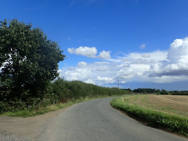
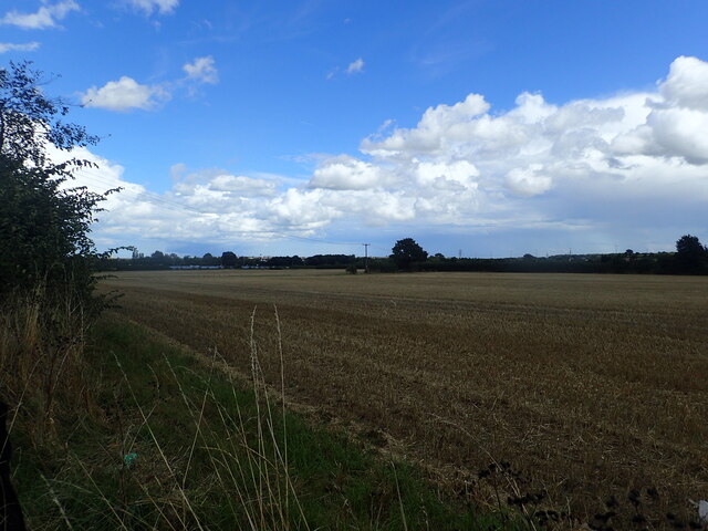
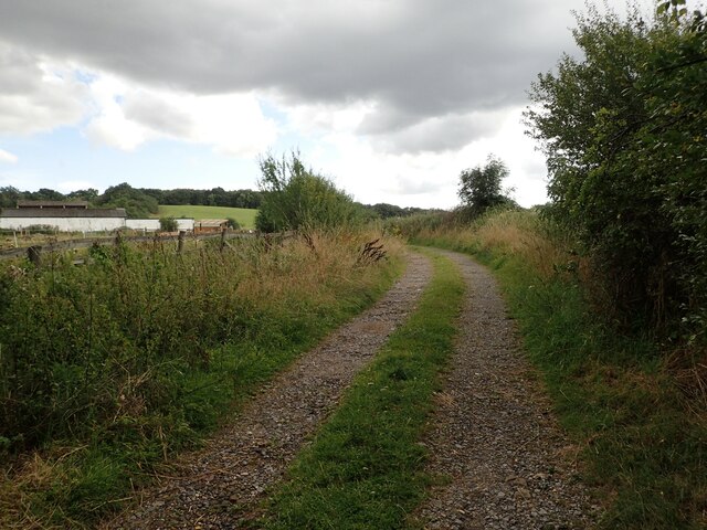
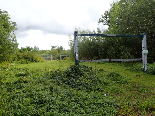
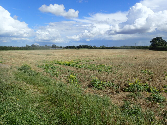
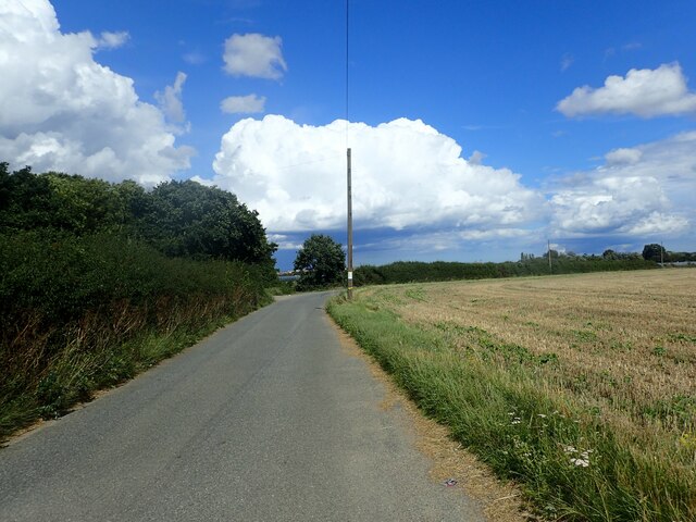
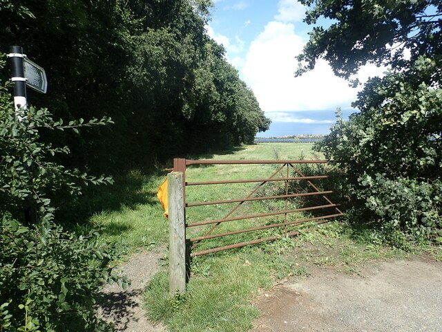
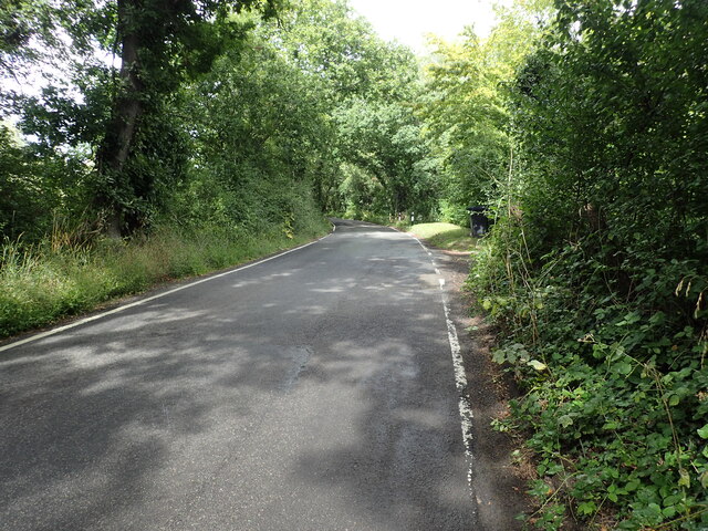
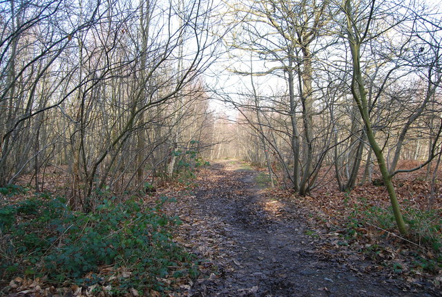
Chestfield is renowned for its picturesque countryside setting, with stunning views of the surrounding landscape. The area is characterized by rolling hills, lush green fields, and charming woodlands, making it a popular destination for nature lovers and outdoor enthusiasts.

The parish is known for its rich history, dating back to the Roman era. The remains of a Roman villa can be found in the area, providing valuable insights into the region's past. Additionally, Chestfield is home to St. Mary's Church, a beautiful medieval church that has stood for centuries and serves as a focal point for the community.

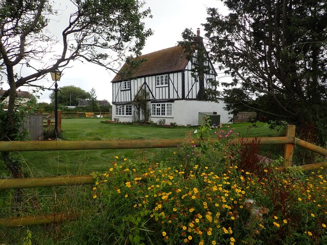
The village itself is a mix of traditional and modern architecture, with a range of housing options available, from quaint cottages to contemporary homes. Amenities in Chestfield include a primary school, a village hall, and a few local shops and businesses, providing residents with essential services.

Chestfield benefits from excellent transport links, with easy access to major road networks and nearby train stations. This allows residents to easily commute to nearby towns and cities, such as Canterbury and London. Overall, Chestfield offers a peaceful and idyllic setting, combined with a close-knit community and convenient amenities, making it a desirable place to live.

If you have any feedback on the listing, please let us know in the comments section below.

Chestfield Images

Images are sourced within 2km of 51.340613/1.070189 or Grid Reference TR1364. Thanks to Geograph Open Source API. All images are credited.

Whitstable from the air South Tankerton plus Tankerton and its beach are prominent in this view which was taken from a Gatwick bound flight from Prague.

See also <a href="https://www.geograph.org.uk/photo/7091164">TR1266 : Whitstable from the air</a>.
Whitstable from the air
South Tankerton plus Tankerton and its beach are prominent in this view which was taken from a Gatwick bound flight from Prague. See also TR1266 : Whitstable from the air.
A299 Thanet Way Eastbound
Molehill Road The footpath on the left here has been re-routed compared to the OS Map.
Molehill Road
The footpath on the left here has been re-routed compared to the OS Map.
View from Molehill Road The A299 Thanet Way is on the other side of the hedge on the right hand side of the field.
View from Molehill Road
The A299 Thanet Way is on the other side of the hedge on the right hand side of the field.
House at Great Ruckinge Farm This attractive house can be seen from Thornden Wood Road.
House at Great Ruckinge Farm
This attractive house can be seen from Thornden Wood Road.
Track at Warren Farm This track leads off Thornden Wood Road. Warren Farm is on the left.
Track at Warren Farm
This track leads off Thornden Wood Road. Warren Farm is on the left.
Former car park in Thornden Wood Street view of July 2009 for Thornden Wood Road shows this as a very small car park but as can be seen, it has now been closed off.
Former car park in Thornden Wood
Street view of July 2009 for Thornden Wood Road shows this as a very small car park but as can be seen, it has now been closed off.
Thornden Wood Road through Thornden Wood This is looking south from the entrance to the West Blean  & Thornden Woods Car Park.
Thornden Wood Road through Thornden Wood
This is looking south from the entrance to the West Blean & Thornden Woods Car Park.
Field next to Molehill Road The A299 (Thanet Way) is just out of sight to the right of the photograph so it is quite noisy here.
Field next to Molehill Road
The A299 (Thanet Way) is just out of sight to the right of the photograph so it is quite noisy here.
Molehill Road The footpath on the left here, opposite the pole, leading to Maydowns Road has been re-routed compared to the OS Map which shows it starting further around the bend.
Molehill Road
The footpath on the left here, opposite the pole, leading to Maydowns Road has been re-routed compared to the OS Map which shows it starting further around the bend.
Footpath from Molehill Road The footpath here which leads to Maydowns Road has been re-routed compared to the OS Map which shows it starting from Molehill Road further to the east.
Footpath from Molehill Road
The footpath here which leads to Maydowns Road has been re-routed compared to the OS Map which shows it starting from Molehill Road further to the east.
House at Great Ruckinge Farm This attractive house can be seen from Thornden Wood Road.
House at Great Ruckinge Farm
This attractive house can be seen from Thornden Wood Road.
Thornden Wood Road This view looks north from Great Ruckinge Farm.
Thornden Wood Road
This view looks north from Great Ruckinge Farm.
Thornden Wood Road This view looks north from the entrance to Warren Farm.
Thornden Wood Road
This view looks north from the entrance to Warren Farm.
Thornden Wood Road This view looks south from the entrance to Warren Farm.
Thornden Wood Road
This view looks south from the entrance to Warren Farm.
Thornden Wood Road through Thornden Wood This looks north from the site of the former car park seen at <a title="www.geograph.org.uk/photo/7578619" href="https://www.geograph.org.uk/photo/7578619">Link</a>
Thornden Wood Road through Thornden Wood
This looks north from the site of the former car park seen at Link
Path into Thornden Wood This is looking west from the West Blean & Thornden Woods Car Park into Thornden Wood. West Blean and Thornden Woods are managed by Kent Wildlife Trust. They are a Site of Special Scientific Interest and in July 2022, as part of the Wilder Blean project, European bison were released into West Blean and Thornden Woods - see <span class="nowrap"><a title="https://en.wikipedia.org/wiki/West_Blean_and_Thornden_Woods" rel="nofollow ugc noopener" href="https://en.wikipedia.org/wiki/West_Blean_and_Thornden_Woods">Link</a><img style="margin-left:2px;" alt="External link" title="External link - shift click to open in new window" src="https://s1.geograph.org.uk/img/external.png" width="10" height="10"/></span>
Path into Thornden Wood
This is looking west from the West Blean & Thornden Woods Car Park into Thornden Wood. West Blean and Thornden Woods are managed by Kent Wildlife Trust. They are a Site of Special Scientific Interest and in July 2022, as part of the Wilder Blean project, European bison were released into West Blean and Thornden Woods - see LinkExternal link
Path into Thornden Wood West Blean and Thornden Woods are managed by Kent Wildlife Trust. They are a Site of Special Scientific Interest and in July 2022, as part of the Wilder Blean project, European bison were released into West Blean and Thornden Woods - see <span class="nowrap"><a title="https://en.wikipedia.org/wiki/West_Blean_and_Thornden_Woods" rel="nofollow ugc noopener" href="https://en.wikipedia.org/wiki/West_Blean_and_Thornden_Woods">Link</a><img style="margin-left:2px;" alt="External link" title="External link - shift click to open in new window" src="https://s1.geograph.org.uk/img/external.png" width="10" height="10"/></span>
Path into Thornden Wood
West Blean and Thornden Woods are managed by Kent Wildlife Trust. They are a Site of Special Scientific Interest and in July 2022, as part of the Wilder Blean project, European bison were released into West Blean and Thornden Woods - see LinkExternal link
Show me another place!

Chestfield is located at Grid Ref: TR1364 (Lat: 51.340613, Lng: 1.070189)

Administrative County: Kent

District: Canterbury

Police Authority: Kent

What 3 Words

///likely.luck.priced. Near Tankerton, Kent

Related Wikis

Radfall

Radfall is a hamlet between Whitstable and Canterbury, in southeast England. It lies between the Thanet Way and Thornden Wood, in the Canterbury district...

Chestfield

Chestfield is a village (and civil parish and with Swalecliffe a district council ward) in the Canterbury District of Kent, England. The parish is centred...

West Blean and Thornden Woods

West Blean and Thornden Woods is a 781-hectare (1,930-acre) biological Site of Special Scientific Interest north of Canterbury in Kent. It is part of the...

South Street Halt railway station

South Street Halt was a minor station on the Canterbury and Whitstable Railway at Tankerton, Kent. It opened in 1911 and closed in 1931. == History... ==

Heart Kent

Heart Kent (previously Invicta FM) was an Independent Local Radio station owned and operated by Global Radio as part of the Heart network. It broadcast...

Chestfield & Swalecliffe railway station

Chestfield and Swalecliffe railway station is on the Ramsgate branch of the Chatham Main Line in England, serving the villages of Chestfield, Swalecliffe...

Swalecliffe

Swalecliffe is a part of the ribbon development of the north Kent coast between Whitstable and Herne Bay in Southeast England. It forms Swalecliffe ward...

The Whitstable School

The Whitstable School is a coeducational secondary school and sixth form located in Whitstable, Kent, England. It was established in 1952 as the Sir William...

Nearby Amenities

Located within 500m of 51.340613,1.070189
Post Box
Postal Code: CT5
Ref: CT5 224
Source: survey
Lat/Long: 51.3392086/1.0657354
Bus Stop
Dukeswood
Flag: no
Naptan AtcoCode: 240096727
Naptan Bearing: SE
Naptan BusStopType: CUS
Naptan CommonName: Dukeswood
Naptan Indicator: adj
Naptan Landmark: Dukeswood
Naptan NaptanCode: kntgmawt
Naptan Street: Radfall Road
Naptan Verified: no
Public Transport: platform
Source: naptan_import
Lat/Long: 51.3392049/1.0657347
Bus Stop
Dukeswood
Bench: no
Bin: no
Flag: no
Naptan AtcoCode: 240096729
Naptan Bearing: NW
Naptan BusStopType: CUS
Naptan CommonName: Dukeswood
Naptan Indicator: opp
Naptan Landmark: Dukeswood
Naptan NaptanCode: kntgmawp
Naptan Street: Radfall Road
Naptan Verified: no
Public Transport: platform
Shelter: no
Source: naptan_import
Tactile Paving: no
Lat/Long: 51.3389718/1.0657048
Radfall
Place: hamlet
Wikidata: Q7280140
Lat/Long: 51.3391881/1.0638321
Hiking: yes
Information: guidepost
Tourism: information
Lat/Long: 51.3417638/1.0682119
Barrier: kissing_gate
Foot: yes
Lat/Long: 51.34156/1.075791
Generator Method: photovoltaic
Generator Output Electricity: yes
Generator Source: solar
Generator Type: solar_photovoltaic_panel
Location: roof
Power: generator
Lat/Long: 51.3366227/1.0684901
Generator Method: photovoltaic
Generator Output Electricity: yes
Generator Source: solar
Generator Type: solar_photovoltaic_panel
Location: roof
Power: generator
Lat/Long: 51.3396045/1.0641034
Generator Method: photovoltaic
Generator Output Electricity: yes
Generator Source: solar
Generator Type: solar_photovoltaic_panel
Location: roof
Power: generator
Lat/Long: 51.3395895/1.064153
The data included in this document is from www.openstreetmap.org. The data is made available under ODbL.

Have you been to Chestfield?

Leave your review of Chestfield below (or comments, questions and feedback).