Chelsworth

Civil Parish in Suffolk Babergh

England

Chelsworth

Monks Eleigh: Lane leading to Monks Eleigh
Monks Eleigh: Lane leading to Monks Eleigh Credit: Michael Garlick

Chelsworth is a civil parish located in the county of Suffolk, England. Situated approximately six miles north of the town of Hadleigh, Chelsworth covers an area of about 1,500 acres and is home to a population of around 300 people. The village is nestled in the picturesque countryside of the Babergh district, renowned for its tranquil and scenic beauty.

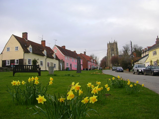
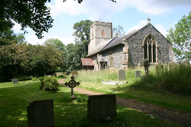
The history of Chelsworth dates back to the medieval period, and the village still retains much of its traditional charm and character. Its centerpiece is the stunning St. Mary's Church, a Grade I listed building that dates back to the 14th century. The church is known for its impressive architecture and houses a collection of historical artifacts.

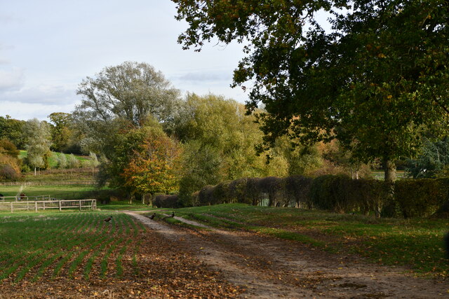
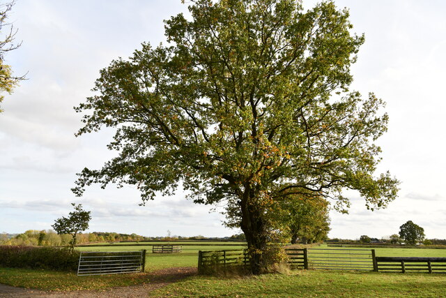
The village itself is predominantly rural, with a scattering of charming cottages and farmhouses. The surrounding landscape is characterized by rolling hills, meadows, and woodland, making it a haven for nature lovers and outdoor enthusiasts. Popular activities include walking, cycling, and horse riding, with numerous footpaths and bridleways crisscrossing the area.

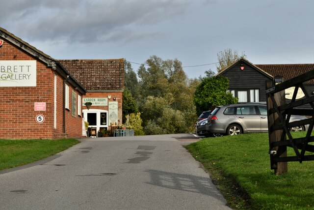
Chelsworth is also famous for hosting the annual Chelsworth Open Gardens event, where visitors can explore the village's beautiful gardens and enjoy homemade refreshments. Additionally, the village boasts a traditional pub, The Peacock Inn, which offers a warm welcome and serves delicious food and drink.

Overall, Chelsworth offers a peaceful and idyllic setting, perfect for those seeking a rural retreat or a taste of traditional English village life.

If you have any feedback on the listing, please let us know in the comments section below.

Chelsworth Images

Images are sourced within 2km of 52.095353/0.893603 or Grid Reference TL9848. Thanks to Geograph Open Source API. All images are credited.

Monks Eleigh: Lane leading to Monks Eleigh
Monks Eleigh: Track leading to a number of enclosed paddocks
Monks Eleigh: Highlands Farm Cottages
Monks Eleigh: Looking towards the sewage works
Monks Eleigh: Paddock Hall
Monks Eleigh: Where Highlands Road joins the A1141
Monks Eleigh: Brett Gallery
Monks Eleigh: Detached house
Chelsworth: 'The Lodge'
Lindsey Tye: Clay Hill
Chelsworth: Clay Hill
Chelsworth: The road to Chelsworth
Semer: Track skirting the left side of Semer Wood
Semer: Tree bordering a field
Lindsey Tye: Ploughed field
The Peacock Inn <span class="nowrap"><a title="https://historicengland.org.uk/listing/the-list/list-entry/1037363?section=official-list-entry" rel="nofollow ugc noopener" href="https://historicengland.org.uk/listing/the-list/list-entry/1037363?section=official-list-entry">Link</a><img style="margin-left:2px;" alt="External link" title="External link - shift click to open in new window" src="https://s1.geograph.org.uk/img/external.png" width="10" height="10"/></span>
The Peacock Inn
Jackdaws Ford, Chelsworth <span class="nowrap"><a title="https://historicengland.org.uk/listing/the-list/list-entry/1194140?section=official-list-entry" rel="nofollow ugc noopener" href="https://historicengland.org.uk/listing/the-list/list-entry/1194140?section=official-list-entry">Link</a><img style="margin-left:2px;" alt="External link" title="External link - shift click to open in new window" src="https://s1.geograph.org.uk/img/external.png" width="10" height="10"/></span>
Jackdaws Ford, Chelsworth
Show me another place!

Chelsworth is located at Grid Ref: TL9848 (Lat: 52.095353, Lng: 0.893603)

Administrative County: Suffolk

District: Babergh

Police Authority: Suffolk

What 3 Words

///homework.stew.estuaries. Near Bildeston, Suffolk

Related Wikis

Chelsworth

Chelsworth is a village and civil parish in Suffolk, England. It lies on the B1115 road, 10 miles in either direction from Sudbury and Stowmarket. It is...

Cosford Hundred

Cosford was a hundred of Suffolk, consisting of 30,712 acres (124.29 km2).The hundred consisted of Hadleigh, the only town of any size, and seventeen other...

Bildeston

Bildeston is a village and civil parish in the Babergh district of Suffolk, England. Located around 5 miles (8 km) north of Hadleigh, in 2005 it had a...

Monks Eleigh

Monks Eleigh is a village and a civil parish in Babergh, Suffolk, United Kingdom, situated on the tributary to the River Brett in a rural area. The parish...

Semer, Suffolk

Semer is a small village and civil parish in Suffolk, England. Located adjacent to a bridge over the River Brett on the B1115 between Hadleigh and Stowmarket...

Hitcham, Suffolk

Hitcham is a village and civil parish in Suffolk, England. Located on the B1115 road, between Hadleigh and Stowmarket, it is part of Babergh district....

Kettlebaston

Kettlebaston is a village and a civil parish with just over 30 inhabitants in the Babergh district of Suffolk, England, located around 3 miles (5 km) east...

Nedging

Nedging is a village and former civil parish on the B1115 road, now in the parish of Nedging-with-Naughton, in the Babergh district, in the county of Suffolk...

Nearby Amenities

Located within 500m of 52.095353,0.893603
Chelsworth
Place: village
Source: npe
Wikidata: Q1069159
Lat/Long: 52.0954891/0.8902146
Bus Stop
The Peacock
Naptan AtcoCode: 390010467
Naptan Bearing: SW
Naptan CommonName: The Peacock
Naptan Indicator: opp
Naptan Landmark: The Peacock
Naptan NaptanCode: sufagjmp
Naptan Street: The Street
Naptan Verified: no
Source: naptan_import
Lat/Long: 52.0951096/0.8929342
Bus Stop
The Peacock
Naptan AtcoCode: 390010468
Naptan Bearing: NE
Naptan BusStopType: CUS
Naptan CommonName: The Peacock
Naptan Indicator: adj
Naptan Landmark: The Peacock
Naptan NaptanCode: sufagjmt
Naptan Street: The Street
Naptan Verified: no
Source: naptan_import
Lat/Long: 52.095217/0.8929557
Pub
The Peacock
Addr City: Ipswich
Addr Housenumber: 24-26
Addr Postcode: IP7 7HU
Addr Street: The Street
Addr Village: Chelsworth
Fhrs Id: 1404214
Fixme: Check location and housenumber
Lat/Long: 52.0951039/0.8924729
Defibrillator
Defibrillator Location: On the front wall of the Victory Hall.
Emergency: defibrillator
Indoor: no
Operator: EireMed
Ref: Not marked
Ref GB The Circuit: 93A268EA-477B-4E6E-86C5-AD6E00A5CABD
Lat/Long: 52.0957264/0.8942716
Information: guidepost
Tourism: information
Lat/Long: 52.0950144/0.8924883
Telephone
Booth: K6
Covered: booth
Listed Status: Grade II
Phone: +44 1449 740331
Lat/Long: 52.0950858/0.8929193
Post Box
Operator: Royal Mail
Operator Wikidata: Q638098
Post Box Mounting: brick_wall
Post Box Type: wall
Ref: IP7 1187
Royal Cypher: EIIR
Royal Cypher Wikidata: Q33102113
Lat/Long: 52.0954683/0.8937134
The data included in this document is from www.openstreetmap.org. The data is made available under ODbL.

Have you been to Chelsworth?

Leave your review of Chelsworth below (or comments, questions and feedback).