Charlton (Upavon Ward)

Civil Parish in Wiltshire

England

Charlton (Upavon Ward)

Bridleway into Vale of Pewsey The bridleway is descending from the Larkhill Artillery Range
Bridleway into Vale of Pewsey Credit: Doug Lee

Charlton (Upavon Ward) is a civil parish located in the county of Wiltshire, England. Situated in the western part of the county, it covers an area of approximately 613 hectares. The parish is part of the larger electoral ward of Upavon, which encompasses several other nearby villages.

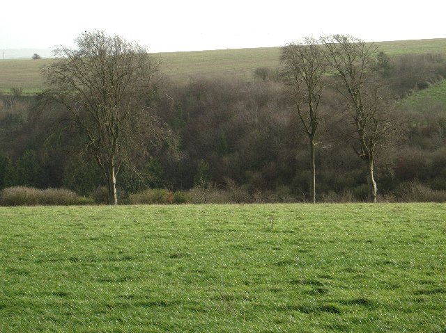
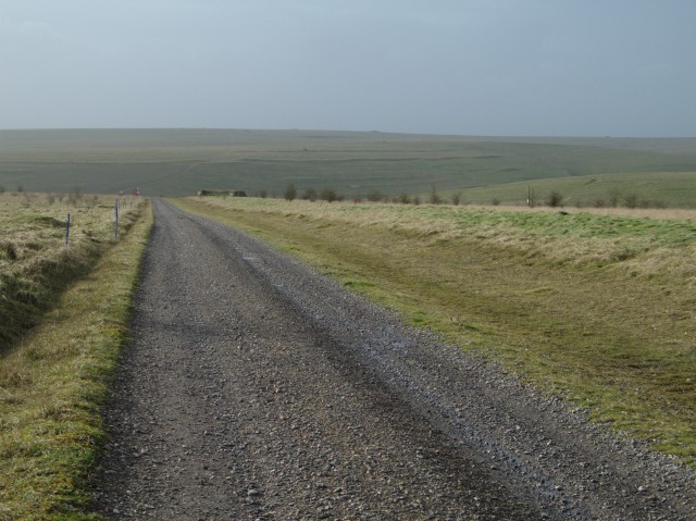
Charlton is a small village with a population of around 150 residents. It is situated on the banks of the River Avon and surrounded by picturesque countryside, offering stunning views and a peaceful atmosphere. The village is known for its charming thatched cottages, historic buildings, and well-maintained gardens.

The parish is primarily an agricultural area, with farms and fields dominating the landscape. The fertile soil and favorable climate provide excellent conditions for crop cultivation and livestock rearing. As a result, agriculture plays a significant role in the local economy.

Within the village, there are a few amenities to serve the residents' needs, including a pub, a village hall, and a parish church. The community spirit is strong, and various events and activities are organized throughout the year to bring the residents together.

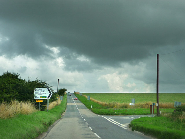
Charlton is well-connected to nearby towns and cities by road, with the A342 passing through the parish, providing easy access to Salisbury, Devizes, and Andover. The village also benefits from its proximity to the larger village of Upavon, where additional services and amenities can be found.

Overall, Charlton (Upavon Ward) offers a tranquil and idyllic setting for those seeking a peaceful rural lifestyle in the heart of Wiltshire.

If you have any feedback on the listing, please let us know in the comments section below.

Charlton (Upavon Ward) Images

Images are sourced within 2km of 51.28467/-1.862185 or Grid Reference SU0953. Thanks to Geograph Open Source API. All images are credited.

Bridleway into Vale of Pewsey The bridleway is descending from the Larkhill Artillery Range
Bridleway into Vale of Pewsey
The bridleway is descending from the Larkhill Artillery Range
Larkhill Artillery Range
Byway with view across Vale Of Pewsey This byway descends Wilsford Hill and leads to Wilsford
Byway with view across Vale Of Pewsey
This byway descends Wilsford Hill and leads to Wilsford
Barn and Broadbury Banks hillfort The bank to the left of the track past the barn is the outer bank of the Broadbury Banks hill fort.
Barn and Broadbury Banks hillfort
The bank to the left of the track past the barn is the outer bank of the Broadbury Banks hill fort.
Larkhill Artillery Range
Trig point
Trig point
Flock of birds over piggery The farm with the extensive pig unit in this grid square seems to feed rather a lot more birds than it does pigs.  There were extensive numbers of rooks and, I think, starlings but I couldn't say what made up the flock shown here.  This flock in the air represents less than a quarter of those that I observed in the piggery as a whole.
Flock of birds over piggery
The farm with the extensive pig unit in this grid square seems to feed rather a lot more birds than it does pigs. There were extensive numbers of rooks and, I think, starlings but I couldn't say what made up the flock shown here. This flock in the air represents less than a quarter of those that I observed in the piggery as a whole.
Disused barn
Disused barn
Open field and trees In the slightly more sheltered ground off Salisbury Plain trees are more able to thrive
Open field and trees
In the slightly more sheltered ground off Salisbury Plain trees are more able to thrive
Larkhill Artillery Range building This building guards one of the entrances to the Larkhill Artillery Range.  In the background is the piggery that feeds the birds shown in <a href="https://www.geograph.org.uk/photo/301441">SU1054 : Flock of birds over piggery</a>
Larkhill Artillery Range building
This building guards one of the entrances to the Larkhill Artillery Range. In the background is the piggery that feeds the birds shown in SU1054 : Flock of birds over piggery
The Demolition Road This track leads to the "Demolition Area" on Larkhill Artillery Range.

To the upper right of the image the earthworks associated with the "Long Ditch" can be seen on the slope of the hill.
The Demolition Road
This track leads to the "Demolition Area" on Larkhill Artillery Range. To the upper right of the image the earthworks associated with the "Long Ditch" can be seen on the slope of the hill.
View over open fields towards Widdington Farm
View across Casterley Camp The outer bank of Casterley Camp is approximately one metre high around most of the perimeter of the hill fort.  The foreground of this image shows part of the north westerly section of the ditch and bank.  The southern and southeasterly sections of the bank can be seen at the far edge of the field that is now contained within the fort.
View across Casterley Camp
The outer bank of Casterley Camp is approximately one metre high around most of the perimeter of the hill fort. The foreground of this image shows part of the north westerly section of the ditch and bank. The southern and southeasterly sections of the bank can be seen at the far edge of the field that is now contained within the fort.
Byway near Marden Down The byway is viewed here from a west-facing position. The fence at the right marks the northern gridline of this square.
Byway near Marden Down
The byway is viewed here from a west-facing position. The fence at the right marks the northern gridline of this square.
Byway north of Marden Down, Salisbury Plain The byway runs closely parallel to the northern gridline of the square such that the trees to the left are in the next square north while the byway and the trees to the right are in this square.
Byway north of Marden Down, Salisbury Plain
The byway runs closely parallel to the northern gridline of the square such that the trees to the left are in the next square north while the byway and the trees to the right are in this square.
Water Dean Bottom, Salisbury Plain The very tussocky grass in the foreground didn't make for easy walking but the view compensated somewhat.
Water Dean Bottom, Salisbury Plain
The very tussocky grass in the foreground didn't make for easy walking but the view compensated somewhat.
Re-entrant near Water Dean Bottom, Salisbury Plain The sides of the re-entrant, particularly the one nearest the viewpoint, are steeper than they appear in this image.
Re-entrant near Water Dean Bottom, Salisbury Plain
The sides of the re-entrant, particularly the one nearest the viewpoint, are steeper than they appear in this image.
North of Water Dean Bottom, Salisbury Plain The land is rising gently towards Casterley Camp in the next square north. The ground cover is very coarse and tussocky. The weather wasn't too bad, sunny intervals but with a stiff breeze.
North of Water Dean Bottom, Salisbury Plain
The land is rising gently towards Casterley Camp in the next square north. The ground cover is very coarse and tussocky. The weather wasn't too bad, sunny intervals but with a stiff breeze.
Show me another place!

Charlton (Upavon Ward) is located at Grid Ref: SU0953 (Lat: 51.28467, Lng: -1.862185)

Unitary Authority: Wiltshire

Police Authority: Wiltshire

What 3 Words

///punctual.slower.clots. Near Wilsford, Wiltshire

Nearby Locations

Charlton (Upavon Ward)

Related Wikis

Casterley Camp

Casterley Camp is the site of an Iron Age univallate hillfort in Wiltshire, England, about 1+1⁄2 miles (2.4 km) south-west of the village of Upavon. The...

Charlton St Peter and Wilsford

Charlton St Peter and Wilsford Joint Parish Council is a grouped parish council serving the adjacent civil parishes of Charlton St Peter and Wilsford,...

A342 road

The A342 is an A road in England that runs from Pewsham near Chippenham, Wiltshire to Andover, Hampshire. == Route == The road begins at the A4 junction...

Charlton St Peter

Charlton St Peter or just Charlton is a small village and civil parish in the Vale of Pewsey in the English county of Wiltshire. The village lies about...

Wiltshire

Wiltshire (; abbreviated to Wilts) is a ceremonial county in South West England. It borders Gloucestershire to the north, Oxfordshire and Berkshire to...

Wilsford, Wiltshire

Wilsford is a small village and civil parish in the Vale of Pewsey in the English county of Wiltshire, about 4 miles (6 km) southwest of Pewsey. The Salisbury...

Rushall, Wiltshire

Rushall is a small village and civil parish in Wiltshire, England, 8 miles (13 km) southeast of Devizes and 3⁄4 mile (1.2 km) northwest of Upavon on the...

Wilsford Henge

Wilsford Henge is the site of a Neolithic henge, west of the village of Wilsford, Wiltshire in the United Kingdom (grid reference SU09305732). The site...

Have you been to Charlton (Upavon Ward)?

Leave your review of Charlton (Upavon Ward) below (or comments, questions and feedback).