Chaldon

Civil Parish in Surrey Tandridge

England

Chaldon

M23/M25 Intersection The huge multi-level junction of the M25 and M23 near Merstham, which totally dominates this square.
M23/M25 Intersection Credit: Ben Gamble

Chaldon is a civil parish located in the county of Surrey, England. Situated approximately 20 miles south of London, it is a small, picturesque village encompassing an area of around 6.5 square kilometers.

The village is known for its rich history, dating back to the Roman era. It is home to the famous landmark of the Chaldon Church, also known as the Church of St. Peter and St. Paul. This historic church, built in the 12th century, features remarkable medieval wall paintings, including the renowned "Doom Painting," which depicts the Last Judgment.

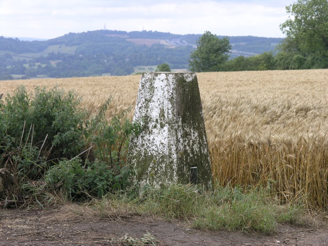
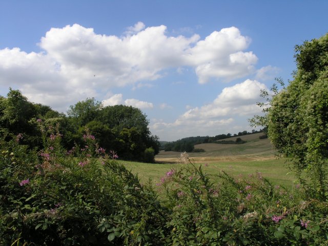
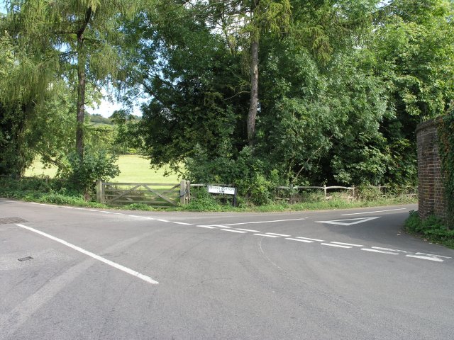
Chaldon is surrounded by stunning countryside scenery and offers numerous walking and hiking routes for outdoor enthusiasts. The North Downs Way, a long-distance footpath, passes through the village, providing access to breathtaking views of the surrounding areas.

Despite its small size, Chaldon boasts a tight-knit community and a range of amenities for its residents. These include a village hall, a primary school, and a local pub, providing a hub for socializing and community gatherings.

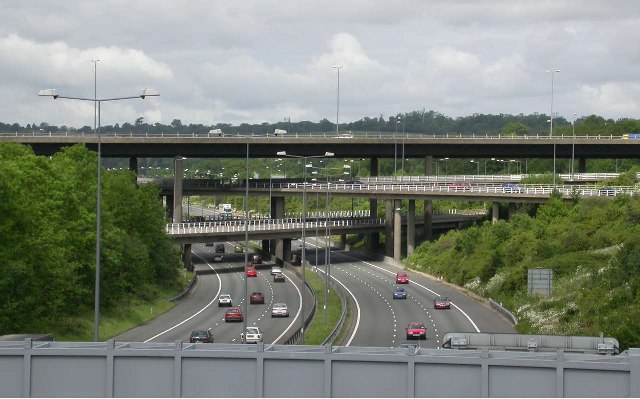
The village is well-connected to neighboring towns and cities, with good transport links. The nearby town of Caterham offers further amenities, including shopping centers, supermarkets, and leisure facilities.

Chaldon offers a tranquil and idyllic setting for those seeking a peaceful village lifestyle, while still being within easy reach of larger urban areas. Its historical significance, natural beauty, and strong community spirit make it an attractive place to live or visit in Surrey.

If you have any feedback on the listing, please let us know in the comments section below.

Chaldon Images

Images are sourced within 2km of 51.278736/-0.11198 or Grid Reference TQ3154. Thanks to Geograph Open Source API. All images are credited.

M23/M25 Intersection The huge multi-level junction of the M25 and M23 near Merstham, which totally dominates this square.
M23/M25 Intersection
The huge multi-level junction of the M25 and M23 near Merstham, which totally dominates this square.
Chaldon Church The Parish Church of Chaldon, St. Peter and St. Paul.  This church was listed in the Domesday Book and has a sign nearby indicating that it was built in 1086.
Chaldon Church
The Parish Church of Chaldon, St. Peter and St. Paul. This church was listed in the Domesday Book and has a sign nearby indicating that it was built in 1086.
Trig Point near Chaldon Trig point with Reigate Hill, with its twin transmitter masts in the background.
Trig Point near Chaldon
Trig point with Reigate Hill, with its twin transmitter masts in the background.
The Clifton Arms, Caterham The Clifton Arms, established in 1869 on a roundabout road junction.
The Clifton Arms, Caterham
The Clifton Arms, established in 1869 on a roundabout road junction.
St. Lawrence, Caterham Built in 1085, this was the main parish church for Caterham until it was replaced by a larger building across the road in 1866.
St. Lawrence, Caterham
Built in 1085, this was the main parish church for Caterham until it was replaced by a larger building across the road in 1866.
St. Mary the Virgin, Caterham This is the parish church for Caterham.  It was consecrated in 1866 to replace a smaller building which still exists across the road. It has a peal of 8 bells and a church hall is situated behind the main building.
St. Mary the Virgin, Caterham
This is the parish church for Caterham. It was consecrated in 1866 to replace a smaller building which still exists across the road. It has a peal of 8 bells and a church hall is situated behind the main building.
Caterham School Caterham prep and senior school, founded in 1811, provides co-educational schooling from the age of 3 to 18. The current school is a merger of two schools - Caterham Boys' school, founded in 1811, and Eothen girls' school, founded in 1892.
Caterham School
Caterham prep and senior school, founded in 1811, provides co-educational schooling from the age of 3 to 18. The current school is a merger of two schools - Caterham Boys' school, founded in 1811, and Eothen girls' school, founded in 1892.
Farmland, not far from Chaldon Arable land near Chaldon, taken on the junction with Spring Bottom Lane.  The black spot in the sky is actually an approaching Chinook helicopter, a common sight seen in these parts as the edge of the downs/M25 corridor is a common helicopter route.
Farmland, not far from Chaldon
Arable land near Chaldon, taken on the junction with Spring Bottom Lane. The black spot in the sky is actually an approaching Chinook helicopter, a common sight seen in these parts as the edge of the downs/M25 corridor is a common helicopter route.
Countryside road junction near Chaldon This junction is one of many on the narrow country roads that link this area.  The road branching off is marked as Spring Bottom Lane.
Countryside road junction near Chaldon
This junction is one of many on the narrow country roads that link this area. The road branching off is marked as Spring Bottom Lane.
Chaldon Village Hall Chaldon Village Hall, taken from the small private car park opposite, which serves the hall.
Chaldon Village Hall
Chaldon Village Hall, taken from the small private car park opposite, which serves the hall.
Six Brothers Field, Chaldon Six Brothers Field is Chaldon's main recreational area and is used for many purposes by the community. It was gifted to the National Trust on the 31st December 1926 by Martin Colesharman.   
He donated 6.69 acres for the benefit of Chaldon residents. 

Mr Harman was one of six brothers, and consequently asked that the field should be forever know as Six Brothers Field.  He also had five sisters, but they didn't seem to come into the picture...
Six Brothers Field, Chaldon
Six Brothers Field is Chaldon's main recreational area and is used for many purposes by the community. It was gifted to the National Trust on the 31st December 1926 by Martin Colesharman. He donated 6.69 acres for the benefit of Chaldon residents. Mr Harman was one of six brothers, and consequently asked that the field should be forever know as Six Brothers Field. He also had five sisters, but they didn't seem to come into the picture...
Road junction in a housing area near Chaldon A road junction on Roffe's Lane.
Road junction in a housing area near Chaldon
A road junction on Roffe's Lane.
Football pitch, Coulsdon Common, Surrey Adjoins the "Fox" public house
Football pitch, Coulsdon Common, Surrey
Adjoins the "Fox" public house
"Skaterham", Caterham. Surrey This building, formerly the chapel of the Coldstream Guards barracks (now removed) has been converted into a roller-skating rink for youngsters.
"Skaterham", Caterham. Surrey
This building, formerly the chapel of the Coldstream Guards barracks (now removed) has been converted into a roller-skating rink for youngsters.
A country pub in Surrey Popular with walkers on the adjoining Pilgrims Way. Several fine real ales served and also food.
A country pub in Surrey
Popular with walkers on the adjoining Pilgrims Way. Several fine real ales served and also food.
Hockey training at Caterham School All-weather pitch and School's Sports Centre beyond. Looking West from Harestone Valley Road. Main school buildings are other side of road, directly opposite.
Hockey training at Caterham School
All-weather pitch and School's Sports Centre beyond. Looking West from Harestone Valley Road. Main school buildings are other side of road, directly opposite.
Clifton Arms, Caterham, Surrey No connection with the photographer, but they appear to have got the coat of arms correct on the pub sign.  This view is in 1971.
Additional note from observation, 26 August 2012:  This public house has now been demolished.
Clifton Arms, Caterham, Surrey
No connection with the photographer, but they appear to have got the coat of arms correct on the pub sign. This view is in 1971. Additional note from observation, 26 August 2012: This public house has now been demolished.
Caterham On The Hill old fire station Caterham On The Hill old fire station, High Street, Caterham, Surrey. This is a 'replica' of the original, built to the original plans in 1998 - see <a href="https://www.geograph.org.uk/photo/587717">TQ3355 : Fire Station plaque</a>
Caterham On The Hill old fire station
Caterham On The Hill old fire station, High Street, Caterham, Surrey. This is a 'replica' of the original, built to the original plans in 1998 - see TQ3355 : Fire Station plaque
Show me another place!

Chaldon is located at Grid Ref: TQ3154 (Lat: 51.278736, Lng: -0.11198)

Administrative County: Surrey

District: Tandridge

Police Authority: Surrey

What 3 Words

///sock.maps.cheer. Near Caterham, Surrey

Related Wikis

Chaldon

Chaldon is a village and civil parish in the Tandridge District of Surrey, England. The village is situated high on the North Downs, immediately west of...

Church of St Peter and St Paul, Chaldon

The Church of Saints Peter and Paul at Chaldon, Surrey, is a Church of England parish church in the Diocese of Southwark. The building was begun before...

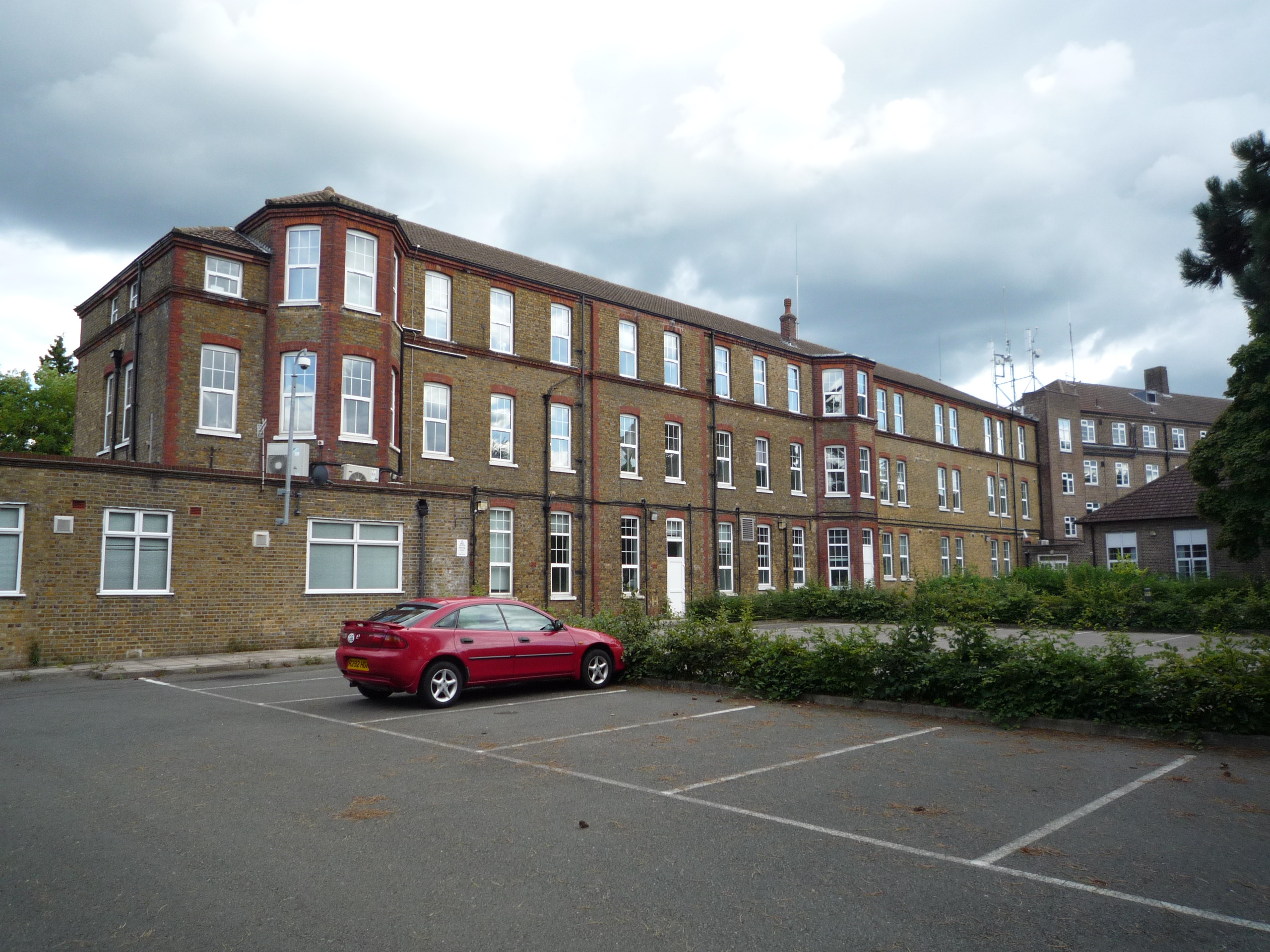
St Lawrence's Hospital, Caterham

St Lawrence's Hospital was a mental health facility in Caterham, Surrey. == History == The facility was commissioned by the Metropolitan Asylums Board...
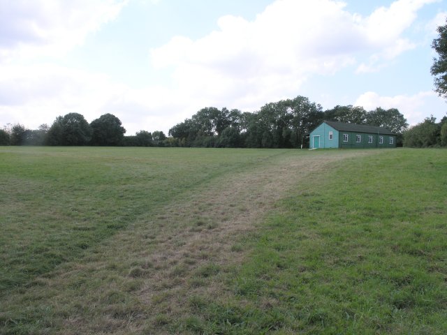
Quarry Hangers

Quarry Hangers is a 28.5-hectare (70-acre) biological Site of Special Scientific Interest south-west of Caterham in Surrey. An area of 11 hectares (27...
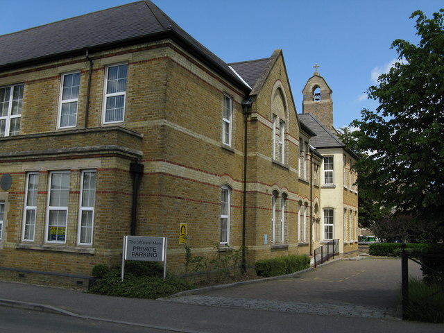
Caterham Barracks

Caterham Barracks was a military installation in Caterham, Surrey. == History == The barracks were built as a depot for the Foot Guards regiments in 1877...

Caterham Common

Caterham Common near Caterham in Surrey was the venue for three historic cricket matches played from 1767 to 1769. In the 18th century, it was the home...

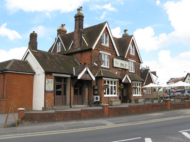
Caterham Arms pub bombing

On 27 August 1975 a Provisional Irish Republican Army bomb exploded without warning at the Caterham Arms public house in Caterham, Surrey, England. There...

Caterham School

Caterham School is an independent co-educational day and boarding school located in Caterham, Surrey and a member of the Headmasters' and Headmistresses...

Nearby Amenities

Located within 500m of 51.278736,-0.11198
Barrier: stile
Lat/Long: 51.2758283/-0.1135735
Bus Stop
Mount Avenue
Naptan AtcoCode: 40004410096A
Naptan Bearing: E
Naptan CommonName: Mount Avenue
Naptan Indicator: Opp
Naptan Landmark: Mount Avenue
Naptan NaptanCode: surdmwdw
Naptan Street: Rook Lane
Naptan Verified: yes
Public Transport: platform
Source: naptan_import
Wheelchair: limited
Lat/Long: 51.2809467/-0.1080258
Bus Stop
Mount Avenue
Naptan AtcoCode: 40004410096B
Naptan Bearing: W
Naptan CommonName: Mount Avenue
Naptan Indicator: adj
Naptan Landmark: Mount Avenue
Naptan NaptanCode: surdmwga
Naptan Street: Rook Lane
Naptan Verified: yes
Public Transport: platform
Source: naptan_import
Wheelchair: limited
Lat/Long: 51.2808591/-0.1078823
Bus Stop
Doctors Lane
Bench: no
Naptan AtcoCode: 40004410097A
Naptan Bearing: E
Naptan CommonName: Doctors Lane
Naptan Indicator: adj
Naptan Landmark: Doctors Lane
Naptan NaptanCode: surdmwgd
Naptan Street: Rook Lane
Naptan Verified: yes
Public Transport: platform
Shelter: no
Source: naptan_import
Tactile Paving: no
Wheelchair: no
Lat/Long: 51.2801535/-0.1137118
Bus Stop
Doctors Lane
Bench: no
Naptan AtcoCode: 40004410097B
Naptan Bearing: W
Naptan CommonName: Doctors Lane
Naptan Indicator: Opp
Naptan Landmark: Doctors Lane
Naptan NaptanCode: surdmwgj
Naptan Street: Rook Lane
Naptan Verified: yes
Public Transport: platform
Shelter: no
Source: naptan_import
Tactile Paving: no
Wheelchair: limited
Lat/Long: 51.2800016/-0.1142458
Barrier: stile
Lat/Long: 51.2800813/-0.1137897
Barrier: motorcycle_barrier
Lat/Long: 51.2763441/-0.1145926
Six Brothers Field
Information: board
Tourism: information
Lat/Long: 51.2769642/-0.1180557
Defibrillator
Access: yes
Defibrillator Location: North wall of Chaldon Village Hall clearly visible from the road
Emergency: defibrillator
Indoor: no
Source Name: local knowledge
Lat/Long: 51.279104/-0.1176476
Waste Basket
Waste: dog_excrement
Lat/Long: 51.2800517/-0.1136881
Power: pole
Source: gps
Lat/Long: 51.2790215/-0.11228
Power: pole
Source: gps
Lat/Long: 51.2779041/-0.1128781
Power: pole
Source: gps
Lat/Long: 51.2768034/-0.1128861
Public Bookcase
Public Bookcase Type: wooden_cabinet
Lat/Long: 51.2791389/-0.1177675
The data included in this document is from www.openstreetmap.org. The data is made available under ODbL.

Have you been to Chaldon?

Leave your review of Chaldon below (or comments, questions and feedback).