Chalbury

Civil Parish in Dorset East Dorset

England

Chalbury

Hay bales, Loverley Farm, Moor Crichel
Hay bales, Loverley Farm, Moor Crichel Credit: Ian Andrews

Chalbury is a small civil parish located in the county of Dorset, England. Situated in the South West region of the country, it is part of the East Dorset district. The parish covers an area of approximately 4 square kilometers and is home to a population of around 200 residents.

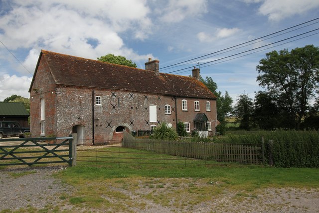
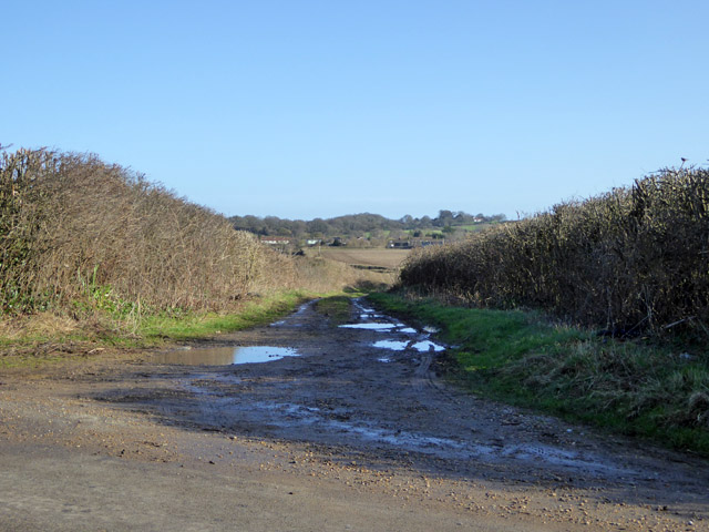
Chalbury is characterized by its picturesque rural setting, with rolling hills, green fields, and charming countryside views. The parish is primarily made up of agricultural land, with farming being an important aspect of the local economy.

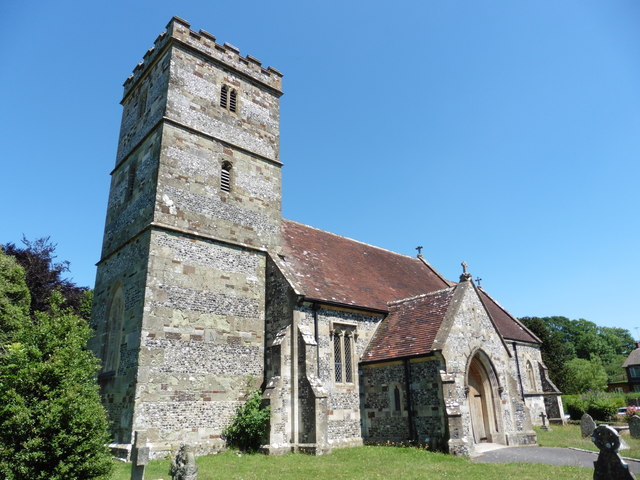
The centerpiece of Chalbury is the St. Mary's Church, a historic place of worship dating back to the 12th century. The church is known for its beautiful architecture, including a medieval tower and stained glass windows. It serves as a place of worship for the local community and also attracts visitors interested in its historical significance.

The parish of Chalbury is a close-knit community, with a strong sense of community spirit. It is home to a number of small businesses, including a village shop and a pub, which serve as meeting places for locals. The parish also organizes regular social events and activities, fostering a sense of belonging and camaraderie among its residents.

Chalbury is surrounded by natural beauty, making it an ideal location for outdoor enthusiasts. The area offers ample opportunities for hiking, cycling, and exploring the countryside. The nearby Cranborne Chase Area of Outstanding Natural Beauty provides further opportunities for outdoor recreation.

Overall, Chalbury is a tranquil and idyllic parish, offering a peaceful retreat from the hustle and bustle of city life. Its rich history, natural beauty, and strong community spirit make it a charming place to live or visit.

If you have any feedback on the listing, please let us know in the comments section below.
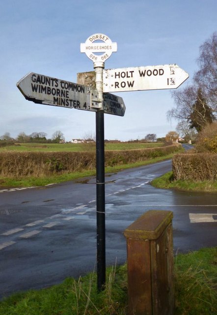
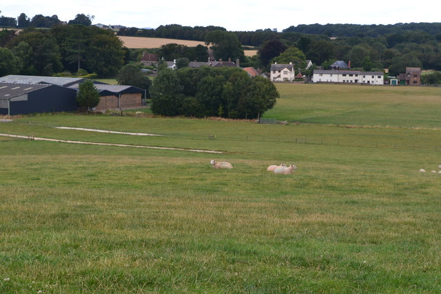
Chalbury Images

Images are sourced within 2km of 50.864611/-1.982377 or Grid Reference SU0107. Thanks to Geograph Open Source API. All images are credited.

Hay bales, Loverley Farm, Moor Crichel
Crichel Mill on the River Allen
Big sky over barley A beautiful day on a circular walk around The Horton Inn, Didlington Mill on the River Allen and Chalbury.
Big sky over barley
A beautiful day on a circular walk around The Horton Inn, Didlington Mill on the River Allen and Chalbury.
River Allen, near Didlington Mill On a beautiful, warm day in July, it was a pleasure standing by this gorgeous chalk stream, watching the brown trout and counting the damsel flies.
River Allen, near Didlington Mill
On a beautiful, warm day in July, it was a pleasure standing by this gorgeous chalk stream, watching the brown trout and counting the damsel flies.
A welcome sight after a long walk; The Horton Inn After almost 6 miles on a warm July day, the sight of The Horton Inn (white building in the distance) is very welcome and makes us pick up our pace for the last half-mile.
A welcome sight after a long walk; The Horton Inn
After almost 6 miles on a warm July day, the sight of The Horton Inn (white building in the distance) is very welcome and makes us pick up our pace for the last half-mile.
Horton Inn View The view of the Inn on the B3078 in Dorset.
Horton Inn View
The view of the Inn on the B3078 in Dorset.
Track towards Hinton Martell The Woodcutts Lane end. It is mapped with some sort of public rights.
Track towards Hinton Martell
The Woodcutts Lane end. It is mapped with some sort of public rights.
Hinton Martell, St John the Evangelist
Old Milepost by the B3078, south west of Knowlton Cast iron post by the B3078, in parish of HORTON (EAST DORSET District), 400m North East of The Horton Inn, set well into hedge by small elder tree, 6m East of telephone pole, on West side of road. Poole cast iron post, erected by the Poole turnpike trust in the 19th century. Hole in front angle.

Inscription reads:-
: 4 / CRAN(-) / BORNE : : 6 / (W)IM- / (BO)RN(E) : : POOLE / TRUST :  

Milestone Society National ID: DO_CBWB04.
Old Milepost by the B3078, south west of Knowlton
Cast iron post by the B3078, in parish of HORTON (EAST DORSET District), 400m North East of The Horton Inn, set well into hedge by small elder tree, 6m East of telephone pole, on West side of road. Poole cast iron post, erected by the Poole turnpike trust in the 19th century. Hole in front angle. Inscription reads:- : 4 / CRAN(-) / BORNE : : 6 / (W)IM- / (BO)RN(E) : : POOLE / TRUST : Milestone Society National ID: DO_CBWB04.
Horton Tower, and surrounding woodland
Old Direction Sign - Signpost in Horton village Annulus and bar finial - 3 arms; Dorset halo with NGR by the UC road, in parish of Horton (East Dorset District), Horton, junction with UC road to Chalbury Common.

Surveyed

Milestone Society National ID: DO_SU0207
Old Direction Sign - Signpost in Horton village
Annulus and bar finial - 3 arms; Dorset halo with NGR by the UC road, in parish of Horton (East Dorset District), Horton, junction with UC road to Chalbury Common. Surveyed Milestone Society National ID: DO_SU0207
Old Direction Sign - Signpost by Hell Corner, Chalbury Common Annulus and bar finial - 3 arms; Dorset halo with NGR by the UC road, in parish of Holt (East Dorset District), Chalbury Common, junction with UC road to Chalbury.

Surveyed

Milestone Society National ID: DO_SU0206B
Old Direction Sign - Signpost by Hell Corner, Chalbury Common
Annulus and bar finial - 3 arms; Dorset halo with NGR by the UC road, in parish of Holt (East Dorset District), Chalbury Common, junction with UC road to Chalbury. Surveyed Milestone Society National ID: DO_SU0206B
Old Direction Sign - Signpost at Horseshoes, Holt parish Annulus and bar finial - 4 arms; Dorset halo with NGR by the UC road, in parish of Holt (East Dorset District), Horseshoes, Uppington, at crossroads UC road to Uppington and Holt.

Surveyed

Milestone Society National ID: DO_SU0206A
Old Direction Sign - Signpost at Horseshoes, Holt parish
Annulus and bar finial - 4 arms; Dorset halo with NGR by the UC road, in parish of Holt (East Dorset District), Horseshoes, Uppington, at crossroads UC road to Uppington and Holt. Surveyed Milestone Society National ID: DO_SU0206A
Road junction at Horton
View across field towards Horton
Church of Wolfrida, Horton
Horton Tower
Horton Tower
Path from Horton Tower
Show me another place!

Chalbury is located at Grid Ref: SU0107 (Lat: 50.864611, Lng: -1.982377)

Administrative County: Dorset

District: East Dorset

Police Authority: Dorset

What 3 Words

///skills.fights.dollar. Near Three Legged Cross, Dorset

Nearby Locations

Chalbury Oxleaze Copse

Related Wikis

Chalbury

Chalbury is a village in the English county of Dorset. It lies on the southern edge of Cranborne Chase within the East Dorset administrative district of...

All Saints' Church, Chalbury

All Saints' Church is a Church of England church in Chalbury, Dorset, England. It has 13th-century origins, with later alterations and additions, and many...

Hinton Martell

Hinton Martell (also known as Hinton Martel) is a village and former civil parish, now in the civil parish of Hinton, in the county of Dorset in southern...

Horton Priory

Horton Priory was a priory at Horton in Dorset, England. It was founded as a Benedictine abbey around 970 by Ordgar, Earl of Devon, or his son, Ordulph...

Horton, Dorset

Horton is a village in East Dorset, England, situated on the boundary between the chalk downland of Cranborne Chase and the Dorset Heaths, and ten miles...

Crichel House

Crichel House is a Grade I listed, Classical Revival country house near the village of Moor Crichel in Dorset, England. The house has an entrance designed...

Moor Crichel

Moor Crichel () is a village and former civil parish, now in the parish of Crichel, in East Dorset, England situated on Cranborne Chase five miles east...

Witchampton

Witchampton is a village and civil parish in East Dorset, England, situated on the River Allen 5 miles (8 km) north of Wimborne Minster. The 2011 census...

Nearby Amenities

Located within 500m of 50.864611,-1.982377
Post Box
Post Box Type: lamp
Ref: BH21 74
Ref GB Uprn: 10015347899
Lat/Long: 50.8668056/-1.9874549
Disused Amenity: post_box
Post Box Type: wall
Lat/Long: 50.8664687/-1.9877253
The data included in this document is from www.openstreetmap.org. The data is made available under ODbL.

Have you been to Chalbury?

Leave your review of Chalbury below (or comments, questions and feedback).