Central Swindon North

Civil Parish in Wiltshire

England

Central Swindon North

Glass roof in the Great Western Outlet Village
Glass roof in the Great Western Outlet Village Credit: Steve Daniels

Central Swindon North is a civil parish located in the county of Wiltshire, England. It is situated within the larger urban area of Swindon, approximately 75 miles west of London. The parish is bordered by the River Ray to the north and is centrally located within the town of Swindon.

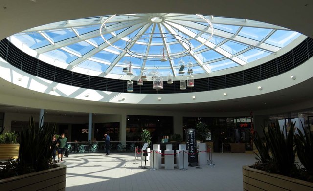
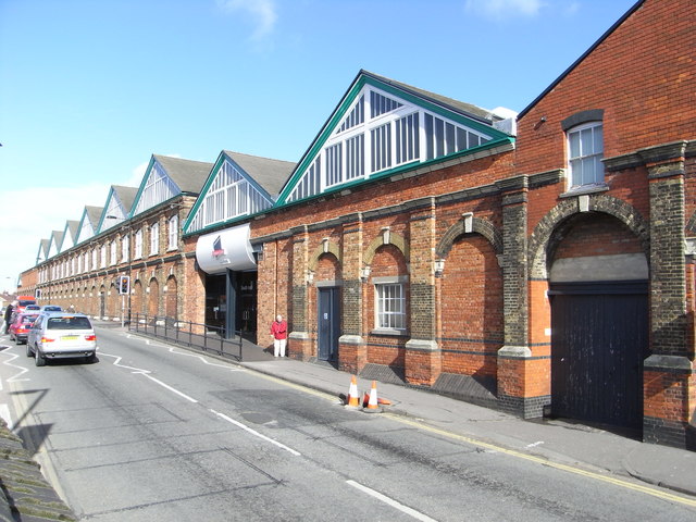
Central Swindon North has a diverse mix of residential, commercial, and industrial areas. It is home to a number of retail parks, including the popular Greenbridge Retail Park, which offers a wide range of shops, restaurants, and entertainment options. The parish also houses several large employers, including the headquarters of Nationwide Building Society.

The area is well-connected, with excellent transport links. The M4 motorway runs to the north of the parish, providing easy access to London and other parts of the country. Swindon Railway Station, located in the town center, offers regular train services to major cities such as Bristol, Cardiff, and London.

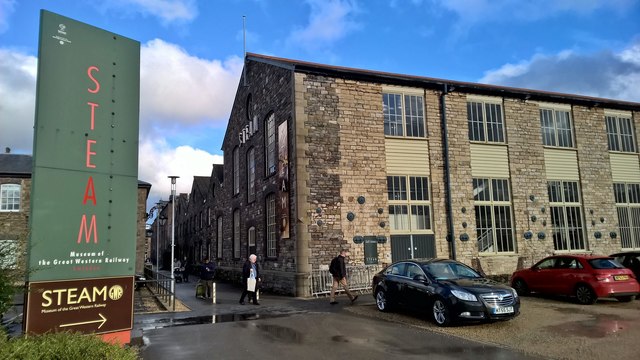
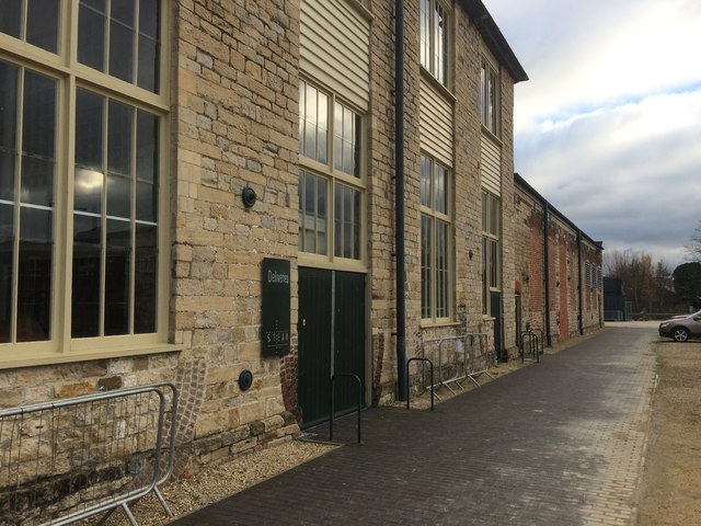
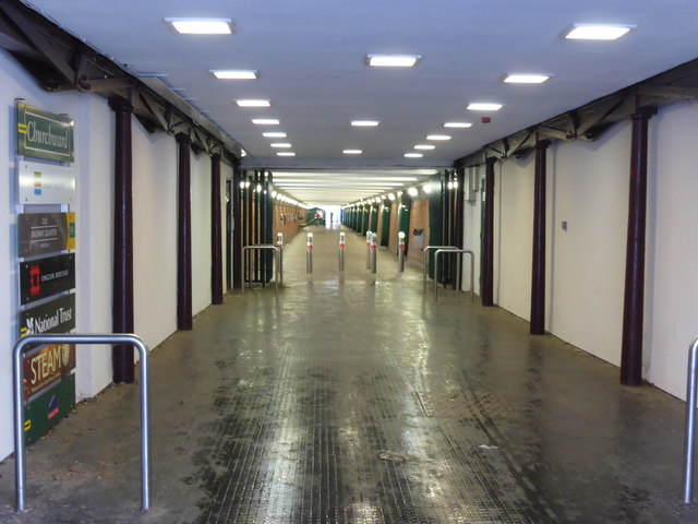
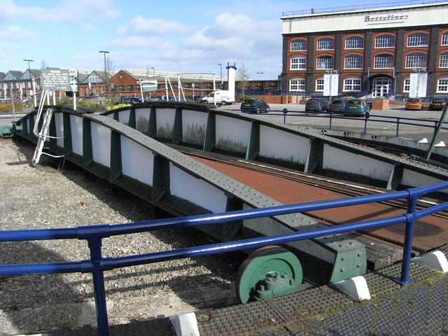
Central Swindon North is home to several notable landmarks and attractions. The STEAM Museum, situated in the former Swindon Railway Works, showcases the town's railway heritage and offers interactive exhibits for visitors. The Oasis Leisure Centre provides a range of sports and leisure facilities, including a swimming pool, gym, and ice rink.

The parish is also known for its green spaces and parks, including the popular Queens Park and Town Gardens. These areas offer a peaceful retreat for residents and visitors alike, with beautiful gardens, play areas, and sports facilities.

Overall, Central Swindon North offers a vibrant mix of residential, commercial, and leisure opportunities, making it an attractive place to live, work, and visit.

If you have any feedback on the listing, please let us know in the comments section below.

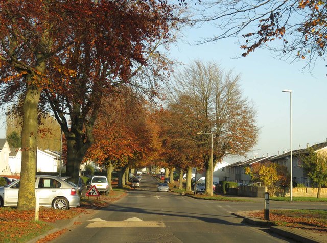
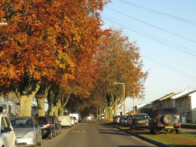
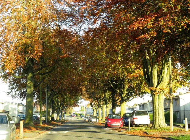
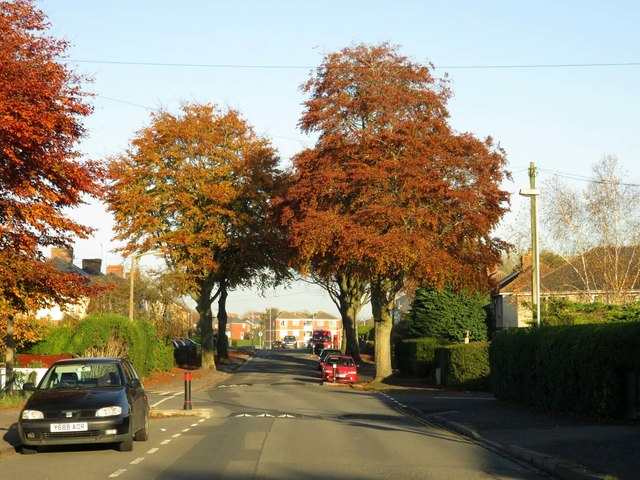
Central Swindon North Images

Images are sourced within 2km of 51.575887/-1.811059 or Grid Reference SU1386. Thanks to Geograph Open Source API. All images are credited.

Glass roof in the Great Western Outlet Village
Heelis Heelis is the headquarters of the National Trust. There is a shop and a cafe for the general public.
Heelis
Heelis is the headquarters of the National Trust. There is a shop and a cafe for the general public.
The Church of St Marks at Swindon Viewed from the north-east.
The Church of St Marks at Swindon
Viewed from the north-east.
The Church of St Mary at Rodbourne Viewed from the north.
The Church of St Mary at Rodbourne
Viewed from the north.
Ordnance Survey Cut Mark This can be found on the wall of St Mary's Church at Rodbourne.
For more detail see : <span class="nowrap"><a title="http://www.bench-marks.org.uk/bm50412" rel="nofollow ugc noopener" href="http://www.bench-marks.org.uk/bm50412">Link</a><img style="margin-left:2px;" alt="External link" title="External link - shift click to open in new window" src="https://s1.geograph.org.uk/img/external.png" width="10" height="10"/></span>
Ordnance Survey Cut Mark
This can be found on the wall of St Mary's Church at Rodbourne. For more detail see : LinkExternal link
Highworth Breakers from railway line Graffiti adorns the walls that surround Highworth Breakers, looking towards Brindley Close.
Highworth Breakers from railway line
Graffiti adorns the walls that surround Highworth Breakers, looking towards Brindley Close.
Steam, Museum of the Great Western Railway After heavy rain had just passed, on the day the National Trust held its AGM in the museum.
Steam, Museum of the Great Western Railway
After heavy rain had just passed, on the day the National Trust held its AGM in the museum.
Heelis The National Trust's headquarters opposite Steam, the Great Western Railway Museum where their Annual General Meeting was being held. The sun has returned after a morning of very heavy rain.
Heelis
The National Trust's headquarters opposite Steam, the Great Western Railway Museum where their Annual General Meeting was being held. The sun has returned after a morning of very heavy rain.
Beech Avenue in Swindon
Steam Museum
Steam Museum
The Great Western Underpass This once provided passage for railway workers from the railway village to the GWR's Swindon works. It now mainly carries shoppers between the town centre and the designer outlet village. It also gives access, for lesser numbers, to the Steam Museum and the National Monuments Record Centre.
The Great Western Underpass
This once provided passage for railway workers from the railway village to the GWR's Swindon works. It now mainly carries shoppers between the town centre and the designer outlet village. It also gives access, for lesser numbers, to the Steam Museum and the National Monuments Record Centre.
Former railway works - redevelopment Another corner of the once vast Swindon Works is being converted to houses. I believe the former chain testing shop is in this area and I believe it is to be preserved, at least in part.

See an earlier view from a slightly different angle - <a href="https://www.geograph.org.uk/photo/757413">SU1485 : Former GWR Works, Swindon</a>.
Former railway works - redevelopment
Another corner of the once vast Swindon Works is being converted to houses. I believe the former chain testing shop is in this area and I believe it is to be preserved, at least in part. See an earlier view from a slightly different angle - SU1485 : Former GWR Works, Swindon.
Old Railway Quarter redevelopment, Swindon One of the original buildings from the Great Western Railway's massive locomotive works. This is being converted to apartments but does include a Listed chain test house that is to be preserved. This includes a hydraulic chain tester with a 130 ton pull and I look forward to seeing this one day.
Old Railway Quarter redevelopment, Swindon
One of the original buildings from the Great Western Railway's massive locomotive works. This is being converted to apartments but does include a Listed chain test house that is to be preserved. This includes a hydraulic chain tester with a 130 ton pull and I look forward to seeing this one day.
Preserved turntable, Swindon This is in a car park for the designer outlet. The big building beyond is the former pattern store of the locomotive works and is now a restaurant.
Preserved turntable, Swindon
This is in a car park for the designer outlet. The big building beyond is the former pattern store of the locomotive works and is now a restaurant.
Designer Outlet Centre, Swindon This is in part of the former Great Western Railway locomotive works in Swindon.
Designer Outlet Centre, Swindon
This is in part of the former Great Western Railway locomotive works in Swindon.
Show me another place!

Central Swindon North is located at Grid Ref: SU1386 (Lat: 51.575887, Lng: -1.811059)

Unitary Authority: Swindon

Police Authority: Wiltshire

What 3 Words

///matter.pencil.rated. Near Swindon, Wiltshire

Nearby Locations

Central Swindon North

Related Wikis

Rodbourne

Rodbourne is a suburb of Swindon in Wiltshire, England, north of the town centre and about 0.9 miles (1.4 km) northwest of Swindon railway station. It...

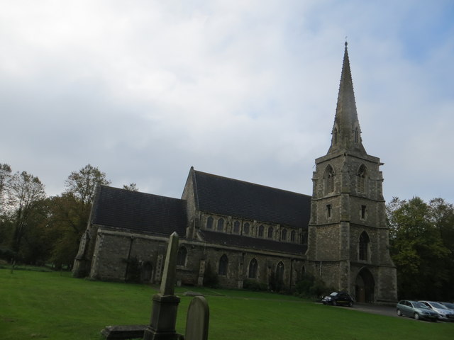
St Augustine's Church, Even Swindon

The Church of St. Augustine is an Anglican parish church in Even Swindon (also known locally as Rodbourne), an area of the town of Swindon, Wiltshire,...

Renault Centre

The Renault Centre (or the Renault Distribution Centre) is a high tech building in Swindon commissioned by the French car company Renault for their UK...

Moredon Halt railway station

Moredon Halt railway station was on the Midland and South Western Junction Railway in Wiltshire. The station, a few miles north west of Swindon, opened...

Nearby Amenities

Located within 500m of 51.575887,-1.811059
Mini Roundabout
Direction: clockwise
Lat/Long: 51.5725752/-1.8081127
Waste Basket
Waste: dog_excrement
Lat/Long: 51.5779239/-1.8077423
Camberley Auto Factors
Opening Hours: Mo-Fr 08:00-17:30; Sa 08:30-16:00
Shop: yes
Lat/Long: 51.5766876/-1.8067298
Crossing
Bicycle: dismount
Crossing: traffic_signals
Crossing Ref: pelican
Lat/Long: 51.5732395/-1.8076765
Manor Garden Centre
Shop: garden_centre
Lat/Long: 51.5773217/-1.805499
Material: wood
Power: pole
Source: Bing
Lat/Long: 51.5744888/-1.8169281
Toolstation
Brand: Toolstation
Brand Wikidata: Q7824103
Contact Website: https://www.toolstation.com/branches/swindon-cheney-manor
Shop: doityourself
Lat/Long: 51.5766342/-1.8072791
Speedy Services
Shop: yes
Lat/Long: 51.5766175/-1.8076492
TLC Electrical Supplies
Shop: yes
Lat/Long: 51.5771592/-1.8075124
Material: wood
Power: pole
Lat/Long: 51.5716252/-1.8118402
Power: pole
Lat/Long: 51.5724837/-1.813935
Material: wood
Power: pole
Lat/Long: 51.5716968/-1.8118483
Power: pole
Lat/Long: 51.572557/-1.8139163
Material: wood
Power: pole
Lat/Long: 51.5733206/-1.8160647
Material: wood
Power: pole
Lat/Long: 51.5733756/-1.8159708
Power: pole
Lat/Long: 51.5738973/-1.8130338
Material: wood
Power: pole
Lat/Long: 51.5748925/-1.8154854
Material: wood
Power: pole
Lat/Long: 51.5754293/-1.8167085
Material: wood
Power: pole
Lat/Long: 51.5744941/-1.8153808
Material: wood
Power: pole
Lat/Long: 51.5751592/-1.8169659
Material: wood
Power: pole
Lat/Long: 51.5760461/-1.8181086
Access: no
Barrier: swing_gate
Material: steel
Lat/Long: 51.5774372/-1.8105993
Pembroke Centre
Addr City: Swindon
Addr Country: GB
Addr Place: Cheney Manor Industrial Estate
Addr Unit: 83
Office: coworking
Lat/Long: 51.5735389/-1.8065643
G&A Plant and Tool Hire
Addr City: Swindon
Addr Housenumber: 1c
Addr Postcode: SN2 2PN
Addr Street: Darby Close
Opening Hours: Mo-Fr 07:30-17:00; Sa 07:30-12:30
Payment Credit Cards: yes
Payment Debit Cards: yes
Phone: +44 1793 640200
Shop: tool_hire
Website: https://www.gaplant.co.uk/
Lat/Long: 51.5731629/-1.8107676
Crossing
Lat/Long: 51.5788506/-1.8076393
Crossing
Lat/Long: 51.5788432/-1.8075661
Bus Stop
Enterprise House
Bus: yes
Naptan AtcoCode: 4680SWA10508
Naptan Bearing: S
Naptan CommonName: Enterprise House
Naptan Indicator: S-bound
Naptan NaptanCode: swiapaj
Naptan PlusbusZoneRef: SDON
Naptan Street: Darby Close
Naptan Verified: no
Public Transport: platform
Lat/Long: 51.5743793/-1.807781
Bus Stop
Enterprise House
Bus: yes
Naptan AtcoCode: 4680SWA10507
Naptan Bearing: N
Naptan CommonName: Enterprise House
Naptan Indicator: N-bound
Naptan NaptanCode: swiapag
Naptan PlusbusZoneRef: SDON
Naptan Street: Darby Close
Naptan Verified: no
Public Transport: platform
Lat/Long: 51.5746294/-1.8080229
Bus Stop
Lynton Road
Bus: yes
Naptan AtcoCode: 4680TTZ01306
Naptan Bearing: N
Naptan CommonName: Lynton Road
Naptan Indicator: N-bound
Naptan NaptanCode: swiamwj
Naptan PlusbusZoneRef: SDON
Naptan Street: Darby Close
Naptan Verified: no
Public Transport: platform
Lat/Long: 51.5767314/-1.8082049
Bus Stop
Lynton Road
Bus: yes
Naptan AtcoCode: 4680TTY38689
Naptan Bearing: S
Naptan CommonName: Lynton Road
Naptan Indicator: S-bound
Naptan NaptanCode: swiamwt
Naptan PlusbusZoneRef: SDON
Naptan Street: Darby Close
Naptan Verified: no
Public Transport: platform
Lat/Long: 51.5764533/-1.8080891
The data included in this document is from www.openstreetmap.org. The data is made available under ODbL.

Have you been to Central Swindon North?

Leave your review of Central Swindon North below (or comments, questions and feedback).