Catterick

Civil Parish in Yorkshire Richmondshire

England

Catterick

Dusk over Bolton-on-Swale Lake Taken from Back Lane, looking across the lake.
Further details from <span class="nowrap"><a title="https://www.ywt.org.uk/nature-reserves/bolton-swale-lake-nature-reserve" rel="nofollow ugc noopener" href="https://www.ywt.org.uk/nature-reserves/bolton-swale-lake-nature-reserve">Link</a><img style="margin-left:2px;" alt="External link" title="External link - shift click to open in new window" src="https://s1.geograph.org.uk/img/external.png" width="10" height="10"/></span>
Dusk over Bolton-on-Swale Lake Credit: Nick W

Catterick is a civil parish located in the district of Richmondshire, in the county of North Yorkshire, England. It is situated approximately 5 miles south-west of Richmond and 5 miles north-west of Northallerton. The parish covers an area of about 9.5 square miles and has a population of around 2,800 people.

Catterick is historically known for its military connections. It is home to Catterick Garrison, the largest British Army garrison in the world, which has been in operation since 1914. The garrison provides training and support for the army, and its presence has had a significant impact on the local economy.

The village of Catterick itself is a charming and picturesque settlement with a rich history. It features a mix of traditional stone buildings and modern developments. The village center offers a range of amenities, including shops, pubs, and restaurants.

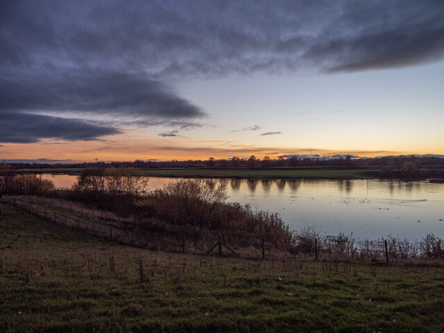
The surrounding countryside is characterized by rolling hills, fields, and woodlands, making it a popular destination for outdoor enthusiasts. The nearby River Swale also provides opportunities for fishing and boating.

Catterick Racecourse, located on the outskirts of the village, is a renowned horse racing venue. It hosts regular race meetings throughout the year, attracting visitors from across the region.

In summary, Catterick is a vibrant civil parish with a strong military presence, picturesque surroundings, and a range of amenities and attractions.

If you have any feedback on the listing, please let us know in the comments section below.

Catterick Images

Images are sourced within 2km of 54.371842/-1.63372 or Grid Reference SE2397. Thanks to Geograph Open Source API. All images are credited.

Dusk over Bolton-on-Swale Lake Taken from Back Lane, looking across the lake.
Further details from <span class="nowrap"><a title="https://www.ywt.org.uk/nature-reserves/bolton-swale-lake-nature-reserve" rel="nofollow ugc noopener" href="https://www.ywt.org.uk/nature-reserves/bolton-swale-lake-nature-reserve">Link</a><img style="margin-left:2px;" alt="External link" title="External link - shift click to open in new window" src="https://s1.geograph.org.uk/img/external.png" width="10" height="10"/></span>
Dusk over Bolton-on-Swale Lake
Taken from Back Lane, looking across the lake. Further details from LinkExternal link
Farm Land Near Bolton-on-Swale Taken from Flat Lane with St Anne's church at Catterick Village visible in the background.
Farm Land Near Bolton-on-Swale
Taken from Flat Lane with St Anne's church at Catterick Village visible in the background.
War memorial and Low Green, Catterick
The Angel Inn, Catterick Dates from the eighteenth century <span class="nowrap"><a title="https://historicengland.org.uk/listing/the-list/list-entry/1301689?section=official-list-entry" rel="nofollow ugc noopener" href="https://historicengland.org.uk/listing/the-list/list-entry/1301689?section=official-list-entry">Link</a><img style="margin-left:2px;" alt="External link" title="External link - shift click to open in new window" src="https://s1.geograph.org.uk/img/external.png" width="10" height="10"/></span>
The Angel Inn, Catterick
Dates from the eighteenth century LinkExternal link
Booth Memorial Institute, Catterick
Pallet Hill, Catterick The site of a short lived twelfth century motte <span class="nowrap"><a title="https://historicengland.org.uk/listing/the-list/list-entry/1021136?section=official-list-entry" rel="nofollow ugc noopener" href="https://historicengland.org.uk/listing/the-list/list-entry/1021136?section=official-list-entry">Link</a><img style="margin-left:2px;" alt="External link" title="External link - shift click to open in new window" src="https://s1.geograph.org.uk/img/external.png" width="10" height="10"/></span>
Pallet Hill, Catterick
The site of a short lived twelfth century motte LinkExternal link
Flat  Lane  meets  Back  Lane The Swale Way goes right to go around the large scale sand and gravel operation which is in the background
Flat Lane meets Back Lane
The Swale Way goes right to go around the large scale sand and gravel operation which is in the background
Sand  and  Gravel  workings  from  Back  Lane
Sand and Gravel workings from Back Lane
Footbridge over Brough Beck, Catterick
Stepping Stones House, Catterick Dates from the early nineteenth century <span class="nowrap"><a title="https://historicengland.org.uk/listing/the-list/list-entry/1131494?section=official-list-entry" rel="nofollow ugc noopener" href="https://historicengland.org.uk/listing/the-list/list-entry/1131494?section=official-list-entry">Link</a><img style="margin-left:2px;" alt="External link" title="External link - shift click to open in new window" src="https://s1.geograph.org.uk/img/external.png" width="10" height="10"/></span>
Stepping Stones House, Catterick
Dates from the early nineteenth century LinkExternal link
Low Green, Catterick Only Chandlers House (on the left) is listed dating from the first half of the nineteenth century <span class="nowrap"><a title="https://historicengland.org.uk/listing/the-list/list-entry/1318265?section=official-list-entry" rel="nofollow ugc noopener" href="https://historicengland.org.uk/listing/the-list/list-entry/1318265?section=official-list-entry">Link</a><img style="margin-left:2px;" alt="External link" title="External link - shift click to open in new window" src="https://s1.geograph.org.uk/img/external.png" width="10" height="10"/></span>
Low Green, Catterick
Only Chandlers House (on the left) is listed dating from the first half of the nineteenth century LinkExternal link
The Corner House, Catterick Dates from the first half of the nineteenth century <span class="nowrap"><a title="https://historicengland.org.uk/listing/the-list/list-entry/1131495?section=official-list-entry" rel="nofollow ugc noopener" href="https://historicengland.org.uk/listing/the-list/list-entry/1131495?section=official-list-entry">Link</a><img style="margin-left:2px;" alt="External link" title="External link - shift click to open in new window" src="https://s1.geograph.org.uk/img/external.png" width="10" height="10"/></span>
The Corner House, Catterick
Dates from the first half of the nineteenth century LinkExternal link
Low Green, Catterick
43 High Street, Catterick Dates from 1709 <span class="nowrap"><a title="https://historicengland.org.uk/listing/the-list/list-entry/1131492?section=official-list-entry" rel="nofollow ugc noopener" href="https://historicengland.org.uk/listing/the-list/list-entry/1131492?section=official-list-entry">Link</a><img style="margin-left:2px;" alt="External link" title="External link - shift click to open in new window" src="https://s1.geograph.org.uk/img/external.png" width="10" height="10"/></span>
43 High Street, Catterick
Dates from 1709 LinkExternal link
St Anne's church, Catterick Substantially of 1412 <span class="nowrap"><a title="https://historicengland.org.uk/listing/the-list/list-entry/1131488?section=official-list-entry" rel="nofollow ugc noopener" href="https://historicengland.org.uk/listing/the-list/list-entry/1131488?section=official-list-entry">Link</a><img style="margin-left:2px;" alt="External link" title="External link - shift click to open in new window" src="https://s1.geograph.org.uk/img/external.png" width="10" height="10"/></span>
St Anne's church, Catterick
Substantially of 1412 LinkExternal link
The former County Hotel, Catterick Dates from 1755 <span class="nowrap"><a title="https://historicengland.org.uk/listing/the-list/list-entry/1179985?section=official-list-entry" rel="nofollow ugc noopener" href="https://historicengland.org.uk/listing/the-list/list-entry/1179985?section=official-list-entry">Link</a><img style="margin-left:2px;" alt="External link" title="External link - shift click to open in new window" src="https://s1.geograph.org.uk/img/external.png" width="10" height="10"/></span>
The former County Hotel, Catterick
Dates from 1755 LinkExternal link
Catterick St Annes Church Catterick
Catterick
St Annes Church Catterick
Bolton-on-Swale Lake Nature reserve and bird hide, managed by Yorkshire Wildlife Trust
Bolton-on-Swale Lake
Nature reserve and bird hide, managed by Yorkshire Wildlife Trust
Show me another place!

Catterick is located at Grid Ref: SE2397 (Lat: 54.371842, Lng: -1.63372)

Division: North Riding

Administrative County: North Yorkshire

District: Richmondshire

Police Authority: North Yorkshire

What 3 Words

///cuddling.playback.blackbird. Near Catterick, North Yorkshire

Nearby Locations

Catterick Catterick

Related Wikis

Church of St Anne, Catterick

The Church of St Anne is a parish church in the village of Catterick, North Yorkshire, England. The present church structure dates back to the early 15th...

Catterick, North Yorkshire

Catterick () is a village, civil parish and electoral ward in North Yorkshire, England. Historically part of the North Riding of Yorkshire, it is 8.5 miles...

Battle of Catraeth

The Battle of Catraeth was fought around AD 600 between a force raised by the Gododdin, a Brythonic people of the Hen Ogledd or "Old North" of Britain...

RAF Catterick

Royal Air Force Catterick or RAF Catterick is a former Royal Air Force airfield located near Catterick, North Yorkshire in England. It is located alongside...

Nearby Amenities

Located within 500m of 54.371842,-1.63372
Barrier: bollard
Lat/Long: 54.3728427/-1.6353389
Turning Circle
Lat/Long: 54.3750791/-1.6345708
Noexit: yes
Lat/Long: 54.3746644/-1.6307014
Noexit: yes
Lat/Long: 54.3710245/-1.6290475
Noexit: yes
Lat/Long: 54.3746995/-1.6305702
Post Box
Check Date: 2021-10-03
Operator: Royal Mail
Operator Wikidata: Q638098
Ref: DL10 108
Royal Cypher: EIIR
Royal Cypher Wikidata: Q33102113
Source: survey
Lat/Long: 54.3718512/-1.6294374
Post Box
Source: survey
Lat/Long: 54.3750721/-1.6335085
Turning Circle
Noexit: yes
Lat/Long: 54.3718616/-1.6286775
Turning Circle
Lat/Long: 54.3733218/-1.6278079
Military: checkpoint
Lat/Long: 54.3689877/-1.6289001
Man Made: tower
Lat/Long: 54.3704664/-1.6276757
Man Made: tower
Tower Construction: lattice
Tower Type: communication
Lat/Long: 54.370993/-1.6339937
The data included in this document is from www.openstreetmap.org. The data is made available under ODbL.

Have you been to Catterick?

Leave your review of Catterick below (or comments, questions and feedback).