Castlemorton

Civil Parish in Worcestershire Malvern Hills

England

Castlemorton

Cattle on Castlemorton Common Looking north-west from near Hurst Farm towards Pinnacle Hill in the background. Cattle spend most of the year on the common, managed by commoners under licence from the Malvern Hills Conservators.
Cattle on Castlemorton Common Credit: Trevor Rickard

Castlemorton is a civil parish located in the county of Worcestershire, England. Situated in the Malvern Hills District, this rural area covers an approximate area of 19 square kilometers. The parish encompasses the small hamlet of Hollybush and is bordered by the neighboring parishes of Welland, Berrow, Birtsmorton, and Hollybush.

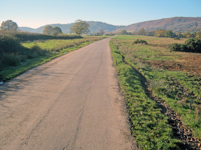
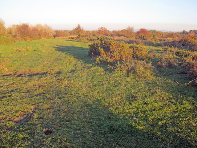
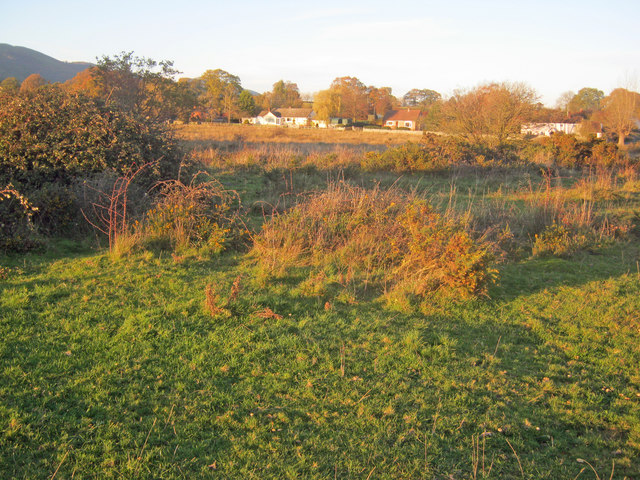
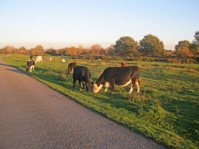
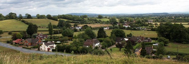
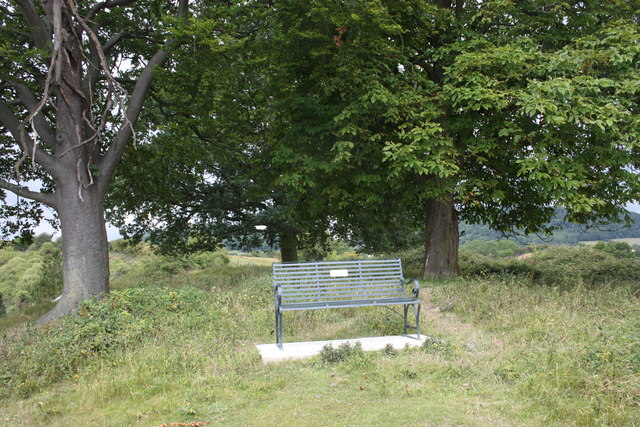
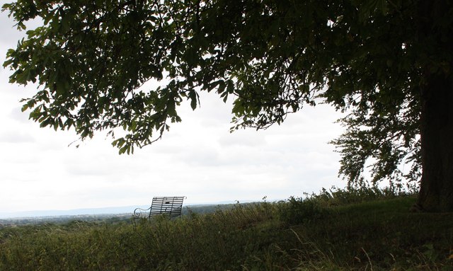
The village of Castlemorton itself is nestled in the stunning countryside of the Malvern Hills, an Area of Outstanding Natural Beauty. It is renowned for its picturesque landscapes, rolling hills, and breathtaking views. The area is popular among nature lovers and outdoor enthusiasts, offering ample opportunities for hiking, cycling, and exploring the surrounding countryside.

The village is home to a close-knit community, with a small population of approximately 500 residents. It has a charming village hall, which serves as a hub for social activities and community events. The village also has a primary school, providing education to the local children.

Historically, Castlemorton is known for its ancient connection to the Knights Templar, with remnants of their presence still visible in the area. The parish boasts a rich heritage, with notable landmarks such as the 12th-century St. Gregory's Church, which is a Grade II listed building.

In terms of amenities, Castlemorton is relatively quiet, with limited services available. However, the nearby towns of Malvern and Upton-upon-Severn offer a wider range of facilities, including shops, restaurants, and healthcare services.

Overall, Castlemorton is a tranquil and picturesque civil parish, offering beautiful countryside, a strong sense of community, and a peaceful way of life.

If you have any feedback on the listing, please let us know in the comments section below.
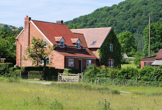
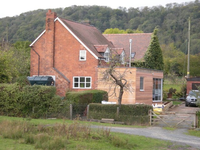
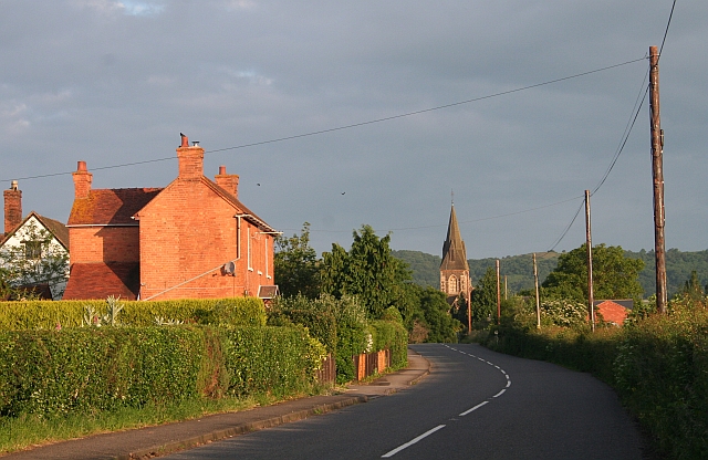
Castlemorton Images

Images are sourced within 2km of 52.039583/-2.307197 or Grid Reference SO7937. Thanks to Geograph Open Source API. All images are credited.

Cattle on Castlemorton Common Looking north-west from near Hurst Farm towards Pinnacle Hill in the background. Cattle spend most of the year on the common, managed by commoners under licence from the Malvern Hills Conservators.
Cattle on Castlemorton Common
Looking north-west from near Hurst Farm towards Pinnacle Hill in the background. Cattle spend most of the year on the common, managed by commoners under licence from the Malvern Hills Conservators.
Castlemorton Common Looking south-west along the south edge of the large common stretching right up to the foot of the Malvern Hills.
Castlemorton Common
Looking south-west along the south edge of the large common stretching right up to the foot of the Malvern Hills.
Cattle on Castlemorton Common - 2 Looking west with Little Malvern Priory in the background.
Cattle on Castlemorton Common - 2
Looking west with Little Malvern Priory in the background.
Lane across Castlemorton Common Long straight lane heading towards Hollybush. Popular route for weekend picnics as it is possible to park on many of the green spaces.
Lane across Castlemorton Common
Long straight lane heading towards Hollybush. Popular route for weekend picnics as it is possible to park on many of the green spaces.
Scrubland at Castlemorton Common View east with Bredon Hill just visible on the horizon. The evening sun highlights the mixture of rough grazing, gorse and scrub in this more inaccessible part of the common.
Scrubland at Castlemorton Common
View east with Bredon Hill just visible on the horizon. The evening sun highlights the mixture of rough grazing, gorse and scrub in this more inaccessible part of the common.
West side of Castlemorton Common Looking north to the cottages on Hancock's Lane lit up by the evening sun.
West side of Castlemorton Common
Looking north to the cottages on Hancock's Lane lit up by the evening sun.
Cattle grazing near Hancocks Lane Cattle are always to be found somewhere on the common where commoners exercise their grazing rights.
Cattle grazing near Hancocks Lane
Cattle are always to be found somewhere on the common where commoners exercise their grazing rights.
Coombegreen The view from Wendy Woodward's seat atop the hillock on Coombegreen Common.
Looking out to the houses on the B4208 and those on Birts Street.
<a href="https://www.geograph.org.uk/photo/2511815">SO7736 : Wendy Woodward's seat, Coombegreen Common</a>
Coombegreen
The view from Wendy Woodward's seat atop the hillock on Coombegreen Common. Looking out to the houses on the B4208 and those on Birts Street. SO7736 : Wendy Woodward's seat, Coombegreen Common
Wendy Woodward's seat, Coombegreen Common The seat is at the front of the hill overlooking the Severn Plain.
Behind are several commemorative trees including one dating back to 1937 for the King's Coronation.
<a href="https://www.geograph.org.uk/photo/2511845">SO7736 : Plaque on Wendy Woodward's seat, Coombe Green</a>
<a href="https://www.geograph.org.uk/photo/2511865">SO7736 : Wendy Woodward's seat, Coombe Green Common</a>
<a href="https://www.geograph.org.uk/photo/2511797">SO7736 : Coombegreen</a>
Wendy Woodward's seat, Coombegreen Common
The seat is at the front of the hill overlooking the Severn Plain. Behind are several commemorative trees including one dating back to 1937 for the King's Coronation. SO7736 : Plaque on Wendy Woodward's seat, Coombe Green SO7736 : Wendy Woodward's seat, Coombe Green Common SO7736 : Coombegreen
Plaque on Wendy Woodward's seat, Coombe Green In loving memory of
Wendy Woodward
Died 3 March 2004 aged 90 years
Enjoy the view as she did
<a href="https://www.geograph.org.uk/photo/2511815">SO7736 : Wendy Woodward's seat, Coombegreen Common</a>
Plaque on Wendy Woodward's seat, Coombe Green
In loving memory of Wendy Woodward Died 3 March 2004 aged 90 years Enjoy the view as she did SO7736 : Wendy Woodward's seat, Coombegreen Common
Wendy Woodward's seat, Coombe Green Common At the front of the hill overlooking the Severn Plain.
<a href="https://www.geograph.org.uk/photo/2511815">SO7736 : Wendy Woodward's seat, Coombegreen Common</a>
Wendy Woodward's seat, Coombe Green Common
At the front of the hill overlooking the Severn Plain. SO7736 : Wendy Woodward's seat, Coombegreen Common
'Ambleside' Castlemorton Common 2009 A large victorian house, considerably extended with matching gables, tiles and brickwork.
'Ambleside' Castlemorton Common 2009
A large victorian house, considerably extended with matching gables, tiles and brickwork.
Ambleside, Castlemorton Common 2011 Large Victorian House now altered and extended. 

Design by Josh Thomas Design House, Ledbury.
<span class="nowrap"><a title="http://www.joshthomasdesignhouse.co.uk/architecture/" rel="nofollow ugc noopener" href="http://www.joshthomasdesignhouse.co.uk/architecture/">Link</a><img style="margin-left:2px;" alt="External link" title="External link - shift click to open in new window" src="https://s1.geograph.org.uk/img/external.png" width="10" height="10"/></span>
Ambleside, Castlemorton Common 2011
Large Victorian House now altered and extended. Design by Josh Thomas Design House, Ledbury. LinkExternal link
Commemorative Tree, Coombegreen Common One of several trees that appear to be planted on the knoll to commemorate royal occasions.
This one was probably planted for the marriage of William and Katherine in 2011.
Will another appear this year for Her Majesty's Diamond Jubilee?
Ragged Stone Hill in the background.
Commemorative Tree, Coombegreen Common
One of several trees that appear to be planted on the knoll to commemorate royal occasions. This one was probably planted for the marriage of William and Katherine in 2011. Will another appear this year for Her Majesty's Diamond Jubilee? Ragged Stone Hill in the background.
Grounds Farm Just off Hancocks Lane with the Hangman's Hill in the distance.
Grounds Farm
Just off Hancocks Lane with the Hangman's Hill in the distance.
Grounds Farm Just off Hancocks Lane.
Grounds Farm
Just off Hancocks Lane.
Former Roberts' Garage, Welland Provided petrol, servicing and repair for many decades.
Recently it became a second hand caravan sales enterprise with the petrol pumps removed.
It has now been sold with "residential redevelopment potential".
To see how this view has changed see <a href="https://www.geograph.org.uk/photo/3934633">SO7939 : Housing development on former garage, Welland</a>
Former Roberts' Garage, Welland
Provided petrol, servicing and repair for many decades. Recently it became a second hand caravan sales enterprise with the petrol pumps removed. It has now been sold with "residential redevelopment potential". To see how this view has changed see SO7939 : Housing development on former garage, Welland
Footpath into pasture This public path joins a network of rights-of-way between Birts Street and Rye Street.
Footpath into pasture
This public path joins a network of rights-of-way between Birts Street and Rye Street.
Show me another place!

Castlemorton is located at Grid Ref: SO7937 (Lat: 52.039583, Lng: -2.307197)

Administrative County: Worcestershire

District: Malvern Hills

Police Authority: West Mercia

What 3 Words

///growth.trample.charcoal. Near Upton upon Severn, Worcestershire

Nearby Locations

Castlemorton Castlemorton

Related Wikis

Castlemorton

Castlemorton is a village and civil parish close to Malvern in the Malvern Hills District in the county of Worcestershire, England. It consists of a...

Hollybed Farm Meadows

Hollybed Farm Meadows is nature reserve of the Worcestershire Wildlife Trust, about 1 mile (1.6 km) west of the village of Castlemorton, in Worcestershire...

Castlemorton Common Festival

The Castlemorton Common Festival was a week-long free festival and rave held in the Malvern Hills near Malvern, Worcestershire, England between 22 and...

Birts Street

Birts Street is a village in Worcestershire, England.

Welland, Worcestershire

Welland is a village and civil parish in the administrative district of Malvern Hills in the county of Worcestershire, England. It has a combined parish...

Rye Cross

Rye Cross is a hamlet in south-west Worcestershire 1 mile west of Castlemorton, 0.5 miles east of Berrow and 1 mile south of Hollybush, near the borders...

Hollybush, Worcestershire

Hollybush is a small village in Worcestershire at the southern end of the Malvern Hills and close to the borders of both Gloucestershire and Herefordshire...

Birtsmorton

Birtsmorton is a village and civil parish in the Malvern Hills of Worcestershire, England, which at the 2021 census had a population of 257. It is in...

Nearby Amenities

Located within 500m of 52.039583,-2.307197
Robin Hood
Naptan AtcoCode: 2000G017100
Naptan Bearing: S
Naptan BusStopType: CUS
Naptan CommonName: Robin Hood
Naptan Indicator: adj
Naptan Landmark: Robin Hood Inn
Naptan NaptanCode: wocdjmaw
Naptan Street: B4208
Naptan Verified: no
Source: naptan_import
Lat/Long: 52.040307/-2.3126163
Robin Hood
Naptan AtcoCode: 2000G717100
Naptan Bearing: N
Naptan BusStopType: CUS
Naptan CommonName: Robin Hood
Naptan Indicator: opp
Naptan Landmark: Robin Hood Inn
Naptan NaptanCode: wocdwatp
Naptan Street: B4208
Naptan Verified: no
Source: naptan_import
Lat/Long: 52.0401176/-2.3128337
Barrier: stile
Lat/Long: 52.0388894/-2.3011277
Post Box
Description: This appears to be The Old Post Office in Castlemorton
Fixme2: ref is by conjecture;the postcode on the FOI list is wrong;it points to the wrong PO.
Post Box Type: wall
Ref: WR13 84
Lat/Long: 52.0362899/-2.3113168
Barrier: stile
Lat/Long: 52.0395748/-2.3053818
Telephone
Booth: K6
Covered: booth
Lat/Long: 52.0361239/-2.3111741
Robin Hood
Power: pole
Transformer: distribution
Voltage Primary: 11000
Lat/Long: 52.0396374/-2.3122774
Power: pole
Lat/Long: 52.0392121/-2.312266
Power: pole
Lat/Long: 52.0388058/-2.3122653
Power: pole
Lat/Long: 52.0381789/-2.3125041
Bannut
Power: pole
Transformer: distribution
Voltage Primary: 11000
Lat/Long: 52.0370598/-2.3129781
Power: pole
Lat/Long: 52.0374158/-2.3134401
Power: pole
Lat/Long: 52.037344/-2.3128742
Power: pole
Lat/Long: 52.0372025/-2.3118228
Castlemorton Post Office
Power: pole
Transformer: distribution
Voltage Primary: 11000
Lat/Long: 52.036307/-2.3104046
Power: pole
Lat/Long: 52.0370647/-2.3107586
Power: pole
Lat/Long: 52.0368311/-2.3095221
Power: pole
Lat/Long: 52.0365778/-2.3080824
Power: pole
Lat/Long: 52.0363618/-2.3065402
Location Transition: yes
Power: pole
Lat/Long: 52.0361234/-2.3047733
Power: pole
Lat/Long: 52.0359609/-2.3036568
The data included in this document is from www.openstreetmap.org. The data is made available under ODbL.

Have you been to Castlemorton?

Leave your review of Castlemorton below (or comments, questions and feedback).