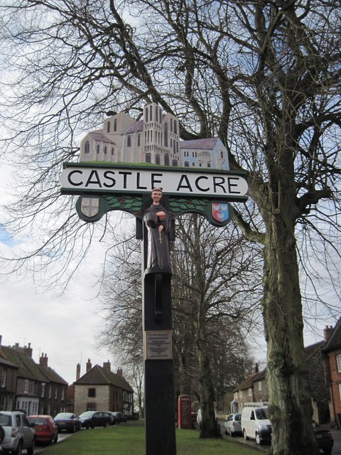
Castle Acre

Civil Parish in Norfolk King's Lynn and West Norfolk

England

Castle Acre

Grazing sheep near High House, West Acre Pasture on the southern part of the extensive parkland surrounding High House, see <span class="nowrap"><a title="http://www.britishlistedbuildings.co.uk/en-221920-high-house-west-acre-norfolk" rel="nofollow ugc noopener" href="http://www.britishlistedbuildings.co.uk/en-221920-high-house-west-acre-norfolk">Link</a><img style="margin-left:2px;" alt="External link" title="External link - shift click to open in new window" src="https://s1.geograph.org.uk/img/external.png" width="10" height="10"/></span>
Grazing sheep near High House, West Acre Credit: Richard Humphrey

Castle Acre is a civil parish located in the county of Norfolk, England. Situated approximately 5 miles north of Swaffham, it is a small village with a population of around 600 residents. The parish is known for its historical significance, particularly its well-preserved castle and priory.

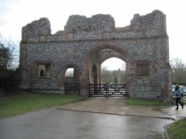
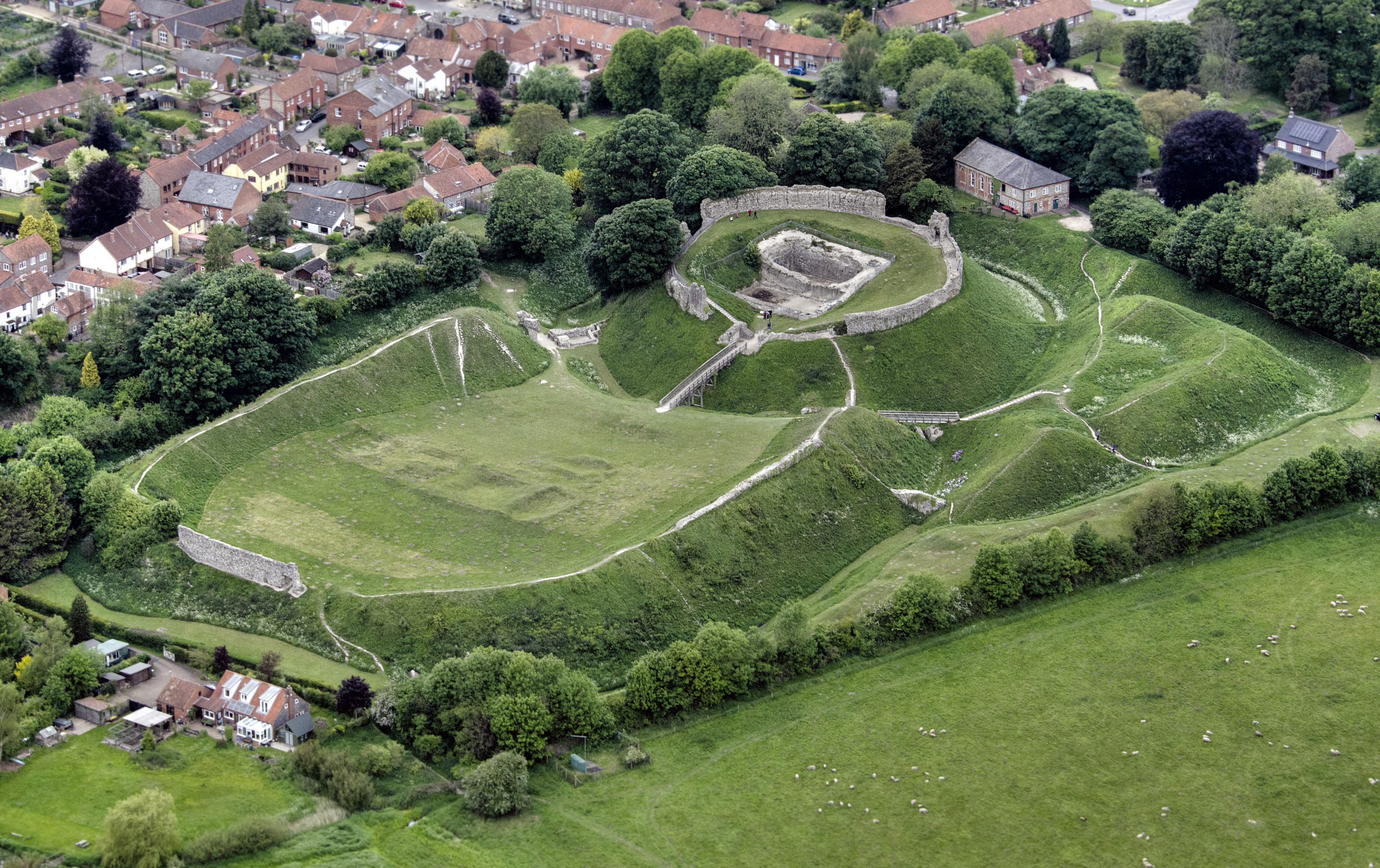
One of the main attractions in Castle Acre is the Castle Acre Castle. Built in the late 11th century, it was once the residence of the powerful de Warenne family. The castle consists of a motte and bailey structure, with a large stone keep and inner and outer baileys. Visitors can explore the ruins and learn about the castle's history through informative displays.

Adjacent to the castle is the Castle Acre Priory, a monastic site founded in 1089 by William de Warenne and his wife, Gundrada. The priory, which belonged to the Cluniac order, was one of the largest and wealthiest monastic establishments in England during the medieval period. Today, visitors can wander through the extensive ruins, including the impressive cloister, chapter house, and beautiful gardens.

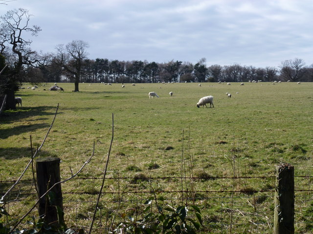
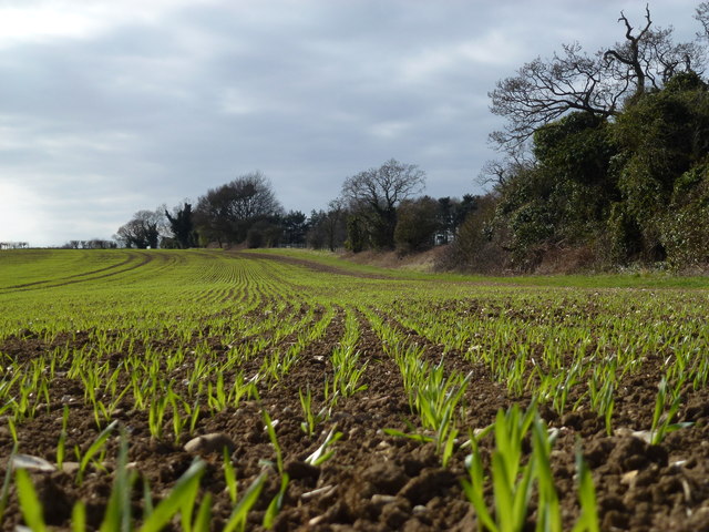
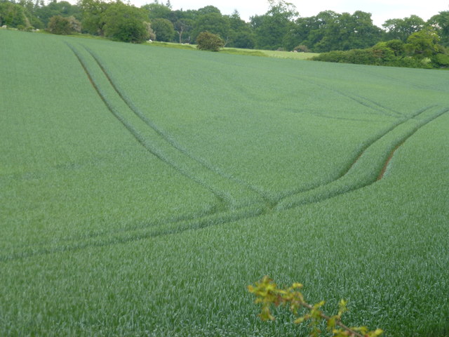
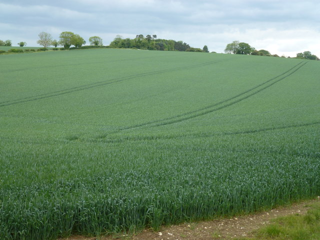
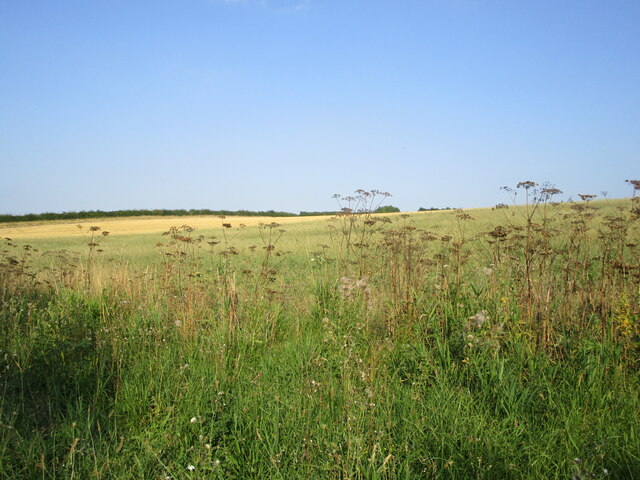
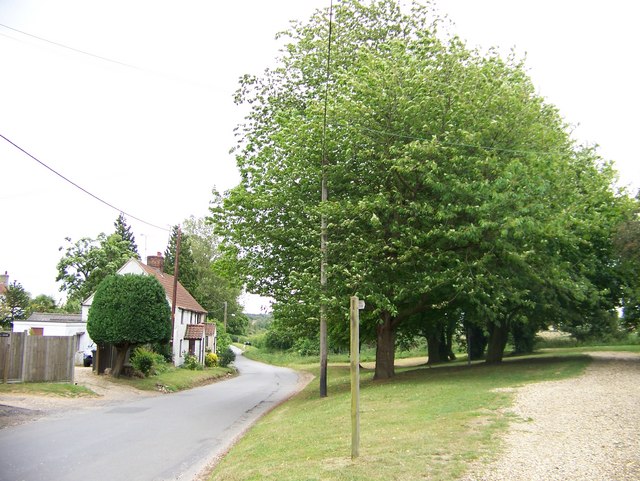
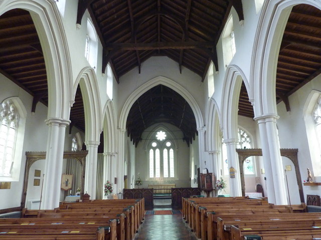
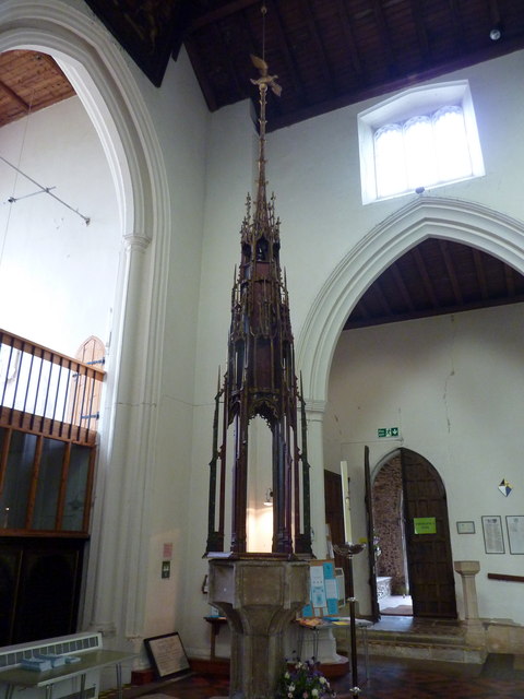
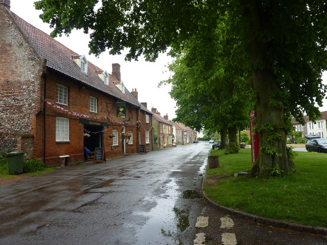
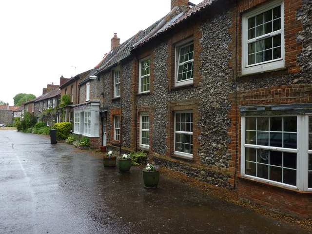
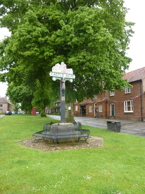
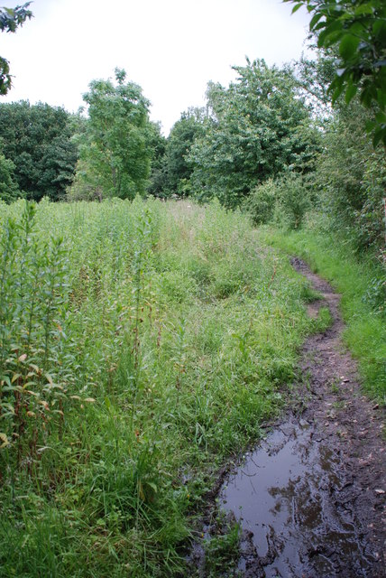
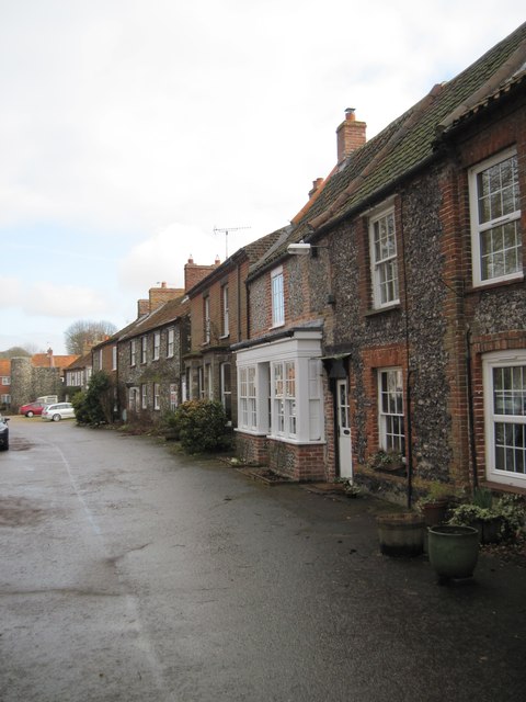
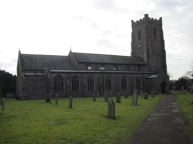
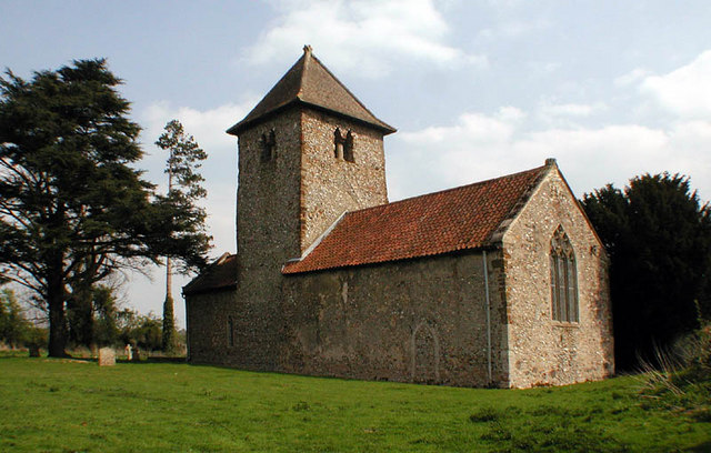
Aside from its historical sites, Castle Acre offers picturesque countryside views, with plenty of walking and cycling routes in the surrounding area. The village itself features charming traditional cottages, a village green, and a Norman church, St. James's Church, which dates back to the 12th century.

Castle Acre is also home to a few amenities, including a village shop, a pub, and a tea room, making it a pleasant destination for tourists exploring the Norfolk countryside.

If you have any feedback on the listing, please let us know in the comments section below.

Castle Acre Images

Images are sourced within 2km of 52.719368/0.684418 or Grid Reference TF8116. Thanks to Geograph Open Source API. All images are credited.

Grazing sheep near High House, West Acre Pasture on the southern part of the extensive parkland surrounding High House, see <span class="nowrap"><a title="http://www.britishlistedbuildings.co.uk/en-221920-high-house-west-acre-norfolk" rel="nofollow ugc noopener" href="http://www.britishlistedbuildings.co.uk/en-221920-high-house-west-acre-norfolk">Link</a><img style="margin-left:2px;" alt="External link" title="External link - shift click to open in new window" src="https://s1.geograph.org.uk/img/external.png" width="10" height="10"/></span>
Grazing sheep near High House, West Acre
Pasture on the southern part of the extensive parkland surrounding High House, see LinkExternal link
A rabbit's eye view of Norfolk farmland Emerging cereal crop alongside the parkland of High House, West Acre
A rabbit's eye view of Norfolk farmland
Emerging cereal crop alongside the parkland of High House, West Acre
Parallel lines in the wheat Norfolk farmland between West Acre and West Acre Gardens at High House. There is a crop of barley in the adjoining field, see <a title="https://www.geograph.org.uk/photo/3992116" href="https://www.geograph.org.uk/photo/3992116">Link</a>
Parallel lines in the wheat
Norfolk farmland between West Acre and West Acre Gardens at High House. There is a crop of barley in the adjoining field, see Link
Shades of dark green in Norfolk A field of wheat between West Acre and West Acre Gardens at High House. There is a crop of barley in the adjoining field, see <a title="https://www.geograph.org.uk/photo/3992080" href="https://www.geograph.org.uk/photo/3992080">Link</a>
Shades of dark green in Norfolk
A field of wheat between West Acre and West Acre Gardens at High House. There is a crop of barley in the adjoining field, see Link
Path towards Swanlane Belt This is not an official path but does appear to be quite well used.
Path towards Swanlane Belt
This is not an official path but does appear to be quite well used.
Hogweed and stubble fields
Unclassified road heading east from Castle Acre
The church of St. James the Great, Castle Acre Part of the medieval rood screen.
The church of St. James the Great, Castle Acre
Part of the medieval rood screen.
Church of St. James the Great, Castle Acrre The nave, looking east.
Church of St. James the Great, Castle Acrre
The nave, looking east.
Church of St. James the Great, Castle Acrre Unusual 15th century perpendicular font cover surmounted by a golden orb and dove. Restoration work has uncovered much of the green, red and gold paintwork. The font is also 15th century.
Church of St. James the Great, Castle Acrre
Unusual 15th century perpendicular font cover surmounted by a golden orb and dove. Restoration work has uncovered much of the green, red and gold paintwork. The font is also 15th century.
High Street, Castle Acre The Ostrich public house in the foreground, the Albert Victor in the distance.
High Street, Castle Acre
The Ostrich public house in the foreground, the Albert Victor in the distance.
High Street, Castle Acre Cottages near the east end of the road.
High Street, Castle Acre
Cottages near the east end of the road.
Castle Acre village sign Viewed from the end of High Street.
Castle Acre village sign
Viewed from the end of High Street.
Broadmeadow Common Ford This ford is found on Sandy Lane, a byway west of Castle Acre. The ford is now silted over but a local resident told me that the milk float used to deliver milk that way.
Broadmeadow Common Ford
This ford is found on Sandy Lane, a byway west of Castle Acre. The ford is now silted over but a local resident told me that the milk float used to deliver milk that way.
Cottages  in  Castle  Acre The Bailey Gate can be seen at the end, behind the red car.
Cottages in Castle Acre
The Bailey Gate can be seen at the end, behind the red car.
Parish  Church  of  St  James  the  Great  Castle  Acre This church dates from the 12th century, enlarged over the years, the tower is 14th century with other additions in the 15th century. In the 19th century two substantial restorations were carried out in 1846 and 1875.
Parish Church of St James the Great Castle Acre
This church dates from the 12th century, enlarged over the years, the tower is 14th century with other additions in the 15th century. In the 19th century two substantial restorations were carried out in 1846 and 1875.
Castle  Acre  Village  Commemorative  Sign On the green to the south side of High Street.
Castle Acre Village Commemorative Sign
On the green to the south side of High Street.
Gateway  to  Castle  Acre  Priory
Gateway to Castle Acre Priory
Show me another place!

Castle Acre is located at Grid Ref: TF8116 (Lat: 52.719368, Lng: 0.684418)

Administrative County: Norfolk

District: King's Lynn and West Norfolk

Police Authority: Norfolk

What 3 Words

///iterative.snippet.missions. Near Narborough, Norfolk

Nearby Locations

Castle Acre

Related Wikis

Peddars Way

The Peddars Way is a long distance footpath that passes through Suffolk and Norfolk, England. == Route == The Peddars Way is 46 miles (74 km) long and...

Castle Acre

Castle Acre is a village and civil parish in the English county of Norfolk. The village is situated on the River Nar some 4 miles (6.4 km) north of the...

Castle Acre Castle and town walls

Castle Acre Castle and town walls are a set of ruined medieval defences built in the village of Castle Acre, Norfolk. The castle was built soon after the...

Castle Acre Priory

Castle Acre Priory was a Cluniac priory in the village of Castle Acre, Norfolk, England, dedicated to St Mary, St Peter, and St Paul. It is thought to...

Castle Acre Common

Castle Acre Common is a 17.8-hectare (44-acre) biological Site of Special Scientific Interest east of King's Lynn in Norfolk.This unimproved grazing marsh...

Newton by Castle Acre

Newton by Castle Acre is a village, Anglican parish and civil parish in the Breckland district of the English county of Norfolk. It is situated on the...

South Acre

South Acre is a village and civil parish in the English county of Norfolk. The village has almost disappeared, but the remnants are located about 1 km...

West Lexham

West Lexham is a village and former civil parish, now in the parish of Lexham, in the Breckland district, in the county of Norfolk, England. It is 5.9...

Have you been to Castle Acre?

Leave your review of Castle Acre below (or comments, questions and feedback).