Carlton Highdale

Civil Parish in Yorkshire Richmondshire

England

Carlton Highdale

Ford and Footbridge at Braidley This ford is found on the River Cover at Braidley.
Ford and Footbridge at Braidley Credit: John Walton

Carlton Highdale is a small civil parish located in the Yorkshire Dales National Park, in the county of Yorkshire, England. Situated in the Richmondshire district, the parish covers an area of approximately 10 square kilometers and has a population of around 200 residents.

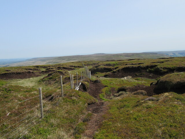
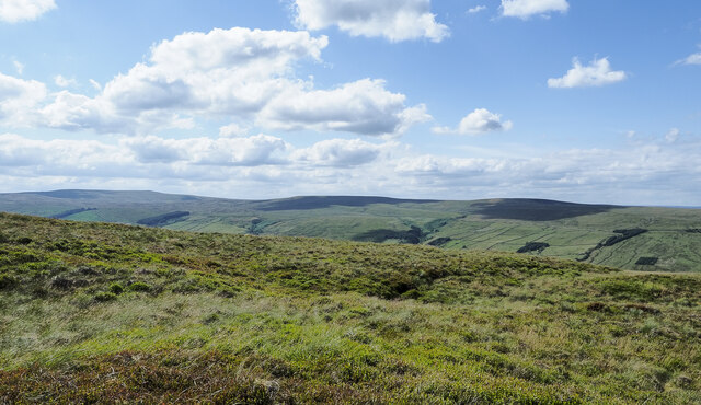
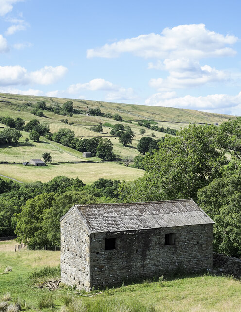
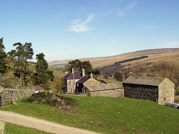
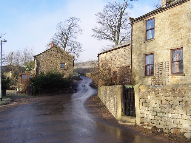
The village of Carlton Highdale is nestled in a picturesque valley, surrounded by rolling hills and lush green countryside. It is characterized by its charming stone-built houses, many of which date back to the 18th and 19th centuries, giving the village a quaint and traditional ambiance.

The parish is predominantly rural, with agriculture being an important part of the local economy. The fertile land supports livestock farming, particularly sheep farming, as well as some arable farming. The village itself has a small number of amenities, including a local pub and a village hall, which serves as a community gathering place for various events and activities.

The surrounding area provides ample opportunities for outdoor activities, with numerous walking and cycling trails crisscrossing the countryside. The nearby River Swale also offers fishing opportunities for enthusiasts. The parish is also within easy reach of popular tourist attractions, such as the Aysgarth Falls and the historic town of Richmond.

Overall, Carlton Highdale offers a peaceful and idyllic setting for those seeking a rural lifestyle in the heart of the Yorkshire Dales. Its natural beauty, coupled with its close-knit community, make it an attractive place to live or visit for those looking to escape the hustle and bustle of city life.

If you have any feedback on the listing, please let us know in the comments section below.

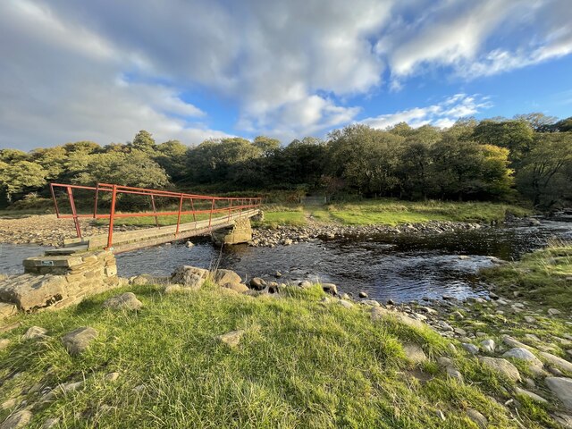
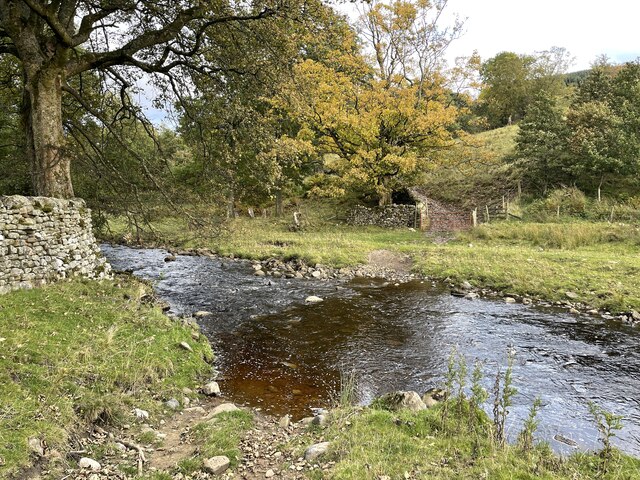
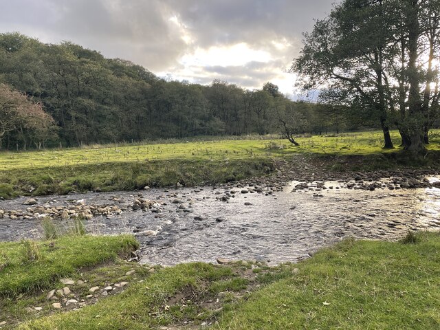
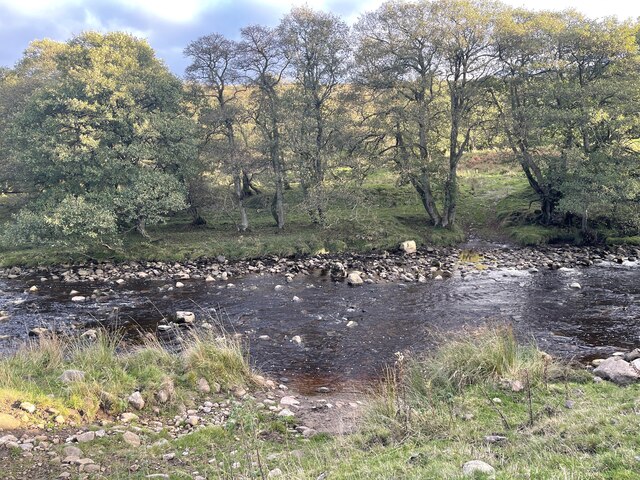
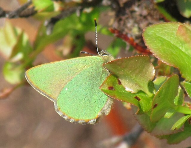
Carlton Highdale Images

Images are sourced within 2km of 54.210565/-1.965252 or Grid Reference SE0279. Thanks to Geograph Open Source API. All images are credited.

Ford and Footbridge at Braidley This ford is found on the River Cover at Braidley.
Ford and Footbridge at Braidley
This ford is found on the River Cover at Braidley.
Ford on the River Cover This is a second ford on the River Cover at Braidley.
Ford on the River Cover
This is a second ford on the River Cover at Braidley.
River Cover Ford A third ford on the River Cover at this location.
River Cover Ford
A third ford on the River Cover at this location.
River Cover Ford This is another of the series of fords on the River Cover at this location.
River Cover Ford
This is another of the series of fords on the River Cover at this location.
River Cover Ford This is the final ford at this stretch of the River Cover.
River Cover Ford
This is the final ford at this stretch of the River Cover.
Sun and mist in Coverdale A similar view to one taken almost 3 years previously, but on this occasion the late November sun contrasted with lengthening shadows and mist that was creeping over the fell tops from Nidderdale.
Sun and mist in Coverdale
A similar view to one taken almost 3 years previously, but on this occasion the late November sun contrasted with lengthening shadows and mist that was creeping over the fell tops from Nidderdale.
Mist creeping into the dale The view up Coverdale towards Woodale on a late autumn afternoon when mist was creeping in over the felltops to eventually fill the valley.
Mist creeping into the dale
The view up Coverdale towards Woodale on a late autumn afternoon when mist was creeping in over the felltops to eventually fill the valley.
Green Hairstreak There were many Green Hairstreaks on Little Whernside.
Green Hairstreak
There were many Green Hairstreaks on Little Whernside.
Little Whernside summit The summit of Little Whernside at 604m.
Little Whernside summit
The summit of Little Whernside at 604m.
Rough moorland slope on Little Whernside The location is east-north-east of Little Whernside's summit where there's heather and grass moorland mingled with bilberry.
Buckden Pike is at the far left of the image with hill domes on the north side of Coverdale nearer and to the right.
Rough moorland slope on Little Whernside
The location is east-north-east of Little Whernside's summit where there's heather and grass moorland mingled with bilberry. Buckden Pike is at the far left of the image with hill domes on the north side of Coverdale nearer and to the right.
Large barn beside Harkera Gill The barn appears to be in good repair. Harkera Gill flows unseen within the trees as it descends to join the River Cover.
Large barn beside Harkera Gill
The barn appears to be in good repair. Harkera Gill flows unseen within the trees as it descends to join the River Cover.
Cover Bridge There are two stone bridges bearing this name, this one at the head of Coverdale and another at the foot where the A6108 crosses the river by the Cover Bridge Inn.
Cover Bridge
There are two stone bridges bearing this name, this one at the head of Coverdale and another at the foot where the A6108 crosses the river by the Cover Bridge Inn.
Lodge Dale Lathe Stone barn to be found on the narrow road between the tiny communities of Woodale and Braidley, in the secluded valley of Coverdale.
Lodge Dale Lathe
Stone barn to be found on the narrow road between the tiny communities of Woodale and Braidley, in the secluded valley of Coverdale.
Pastures near Woodale Following a footpath that runs down from Woodale, to loosely follow the north bank of the River Cover.
Pastures near Woodale
Following a footpath that runs down from Woodale, to loosely follow the north bank of the River Cover.
Stone Barn in Coverdale A faint grass footpath leads passed this stone barn in the secluded valley of Coverdale.
Stone Barn in Coverdale
A faint grass footpath leads passed this stone barn in the secluded valley of Coverdale.
Gate on Cow Side Retrospective view over Coverdale, while ascending Little Whernside from the north - a feat not recommended due to the thickness of vegetation that saps the strength from all but the fittest legs.
Gate on Cow Side
Retrospective view over Coverdale, while ascending Little Whernside from the north - a feat not recommended due to the thickness of vegetation that saps the strength from all but the fittest legs.
View towards High Pasture Fellside moorland dominates, looking down towards Coverdale.
View towards High Pasture
Fellside moorland dominates, looking down towards Coverdale.
Boundary Fence on Little Whernside Summit The summit of Little Whernside is a nightmare landscape of peat haggs and groughs - an inhospitable place even for the most hardened of walkers.  A miserable place shunned by the most hardened of sheep, useful only as an excellent viewpoint.
Boundary Fence on Little Whernside Summit
The summit of Little Whernside is a nightmare landscape of peat haggs and groughs - an inhospitable place even for the most hardened of walkers. A miserable place shunned by the most hardened of sheep, useful only as an excellent viewpoint.
Show me another place!

Carlton Highdale is located at Grid Ref: SE0279 (Lat: 54.210565, Lng: -1.965252)

Division: North Riding

Administrative County: North Yorkshire

District: Richmondshire

Police Authority: North Yorkshire

What 3 Words

///ambushed.campfires.repeats. Near Leyburn, North Yorkshire

Nearby Locations

Woodale Carlton Highdale

Related Wikis

Carlton Highdale

Carlton Highdale is a civil parish in Coverdale, North Yorkshire, England. According to the 2001 census it had a population of 95. The parish covers the...

Woodale

Woodale is a hamlet in Coverdale in the Yorkshire Dales in England. It lies in the civil parish of Carlton Highdale in the Richmondshire district of North...

Braidley

Braidley is a hamlet in Coverdale in the Yorkshire Dales, England. It lies in the civil parish of Carlton Highdale in the Richmondshire district of North...

Little Whernside

Little Whernside is a hill in the Yorkshire Dales, North Yorkshire, England, 2.82 miles (4.54 km) north east of Great Whernside. It is on the boundary...

Nearby Amenities

Located within 500m of 54.210565,-1.965252
Woodale
Is In County: North Yorkshire
Is In Historic County: Yorkshire
Is In Municipality: Richmondshire
Place: hamlet
Source: OS 1:25k
Wikidata: Q8032329
Wikipedia: en:Woodale
Lat/Long: 54.2092342/-1.9679012
former lime kiln
Historic: archaeological_site
Mineral: lime
Source: OS 1852
Lat/Long: 54.2096024/-1.9608751
former lime kiln
Historic: archaeological_site
Mineral: lime
Source: OS 1852
Lat/Long: 54.2101544/-1.9625616
Power: pole
Lat/Long: 54.2092665/-1.9643237
Power: pole
Lat/Long: 54.2089663/-1.965389
Power: pole
Lat/Long: 54.2086541/-1.9665319
Power: pole
Lat/Long: 54.2083646/-1.9676429
Power: pole
Lat/Long: 54.2079084/-1.969315
Power: pole
Lat/Long: 54.2076629/-1.9702115
Power: pole
Lat/Long: 54.2096907/-1.9627223
Power: pole
Lat/Long: 54.210147/-1.9610251
Power: pole
Lat/Long: 54.2105085/-1.9597317
Power: pole
Lat/Long: 54.210818/-1.9587348
The data included in this document is from www.openstreetmap.org. The data is made available under ODbL.

Have you been to Carlton Highdale?

Leave your review of Carlton Highdale below (or comments, questions and feedback).