Cambourne

Civil Parish in Cambridgeshire South Cambridgeshire

England

Cambourne

Road to Pastures Farm, Caxton, Cambridgeshire
Road to Pastures Farm, Caxton, Cambridgeshire Credit: Martin John Bishop

Cambourne is a civil parish located in Cambridgeshire, England. It is situated approximately nine miles west of the city of Cambridge. The parish was established in 1991 and has since grown into a thriving community.

Cambourne is known for its modern and well-planned layout, with a focus on sustainable development. The area consists of three main villages, Great Cambourne, Lower Cambourne, and Upper Cambourne, each with its own distinct character and amenities. The parish also encompasses the nearby villages of Bourn and Caxton.

The community of Cambourne benefits from a range of amenities and facilities, including schools, shops, healthcare services, and recreational spaces. The area features a number of green spaces, parks, and playgrounds, providing residents with ample opportunities for outdoor activities.

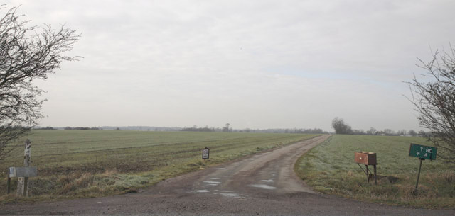
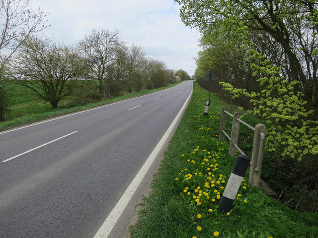
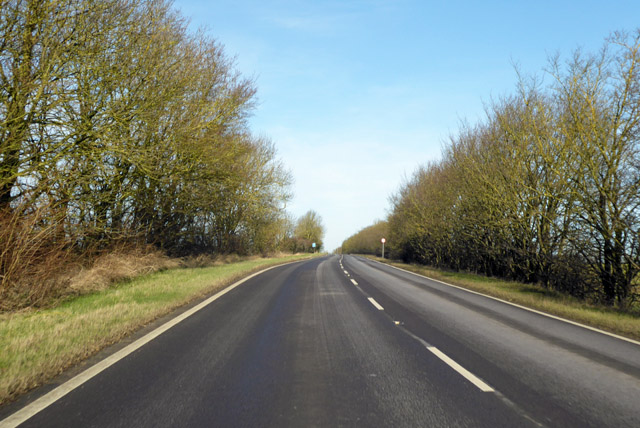
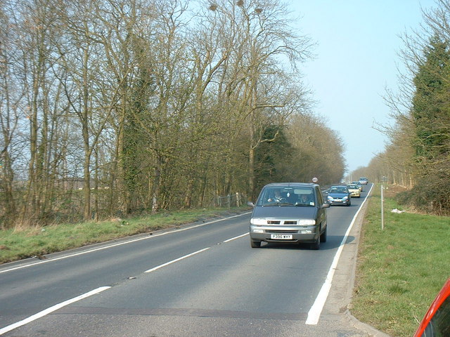
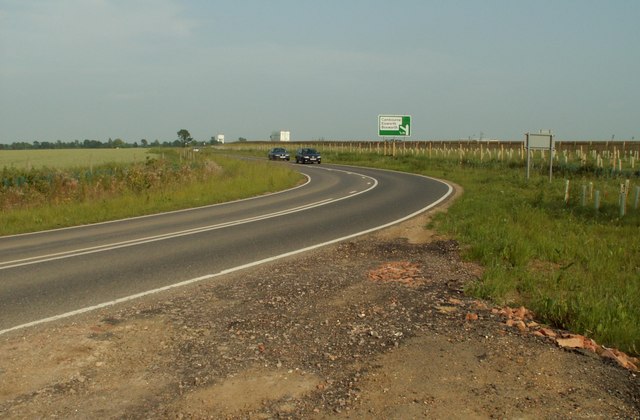
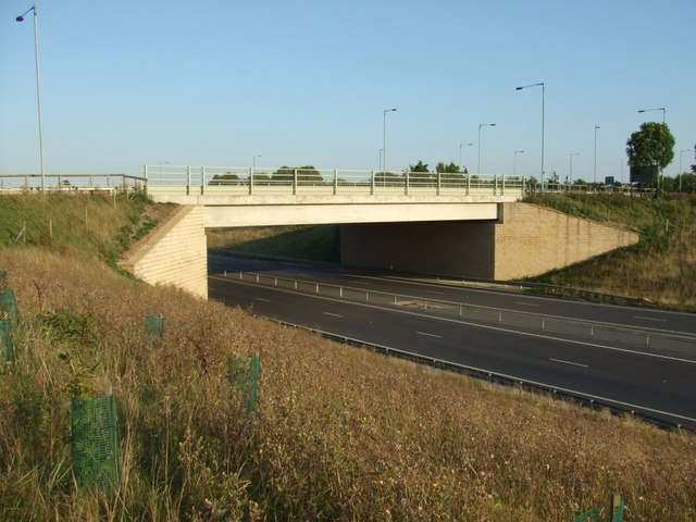
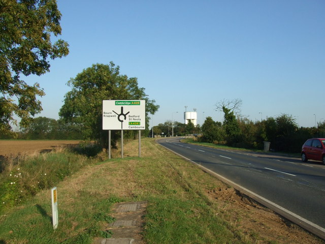
Transport links in Cambourne are well-developed, with regular bus services connecting the parish to nearby towns and villages. The A428 road runs through the parish, providing easy access to Cambridge and other major cities in the region.

Cambourne is home to a diverse population, including families, professionals, and students. The area has a strong sense of community, with various social and cultural events organized throughout the year. The parish also has a number of community groups and organizations that residents can get involved in.

Overall, Cambourne offers a high quality of life, combining modern infrastructure with a rural setting. Its convenient location, amenities, and sense of community make it an attractive place to live for many individuals and families in Cambridgeshire.

If you have any feedback on the listing, please let us know in the comments section below.
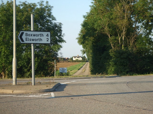
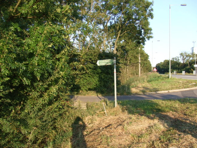
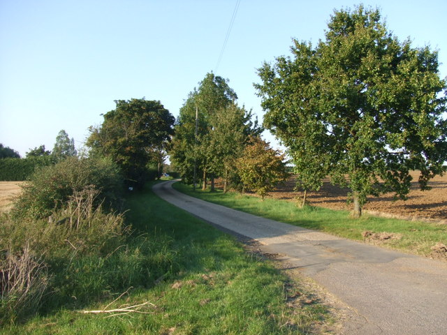
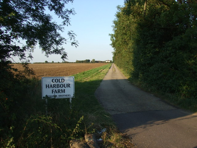
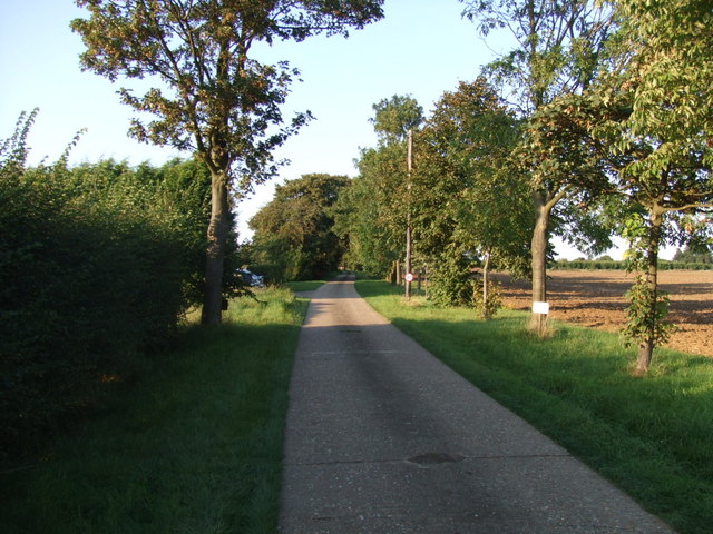
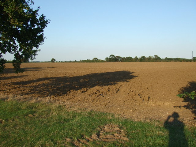
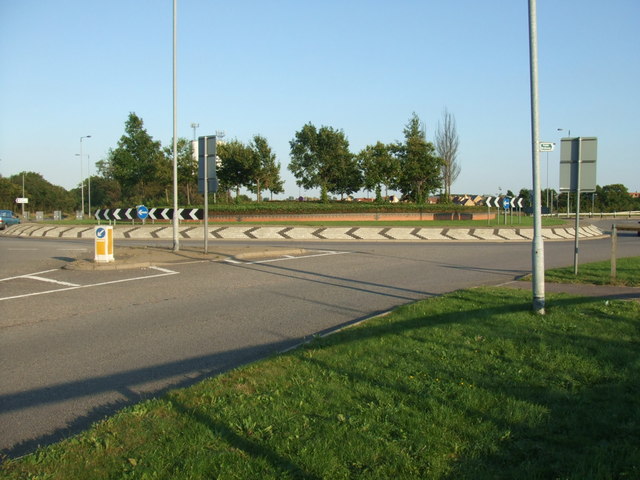
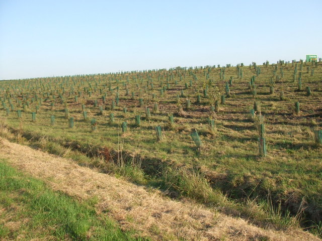
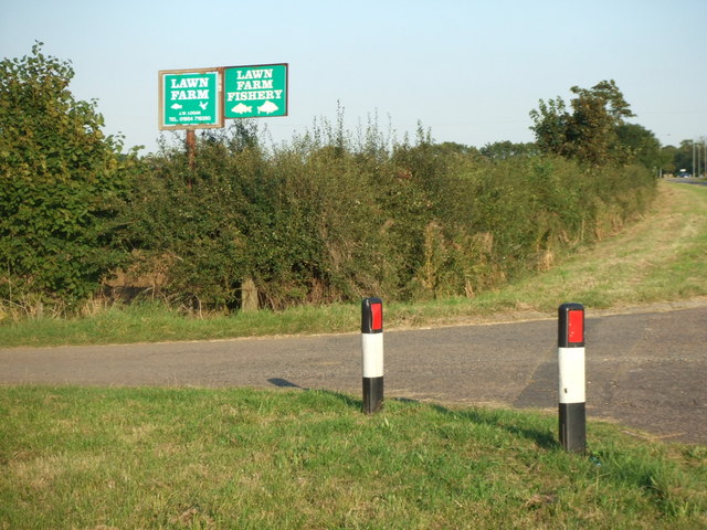
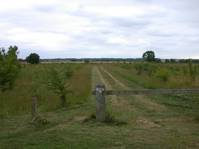
Cambourne Images

Images are sourced within 2km of 52.218519/-0.073385 or Grid Reference TL3159. Thanks to Geograph Open Source API. All images are credited.

Road to Pastures Farm, Caxton, Cambridgeshire
A1198 to Caxton Gibbet
A1198, Ermine Street, northbound A Roman road.
A1198, Ermine Street, northbound
A Roman road.
Water Tower, St. Neots Road. This water tower is only just in square TL3160, but can be seen from the whole area.
Water Tower, St. Neots Road.
This water tower is only just in square TL3160, but can be seen from the whole area.
The old St. Neots Road This stretch of the old St. Neots Road near Cambourne, is soon to be replaced by the A428 dual carriageway.
The old St. Neots Road
This stretch of the old St. Neots Road near Cambourne, is soon to be replaced by the A428 dual carriageway.
St.Neots Road Postbox near New Inn Farm The odd shadow at the bottom of this photo is the photographer!
Postbox No.CB23 276
This Postbox has been renamed Monks Drive Postbox and has the new postbox number of CB3 393
St.Neots Road Postbox near New Inn Farm
The odd shadow at the bottom of this photo is the photographer! Postbox No.CB23 276 This Postbox has been renamed Monks Drive Postbox and has the new postbox number of CB3 393
The road that links Elsworth with Cambourne
Road bridge over the A428 This bridge takes traffic into Cambourne.
Road bridge over the A428
This bridge takes traffic into Cambourne.
Road sign to Boxworth Coldharbour Farm can be seen in the far distance.
Road sign to Boxworth
Coldharbour Farm can be seen in the far distance.
Public footpath sign to Knapwell
The lane to Lawn Farm
Lane to Cold Harbour Farm
Along the lane to Lawn Farm
View over ploughed field I make a shadow appearance in this field which makes up quite a lot of this grid square.
View over ploughed field
I make a shadow appearance in this field which makes up quite a lot of this grid square.
Road sign and water tower
Cambourne roundabout Cambourne has a series of roundabouts to negotiate when arriving from the North, this is the first.
Cambourne roundabout
Cambourne has a series of roundabouts to negotiate when arriving from the North, this is the first.
Tree planting by the A428 One day this will be a forest?
Tree planting by the A428
One day this will be a forest?
Turning off for Lawn Farm
Show me another place!

Cambourne is located at Grid Ref: TL3159 (Lat: 52.218519, Lng: -0.073385)

Administrative County: Cambridgeshire

District: South Cambridgeshire

Police Authority: Cambridgeshire

What 3 Words

///square.employers.rescue. Near Cambourne, Cambridgeshire

Related Wikis

Cambourne Nature Reserve

Cambourne Nature Reserve is a 90 hectare nature reserve in Cambourne in Cambridgeshire. It is managed by the Wildlife Trust for Bedfordshire, Cambridgeshire...

Cambourne

Cambourne is a new settlement and civil parish in Cambridgeshire, England, in the district of South Cambridgeshire. It lies on the A428 road between Cambridge...

Cambourne Church

Cambourne Church is a "local ecumenical partnership" between the Church of England, Baptist Union of Great Britain, Methodist Church of Great Britain and...

Cambourne Village College

Cambourne Village College is a mixed secondary school located in Cambourne, Cambridgeshire, England. It is a free school that opened in 2013, and is part...

Related Videos

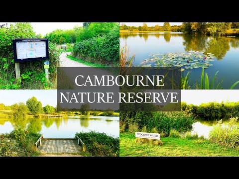
Evening Walk at the Cambourne Nature Reserve in Cambridgeshire, England

In this video, I enjoy an evening walk at the Cambourne Nature Reserve in Cambridgeshire, England. It is a 90 hectare nature ...

Cambourne lakes and a quick view of Bourn windmill

Drone eye views of Cambourne lakes with a wide variety of wildlife to be found. As a resident of Cambourne I always feel very ...

Nearby Amenities

Located within 500m of 52.218519,-0.073385
Crossing
Crossing: unmarked
Crossing Island: yes
Lat/Long: 52.2202134/-0.0676536
Recycling
Location: overground
Operator: Morrison's Foundation, The Salvation Army, Textile Recycling Association, Oxfam
Recycling Clothes: yes
Recycling Shoes: yes
Recycling Type: container
Lat/Long: 52.2196435/-0.0670754
Mini Roundabout
Direction: clockwise
Lat/Long: 52.2196572/-0.0674532
Bicycle Parking
Bicycle Parking: stands
Capacity: 18
Covered: no
Lat/Long: 52.2187449/-0.0685243
Mini Roundabout
Direction: clockwise
Lat/Long: 52.2216127/-0.073136
Mini Roundabout
Direction: clockwise
Lat/Long: 52.2219156/-0.0730863
Towards: Lower Cambourne
Lat/Long: 52.2170346/-0.0732539
Cambourne
Is In: Cambridgeshire, England, UK
Name Ru: Камбурн
Place: town
Population: 4000
Source Name: dictaphone
Source Population: http://www.scambs.gov.uk/CommunityandLiving/VillageServicesAndAmenities/
Wikidata: Q1028175
Wikipedia: en:Cambourne
Lat/Long: 52.219984/-0.0700777
Pharmacy
Lloyds Pharmacy
Addr Housenumber: 9
Addr Postcode: CB23 6JX
Addr Street: High Street
Brand: Lloyds Pharmacy
Brand Wikidata: Q6662870
Healthcare: pharmacy
Opening Hours: Mo-Fr 09:30-17:30; Sa 09:30-12:30
Wheelchair: yes
Lat/Long: 52.2183852/-0.0683897
Fuel
Air Pump: coin_operated
Brand: Morrisons
Brand Wikidata: Q922344
Brand Wikipedia: en:Morrisons
Car Wash: jet_wash
Compressed Air: yes
Fuel Diesel: yes
Fuel Lpg: yes
Fuel Octane 95: yes
Opening Hours: Mo-Sa 05:30-22:30; Su 08:00-21:00
Vacuum: coin_operated
Website: https://my.morrisons.com/storefinder/118/cambourne
Wheelchair: yes
Lat/Long: 52.2199008/-0.0679306
Crossing
Crossing: unmarked
Crossing Island: no
Kerb: flush
Tactile Paving: no
Lat/Long: 52.2154549/-0.0693006
Crossing
Crossing: unmarked
Crossing Island: no
Kerb: flush
Tactile Paving: no
Lat/Long: 52.218536/-0.066468
Crossing
Crossing: unmarked
Crossing Island: no
Tactile Paving: no
Lat/Long: 52.2172252/-0.0686925
Crossing
Crossing: unmarked
Crossing Island: no
Kerb: lowered
Tactile Paving: no
Lat/Long: 52.2163093/-0.0690088
Crossing
Crossing: unmarked
Crossing Island: no
Tactile Paving: no
Lat/Long: 52.2172722/-0.0684693
Generator Output Electricity: yes
Generator Source: wind
Power: generator
Lat/Long: 52.2156921/-0.0757046
Turning Circle
Lat/Long: 52.2164525/-0.07961
Artwork Type: sculpture
Tourism: artwork
Lat/Long: 52.2156878/-0.0693592
Collection Times: Mo-Fr 16:30; Sa 10:30
Note: this postbox has been removed
Operator: Royal Mail
Post Box Design: type_k
Post Box Type: pillar
Ref: CB23 551
Removed Amenity: post_box
Royal Cypher: EIIR
Source: survey
Lat/Long: 52.2180292/-0.075542
Mini Roundabout
Direction: clockwise
Lat/Long: 52.2213741/-0.0731773
Fast Food
Fish 'n' Chick'n
Check Date Opening Hours: 2022-07-26
Cuisine: fish_and_chips
Opening Hours: Mo-Th 12:00-14:00,16:00-22:00; Fr,Sa 12:00-22:00; Su 12:00-21:00; PH 12:00-21:00
Lat/Long: 52.218329/-0.0703745
Cambourne Dry Cleaners
Opening Hours: Mo-Fr 08:00-15:00; Sa 08:00-13:00
Operator: Cambourne Dry Cleaners
Shop: dry_cleaning
Lat/Long: 52.218158/-0.0705099
Ladbrokes
Brand: Ladbrokes
Brand Wikidata: Q1799875
Opening Hours: Mo-Fr 08:30-20:00; Sa 09:00-21:30; Su 10:00-19:00
Operator: Ladbrokes
Shop: bookmaker
Lat/Long: 52.218144/-0.0706373
Fast Food
Wokswagon
Addr Housenumber: 3
Addr Postcode: CB23 6JX
Addr Street: High Street
Cuisine: chinese;pizza
Opening Hours: Mo-Su 16:30-22:00, Fr-Su 12:00-14:00
Wheelchair: yes
Lat/Long: 52.2183572/-0.0687926
Restaurant
Chutney Joe's
Addr Housenumber: 1
Addr Postcode: CB23 6JX
Addr Street: High Street
Cuisine: indian
Opening Hours: Mo-Su 12:00-14:00,16:30-22:00
Wheelchair: yes
Lat/Long: 52.2183255/-0.0689349
Post Box
Brand: Royal Mail
Brand Wikidata: Q638098
Collection Times: Mo-Fr 17:00, Sa 11:00
Indoor: yes
Operator: Royal Mail
Operator Wikidata: Q638098
Post Box Design: indoor_pillar
Post Box Type: pillar
Ref: CB23 552
Royal Cypher: EIIR
Royal Cypher Wikidata: Q33102113
Source: survey
Lat/Long: 52.218877/-0.0686816
Bus Stop
Monkfield Park Primary School
Bench: no
Bin: no
Lit: yes
Naptan AtcoCode: 0500SCAMB001
Naptan Bearing: SW
Naptan CommonName: Monkfield Park Primary School
Naptan Indicator: near
Naptan Landmark: Monkfield Park Primary School
Naptan NaptanCode: cmbdtwdw
Naptan ShortCommonName: Primary School
Naptan Street: School Lane
Naptan Verified: no
Public Transport: platform
Shelter: no
Source: naptan_import
Tactile Paving: no
Lat/Long: 52.2172998/-0.072372
Bus Stop
Oaks Wood
Bench: no
Bin: no
Lit: yes
Naptan AtcoCode: 0500SCAMB002
Naptan Bearing: NW
Naptan CommonName: Oaks Wood
Naptan Indicator: opp
Naptan Landmark: Oaks Wood
Naptan NaptanCode: cmbdtwga
Naptan ShortCommonName: Oaks Wood
Naptan Street: School Lane
Naptan Verified: no
Public Transport: platform
Shelter: no
Source: naptan_import
Tactile Paving: no
Lat/Long: 52.2174033/-0.0748563
Bus Stop
Monkfield Park Primary School
Bench: no
Bin: no
Lit: yes
Naptan AtcoCode: 0500SCAMB003
Naptan Bearing: NE
Naptan CommonName: Monkfield Park Primary School
Naptan Indicator: opp
Naptan Landmark: Monkfield Park Primary School
Naptan NaptanCode: cmbdtwgd
Naptan ShortCommonName: Primary School
Naptan Street: School Lane
Naptan Verified: no
Public Transport: platform
Shelter: no
Source: naptan_import
Tactile Paving: no
Lat/Long: 52.2175854/-0.0722425
Bus Stop
De La Warr Way
Bench: no
Bin: yes
Bus: yes
Lit: yes
Naptan AtcoCode: 0500SCAMB007
Naptan Bearing: NW
Naptan CommonName: De La Warr Way
Naptan Indicator: opp
Naptan Landmark: De La Warr Way
Naptan NaptanCode: cmbdtwgt
Naptan ShortCommonName: De La Warr Way
Naptan Street: Broad Street
Naptan Verified: no
Public Transport: platform
Shelter: no
Source: naptan_import
Tactile Paving: no
Lat/Long: 52.2190641/-0.0702214
Bus Stop
Business Park
Naptan AtcoCode: 0500SCAMB008
Naptan Bearing: E
Naptan CommonName: Business Park
Naptan Indicator: E-bound
Naptan Landmark: Regus House
Naptan NaptanCode: cmbdtwgw
Naptan ShortCommonName: Business Park
Naptan Street: Cambourne Business Park
Naptan Verified: no
Public Transport: platform
Source: naptan_import
Lat/Long: 52.2215007/-0.0719265
Bus Stop
Sackville Way
Bench: yes
Bin: yes
Bus: yes
Lit: yes
Naptan AtcoCode: 0500SCAMB009
Naptan Bearing: W
Naptan CommonName: Sackville Way
Naptan Indicator: opp
Naptan Landmark: Sackville Way
Naptan NaptanCode: cmbdtwja
Naptan ShortCommonName: Sackville Way
Naptan Street: High Street
Naptan Verified: no
Public Transport: platform
Shelter: yes
Source: naptan_import
Tactile Paving: no
Lat/Long: 52.2184118/-0.0672438
Bus Stop
Priory Walk
Bench: no
Bin: no
Lit: yes
Naptan AtcoCode: 0500SCAMB010
Naptan Bearing: SW
Naptan CommonName: Priory Walk
Naptan Indicator: opp
Naptan Landmark: Priory Walk
Naptan NaptanCode: cmbdtwjd
Naptan ShortCommonName: Priory Walk
Naptan Street: Monkfield Lane
Naptan Verified: no
Public Transport: platform
Shelter: no
Source: naptan_import
Tactile Paving: no
Lat/Long: 52.217626/-0.068127
Bus Stop
De La Warr Way
Bench: no
Bin: yes
Lit: yes
Naptan AtcoCode: 0500SCAMB011
Naptan Bearing: SE
Naptan CommonName: De La Warr Way
Naptan Indicator: near
Naptan Landmark: De La Warr Way
Naptan NaptanCode: cmbdtwjg
Naptan ShortCommonName: De La Warr Way
Naptan Street: Broad Street
Naptan Verified: no
Public Transport: platform
Shelter: no
Source: naptan_import
Tactile Paving: no
Lat/Long: 52.218827/-0.0698577
Bus Stop
Apley Way
Bench: no
Bin: no
Lit: yes
Naptan AtcoCode: 0500SCAMB013
Naptan Bearing: W
Naptan CommonName: Apley Way
Naptan Indicator: opp
Naptan Landmark: Apley Way
Naptan NaptanCode: cmbdtwjp
Naptan ShortCommonName: Apley Way
Naptan Street: School Lane
Naptan Verified: no
Public Transport: platform
Shelter: no
Source: naptan_import
Tactile Paving: no
Lat/Long: 52.2179611/-0.0781875
Bus Stop
Apley Way
Bench: no
Bin: no
Lit: yes
Naptan AtcoCode: 0500SCAMB014
Naptan Bearing: E
Naptan CommonName: Apley Way
Naptan Indicator: near
Naptan Landmark: Apley Way
Naptan NaptanCode: cmbdtwjt
Naptan ShortCommonName: Apley Way
Naptan Street: School Lane
Naptan Verified: no
Public Transport: platform
Shelter: no
Source: naptan_import
Tactile Paving: no
Lat/Long: 52.2180825/-0.0778828
Bus Stop
Business Park
Naptan AtcoCode: 0500SCAMB017
Naptan Bearing: N
Naptan CommonName: Business Park
Naptan Indicator: near
Naptan Landmark: Cambourne Business Park
Naptan NaptanCode: cmbgdwdp
Naptan ShortCommonName: Business Park
Naptan Street: Cambourne Road
Naptan Verified: no
Public Transport: platform
Source: naptan_import
Lat/Long: 52.2221887/-0.0718631
Bus Stop
Business Park
Bus: yes
Naptan AtcoCode: 0500SCAMB018
Naptan Bearing: SE
Naptan BusStopType: CUS
Naptan CommonName: Business Park
Naptan Indicator: opp
Naptan Landmark: Cambourne Business Park
Naptan NaptanCode: cmbgdwdt
Naptan ShortCommonName: Business Park
Naptan Street: Cambourne Road
Naptan Verified: no
Public Transport: platform
Source: naptan_import
Lat/Long: 52.2220724/-0.0705925
Cafe
Green's Coffee & Co.
Addr Housenumber: 5
Addr Postcode: CB23 6JX
Addr Street: High Street
Opening Hours: Mo-Sa 09:00-16:00; Su 10:00-16:00
Wheelchair: yes
Lat/Long: 52.2183761/-0.068588
Artwork Type: sculpture
Tourism: artwork
Lat/Long: 52.2184197/-0.0692494
Entrance: yes
Lat/Long: 52.2189208/-0.0687179
Crossing
Crossing Island: no
Crossing Markings: zebra
Crossing Ref: zebra
Lat/Long: 52.2190572/-0.0672788
Crossing
Crossing Island: no
Crossing Markings: zebra
Crossing Ref: zebra
Lat/Long: 52.2192164/-0.0673163
Crossing
Crossing Island: no
Crossing Markings: zebra
Crossing Ref: zebra
Lat/Long: 52.2189198/-0.0672451
Crossing
Crossing: marked
Tactile Paving: no
Lat/Long: 52.2191325/-0.0673716
Crossing
Crossing Island: no
Crossing Markings: zebra
Crossing Ref: zebra
Lat/Long: 52.2193596/-0.0673499
Crossing
Crossing Island: no
Crossing Markings: zebra
Crossing Ref: zebra
Lat/Long: 52.2195115/-0.068385
Car Wash
Morrison's
Automated: yes
Opening Hours: 24/7
Self Service: yes
Wheelchair: yes
Lat/Long: 52.219884/-0.0674723
Crossing
Crossing: marked
Tactile Paving: no
Lat/Long: 52.2191422/-0.0667286
Crossing
Crossing Island: no
Crossing Markings: zebra
Crossing Ref: zebra
Lat/Long: 52.2195793/-0.0681798
Barrier: block
Lat/Long: 52.2208198/-0.0728936
Barrier: block
Lat/Long: 52.2208329/-0.0729132
Barrier: block
Lat/Long: 52.2208452/-0.072936
Barrier: block
Lat/Long: 52.2208543/-0.0729628
Fast Food
Domino's
Addr Country: GB
Brand: Domino's
Brand Wikidata: Q839466
Brand Wikipedia: en:Domino's Pizza
Check Date Opening Hours: 2022-07-26
Contact Website: https://www.dominos.co.uk/pizza-near-me/great-cambourne/unit-1a-caxton-house
Cuisine: pizza
Opening Hours: Mo-Su 11:00-23:00
Lat/Long: 52.218503/-0.0702484
Entrance: main
Lat/Long: 52.2174828/-0.0685425
Entrance: main
Lat/Long: 52.2176096/-0.0684727
Entrance: main
Lat/Long: 52.2173672/-0.0686698
Addr City: Cambridge
Addr Country: GB
Addr Housenumber: 25
Addr Locality: Great Cambourne
Addr Postcode: CB23 5BL
Addr Street: Priory Walk
Addr Town: Cambourne
Entrance: yes
Lat/Long: 52.2174005/-0.0688593
Crossing
Crossing: unmarked
Crossing Island: no
Kerb: flush
Tactile Paving: no
Lat/Long: 52.2166886/-0.0684763
Crossing
Crossing: unmarked
Crossing Island: no
Kerb: lowered
Tactile Paving: no
Lat/Long: 52.2182564/-0.0682724
Post Box
Brand: Royal Mail
Brand Wikidata: Q638098
Collection Times: Mo-Fr 17:00; Sa 11:00
Operator: Royal Mail
Operator Wikidata: Q638098
Post Box Design: type_k
Post Box Type: pillar
Ref: CB23 550
Royal Cypher: EIIR
Royal Cypher Wikidata: Q33102113
Source: survey
Lat/Long: 52.2153744/-0.0688845
Barrier: bollard
Lat/Long: 52.2183311/-0.0700438
Barrier: bollard
Lat/Long: 52.2183237/-0.070131
Barrier: bollard
Lat/Long: 52.2181257/-0.0702993
Barrier: bollard
Lat/Long: 52.218525/-0.0700136
Parking
Access: yes
Fee: no
Parking: street_side
Lat/Long: 52.2185874/-0.066256
Barrier: bollard
Lat/Long: 52.2180801/-0.0707023
Barrier: bollard
Lat/Long: 52.2184252/-0.0702503
Barrier: bollard
Lat/Long: 52.2184453/-0.0702161
Barrier: bollard
Lat/Long: 52.2184827/-0.0700271
Barrier: bollard
Lat/Long: 52.2182407/-0.0702343
Barrier: bollard
Lat/Long: 52.2181228/-0.0703825
Barrier: bollard
Lat/Long: 52.218366/-0.0700787
Barrier: bollard
Lat/Long: 52.218276/-0.0699104
Barrier: bollard
Lat/Long: 52.2183791/-0.0702939
Barrier: bollard
Lat/Long: 52.2181203/-0.0702678
Crossing
Crossing: unmarked
Crossing Island: yes
Crossing Markings: no
Kerb: flush
Tactile Paving: yes
Lat/Long: 52.2182789/-0.0696156
Parking
Access: yes
Fee: no
Parking: street_side
Lat/Long: 52.218423/-0.0676521
Barrier: bollard
Lat/Long: 52.2181906/-0.0702275
Barrier: bollard
Lat/Long: 52.2181302/-0.0703268
Parking
Access: yes
Fee: no
Parking: street_side
Lat/Long: 52.2185405/-0.0660414
Barrier: bollard
Lat/Long: 52.2184625/-0.0700492
Barrier: bollard
Lat/Long: 52.2181072/-0.0705005
Barrier: bollard
Lat/Long: 52.2183093/-0.0702993
Barrier: bollard
Lat/Long: 52.2181269/-0.0703556
Barrier: bollard
Lat/Long: 52.218078/-0.0707271
Barrier: bollard
Lat/Long: 52.218099/-0.0705555
Barrier: bollard
Lat/Long: 52.2181027/-0.070528
Barrier: bollard
Lat/Long: 52.2183512/-0.0700492
Barrier: bollard
Lat/Long: 52.2184517/-0.0700801
Barrier: bollard
Lat/Long: 52.2185032/-0.0700183
Barrier: bollard
Lat/Long: 52.2181146/-0.0704428
Barrier: bollard
Lat/Long: 52.2180871/-0.0706433
Barrier: bollard
Lat/Long: 52.2182748/-0.0702778
Barrier: bollard
Lat/Long: 52.2181187/-0.0704127
Barrier: bollard
Lat/Long: 52.2184469/-0.0701102
Barrier: bollard
Lat/Long: 52.2182629/-0.0699238
Barrier: bollard
Lat/Long: 52.2183459/-0.070135
Barrier: bollard
Lat/Long: 52.2183097/-0.0701015
Barrier: bollard
Lat/Long: 52.2183619/-0.0701156
Barrier: bollard
Lat/Long: 52.2184597/-0.0701679
Barrier: bollard
Lat/Long: 52.2181105/-0.070473
Parking
Access: private
Parking: street_side
Lat/Long: 52.2186675/-0.068348
Barrier: bollard
Lat/Long: 52.2181146/-0.070241
Barrier: bollard
Lat/Long: 52.2183631/-0.0703
Barrier: bollard
Lat/Long: 52.2184666/-0.0701142
Barrier: bollard
Lat/Long: 52.2183118/-0.0700666
Barrier: bollard
Lat/Long: 52.2185558/-0.0700136
Barrier: bollard
Lat/Long: 52.2180912/-0.0706152
Barrier: bollard
Lat/Long: 52.2180771/-0.0707496
Barrier: bollard
Lat/Long: 52.218094/-0.0705863
Barrier: bollard
Lat/Long: 52.2180838/-0.0706715
Sculpture
Lat/Long: 52.2152154/-0.070396
Sculpture
Lat/Long: 52.2154315/-0.0696047
Sculpture
Lat/Long: 52.215171/-0.0702954
Sculpture
Lat/Long: 52.2153378/-0.0703035
Sculpture
Lat/Long: 52.2154611/-0.0699427
Sculpture
Lat/Long: 52.21513/-0.0704738
Sculpture
Lat/Long: 52.2154709/-0.069779
Sculpture
Lat/Long: 52.2152803/-0.0703625
Sculpture
Lat/Long: 52.2152352/-0.0702565
Sculpture
Lat/Long: 52.2151242/-0.0703343
Sculpture
Lat/Long: 52.2152163/-0.0701814
Sculpture
Lat/Long: 52.215388/-0.0702686
Crossing
Crossing: unmarked
Crossing Island: no
Kerb: flush
Tactile Paving: no
Lat/Long: 52.2177528/-0.0800332
Crossing
Crossing: unmarked
Crossing Island: no
Kerb: lowered
Tactile Paving: no
Lat/Long: 52.2171758/-0.0738081
Crossing
Crossing: unmarked
Crossing Island: no
Kerb: lowered
Tactile Paving: no
Lat/Long: 52.2180638/-0.0782047
Crossing
Crossing: unmarked
Crossing Island: no
Kerb: lowered
Tactile Paving: no
Lat/Long: 52.2181501/-0.076516
Turning Circle
Lat/Long: 52.2160606/-0.0792647
Turning Circle
Lat/Long: 52.2165534/-0.0798026
Entrance: main
Lat/Long: 52.2188945/-0.0703365
Entrance: main
Lat/Long: 52.2190048/-0.0709326
Entrance: main
Lat/Long: 52.2194445/-0.0715551
Entrance: main
Lat/Long: 52.219212/-0.0712769
Entrance: main
Lat/Long: 52.2195075/-0.0713579
Entrance: main
Lat/Long: 52.2189419/-0.0711277
Entrance: main
Lat/Long: 52.219462/-0.0701679
Crossing
Crossing: unmarked
Crossing Island: yes
Lat/Long: 52.2204777/-0.0673492
Crossing
Crossing: unmarked
Crossing Island: yes
Lat/Long: 52.2202811/-0.0669426
Addr City: Cambridge
Addr Country: GB
Addr Housenumber: 3
Addr Locality: Great Cambourne
Addr Postcode: CB23 5EF
Addr Street: Greenhaze Lane
Addr Town: Cambourne
Lat/Long: 52.2144405/-0.0707972
Addr City: Cambridge
Addr Country: GB
Addr Housenumber: 5
Addr Locality: Great Cambourne
Addr Postcode: CB23 5EF
Addr Street: Greenhaze Lane
Addr Town: Cambourne
Lat/Long: 52.2144134/-0.0708175
Entrance: yes
Lat/Long: 52.2149408/-0.0730485
Barrier: bollard
Lat/Long: 52.215088/-0.0744581
Entrance: yes
Lat/Long: 52.2149075/-0.0730438
Barrier: bollard
Lat/Long: 52.2150867/-0.0745003
Entrance: main
Lat/Long: 52.2205745/-0.0671555
Turning Circle
Lat/Long: 52.216867/-0.0782066
Turning Circle
Lat/Long: 52.2165112/-0.0786491
Addr City: Cambridge
Addr Country: GB
Addr Housenumber: 1
Addr Locality: Lower Cambourne
Addr Postcode: CB23 5EJ
Addr Street: Damson Way
Addr Town: Cambourne
Lat/Long: 52.2178809/-0.0774767
Addr City: Cambridge
Addr Country: GB
Addr Housenumber: 29
Addr Locality: Lower Cambourne
Addr Postcode: CB23 5DZ
Addr Street: School Lane
Addr Town: Cambourne
Lat/Long: 52.21792/-0.0773498
Addr City: Cambridge
Addr Country: GB
Addr Housenumber: 27
Addr Locality: Lower Cambourne
Addr Postcode: CB23 5DZ
Addr Street: School Lane
Addr Town: Cambourne
Lat/Long: 52.2178608/-0.0772969
Addr City: Cambridge
Addr Country: GB
Addr Housenumber: 31
Addr Locality: Lower Cambourne
Addr Postcode: CB23 5DZ
Addr Street: School Lane
Addr Town: Cambourne
Lat/Long: 52.2179247/-0.077386
Entrance: yes
Lat/Long: 52.2173181/-0.0775697
Entrance: yes
Lat/Long: 52.2173615/-0.0776282
Entrance: yes
Lat/Long: 52.2175003/-0.0780656
Entrance: yes
Lat/Long: 52.2174154/-0.0781121
Entrance: yes
Lat/Long: 52.2171922/-0.0777491
Entrance: yes
Lat/Long: 52.2174579/-0.0780889
Entrance: yes
Lat/Long: 52.2173576/-0.077983
Entrance: yes
Lat/Long: 52.2172473/-0.0778271
Entrance: yes
Lat/Long: 52.2175067/-0.0778487
Entrance: yes
Lat/Long: 52.2175096/-0.0776874
Entrance: yes
Lat/Long: 52.2174342/-0.0787056
Entrance: yes
Lat/Long: 52.2173958/-0.0787116
Entrance: yes
Lat/Long: 52.2174726/-0.0786995
Entrance: yes
Lat/Long: 52.217511/-0.0786935
Entrance: yes
Lat/Long: 52.2169927/-0.0782027
Entrance: yes
Lat/Long: 52.2172652/-0.0787117
Entrance: yes
Lat/Long: 52.2170856/-0.0787368
Entrance: yes
Lat/Long: 52.2168042/-0.0782753
Entrance: yes
Lat/Long: 52.2165743/-0.0790963
Entrance: yes
Lat/Long: 52.2167845/-0.0791808
Entrance: yes
Lat/Long: 52.216979/-0.0788793
Entrance: yes
Lat/Long: 52.2165582/-0.079476
Entrance: yes
Lat/Long: 52.216123/-0.0792108
Entrance: yes
Lat/Long: 52.2165953/-0.0800247
Entrance: yes
Lat/Long: 52.2167074/-0.0800567
Entrance: yes
Lat/Long: 52.21667/-0.080046
Entrance: yes
Lat/Long: 52.2167448/-0.0800673
Entrance: yes
Lat/Long: 52.2166326/-0.0800354
Entrance: yes
Lat/Long: 52.2168522/-0.0799695
Entrance: yes
Lat/Long: 52.2169285/-0.0798305
Entrance: yes
Lat/Long: 52.2168776/-0.0799232
Entrance: yes
Lat/Long: 52.2169031/-0.0798769
Entrance: yes
Lat/Long: 52.2168268/-0.0800158
Entrance: yes
Lat/Long: 52.216932/-0.0796409
Entrance: yes
Lat/Long: 52.216942/-0.0796999
Entrance: yes
Lat/Long: 52.2169121/-0.0795229
Entrance: yes
Lat/Long: 52.2169221/-0.0795819
Entrance: yes
Lat/Long: 52.2169021/-0.0794639
Entrance: yes
Lat/Long: 52.2172167/-0.0794709
Entrance: yes
Lat/Long: 52.2174392/-0.078996
Entrance: yes
Lat/Long: 52.2173249/-0.0790144
Entrance: yes
Lat/Long: 52.2174011/-0.0790021
Entrance: yes
Lat/Long: 52.217363/-0.0790082
Crossing
Crossing: unmarked
Crossing Island: no
Kerb: flush
Tactile Paving: no
Lat/Long: 52.2179896/-0.0785
Barrier: height_restrictor
Maxheight: 2.1
Lat/Long: 52.2177234/-0.0749348
Addr City: Cambridge
Addr Country: GB
Addr Housenumber: 1
Addr Locality: Great Cambourne
Addr Postcode: CB23 5EG
Addr Street: Stable Yard
Addr Town: Cambourne
Lat/Long: 52.2143608/-0.0707987
Addr City: Cambridge
Addr Country: GB
Addr Housenumber: 1
Addr Locality: Great Cambourne
Addr Postcode: CB23 5EF
Addr Street: Greenhaze Lane
Addr Town: Cambourne
Lat/Long: 52.2144579/-0.0707045
Fixme: Many houses in this area have an addr:street that is not their closest street. Confirm or fix these addresses.
Lat/Long: 52.2148054/-0.0731949
Bank
The Cambridge Building Society
Addr Housenumber: 15
Addr Postcode: CB23 6JX
Addr Street: High Street
Brand: The Cambridge Building Society
Brand Wikidata: Q5025370
Opening Hours: Mo,Th,Fr 09:00-17:00; Tu,We 09:00-15:00; Sa 09:00-12:00
Website: https://www.cambridgebs.co.uk/contact/cambourne
Wheelchair: yes
Lat/Long: 52.21846/-0.0681229
Sharman Quinney
Addr Housenumber: 13
Addr Postcode: CB23 6JX
Addr Street: High Street
Office: estate_agent
Opening Hours: Mo-Fr 08:30-18:00; Sa 09:00-17:00
Wheelchair: yes
Lat/Long: 52.2184324/-0.0681925
Salon Se7en
Addr Housenumber: 7
Addr Postcode: CB23 6JX
Addr Street: High Street
Opening Hours: Mo-We,Fr 09:00-18:00; Th 09:00-19:30; Sa 09:00-15:00
Shop: hairdresser
Website: https://www.salon-se7en.co.uk/
Wheelchair: yes
Lat/Long: 52.2183656/-0.0687022
Bench
Backrest: yes
Lat/Long: 52.2155826/-0.0696023
Bench
Backrest: yes
Lat/Long: 52.2153935/-0.0691275
Entrance: yes
Lat/Long: 52.2188339/-0.0686253
Entrance: yes
Lat/Long: 52.2185657/-0.0694687
Bicycle Parking
Bicycle Parking: stands
Capacity: 20
Covered: no
Lat/Long: 52.2185717/-0.0693665
Bicycle Parking
Bicycle Parking: stands
Capacity: 10
Covered: no
Lat/Long: 52.2183025/-0.0685601
Atm
Check Date: 2021-06-26
Fee: no
Indoor: no
Operator: MasterCard, Maestro, Cirrus, Visa, Link
Wheelchair: yes
Lat/Long: 52.2188048/-0.0686413
Atm
Check Date: 2021-06-26
Fee: no
Indoor: no
Wheelchair: yes
Lat/Long: 52.2187954/-0.0686323
Malcolms
Check Date Opening Hours: 2022-07-26
Office: estate_agent
Opening Hours Signed: no
Lat/Long: 52.21818/-0.0703794
Connells
Check Date Opening Hours: 2022-07-26
Office: estate_agent
Opening Hours Signed: no
Lat/Long: 52.2184552/-0.0703231
Taylor Keeble LLP
Addr City: Cambridge
Addr Housename: 9 Caxton House
Addr Locality: Great Cambourne
Addr Postcode: CB23 6JN
Addr Street: Broad Street
Check Date Opening Hours: 2022-07-26
Email: info@taylorkeeble.co.uk
Office: accountant
Opening Hours Signed: no
Phone: +44 1954 771025
Website: https://www.taylorkeeble.co.uk/
Lat/Long: 52.2181942/-0.0705709
Artwork Type: sculpture
Tourism: artwork
Lat/Long: 52.222108/-0.0766725
Leisure: picnic_table
Lat/Long: 52.2221425/-0.0766617
Biochrom Ltd
Addr Housenumber: 1020
Addr Postcode: CB23 6DW
Addr Street: Cambourne Business Park
Lat/Long: 52.220718/-0.0733183
Addr City: Cambridge
Addr Country: GB
Addr Flats: ;1-16
Addr Housenumber: 11
Addr Locality: Great Cambourne
Addr Postcode: CB23 6GX
Addr Street: High Street
Addr Town: Cambourne
Entrance: main
Lat/Long: 52.2183708/-0.0682871
Shield Care
Addr Housenumber: 1010
Addr Postcode: CB23 6DP
Addr Street: Cambourne Business Park
Lat/Long: 52.2212111/-0.0724653
Fluenta
Addr Housenumber: 2020
Addr Postcode: CB23 6DW
Addr Street: Cambourne Business Park
Lat/Long: 52.2226142/-0.0744982
MediaTek
Addr Housenumber: 2030
Addr Postcode: CB23 6DW
Addr Street: Cambourne Business Park
Lat/Long: 52.2223547/-0.0755713
EEF
Addr Housenumber: 2030
Addr Postcode: CB23 6DW
Addr Street: Cambourne Business Park
Lat/Long: 52.2224827/-0.0755338
Premier Travel
Addr Housenumber: 1020
Addr Postcode: CB23 6DW
Addr Street: Cambourne Business Park
Lat/Long: 52.2207213/-0.0730662
Global Graphics
Addr Housenumber: 2030
Addr Postcode: CB23 6DW
Addr Street: Cambourne Business Park
Lat/Long: 52.222601/-0.0755016
Netcracker
Addr Housenumber: 2010
Addr Postcode: CB23 6DW
Addr Street: Cambourne Business Park
Lat/Long: 52.2222856/-0.0729911
ProCam
Addr Housenumber: 2020
Addr Postcode: CB23 6DW
Addr Street: Cambourne Business Park
Lat/Long: 52.2225289/-0.0737633
Information: board
Tourism: information
Lat/Long: 52.215085/-0.077289
Information: board
Tourism: information
Lat/Long: 52.2153218/-0.077206
Information: board
Tourism: information
Lat/Long: 52.2163181/-0.0765969
Information: board
Tourism: information
Lat/Long: 52.2173084/-0.0763306
Information: board
Tourism: information
Lat/Long: 52.2174384/-0.07628
Bench
Lat/Long: 52.2161835/-0.076569
Bench
Lat/Long: 52.2162369/-0.0766106
Barrier: cycle_barrier
Cycle Barrier: double
Lat/Long: 52.2178665/-0.0758816
Bench
Backrest: no
Lat/Long: 52.2186716/-0.0748638
Bench
Backrest: yes
Lat/Long: 52.2198182/-0.0723392
Bench
Backrest: no
Lat/Long: 52.2193322/-0.0752165
Bench
Backrest: no
Lat/Long: 52.2189453/-0.0742783
Bench
Backrest: no
Lat/Long: 52.2182399/-0.0753406
Board Type: nature
Information: board
Tourism: information
Lat/Long: 52.2179831/-0.075346
Leisure: fishing
Lat/Long: 52.2183157/-0.0753396
Board Type: nature
Information: board
Tourism: information
Lat/Long: 52.2182543/-0.0753932
Waste Basket
Lat/Long: 52.2180575/-0.0755578
Barrier: cycle_barrier
Cycle Barrier: double
Lat/Long: 52.2177741/-0.0757154
Bench
Lat/Long: 52.2153283/-0.0773851
Bench
Lat/Long: 52.2167531/-0.0774622
Crossing
Lat/Long: 52.2147326/-0.0712769
Crossing
Crossing: unmarked
Crossing Island: yes
Lat/Long: 52.2200315/-0.0672245
Crossing
Crossing: unmarked
Crossing Island: yes
Crossing Markings: no
Tactile Paving: yes
Lat/Long: 52.2181687/-0.0691808
Crossing
Crossing: unmarked
Crossing Island: yes
Crossing Markings: no
Lat/Long: 52.2180981/-0.0698821
Entrance: yes
Lat/Long: 52.2173025/-0.0779051
Entrance: yes
Lat/Long: 52.216849/-0.079274
Entrance: yes
Lat/Long: 52.2172371/-0.0796851
Entrance: yes
Lat/Long: 52.2170519/-0.0790063
Entrance: yes
Lat/Long: 52.2160116/-0.0793528
Entrance: yes
Lat/Long: 52.2172494/-0.0789504
Entrance: yes
Lat/Long: 52.2175092/-0.0789054
Entrance: yes
Lat/Long: 52.2175473/-0.0788991
Entrance: yes
Lat/Long: 52.2175854/-0.0788928
Entrance: yes
Lat/Long: 52.2176235/-0.0788865
Entrance: yes
Lat/Long: 52.2193433/-0.0805239
Entrance: yes
Lat/Long: 52.2193092/-0.0801632
Entrance: yes
Lat/Long: 52.2193339/-0.0802242
Entrance: yes
Lat/Long: 52.219453/-0.0803496
Entrance: yes
Lat/Long: 52.2193959/-0.0803301
Entrance: yes
Lat/Long: 52.2193614/-0.080296
Entrance: yes
Lat/Long: 52.2195403/-0.0803795
Entrance: yes
Lat/Long: 52.2196251/-0.0803333
Addr City: Cambridge
Addr Country: GB
Addr Housenumber: 7
Addr Locality: Great Cambourne
Addr Postcode: CB23 5JR
Addr Street: Moss-Nook
Addr Town: Cambourne
Lat/Long: 52.2148723/-0.072991
Addr City: Cambridge
Addr Country: GB
Addr Housenumber: 1
Addr Locality: Great Cambourne
Addr Postcode: CB23 5JR
Addr Street: Moss-Nook
Addr Town: Cambourne
Lat/Long: 52.2149779/-0.0729977
Entrance: yes
Lat/Long: 52.2149163/-0.0729514
Entrance: yes
Lat/Long: 52.2149409/-0.0729547
Addr City: Cambridge
Addr Country: GB
Addr Housenumber: 23
Addr Locality: Great Cambourne
Addr Postcode: CB23 5BL
Addr Street: Priory Walk
Addr Town: Cambourne
Lat/Long: 52.2173345/-0.068684
Addr City: Cambridge
Addr Country: GB
Addr Housenumber: 20
Addr Locality: Great Cambourne
Addr Postcode: CB23 5BL
Addr Street: Priory Walk
Addr Town: Cambourne
Lat/Long: 52.2173649/-0.0685781
Addr City: Cambridge
Addr Country: GB
Addr Housenumber: 19
Addr Locality: Great Cambourne
Addr Postcode: CB23 5BL
Addr Street: Priory Walk
Addr Town: Cambourne
Lat/Long: 52.217431/-0.068515
Addr City: Cambridge
Addr Country: GB
Addr Housenumber: 14
Addr Locality: Great Cambourne
Addr Postcode: CB23 5BL
Addr Street: Priory Walk
Addr Town: Cambourne
Lat/Long: 52.2175021/-0.0684667
Addr City: Cambridge
Addr Country: GB
Addr Housenumber: 13
Addr Locality: Great Cambourne
Addr Postcode: CB23 5BL
Addr Street: Priory Walk
Addr Town: Cambourne
Lat/Long: 52.2175805/-0.0684131
Addr City: Cambridge
Addr Country: GB
Addr Housenumber: 10
Addr Locality: Great Cambourne
Addr Postcode: CB23 5BL
Addr Street: Priory Walk
Addr Town: Cambourne
Lat/Long: 52.2176524/-0.0684419
Addr City: Cambridge
Addr Country: GB
Addr Housenumber: 24
Addr Locality: Great Cambourne
Addr Postcode: CB23 5BL
Addr Street: Priory Walk
Addr Town: Cambourne
Entrance: yes
Lat/Long: 52.2173961/-0.0688335
Gewiss UK Ltd
Addr Housenumber: 2020
Addr Postcode: CB23 6DW
Addr Street: Cambourne Business Park
Lat/Long: 52.2226584/-0.0747398
Addr City: Cambridge
Addr Country: GB
Addr Housenumber: 89
Addr Locality: Great Cambourne
Addr Postcode: CB23 6DH
Addr Street: Broad Street
Addr Town: Cambourne
Lat/Long: 52.2195361/-0.071447
Addr City: Cambridge
Addr Country: GB
Addr Housenumber: 95
Addr Locality: Great Cambourne
Addr Postcode: CB23 6DH
Addr Street: Broad Street
Addr Town: Cambourne
Lat/Long: 52.2195683/-0.0713458
Addr City: Cambridge
Addr Country: GB
Addr Housenumber: 81
Addr Locality: Great Cambourne
Addr Postcode: CB23 6DH
Addr Street: Broad Street
Addr Town: Cambourne
Lat/Long: 52.2194717/-0.0716495
Addr City: Cambridge
Addr Country: GB
Addr Housenumber: 87
Addr Locality: Great Cambourne
Addr Postcode: CB23 6DH
Addr Street: Broad Street
Addr Town: Cambourne
Lat/Long: 52.2195039/-0.0715483
Addr City: Cambridge
Addr Country: GB
Addr Housenumber: 69
Addr Locality: Great Cambourne
Addr Postcode: CB23 6DH
Addr Street: Broad Street
Addr Town: Cambourne
Lat/Long: 52.2191628/-0.0713303
Addr City: Cambridge
Addr Country: GB
Addr Housenumber: 79
Addr Locality: Great Cambourne
Addr Postcode: CB23 6DH
Addr Street: Broad Street
Addr Town: Cambourne
Lat/Long: 52.2192183/-0.0713739
Addr City: Cambridge
Addr Country: GB
Addr Housenumber: 59
Addr Locality: Great Cambourne
Addr Postcode: CB23 6DH
Addr Street: Broad Street
Addr Town: Cambourne
Lat/Long: 52.2189123/-0.071048
Addr City: Cambridge
Addr Country: GB
Addr Housenumber: 65
Addr Locality: Great Cambourne
Addr Postcode: CB23 6DH
Addr Street: Broad Street
Addr Town: Cambourne
Lat/Long: 52.2188802/-0.0711526
Addr City: Cambridge
Addr Country: GB
Addr Housenumber: 51
Addr Locality: Great Cambourne
Addr Postcode: CB23 6DH
Addr Street: Broad Street
Addr Town: Cambourne
Lat/Long: 52.2189764/-0.0708386
Addr City: Cambridge
Addr Country: GB
Addr Housenumber: 57
Addr Locality: Great Cambourne
Addr Postcode: CB23 6DH
Addr Street: Broad Street
Addr Town: Cambourne
Lat/Long: 52.2189443/-0.0709433
Addr City: Cambridge
Addr Country: GB
Addr Housenumber: 23
Addr Locality: Great Cambourne
Addr Postcode: CB23 6EL
Addr Street: Broad Street
Addr Town: Cambourne
Lat/Long: 52.2189013/-0.0704294
Addr City: Cambridge
Addr Country: GB
Addr Housenumber: 19
Addr Locality: Great Cambourne
Addr Postcode: CB23 6EL
Addr Street: Broad Street
Addr Town: Cambourne
Lat/Long: 52.2188524/-0.0703885
Entrance: main
Lat/Long: 52.2200192/-0.0706397
Entrance: main
Lat/Long: 52.2203246/-0.070735
Entrance: main
Lat/Long: 52.2203151/-0.0710308
Entrance: staircase
Lat/Long: 52.21794/-0.0695363
Entrance: staircase
Lat/Long: 52.2179296/-0.068372
Entrance: yes
Lat/Long: 52.2178911/-0.0690203
Entrance: staircase
Lat/Long: 52.218063/-0.0690286
Entrance: main
Lat/Long: 52.2180978/-0.0684706
Horizon House
Addr City: Cambridge
Addr Country: GB
Addr Flats: ;1-18
Addr Locality: Great Cambourne
Addr Postcode: CB23 6JX
Addr Street: High Street
Addr Town: Cambourne
Entrance: main
Lat/Long: 52.2183525/-0.0684809
Addr City: Cambridge
Addr Country: GB
Addr Housenumber: 10
Addr Locality: Great Cambourne
Addr Postcode: CB23 6GE
Addr Street: New Hall Lane
Addr Town: Cambourne
Lat/Long: 52.220635/-0.0671275
Addr City: Cambridge
Addr Country: GB
Addr Housenumber: 2a
Addr Locality: Great Cambourne
Addr Postcode: CB23 6GE
Addr Street: New Hall Lane
Addr Town: Cambourne
Lat/Long: 52.2205766/-0.0670889
Addr City: Cambridge
Addr Country: GB
Addr Housenumber: 2
Addr Locality: Great Cambourne
Addr Postcode: CB23 6GE
Addr Street: New Hall Lane
Addr Town: Cambourne
Lat/Long: 52.2205464/-0.067069
Entrance: yes
Lat/Long: 52.2186445/-0.0695842
Barrier: bollard
Lat/Long: 52.2187384/-0.0683621
Barrier: bollard
Lat/Long: 52.2187456/-0.0683014
Barrier: bollard
Lat/Long: 52.2187491/-0.0682475
Barrier: bollard
Lat/Long: 52.2187544/-0.0681982
Barrier: bollard
Lat/Long: 52.2187596/-0.0681442
Barrier: bollard
Lat/Long: 52.2187649/-0.0680949
Barrier: bollard
Lat/Long: 52.2187703/-0.0680396
Barrier: bollard
Lat/Long: 52.218775/-0.0679937
Barrier: bollard
Lat/Long: 52.218782/-0.0679353
Barrier: bollard
Lat/Long: 52.2187853/-0.067887
Barrier: bollard
Lat/Long: 52.2187902/-0.0678401
Barrier: bollard
Lat/Long: 52.2187945/-0.0677965
Barrier: bollard
Lat/Long: 52.2187976/-0.067762
Barrier: bollard
Lat/Long: 52.2188017/-0.0677241
Barrier: bollard
Lat/Long: 52.2188048/-0.0676845
Barrier: bollard
Lat/Long: 52.218807/-0.067651
Barrier: bollard
Lat/Long: 52.218812/-0.0676161
Barrier: bollard
Lat/Long: 52.2188138/-0.0675799
Barrier: bollard
Lat/Long: 52.2188171/-0.0675434
Barrier: bollard
Lat/Long: 52.2188208/-0.0675068
Barrier: bollard
Lat/Long: 52.2188237/-0.0674686
Barrier: bollard
Lat/Long: 52.2188272/-0.0674327
Barrier: bollard
Lat/Long: 52.2194695/-0.0684915
Barrier: bollard
Lat/Long: 52.2194664/-0.0685288
Barrier: bollard
Lat/Long: 52.2194633/-0.0685683
Barrier: bollard
Lat/Long: 52.2194536/-0.0686293
Barrier: bollard
Lat/Long: 52.2194432/-0.0686585
Barrier: bollard
Lat/Long: 52.2194335/-0.0686904
Barrier: bollard
Lat/Long: 52.2194228/-0.0687219
Barrier: bollard
Lat/Long: 52.2194128/-0.0687551
Barrier: bollard
Lat/Long: 52.2194019/-0.0687863
Barrier: bollard
Lat/Long: 52.219392/-0.0688171
Barrier: bollard
Lat/Long: 52.2193816/-0.068851
Barrier: bollard
Lat/Long: 52.2193676/-0.0688956
Barrier: bollard
Lat/Long: 52.2193596/-0.0689184
Barrier: bollard
Lat/Long: 52.2193509/-0.0689492
Barrier: bollard
Lat/Long: 52.2195206/-0.0683264
Barrier: bollard
Lat/Long: 52.2195325/-0.0682911
Barrier: bollard
Lat/Long: 52.2195434/-0.068256
Barrier: bollard
Lat/Long: 52.2195534/-0.0682238
Barrier: bollard
Lat/Long: 52.2195701/-0.0682386
Barrier: bollard
Lat/Long: 52.2195593/-0.0682714
Barrier: bollard
Lat/Long: 52.2195489/-0.0683046
Barrier: bollard
Lat/Long: 52.2195381/-0.0683363
Crossing
Crossing Island: no
Crossing Markings: zebra
Crossing Ref: zebra
Lat/Long: 52.2189736/-0.0685917
Barrier: bollard
Lat/Long: 52.2189697/-0.0686537
Barrier: bollard
Lat/Long: 52.2189745/-0.0686743
Barrier: bollard
Lat/Long: 52.2189795/-0.0686929
Barrier: bollard
Lat/Long: 52.2189879/-0.0687071
Barrier: bollard
Lat/Long: 52.2189991/-0.068718
Barrier: bollard
Lat/Long: 52.2190112/-0.0687279
Barrier: bollard
Lat/Long: 52.2190355/-0.0687475
Barrier: bollard
Lat/Long: 52.2190469/-0.0687561
Barrier: bollard
Lat/Long: 52.2190581/-0.0687661
Barrier: bollard
Lat/Long: 52.2190722/-0.0687698
Barrier: bollard
Lat/Long: 52.2190842/-0.0687628
Barrier: bollard
Lat/Long: 52.2190183/-0.0685053
Barrier: bollard
Lat/Long: 52.2190225/-0.0684585
Barrier: bollard
Lat/Long: 52.2190705/-0.0679358
Barrier: bollard
Lat/Long: 52.219051/-0.0681494
Barrier: bollard
Lat/Long: 52.2190832/-0.0677913
Barrier: bollard
Lat/Long: 52.2190668/-0.0679714
Barrier: bollard
Lat/Long: 52.2190434/-0.0682238
Barrier: bollard
Lat/Long: 52.2190604/-0.0680435
Barrier: bollard
Lat/Long: 52.21909/-0.0677179
Barrier: bollard
Lat/Long: 52.2190325/-0.0683626
Barrier: bollard
Lat/Long: 52.2191042/-0.0675764
Barrier: bollard
Lat/Long: 52.2190466/-0.068188
Barrier: bollard
Lat/Long: 52.2190801/-0.0678269
Barrier: bollard
Lat/Long: 52.219097/-0.0676465
Barrier: bollard
Lat/Long: 52.2190269/-0.0684124
Barrier: bollard
Lat/Long: 52.219074/-0.0678993
Barrier: bollard
Lat/Long: 52.2191107/-0.0675037
Barrier: bollard
Lat/Long: 52.219058/-0.0680768
Barrier: bollard
Lat/Long: 52.2190869/-0.0677565
Barrier: bollard
Lat/Long: 52.2190631/-0.0680082
Barrier: bollard
Lat/Long: 52.2190939/-0.0676837
Barrier: bollard
Lat/Long: 52.219107/-0.0675399
Barrier: bollard
Lat/Long: 52.2190355/-0.0683216
Barrier: bollard
Lat/Long: 52.2191009/-0.0676109
Barrier: bollard
Lat/Long: 52.2190397/-0.0682723
Barrier: bollard
Lat/Long: 52.2190546/-0.0681165
Barrier: bollard
Lat/Long: 52.219077/-0.0678654
Barrier: bollard
Lat/Long: 52.2191301/-0.0675085
Barrier: bollard
Lat/Long: 52.2191264/-0.0675447
Barrier: bollard
Lat/Long: 52.2191236/-0.0675813
Barrier: bollard
Lat/Long: 52.2191203/-0.0676158
Barrier: bollard
Lat/Long: 52.2191164/-0.0676513
Barrier: bollard
Lat/Long: 52.2191125/-0.0676882
Barrier: bollard
Lat/Long: 52.2191094/-0.0677228
Barrier: bollard
Lat/Long: 52.2191063/-0.0677613
Barrier: bollard
Lat/Long: 52.2191026/-0.0677962
Barrier: bollard
Lat/Long: 52.2190995/-0.0678317
Barrier: bollard
Lat/Long: 52.2190964/-0.0678703
Barrier: bollard
Lat/Long: 52.2190934/-0.0679041
Barrier: bollard
Lat/Long: 52.2190899/-0.0679407
Barrier: bollard
Lat/Long: 52.2190862/-0.0679762
Barrier: bollard
Lat/Long: 52.2190825/-0.0680131
Barrier: bollard
Lat/Long: 52.2190798/-0.0680483
Barrier: bollard
Lat/Long: 52.2190773/-0.0680818
Barrier: bollard
Lat/Long: 52.2190704/-0.0681543
Barrier: bollard
Lat/Long: 52.219066/-0.0681928
Barrier: bollard
Lat/Long: 52.2190732/-0.0681211
Barrier: bollard
Lat/Long: 52.2190628/-0.0682287
Barrier: bollard
Lat/Long: 52.2190556/-0.0683035
Barrier: bollard
Lat/Long: 52.2190519/-0.0683548
Barrier: bollard
Lat/Long: 52.2190597/-0.0682646
Barrier: bollard
Lat/Long: 52.2190467/-0.0683997
Barrier: bollard
Lat/Long: 52.2190426/-0.0684486
Barrier: bollard
Lat/Long: 52.2190375/-0.0684966
Barrier: bollard
Lat/Long: 52.2190332/-0.0685452
Barrier: bollard
Lat/Long: 52.2191706/-0.0668655
Barrier: bollard
Lat/Long: 52.2191675/-0.0669033
Barrier: bollard
Lat/Long: 52.2191844/-0.066909
Barrier: bollard
Lat/Long: 52.2191876/-0.0668732
Barrier: bollard
Lat/Long: 52.2191911/-0.066838
Barrier: bollard
Lat/Long: 52.2191946/-0.0668024
Barrier: bollard
Lat/Long: 52.2191977/-0.0667679
Barrier: bollard
Lat/Long: 52.2191803/-0.0669489
Barrier: bollard
Lat/Long: 52.2191772/-0.0669818
Barrier: bollard
Lat/Long: 52.2191749/-0.0670163
Barrier: bollard
Lat/Long: 52.2191712/-0.0670529
Barrier: bollard
Lat/Long: 52.2191671/-0.0670904
Barrier: bollard
Lat/Long: 52.2191642/-0.067125
Barrier: bollard
Lat/Long: 52.2191607/-0.0671625
Barrier: bollard
Lat/Long: 52.2191572/-0.0671984
Barrier: bollard
Lat/Long: 52.2191544/-0.0672353
Barrier: bollard
Lat/Long: 52.2191628/-0.0669449
Barrier: bollard
Lat/Long: 52.2191599/-0.0669774
Barrier: bollard
Lat/Long: 52.2191566/-0.0670113
Barrier: bollard
Lat/Long: 52.2191529/-0.0670478
Barrier: bollard
Lat/Long: 52.2191499/-0.0670864
Barrier: bollard
Lat/Long: 52.2191464/-0.0671213
Barrier: bollard
Lat/Long: 52.2191435/-0.0671558
Barrier: bollard
Lat/Long: 52.2191396/-0.0671944
Barrier: bollard
Lat/Long: 52.2191365/-0.0672286
Information: guidepost
Tourism: information
Lat/Long: 52.2179306/-0.075475
Bench
Backrest: no
Lat/Long: 52.2186912/-0.0748782
Waste Basket
Lat/Long: 52.2176931/-0.0748336
Board Type: rules
Information: board
Tourism: information
Lat/Long: 52.2181631/-0.0756021
Information: map
Tourism: information
Lat/Long: 52.2178079/-0.0750388
Board Type: nature
Information: board
Tourism: information
Lat/Long: 52.2178036/-0.0750509
Board Type: nature
Information: board
Tourism: information
Lat/Long: 52.2205934/-0.0790112
Board Type: nature
Information: board
Tourism: information
Lat/Long: 52.2186836/-0.0739022
The data included in this document is from www.openstreetmap.org. The data is made available under ODbL.

Have you been to Cambourne?

Leave your review of Cambourne below (or comments, questions and feedback).