Cadeby

Civil Parish in Yorkshire Doncaster

England

Cadeby

Conisbrough Railway Station Seen from the pedestrian bridge.
Conisbrough Railway Station Credit: Neil Theasby

Cadeby is a civil parish located in the county of Yorkshire, England. Situated in the metropolitan borough of Rotherham, it is a small rural community known for its picturesque landscapes and historical significance.

The parish is home to approximately 150 residents, making it a close-knit community where everyone knows each other. The village itself is characterized by its charming stone-built houses and well-preserved traditional architecture, reflecting its rich history. Cadeby is surrounded by vast farmlands and rolling hills, offering breathtaking views of the countryside.

One of the notable landmarks in Cadeby is the St. John the Baptist Church, a medieval church dating back to the 12th century. The church features stunning stained glass windows and intricate stonework, attracting visitors interested in history and architecture.

Despite its small size, Cadeby has a strong sense of community and hosts various events throughout the year. The village hall serves as a central meeting place for residents to socialize and organize activities such as fairs, fundraisers, and community gatherings.

Cadeby is also known for its proximity to Wentworth Woodhouse, a grand stately home and garden known for its impressive Baroque architecture. The estate offers guided tours and hosts special events, drawing both locals and tourists alike.

In summary, Cadeby is a quaint and idyllic civil parish in Yorkshire, offering a peaceful and close-knit community surrounded by beautiful countryside and steeped in history.

If you have any feedback on the listing, please let us know in the comments section below.

Cadeby Images

Images are sourced within 2km of 53.500253/-1.220133 or Grid Reference SE5100. Thanks to Geograph Open Source API. All images are credited.
Conisbrough Railway Station Seen from the pedestrian bridge.
Conisbrough Railway Station
Seen from the pedestrian bridge.
Rainbow Bridge Functioning railway bridge crossing The River Don near Conisbrough
Rainbow Bridge
Functioning railway bridge crossing The River Don near Conisbrough
By The River Don - approaching Conisbrough Viaduct
The River Don seen from Conisbrough Viaduct
Dearne Street, Conisbrough
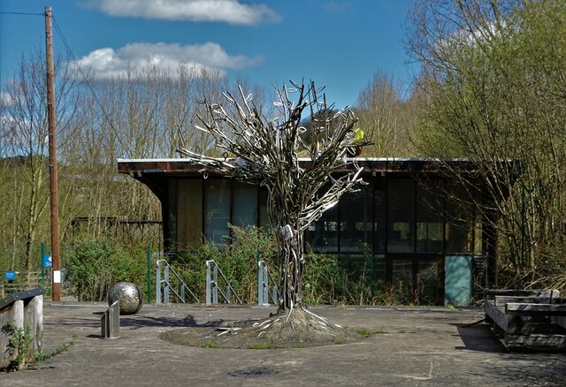
Legacy of Failure At the disused entrance to "The Earth Centre" which operated between 1999 and 2004. In spite of enormous funding and lofty ambitions it was ultimately a dismal failure. See <span class="nowrap"><a title="https://en.wikipedia.org/wiki/Earth_Centre,_Doncaster" rel="nofollow ugc noopener" href="https://en.wikipedia.org/wiki/Earth_Centre,_Doncaster">Link</a><img style="margin-left:2px;" alt="External link" title="External link - shift click to open in new window" src="https://s1.geograph.org.uk/img/external.png" width="10" height="10"/></span>
Legacy of Failure
At the disused entrance to "The Earth Centre" which operated between 1999 and 2004. In spite of enormous funding and lofty ambitions it was ultimately a dismal failure. See LinkExternal link
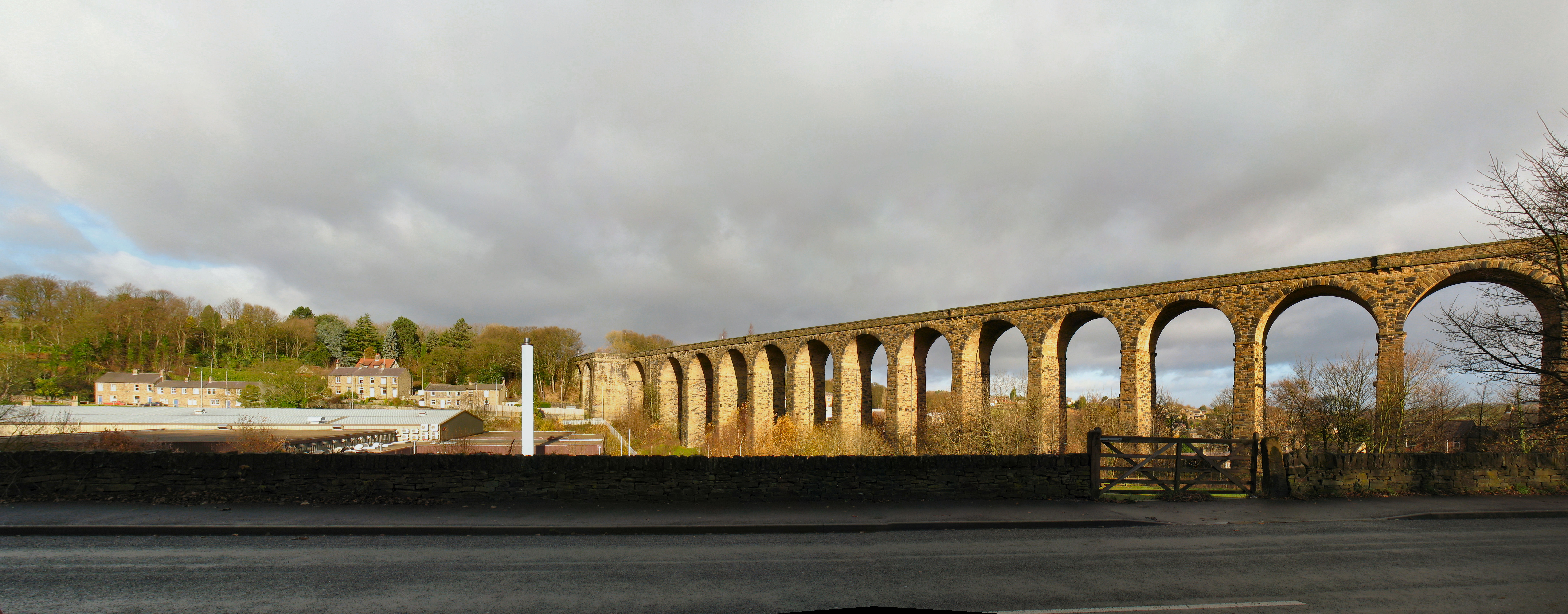
Beneath the awesome Conisbrough Railway Viaduct With The River Don flowing by beneath it. 

"The magnificent Conisbrough viaduct is impossible to overlook with its 21 arches, 150 foot lattice iron girder span over the river, and 1,527 feet in length. Opened in 1909, it was part of a connection between the Hull & Barnsley Railway and those of the Great Northern and Great Eastern. It consists of more than 15 million bricks, and features some beautiful decorative brickwork." - copied from the "Railway Paths" website.
Beneath the awesome Conisbrough Railway Viaduct
With The River Don flowing by beneath it. "The magnificent Conisbrough viaduct is impossible to overlook with its 21 arches, 150 foot lattice iron girder span over the river, and 1,527 feet in length. Opened in 1909, it was part of a connection between the Hull & Barnsley Railway and those of the Great Northern and Great Eastern. It consists of more than 15 million bricks, and features some beautiful decorative brickwork." - copied from the "Railway Paths" website.
Conisbrough Castle The barbican and keep
Conisbrough Castle
The barbican and keep
Abandoned roadway On site of former Cadeby Main colliery and railway towards Conisbrough Viaduct
Abandoned roadway
On site of former Cadeby Main colliery and railway towards Conisbrough Viaduct
Constitution Hill road bridge
Conisbrough Viaduct
Conisbrough Viaduct
Don Valley from Conisbrough Viaduct Looking towards Conisbrough Castle
Don Valley from Conisbrough Viaduct
Looking towards Conisbrough Castle
Don Valley from Conisbrough Viaduct Looking west
Don Valley from Conisbrough Viaduct
Looking west
Don Valley from Conisbrough Viaduct Looking east
Don Valley from Conisbrough Viaduct
Looking east
Houses on Doncaster Road
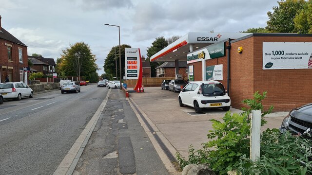
Filling station on A630 Recording what is a low price in these parts in October 2022, with every pump in service
Filling station on A630
Recording what is a low price in these parts in October 2022, with every pump in service
Conisbrough Castle From Coronation Park
Conisbrough Castle
From Coronation Park
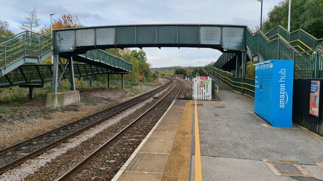
Conisbrough Station Looking east. 

The ramps to the footbridge must are so long that almost anyone with disabilities would rather struggle up the steps!
Conisbrough Station
Looking east. The ramps to the footbridge must are so long that almost anyone with disabilities would rather struggle up the steps!
Show me another place!

Cadeby is located at Grid Ref: SE5100 (Lat: 53.500253, Lng: -1.220133)

Division: West Riding

Administrative County: South Yorkshire

District: Doncaster

Police Authority: South Yorkshire

What 3 Words

///seagull.poem.searching. Near Conisbrough, South Yorkshire

Related Wikis

Cadeby, South Yorkshire

Cadeby is a village and civil parish in the City of Doncaster in South Yorkshire, England. The population at the census of 2011 was 203. It is about five...

Dearne Valley

The Dearne Valley is an area of South Yorkshire, England, along the River Dearne. It encompasses the towns of Wombwell, Wath-upon-Dearne, Swinton, Conisbrough...

St John the Evangelist's Church, Cadeby

St John the Evangelist's Church is a redundant Anglican church in the village of Cadeby, South Yorkshire, England. It is recorded in the National Heritage...

Cadeby Main Colliery

The Cadeby Main Colliery was a coal mine sunk in 1889 in Cadeby, South Yorkshire, England. It commenced production in 1893 and was worked until it was...

Nearby Amenities

Located within 500m of 53.500253,-1.220133
Cadeby
Place: village
Source: npe
Wikidata: Q2992371
Wikipedia: en:Cadeby, South Yorkshire
Lat/Long: 53.4995392/-1.2224675
Bus Stop
Cadeby Lane/Garden Lane
Alt Name: Cadeby Lane/Garden Lane
Bus: yes
Naptan AltCommonName: Cadeby Lane/Garden Lane
Naptan AtcoCode: 370040148
Naptan Bearing: NE
Naptan CommonName: Cadeby Lane/Garden Lane
Naptan Indicator: 40148
Naptan Landmark: WHITEHOUSE FARM
Naptan PlusbusZoneRef: ROTHCEN
Naptan Street: Cadeby Lane
Naptan Verified: no
Public Transport: platform
Source: naptan_import
Lat/Long: 53.499738/-1.2220394
Cadeby Lane/Garden Lane
Alt Name: Cadeby Lane/Garden Lane
Naptan AltCommonName: Cadeby Lane/Garden Lane
Naptan AtcoCode: 370045866
Naptan Bearing: SW
Naptan BusStopType: CUS
Naptan CommonName: Cadeby Lane/Garden Lane
Naptan Indicator: 45866
Naptan Landmark: WHITEHOUSE FARM
Naptan PlusbusZoneRef: ROTHCEN
Naptan Street: Doncaster Road
Naptan Verified: no
Source: naptan_import
Lat/Long: 53.4996655/-1.2219503
Generator Method: photovoltaic
Generator Output Electricity: yes
Generator Source: solar
Generator Type: solar_photovoltaic_panel
Location: roof
Power: generator
Lat/Long: 53.4999534/-1.2230579
Generator Method: photovoltaic
Generator Output Electricity: yes
Generator Source: solar
Generator Type: solar_photovoltaic_panel
Location: roof
Power: generator
Lat/Long: 53.4994045/-1.2219179
Generator Method: photovoltaic
Generator Output Electricity: yes
Generator Source: solar
Generator Type: solar_photovoltaic_panel
Location: roof
Power: generator
Lat/Long: 53.4989594/-1.2225456
Generator Method: photovoltaic
Generator Output Electricity: yes
Generator Source: solar
Generator Type: solar_photovoltaic_panel
Location: roof
Power: generator
Lat/Long: 53.4989418/-1.2213493
Generator Method: photovoltaic
Generator Output Electricity: yes
Generator Source: solar
Generator Type: solar_photovoltaic_panel
Location: roof
Power: generator
Lat/Long: 53.4988206/-1.2211535
Generator Method: photovoltaic
Generator Output Electricity: yes
Generator Source: solar
Generator Type: solar_photovoltaic_panel
Location: roof
Power: generator
Lat/Long: 53.498827/-1.2211052
Generator Method: photovoltaic
Generator Output Electricity: yes
Generator Source: solar
Generator Type: solar_photovoltaic_panel
Location: roof
Power: generator
Lat/Long: 53.4982941/-1.2225134
Generator Method: photovoltaic
Generator Output Electricity: yes
Generator Source: solar
Generator Type: solar_photovoltaic_panel
Location: roof
Power: generator
Lat/Long: 53.499369/-1.2249422
Generator Method: photovoltaic
Generator Output Electricity: yes
Generator Source: solar
Generator Type: solar_photovoltaic_panel
Location: roof
Power: generator
Lat/Long: 53.4993243/-1.2249959
The data included in this document is from www.openstreetmap.org. The data is made available under ODbL.

Have you been to Cadeby?

Leave your review of Cadeby below (or comments, questions and feedback).