Byford

Civil Parish in Herefordshire

England

Byford

St Lawrence Church, Preston on Wye Rebuilt in the 19th Century.
St Lawrence Church, Preston on Wye Credit: Stuart Wilding

Byford is a civil parish located in Herefordshire, England. It is situated in the picturesque countryside, approximately 9 miles west of Hereford, the county town. The parish covers an area of around 2.5 square miles and is home to a small population.

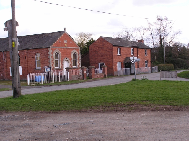
The village of Byford itself is characterized by its charming rural atmosphere and traditional English architecture. The centerpiece of the village is the St John the Baptist Church, a historic building dating back to the 12th century. The church is known for its beautiful stained glass windows and intricate carvings, attracting visitors interested in history and architecture.

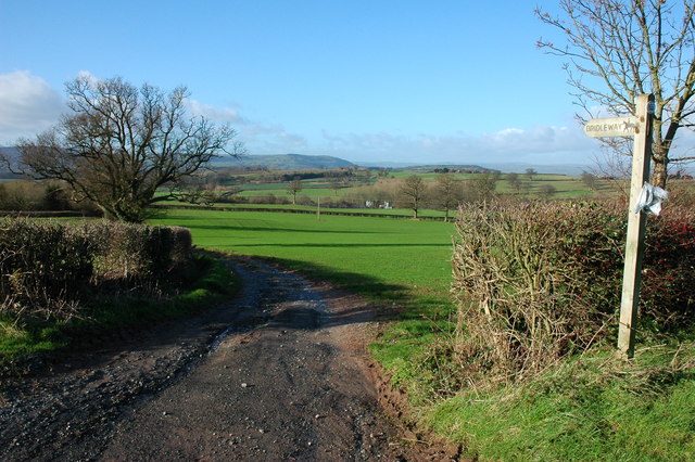
The surrounding countryside offers stunning views and ample opportunities for outdoor activities. The Golden Valley, a nearby scenic area, is a popular spot for hiking and exploring nature. The River Wye, which runs through the parish, also provides opportunities for fishing and water-based activities.

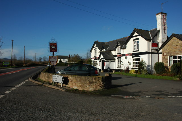
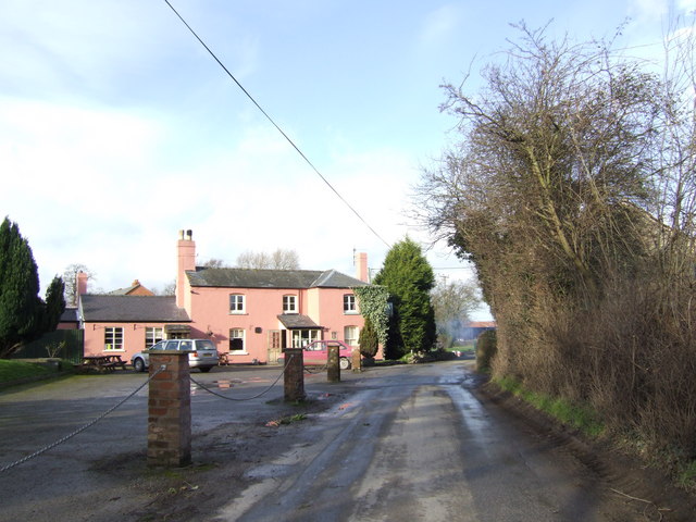
Although small, Byford has a close-knit community and is known for its friendly and welcoming atmosphere. The village has a village hall, which serves as a hub for community events and gatherings. Additionally, there is a pub located in the village, providing a social meeting place for residents and visitors alike.

Overall, Byford offers a peaceful and idyllic setting, making it an attractive destination for those seeking a rural retreat or a taste of traditional English village life.

If you have any feedback on the listing, please let us know in the comments section below.

Byford Images

Images are sourced within 2km of 52.083452/-2.884754 or Grid Reference SO3943. Thanks to Geograph Open Source API. All images are credited.

St Lawrence Church, Preston on Wye Rebuilt in the 19th Century.
St Lawrence Church, Preston on Wye
Rebuilt in the 19th Century.
Preston on Wye A rather uninspiring view of Preston on Wye, the building on the left is the Baptist Church.
Preston on Wye
A rather uninspiring view of Preston on Wye, the building on the left is the Baptist Church.
Byford church Byford church is dedicated to St John the Baptist.
Byford church
Byford church is dedicated to St John the Baptist.
Garnons, Mansell Gamage Garnons is a large country house in parkland situated below the wooded Garnon Hill to the north Byford. Pevsner states that the house was built c.1860 as an addition to an earlier house.
Garnons, Mansell Gamage
Garnons is a large country house in parkland situated below the wooded Garnon Hill to the north Byford. Pevsner states that the house was built c.1860 as an addition to an earlier house.
Farmland by Chestnut Coppice, Byford
Cottage in Mansell Gamage
The Portway Inn Hotel, Staunton on Wye <span class="nowrap"><a title="http://www.theportwayinnhotel.co.uk/" rel="nofollow ugc noopener" href="http://www.theportwayinnhotel.co.uk/">Link</a><img style="margin-left:2px;" alt="External link" title="External link - shift click to open in new window" src="https://s1.geograph.org.uk/img/external.png" width="10" height="10"/></span>
The Portway Inn Hotel, Staunton on Wye
The Yew Tree This pub is in the isolated village of Preston-on-Wye. The colour they chose to decorate the exterior would be more typical of Suffolk!
The Yew Tree
This pub is in the isolated village of Preston-on-Wye. The colour they chose to decorate the exterior would be more typical of Suffolk!
Farm at Byford The concrete structure on the left is possibly a silage clamp. The footpath signpost indicates the route of the Wye Valley Walk.
Farm at Byford
The concrete structure on the left is possibly a silage clamp. The footpath signpost indicates the route of the Wye Valley Walk.
The A438 at Byford Here the Hereford to Brecon road passes to the south of parkland at Garnons.
The A438 at Byford
Here the Hereford to Brecon road passes to the south of parkland at Garnons.
Bridleway at Mansell Gamage View to the west.
Bridleway at Mansell Gamage
View to the west.
Dying Oak Tree This once magnificent tree is slowly dying. Situated between the A438 and the River Wye. Close to the village of Monnington on Wye. I first photographed this Oak Tree six years ago [2000]. Then seeing it again, I was heart broken to see how many branches have gone and only one living branch left.
Dying Oak Tree
This once magnificent tree is slowly dying. Situated between the A438 and the River Wye. Close to the village of Monnington on Wye. I first photographed this Oak Tree six years ago [2000]. Then seeing it again, I was heart broken to see how many branches have gone and only one living branch left.
Byford Church St John the Baptist church, Byford.
Byford Church
St John the Baptist church, Byford.
View from Mansell Lodge One of the two lodges on the Garnons estate.
View from Mansell Lodge
One of the two lodges on the Garnons estate.
St John Baptist, Byford By Byford Court, its neighbour for the past 500 years or more.
St John Baptist, Byford
By Byford Court, its neighbour for the past 500 years or more.
Byford Court Across the lane from the church.
Byford Court
Across the lane from the church.
The interior of Byford Church The nave of St John the Baptist's church, Byford.
The interior of Byford Church
The nave of St John the Baptist's church, Byford.
Interior of Byford Church Arches in the nave of St John the Baptist's church, Byford.
Interior of Byford Church
Arches in the nave of St John the Baptist's church, Byford.
Show me another place!

Byford is located at Grid Ref: SO3943 (Lat: 52.083452, Lng: -2.884754)

Unitary Authority: County of Herefordshire

Police Authority: West Mercia

What 3 Words

///bonfires.parkway.ballparks. Near Bridge Sollers, Herefordshire

Related Wikis

Byford

Byford is a village and civil parish on the River Wye in Herefordshire, England, about 11 km (7 mi) west of Hereford. According to the 2001 census, it...

Mansell Gamage

Mansell Gamage is a village and civil parish in Herefordshire, England. It is on the B4230 road and is near the A438 road. == References ==

Bridge Sollers

Bridge Sollers is a village and civil parish in Herefordshire, England, 10 km (6.2 mi) west of Hereford, on the River Wye. The village consists of 12 households...

Preston on Wye

Preston on Wye is a village and civil parish in Herefordshire, England. It is situated near the River Wye, about 9 miles west of Hereford. Nearby places...

Monnington on Wye

Monnington on Wye is a village and former civil parish, now in the parish of Brobury with Monnington-on-Wye, in western Herefordshire, England, located...

Bishopstone, Herefordshire

Bishopstone is a village and civil parish in Herefordshire, England, 10 km (6.2 mi) west of Hereford, near the River Wye and the Roman town of Magnis....

Westmoor Flag railway station

Westmoor Flag railway station was a private station to the west of Mansel Lacy, Herefordshire, England. The station was opened in 1863 and may have closed...

Staunton on Wye

Staunton on Wye is a relatively unpopulated civil parish in West Herefordshire, which is perhaps one of the most uninhabited locations of England. The...

Nearby Amenities

Located within 500m of 52.083452,-2.884754
Byford
Place: village
Wikidata: Q3784403
Lat/Long: 52.0816439/-2.8820541
Bus Stop
Old School
Naptan AtcoCode: 2090A088500
Naptan Bearing: NW
Naptan BusStopType: CUS
Naptan CommonName: Old School
Naptan Indicator: adj
Naptan Landmark: Old School House
Naptan NaptanCode: heradjtm
Naptan Street: A438
Naptan Verified: no
Source: naptan_import
Lat/Long: 52.0854093/-2.8877196
Bus Stop
Old School
Naptan AtcoCode: 2090A18675
Naptan Bearing: SE
Naptan BusStopType: CUS
Naptan CommonName: Old School
Naptan Indicator: opp
Naptan Landmark: Old School House
Naptan NaptanCode: herajajt
Naptan Street: A438
Naptan Verified: no
Source: naptan_import
Lat/Long: 52.0854717/-2.8876743
Power: pole
Source: bing
Lat/Long: 52.0821549/-2.8805476
Power: pole
Source: bing
Lat/Long: 52.0819851/-2.8795794
Power: pole
Source: bing
Lat/Long: 52.0815335/-2.8792092
Power: pole
Source: bing
Lat/Long: 52.0811807/-2.8788739
Power: pole
Source: bing
Lat/Long: 52.079806/-2.8833613
Power: pole
Source: bing
Lat/Long: 52.0798208/-2.8847453
Power: pole
Source: bing
Lat/Long: 52.0800187/-2.8860784
Power: pole
Source: bing
Lat/Long: 52.0803928/-2.8885943
Power: pole
Source: bing
Lat/Long: 52.0811165/-2.8886211
Power: pole
Source: bing
Lat/Long: 52.0820692/-2.8886908
Power: pole
Source: bing
Lat/Long: 52.0828076/-2.888723
Power: pole
Source: bing
Lat/Long: 52.0833779/-2.8891575
Power: pole
Source: bing
Lat/Long: 52.0840059/-2.8896403
Power: pole
Source: bing
Lat/Long: 52.0846949/-2.8913677
Power: pole
Lat/Long: 52.0846322/-2.8903833
Power: pole
Source: bing
Lat/Long: 52.084596/-2.889812
Power: pole
Source: bing
Lat/Long: 52.0844789/-2.8880176
Note: Connection to BY21 needs ground verification
Lat/Long: 52.0825202/-2.8903148
Barrier: stile
Lat/Long: 52.0864123/-2.889739
The data included in this document is from www.openstreetmap.org. The data is made available under ODbL.

Have you been to Byford?

Leave your review of Byford below (or comments, questions and feedback).