Bushley

Civil Parish in Worcestershire Malvern Hills

England

Bushley

On Mythe Bridge Crossing the River Severn.
On Mythe Bridge Credit: JThomas

Bushley is a civil parish located in the county of Worcestershire, England. Situated on the eastern bank of the River Severn, it lies approximately 3 miles southeast of the town of Tewkesbury and 13 miles northeast of the city of Gloucester. The parish covers an area of around 6 square miles and is bordered by the parishes of Ripple, Tewkesbury, and Kinnersley.

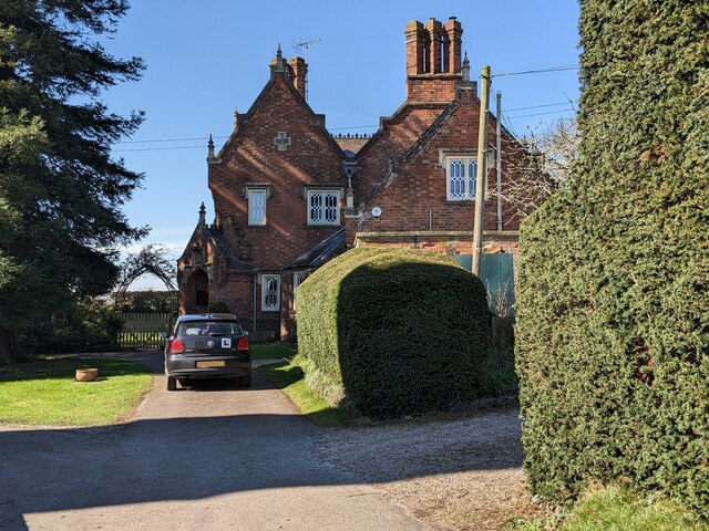
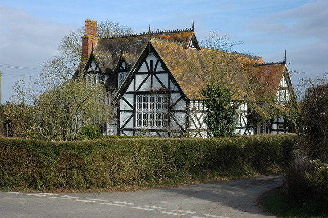
The village of Bushley itself is a small, rural community with a population of around 400 residents. It is characterized by its picturesque countryside setting and charming traditional cottages. The parish is predominantly agricultural, with farmland and meadows dominating the landscape. The River Severn and its associated floodplains also play a significant role in shaping the local environment.

Bushley has a rich history, with evidence of human habitation dating back to the prehistoric and Roman periods. The village's name is derived from the Old English words "bosc" and "leah," meaning "woodland clearing," reflecting its historical connection to the surrounding forests.

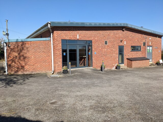
Despite its small size, Bushley offers a range of amenities to its residents, including a primary school, a village hall, and a church dedicated to St. Peter. The area is well-connected to neighboring towns and cities by road, with the A38 passing through the parish, providing easy access to major transportation routes.

Bushley's tranquil and idyllic setting, combined with its close proximity to urban centers, makes it an attractive place to live for those seeking a peaceful rural lifestyle within reach of essential services and amenities.

If you have any feedback on the listing, please let us know in the comments section below.

Bushley Images

Images are sourced within 2km of 52.007254/-2.19146 or Grid Reference SO8634. Thanks to Geograph Open Source API. All images are credited.

On Mythe Bridge Crossing the River Severn.
On Mythe Bridge
Crossing the River Severn.
Milestone, Upper Lode Lock, River Severn On the NW bank of the lock. 
An image of the lock itself is <a href="https://www.geograph.org.uk/photo/2349285">SO8832 : Upper Lode lock on the River Severn near Tewkesbury</a>.
In 1842 the Severn Commission was set up to improve the navigation between Gloucester and Stourport. It also created a navigable linkage between the Gloucester & Sharpness Canal and the Staffordshire & Worcestershire Canal. Another Severn mile peg can be seen on <a href="https://www.geograph.org.uk/photo/7167223">SO8359 : Milestone, Bevere Lock, River Severn</a>.

Inscription: To Worcester / 16½ / Miles

Milestone Society National ID: SEV-29
Milestone, Upper Lode Lock, River Severn
On the NW bank of the lock. An image of the lock itself is SO8832 : Upper Lode lock on the River Severn near Tewkesbury. In 1842 the Severn Commission was set up to improve the navigation between Gloucester and Stourport. It also created a navigable linkage between the Gloucester & Sharpness Canal and the Staffordshire & Worcestershire Canal. Another Severn mile peg can be seen on SO8359 : Milestone, Bevere Lock, River Severn. Inscription: To Worcester / 16½ / Miles Milestone Society National ID: SEV-29
Road approaching Upper Lode The tower of Tewkesbury Abbey can be seen in the background.
Road approaching Upper Lode
The tower of Tewkesbury Abbey can be seen in the background.
Footpath and road Footpath and road to Upper Lode.  The tower of Tewkesbury Abbey can be seen in the background.
Footpath and road
Footpath and road to Upper Lode. The tower of Tewkesbury Abbey can be seen in the background.
View to Mythe Waterworks View across a field to Mythe Waterworks from the footpath near Upper Lode.
View to Mythe Waterworks
View across a field to Mythe Waterworks from the footpath near Upper Lode.
House at Upper Lode Surprisingly this house does appear to be listed even though it appears of some age.  The former course of the River Severn was to the rear of the house before the river was diverted and a weir and lock constructed in the 1840s.
House at Upper Lode
Surprisingly this house does appear to be listed even though it appears of some age. The former course of the River Severn was to the rear of the house before the river was diverted and a weir and lock constructed in the 1840s.
Basin and Upper Lode Lock Basin and Upper Lode Lock with the Lockkeeper's house.  The lock was constructed in the 1840s.
Basin and Upper Lode Lock
Basin and Upper Lode Lock with the Lockkeeper's house. The lock was constructed in the 1840s.
The River Severn at Upper Lode View of the River Severn, downstream from Upper Lode.
The River Severn at Upper Lode
View of the River Severn, downstream from Upper Lode.
Former course of the River Severn Former course of the River Severn at Upper Lode.
Former course of the River Severn
Former course of the River Severn at Upper Lode.
Footbridge beside the River Severn Footbridge crossing the old course of the River Severn.  The river was realigned here in the 1840s when a weir and lock were constructed here at Upper Lode.
Footbridge beside the River Severn
Footbridge crossing the old course of the River Severn. The river was realigned here in the 1840s when a weir and lock were constructed here at Upper Lode.
Footbridge at Upper Lode Footbridge crossing the old course of the River Severn.  The river was realigned here in the 1840s when a weir and lock were constructed here at Upper Lode.
Footbridge at Upper Lode
Footbridge crossing the old course of the River Severn. The river was realigned here in the 1840s when a weir and lock were constructed here at Upper Lode.
The old River Severn Until the weir and lock was constructed in the 1840s at Upper Lode, this was the course of the River Severn.  This is almost like an oxbow lake, though at the southern end it is still connected to the main course of the river.
The old River Severn
Until the weir and lock was constructed in the 1840s at Upper Lode, this was the course of the River Severn. This is almost like an oxbow lake, though at the southern end it is still connected to the main course of the river.
House building There was a house on this site beside Mythe Bridge <a href="https://www.geograph.org.uk/photo/3780413">SO8833 : Mythe Bridge House near Tewkesbury</a> but it was demolished and now a new one is being built in the same site.
House building
There was a house on this site beside Mythe Bridge SO8833 : Mythe Bridge House near Tewkesbury but it was demolished and now a new one is being built in the same site.
Bushey village hall Here is the village hall at Bushley, built in the 1970s and altered in the 2010s. The car park is open for visitors from 8am to 6pm (the same times for adjacent Bushley parish church).
Bushey village hall
Here is the village hall at Bushley, built in the 1970s and altered in the 2010s. The car park is open for visitors from 8am to 6pm (the same times for adjacent Bushley parish church).
St. Peter's church (Bushley) The grand parish church of St. Peter in Bushley was built by Edward Blore in 1843, with the chancel added by G. G. Scott in 1856. The building is open to visitors from 8am to 6pm, and car parking is available at the village hall (the gates are shut after 6pm). This was grade II listed in March 1968.
St. Peter's church (Bushley)
The grand parish church of St. Peter in Bushley was built by Edward Blore in 1843, with the chancel added by G. G. Scott in 1856. The building is open to visitors from 8am to 6pm, and car parking is available at the village hall (the gates are shut after 6pm). This was grade II listed in March 1968.
The Old School (Bushley) This timber-framed building mainly dates from the mid-nineteenth century, although incorporates parts of an earlier house from the sixteenth/seventeenth century. This was grade II listed in May 1984, and here it is from the cemetery adjacent to the parish church.
The Old School (Bushley)
This timber-framed building mainly dates from the mid-nineteenth century, although incorporates parts of an earlier house from the sixteenth/seventeenth century. This was grade II listed in May 1984, and here it is from the cemetery adjacent to the parish church.
Wellingtonia House (Bushley) The splendid house by St. Peter parish church takes its name from the adjacent Wellingtonia trees. This was built of red brick in the mid-nineteenth century as the rectory/vicarage, and this received grade II listed status in May 1984.
Wellingtonia House (Bushley)
The splendid house by St. Peter parish church takes its name from the adjacent Wellingtonia trees. This was built of red brick in the mid-nineteenth century as the rectory/vicarage, and this received grade II listed status in May 1984.
Bushley Green Road Here is Bushley Green Road from the grassland adjacent to St. Peter parish church. There are many nice buildings in the village that have listed status.
Bushley Green Road
Here is Bushley Green Road from the grassland adjacent to St. Peter parish church. There are many nice buildings in the village that have listed status.
Show me another place!

Bushley is located at Grid Ref: SO8634 (Lat: 52.007254, Lng: -2.19146)

Administrative County: Worcestershire

District: Malvern Hills

Police Authority: West Mercia

What 3 Words

///stocks.scraper.crumbles. Near Tewkesbury, Gloucestershire

Nearby Locations

Bushley Green Bushley

Related Wikis

Bushley

Bushley is a small village and civil parish in the Malvern Hills district in Worcestershire, England. The church is dedicated to Saint Peter. At the 2021...

Old River Severn, Upper Lode

Old River Severn, Upper Lode (grid reference SO880331) is a 3.72-hectare (9.2-acre) biological Site of Special Scientific Interest in Gloucestershire,...

Mythe Railway Nature Reserve

Mythe Railway Nature Reserve (grid reference SO887341) is a 2.8-hectare (6.9-acre) nature reserve in Gloucestershire. The site is listed in the ‘Tewkesbury...

Borough of Tewkesbury

The Borough of Tewkesbury is a local government district with borough status in Gloucestershire, England. The borough is named after its largest town,...
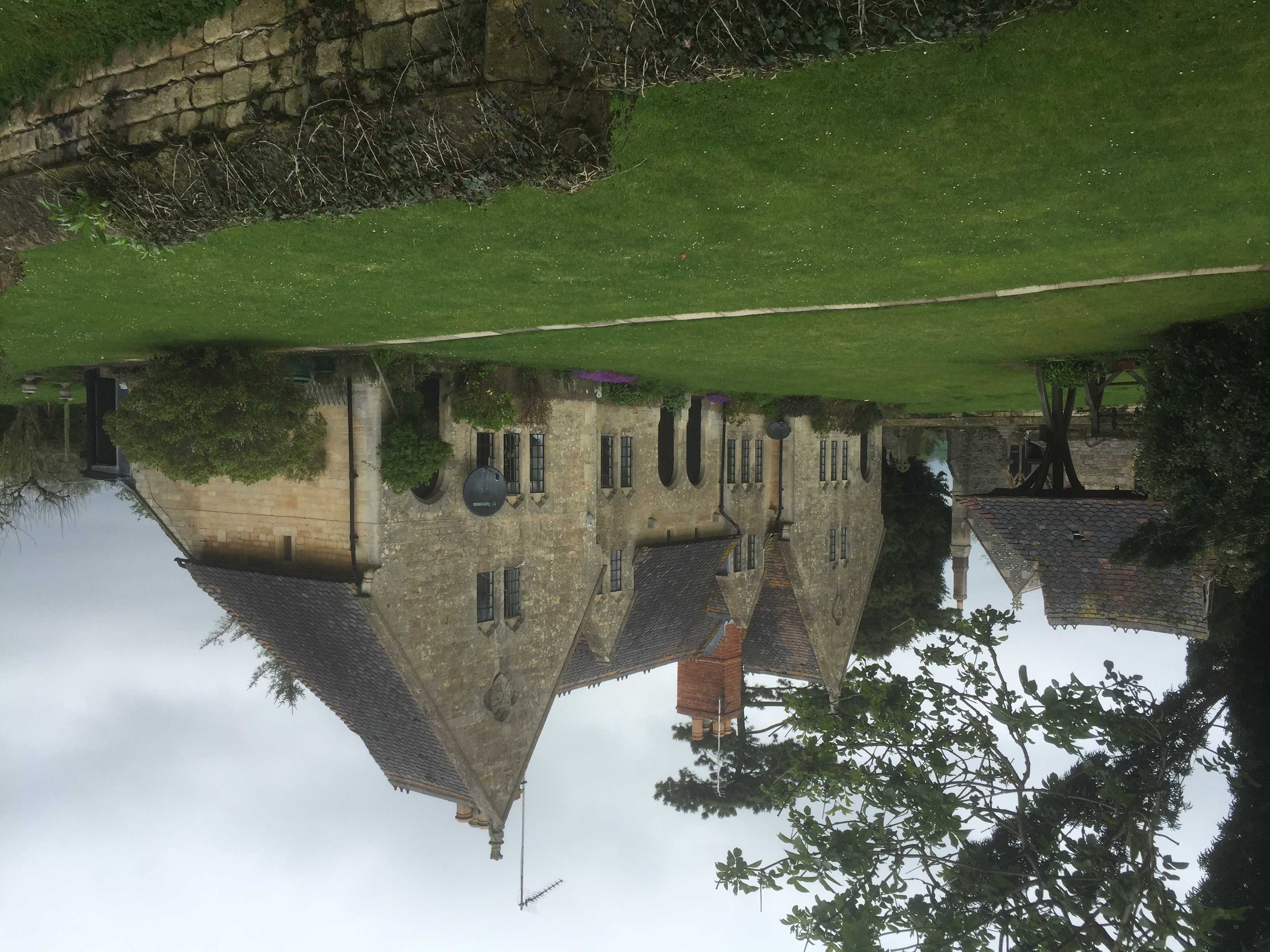
Bredon School

Bredon School, formerly Pull Court, is a private school in Bushley, Worcestershire, England. The house was built for the Reverend Canon E. C. Dowdeswell...
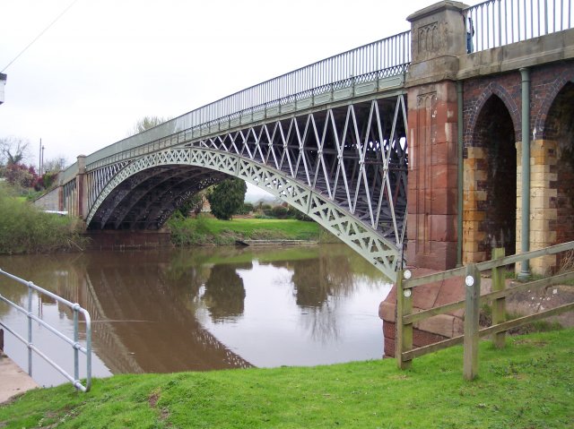
Mythe Bridge

Mythe Bridge carries the A438 road across the River Severn at Tewkesbury. It is a cast-iron arch bridge spanning 170 feet (52 m) and 24 feet (7.3 m) wide...

Yorke Almshouses

The Yorke Almshouses, Nos. 14–17 Church Row, Forthampton, Gloucestershire, England, are a range of four almshouses designed by the architect William Burges...
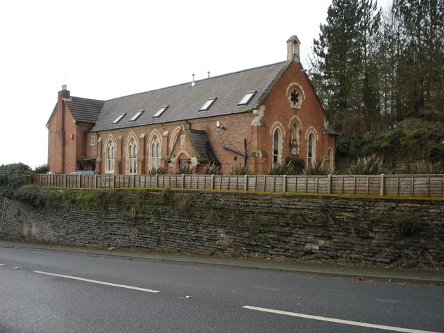
Mythe Chapel

The Mythe Chapel is located at Tewkesbury on the Mythe (off the A38 overlooking Mythe Bridge, between Severn Trent Water and the Tewkesbury Garden Centre...

Nearby Amenities

Located within 500m of 52.007254,-2.19146
Bus Stop
Crofts Field
Bus: yes
Naptan AtcoCode: 2000G063900
Naptan Bearing: W
Naptan BusStopType: CUS
Naptan CommonName: Crofts Field
Naptan Indicator: Adj
Naptan NaptanCode: wocdjpap
Naptan Street: Bushley Green Road
Naptan Verified: no
Public Transport: platform
Source: naptan_import
Lat/Long: 52.0084236/-2.1858308
Natural: spring
Lat/Long: 52.0061114/-2.1966438
Turning Circle
Lat/Long: 52.0088784/-2.18611
Turning Loop
Lat/Long: 52.004632/-2.1869137
Post Box
Post Box Type: lamp
Lat/Long: 52.00858/-2.1858121
Power: pole
Lat/Long: 52.0062278/-2.1845332
Power: pole
Lat/Long: 52.0044407/-2.1864456
Power: pole
Lat/Long: 52.0048/-2.1866924
Power: pole
Lat/Long: 52.0056239/-2.1862042
Bushley Village Hall
Power: pole
Transformer: distribution
Voltage Primary: 11000
Lat/Long: 52.0079779/-2.184733
Power: pole
Lat/Long: 52.0074075/-2.1851273
Power: pole
Lat/Long: 52.0067124/-2.1856047
Power: pole
Lat/Long: 52.0063995/-2.1857449
Power: pole
Lat/Long: 52.0066096/-2.1872006
Power: pole
Lat/Long: 52.0068148/-2.1886618
Power: pole
Lat/Long: 52.0070253/-2.1901209
Power: pole
Lat/Long: 52.0072432/-2.1916712
Power: pole
Lat/Long: 52.0067161/-2.1981065
Power: pole
Lat/Long: 52.0068234/-2.1967775
Power: pole
Lat/Long: 52.0069316/-2.1954766
Power: pole
Lat/Long: 52.007171/-2.1942146
Power: pole
Lat/Long: 52.0074174/-2.192905
Power: pole
Lat/Long: 52.0081241/-2.1929707
Yanley South
Power: pole
Transformer: distribution
Voltage Primary: 11000
Lat/Long: 52.0088786/-2.1931062
Power: pole
Lat/Long: 52.0095125/-2.1932296
Green Farm
Power: pole
Transformer: distribution
Voltage Primary: 11000
Lat/Long: 52.0100429/-2.1962357
Power: pole
Lat/Long: 52.0100925/-2.1947732
Power: pole
Lat/Long: 52.0101424/-2.1933603
Power: pole
Lat/Long: 52.0108956/-2.1936768
The data included in this document is from www.openstreetmap.org. The data is made available under ODbL.

Have you been to Bushley?

Leave your review of Bushley below (or comments, questions and feedback).