Burrough Green

Civil Parish in Cambridgeshire East Cambridgeshire

England

Burrough Green

"the kings head", Dullingham Someone tell them about capital letters please! Still, it's a service in TL65 and there aren't many.
"the kings head", Dullingham Credit: Hugh Venables

Burrough Green is a small civil parish located in the county of Cambridgeshire, England. Situated approximately 15 miles southeast of Cambridge, it is nestled in the picturesque countryside of East Anglia. The parish covers an area of around 6 square miles and is home to a population of just over 200 residents.

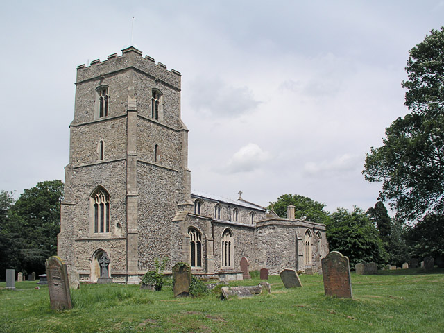
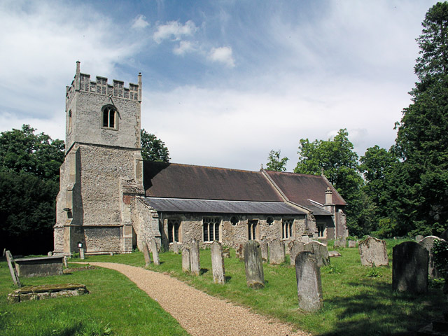
The village itself is characterized by its charming and idyllic setting, with many traditional thatched cottages and historic buildings dotting its landscape. The centerpiece of Burrough Green is the All Saints Church, a grade II listed building dating back to the 13th century, which adds to the village's historic appeal.

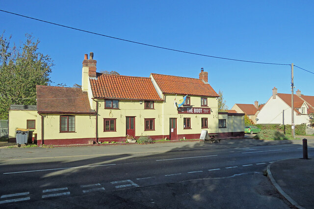
The community in Burrough Green is close-knit and friendly, with various social events and activities organized throughout the year. The village has a vibrant local pub, The Bull Inn, which serves as a popular gathering spot for residents and visitors alike.

Surrounding the village are expansive fields and meadows, providing ample opportunities for outdoor activities such as walking, cycling, and horse riding. The area is also known for its equestrian heritage, with several horse trainers and stables located nearby.

Despite its small size, Burrough Green benefits from its proximity to larger towns and cities. Cambridge, with its world-renowned university and cultural offerings, is a short drive away, providing access to a wider range of amenities and services.

In summary, Burrough Green is a picturesque and tightly-knit community in Cambridgeshire, offering a tranquil countryside setting with historic charm and easy access to larger urban areas.

If you have any feedback on the listing, please let us know in the comments section below.

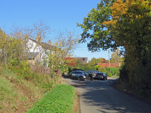
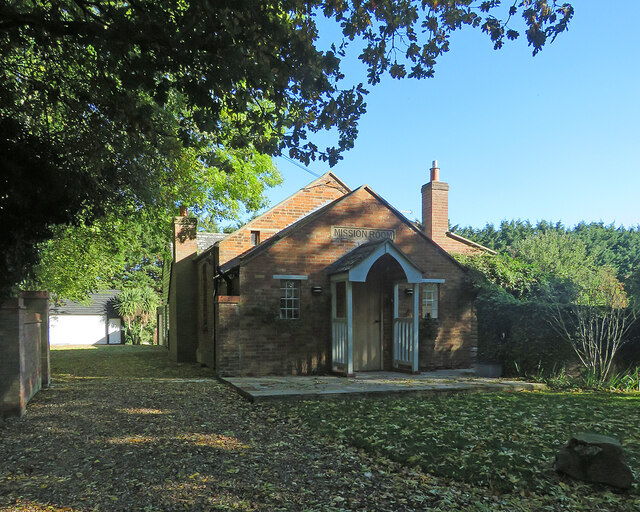
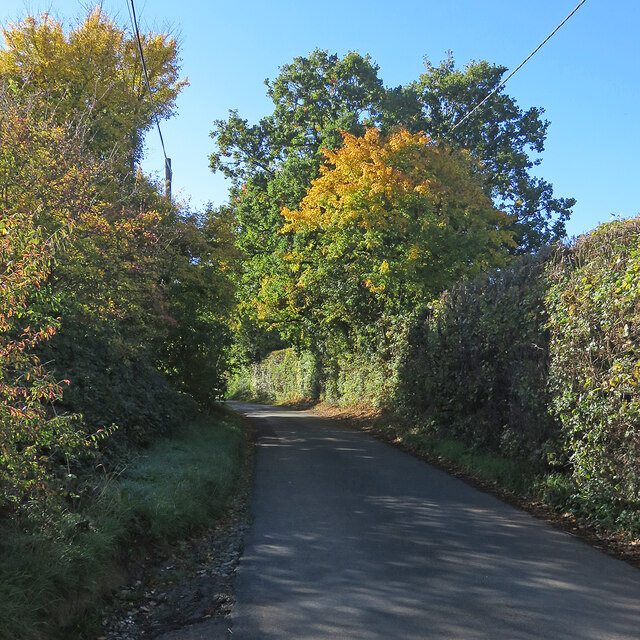
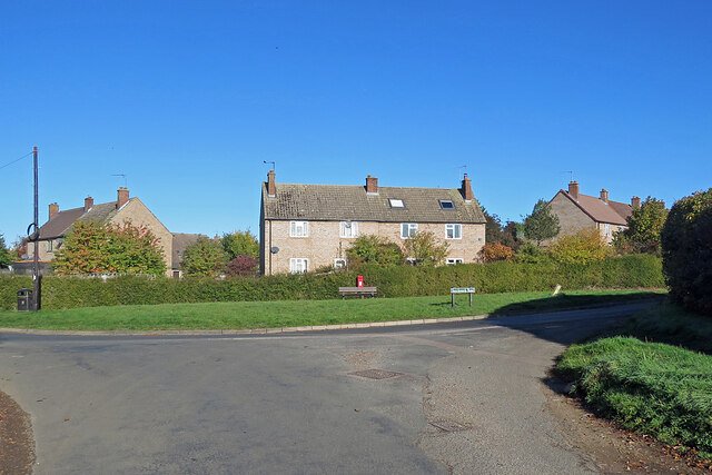
Burrough Green Images

Images are sourced within 2km of 52.18075/0.378097 or Grid Reference TL6256. Thanks to Geograph Open Source API. All images are credited.

"the kings head", Dullingham Someone tell them about capital letters please! Still, it's a service in TL65 and there aren't many.
"the kings head", Dullingham
Someone tell them about capital letters please! Still, it's a service in TL65 and there aren't many.
North-west from Westley Waterless Straight on for Westley Bottom.
North-west from Westley Waterless
Straight on for Westley Bottom.
Westley Waterless: water shortage After the drought summer of 2022 the water level looks low in the pond on Church Lane.

For comparison: <a href="https://www.geograph.org.uk/photo/3276200">TL6156 : Westley Waterless: Church Lane and pond</a> (2012).
Westley Waterless: water shortage
After the drought summer of 2022 the water level looks low in the pond on Church Lane. For comparison: TL6156 : Westley Waterless: Church Lane and pond (2012).
Westley Waterless: St Mary - restoration Two men were working on the bellcote - one on the lead, the other painting the louvres. The spirelet replaced a round tower which collapsed in 1855.

Inside are two exquisite 14th-century brasses: <a href="https://www.geograph.org.uk/photo/3276297">TL6156 : Westley Waterless: brass of Sir John Creke (detail)</a> and <a href="https://www.geograph.org.uk/photo/3276294">TL6156 : Westley Waterless: brass of Lady Creke (detail)</a>.
Westley Waterless: St Mary - restoration
Two men were working on the bellcote - one on the lead, the other painting the louvres. The spirelet replaced a round tower which collapsed in 1855. Inside are two exquisite 14th-century brasses: TL6156 : Westley Waterless: brass of Sir John Creke (detail) and TL6156 : Westley Waterless: brass of Lady Creke (detail).
Westley Waterless: building work A new house on Main Road
Westley Waterless: building work
A new house on Main Road
Converted water tower near Burrough Green A house on the B1061 between Dullingham and Brinkley.
Converted water tower near Burrough Green
A house on the B1061 between Dullingham and Brinkley.
Houses at Cross Green A straggle of houses on the road from Dullingham Ley to Dullingham.
Houses at Cross Green
A straggle of houses on the road from Dullingham Ley to Dullingham.
Between Dullingham Ley and Dullingham A cloudless October morning.
Between Dullingham Ley and Dullingham
A cloudless October morning.
Dullingham Ley: former Mission Room Now a house, in a hamlet half way down a dead-end lane serving a number of stud farms.
Dullingham Ley: former Mission Room
Now a house, in a hamlet half way down a dead-end lane serving a number of stud farms.
Houses at Dullingham Leys A hamlet on a dead-end lane which serves a number of stud farms.
Houses at Dullingham Leys
A hamlet on a dead-end lane which serves a number of stud farms.
Barns near Dullingham Ley Stud This dead-end lane in East Cambridgeshire, south of Newmarket, serves a number of stud farms.
Barns near Dullingham Ley Stud
This dead-end lane in East Cambridgeshire, south of Newmarket, serves a number of stud farms.
Light, shade and changing colours A cloudless October morning in the horse-racing country south of Newmarket. This is the single-track dead-end lane to Dullingham Ley and Widgham Green, serving a scattering of houses and a number of stud farms.
Light, shade and changing colours
A cloudless October morning in the horse-racing country south of Newmarket. This is the single-track dead-end lane to Dullingham Ley and Widgham Green, serving a scattering of houses and a number of stud farms.
Down Stetchworth Road Council-built houses between Stetchworth and Dullingham (ahead).
Down Stetchworth Road
Council-built houses between Stetchworth and Dullingham (ahead).
Dullingham: houses on the corner Council-built houses on the sharp corner where the dead-end lane from Dullingham Ley meets Stetchworth Road on the edge of Dullingham.
Dullingham: houses on the corner
Council-built houses on the sharp corner where the dead-end lane from Dullingham Ley meets Stetchworth Road on the edge of Dullingham.
Dullingham: St Mary All things bright and beautiful on a lovely October morning. St Mary's is Grade I listed - see <span class="nowrap"><a title="http://www.britishlistedbuildings.co.uk/en-49159-parish-church-of-st-mary-dullingham-cambr" rel="nofollow ugc noopener" href="http://www.britishlistedbuildings.co.uk/en-49159-parish-church-of-st-mary-dullingham-cambr">Link</a><img style="margin-left:2px;" alt="External link" title="External link - shift click to open in new window" src="https://s1.geograph.org.uk/img/external.png" width="10" height="10"/></span> .
Dullingham: St Mary
All things bright and beautiful on a lovely October morning. St Mary's is Grade I listed - see LinkExternal link .
Dullingham: The Boot Photographed from the shadows of Church Close on a bright October morning. The pub was flying a Ukrainian flag during the eighth month of the Russian invasion of Ukraine.
Dullingham: The Boot
Photographed from the shadows of Church Close on a bright October morning. The pub was flying a Ukrainian flag during the eighth month of the Russian invasion of Ukraine.
Dullingham: a house with a history The Grade II listing for the house on the left begins "Originally the workhouse, now dwellings. Late C17 or early C18. Local red brick; red pantile roof. Two symmetrical stacks and rear stack. Two storeys and attic with outshut. Central facade gable with round window."
Dullingham: a house with a history
The Grade II listing for the house on the left begins "Originally the workhouse, now dwellings. Late C17 or early C18. Local red brick; red pantile roof. Two symmetrical stacks and rear stack. Two storeys and attic with outshut. Central facade gable with round window."
Burrough End: the B1052 near the Westley Waterless turn <a href="https://www.geograph.org.uk/photo/3276486">TL6255 : Nearing Burrough End</a> is a winter view from the other side of the road, taken nearly ten years before.
Burrough End: the B1052 near the Westley Waterless turn
TL6255 : Nearing Burrough End is a winter view from the other side of the road, taken nearly ten years before.
Show me another place!

Burrough Green is located at Grid Ref: TL6256 (Lat: 52.18075, Lng: 0.378097)

Administrative County: Cambridgeshire

District: East Cambridgeshire

Police Authority: Cambridgeshire

What 3 Words

///skewing.sedative.ignore. Near Balsham, Cambridgeshire

Related Wikis

Westley Waterless

Westley Waterless is a small village and civil parish in East Cambridgeshire, England, 5 miles south west of Newmarket. == History == The parish of Westley...

Dullingham

Dullingham is a small village and civil parish in East Cambridgeshire, England. It is situated 4 miles (6 km) south of Newmarket and 14 miles (23 km) east...

Brinkley, Cambridgeshire

Brinkley is a small village in Cambridgeshire, England. It is situated about 15 miles east of Cambridge and 5 miles south of Newmarket, the horse racing...

Burrough Green

Burrough Green is a village and parish in Cambridgeshire, England. The population of the village at the 2011 census was 378. The soil is various; subsoil...

Park Wood, Cambridgeshire

Park Wood is an 8.1-hectare (20-acre) biological Site of Special Scientific Interest east of Brinkley in Cambridgeshire.This is woodland of the wet ash/maple...

Dullingham railway station

Dullingham is a railway station that serves the village of Dullingham in Cambridgeshire, England. It is about 1 mile (1.6 km) north-west of the centre...

Stetchworth

Stetchworth is a small village and civil parish in East Cambridgeshire, England, 3 miles (5 km) to the south of the horse-racing centre of Newmarket and...

Weston Colville

Weston Colville is a village in South Cambridgeshire, 10 miles southeast of Cambridge and 6 miles south of Newmarket, close to the border with Suffolk...

Nearby Amenities

Located within 500m of 52.18075,0.378097
Grove Park Farm
Landuse: farm
Note Retag: CS #48756035
Lat/Long: 52.181105/0.3851131
Recycling
Lat/Long: 52.1789429/0.3735573
Parking
Lat/Long: 52.1790232/0.3734259
Bus Stop
Village Hall
Naptan AtcoCode: 0500EWESW002
Naptan Bearing: E
Naptan BusStopType: CUS
Naptan CommonName: Village Hall
Naptan Indicator: near
Naptan Landmark: Village Hall
Naptan NaptanCode: cmbdjmag
Naptan ShortCommonName: Village Hall
Naptan Street: Westley Bottom Road
Naptan Verified: no
Source: naptan_import
Lat/Long: 52.1788625/0.3733733
Bus Stop
Village Hall
Naptan AtcoCode: 0500EWESW004
Naptan Bearing: W
Naptan BusStopType: CUS
Naptan CommonName: Village Hall
Naptan Indicator: opp
Naptan Landmark: Westley Waterless Village Hall
Naptan NaptanCode: cmbdjmam
Naptan ShortCommonName: Village Hall
Naptan Street: Westley Bottom Road
Naptan Verified: no
Source: naptan_import
Lat/Long: 52.1787898/0.3733147
Power: pole
Lat/Long: 52.1789993/0.3797313
Power: pole
Lat/Long: 52.1788149/0.3783431
Power: pole
Lat/Long: 52.179177/0.3811851
Power: pole
Lat/Long: 52.1785766/0.3838856
Power: pole
Lat/Long: 52.1788645/0.3825313
Power: pole
Lat/Long: 52.1799352/0.3723713
Power: pole
Lat/Long: 52.1802936/0.3713467
Power: pole
Lat/Long: 52.1787566/0.3765743
Post Box
Collection Times: Mo-Fr 16:15; Sa 10:00
Operator: Royal Mail
Post Box Type: lamp
Ref: CB8 121
Royal Cypher: EIIR
Royal Cypher Wikidata: Q33102113
Source: survey
Lat/Long: 52.1789498/0.3732464
Westley Waterless
Man Made: village_sign
Source: survey
Tourism: artwork
Lat/Long: 52.1787921/0.3733997
The data included in this document is from www.openstreetmap.org. The data is made available under ODbL.

Have you been to Burrough Green?

Leave your review of Burrough Green below (or comments, questions and feedback).