Broad Green

Settlement in Bedfordshire

England

Broad Green

Marston Hill entering Cranfield 30 limit
Marston Hill entering Cranfield 30 limit Credit: Robin Webster

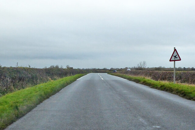
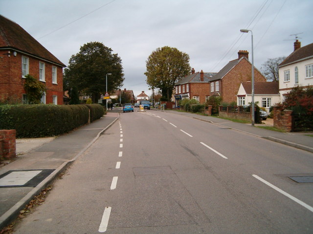
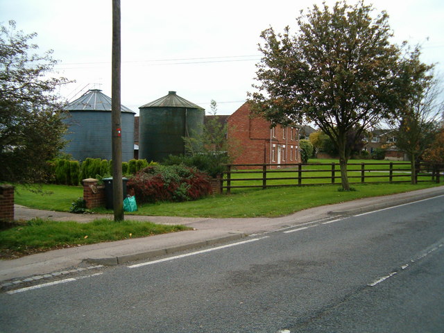
Broad Green is a small village located in the county of Bedfordshire, England. Situated approximately 5 miles southwest of the town of Bedford, it falls within the administrative district of Central Bedfordshire. The village is nestled amidst picturesque countryside, offering residents a tranquil and idyllic setting.

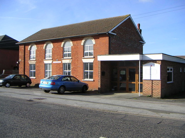
The history of Broad Green dates back several centuries, with records indicating the presence of a settlement on this site since medieval times. Today, it remains a close-knit community with a population of around 500 residents. The village is characterized by its charming cottages, many of which are made from traditional Bedfordshire clunch stone, giving the area a distinct rural aesthetic.

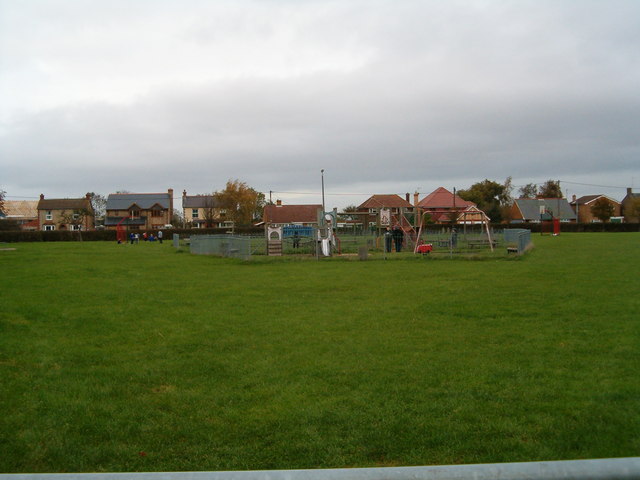
The village is served by a local primary school, providing education for children within the community. Amenities such as a village hall and a community center contribute to the strong sense of community spirit present in Broad Green. Additionally, there are a number of recreational facilities nearby, including parks, walking trails, and sports fields, offering opportunities for outdoor activities.

Broad Green benefits from its proximity to Bedford, which provides residents with access to a wider range of amenities, including shops, supermarkets, and healthcare facilities. The village is well-connected with good transport links, including regular bus services and easy access to major road networks, making it an attractive location for commuters.

In summary, Broad Green is a charming village in Bedfordshire, offering a peaceful and picturesque environment for its residents. With its rich history, strong community spirit, and convenient location, it is a desirable place to live for those seeking a rural lifestyle with easy access to nearby urban amenities.

If you have any feedback on the listing, please let us know in the comments section below.

Broad Green Images

Images are sourced within 2km of 52.077881/-0.598398 or Grid Reference SP9643. Thanks to Geograph Open Source API. All images are credited.

Marston Hill entering Cranfield 30 limit
Crawley Road, Cranfield The road passes the end of the Cranfield airfield runway. The sign, on the wrong side of the road, has been reversed by wind or some other agency, as the runway centreline is behind the camera.
Crawley Road, Cranfield
The road passes the end of the Cranfield airfield runway. The sign, on the wrong side of the road, has been reversed by wind or some other agency, as the runway centreline is behind the camera.
Crawley Road towards North Crawley
Crawley Road towards North Crawley From Cranfield.
Crawley Road towards North Crawley
From Cranfield.
War Memorial, Cranfield Situated on the corner of the High Street and Church Walk.
War Memorial, Cranfield
Situated on the corner of the High Street and Church Walk.
The Cross Keys public house Cranfield
Natwest Bank, Cranfield University A Natwest Bank branch located on the Cranfield University campus.
Natwest Bank, Cranfield University
A Natwest Bank branch located on the Cranfield University campus.
Cranfield Methodist Church Meeting Hall & Methodist Church located in Cranfield along the main road.
Cranfield Methodist Church
Meeting Hall & Methodist Church located in Cranfield along the main road.
Path to the woods A path across farmland on the Buckinghamshire/Bedfordshire border.
Path to the woods
A path across farmland on the Buckinghamshire/Bedfordshire border.
Cranfield The main road running through Cranfield village.
Cranfield
The main road running through Cranfield village.
East End, Cranfield Where rural life and village life meet.  A couple of silos in the middle of a row of houses.
East End, Cranfield
Where rural life and village life meet. A couple of silos in the middle of a row of houses.
Broad Green, Cranfield A children's play area in the middle of the village green.
Broad Green, Cranfield
A children's play area in the middle of the village green.
Cranfield United Sportsground on the edge of Cranfield village.
Cranfield United
Sportsground on the edge of Cranfield village.
Round the back Looking across at the back of the high street in Cranfield from Lodge Lane.
Round the back
Looking across at the back of the high street in Cranfield from Lodge Lane.
Cranfield Church The parish church, Cranfield.
Cranfield Church
The parish church, Cranfield.
Baptist Church The Baptist church, East End, Cranfield.
Baptist Church
The Baptist church, East End, Cranfield.
Village boundary Footpath on the edge of Cranfield village
Village boundary
Footpath on the edge of Cranfield village
Autumn Lane The lane to Rectory Farm, Cranfield, resplendent in autumn colour.
Autumn Lane
The lane to Rectory Farm, Cranfield, resplendent in autumn colour.
Show me another place!

Broad Green is located at Grid Ref: SP9643 (Lat: 52.077881, Lng: -0.598398)

Unitary Authority: Central Bedfordshire

Police Authority: Bedfordshire

What 3 Words

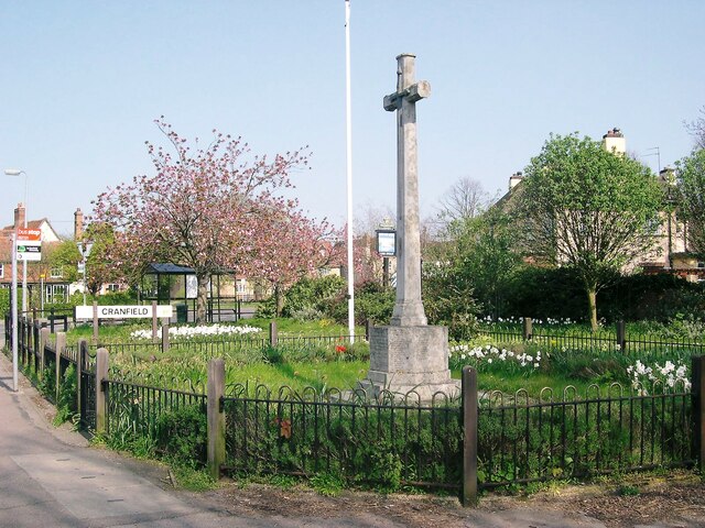
///elite.regal.headed. Near Cranfield, Bedfordshire

Related Wikis

Cranfield United F.C.

Cranfield United Football Club is a football club based in Cranfield, near Bedford, Bedfordshire, England. The club is affiliated to the Bedfordshire County...
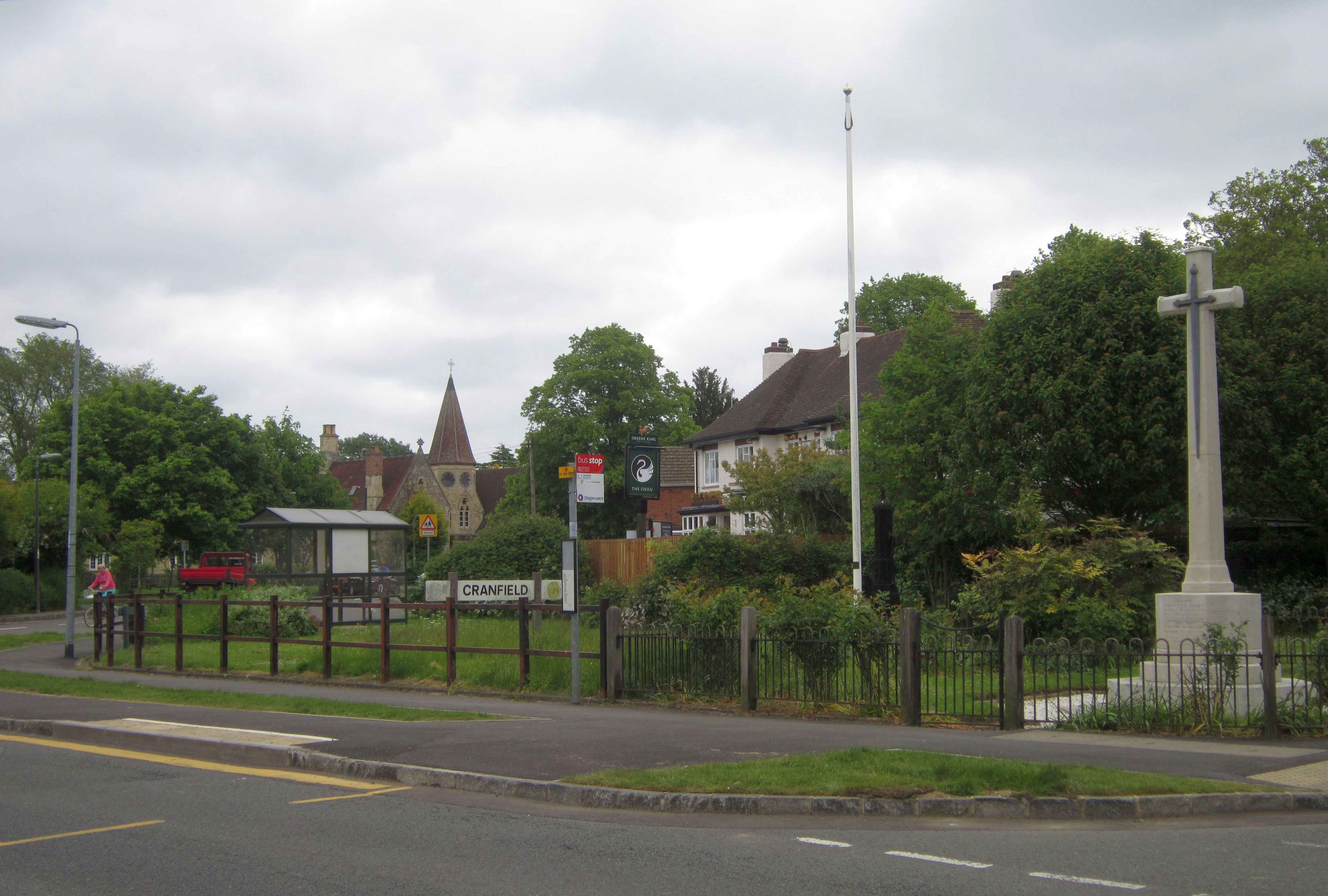
Cranfield

Cranfield is a village and civil parish in the west of Bedfordshire, England, situated between Bedford and Milton Keynes. It had a population of 4,909...

Church of St Peter & St Paul, Cranfield

Church of St Peter & St Paul is a Grade I listed church in Cranfield, Bedfordshire, England. It became a listed building on 23 January 1961. == See... ==

Cranfield Airport

Cranfield Airport (ICAO: EGTC) is an airfield just outside the village of Cranfield, in Bedfordshire, England. It is 7 NM (13 km; 8.1 mi) south-west of...

Nearby Amenities

Located within 500m of 52.077881,-0.598398
Traffic Calming: table
Lat/Long: 52.0756473/-0.5942135
Mini Roundabout
Direction: clockwise
Traffic Calming: table
Lat/Long: 52.0764705/-0.5987671
Turning Circle
Turning Circle: square
Lat/Long: 52.0737927/-0.5995236
Turning Circle
Turning Circle: hammer
Lat/Long: 52.0774241/-0.5956806
Post Box
Check Date: 2021-04-30
Collection Times: Mo-Fr 16:00; Sa 08:00
Operator: Royal Mail
Post Box Type: lamp
Ref: MK43 384
Royal Cypher: EIIR
Royal Cypher Wikidata: Q33102113
Lat/Long: 52.0767617/-0.5989929
Post Box
Collection Times: Mo-Fr 17:00; Sa 09:30
Post Box Type: lamp
Ref: MK43 385
Royal Cypher: EIIR
Royal Cypher Wikidata: Q33102113
Source: Bing
Survey Date: 2014-02-04
Lat/Long: 52.0748438/-0.5950968
Barrier: cattle_grid
Lat/Long: 52.0776665/-0.5926057
Turning Circle
Turning Circle: knuckle
Lat/Long: 52.0751505/-0.5934882
Traffic Calming: table
Lat/Long: 52.079306/-0.6014994
Turning Circle
Turning Circle: square
Lat/Long: 52.0763558/-0.5950303
Addr City: Cranfield
Addr Housenumber: 43
Addr Street: Lordsmead
Lat/Long: 52.0756772/-0.5975777
Addr City: Cranfield
Addr Housenumber: 45
Addr Street: Lordsmead
Lat/Long: 52.0756525/-0.5974382
Addr City: Cranfield
Addr Housenumber: 46
Addr Street: Lordsmead
Lat/Long: 52.075641/-0.5973524
Addr City: Cranfield
Addr Housenumber: 44
Addr Street: Lordsmead
Lat/Long: 52.0756656/-0.597516
Addr City: Cranfield
Addr Housenumber: 42
Addr Street: Lordsmead
Lat/Long: 52.0757249/-0.5977196
Addr City: Cranfield
Addr Housenumber: 41
Addr Street: Lordsmead
Lat/Long: 52.0757381/-0.5978054
Addr City: Cranfield
Addr Housenumber: 47
Addr Street: Lordsmead
Lat/Long: 52.0758932/-0.5971378
Addr City: Cranfield
Addr Housenumber: 48
Addr Street: Lordsmead
Lat/Long: 52.0759524/-0.5970761
Addr City: Cranfield
Addr Housenumber: 15
Addr Street: Lordsmead
Lat/Long: 52.0747907/-0.5967852
Addr City: Cranfield
Addr Housenumber: 11
Addr Street: Lordsmead
Lat/Long: 52.0749688/-0.5965465
Addr City: Cranfield
Addr Housenumber: 16
Addr Street: Lordsmead
Lat/Long: 52.0747544/-0.5968335
Addr City: Cranfield
Addr Housenumber: 9
Addr Street: Lordsmead
Lat/Long: 52.0750727/-0.5964633
Addr City: Cranfield
Addr Housenumber: 13
Addr Street: Lordsmead
Lat/Long: 52.0748879/-0.596627
Addr City: Cranfield
Addr Housenumber: 18
Addr Street: Lordsmead
Lat/Long: 52.0746852/-0.5969488
Addr City: Cranfield
Addr Housenumber: 8
Addr Street: Lordsmead
Lat/Long: 52.0751105/-0.5964202
Addr City: Cranfield
Addr Housenumber: 17
Addr Street: Lordsmead
Lat/Long: 52.074728/-0.5968845
Addr City: Cranfield
Addr Housenumber: 7
Addr Street: Lordsmead
Lat/Long: 52.0751551/-0.5963775
Addr City: Cranfield
Addr Housenumber: 6
Addr Street: Lordsmead
Lat/Long: 52.0751946/-0.5963373
Addr City: Cranfield
Addr Housenumber: 12
Addr Street: Lordsmead
Lat/Long: 52.0749258/-0.5965921
Addr City: Cranfield
Addr Housenumber: 14
Addr Street: Lordsmead
Lat/Long: 52.0748237/-0.5967316
Addr City: Cranfield
Addr Housenumber: 10
Addr Street: Lordsmead
Lat/Long: 52.0750116/-0.5965036
Addr City: Cranfield
Addr Housenumber: 26
Addr Street: Lordsmead
Lat/Long: 52.0751227/-0.5969052
Addr City: Cranfield
Addr Housenumber: 20
Addr Street: Lordsmead
Lat/Long: 52.0748656/-0.5971855
Addr City: Cranfield
Addr Housenumber: 21
Addr Street: Lordsmead
Lat/Long: 52.0749101/-0.5971426
Addr City: Cranfield
Addr Housenumber: 24
Addr Street: Lordsmead
Lat/Long: 52.0750378/-0.5969897
Addr City: Cranfield
Addr Housenumber: 22
Addr Street: Lordsmead
Lat/Long: 52.0749521/-0.5970996
Addr City: Cranfield
Addr Housenumber: 19
Addr Street: Lordsmead
Lat/Long: 52.0748252/-0.597227
Addr City: Cranfield
Addr Housenumber: 25
Addr Street: Lordsmead
Lat/Long: 52.0750807/-0.5969467
Addr City: Cranfield
Addr Housenumber: 23
Addr Street: Lordsmead
Lat/Long: 52.0749966/-0.5970299
Turning Loop
Lat/Long: 52.0810486/-0.5968927
Bus Stop
Crane Way
Bench: yes
Bus: yes
Check Date Shelter: 2021-03-30
Naptan AtcoCode: 021023501
Naptan Bearing: E
Naptan CommonName: Crane Way
Naptan Crossing: Bedford Road
Naptan Indicator: E-bound
Naptan NaptanCode: ahlapwtp
Naptan Street: Crane Way
Public Transport: platform
Shelter: yes
Source: naptan_import
Tactile Paving: yes
Lat/Long: 52.0758182/-0.5959186
Bus Stop
Crane Way
Bench: no
Bin: no
Bus: yes
Check Date Shelter: 2021-04-19
Naptan AtcoCode: 021023500
Naptan Bearing: W
Naptan CommonName: Crane Way
Naptan Indicator: W-bound
Naptan Landmark: Bedford Road
Naptan NaptanCode: ahlapwtm
Naptan Street: Crane Way
Public Transport: platform
Shelter: no
Source: naptan_import
Tactile Paving: no
Lat/Long: 52.0756055/-0.594737
Noexit: yes
Lat/Long: 52.0778041/-0.6021459
Noexit: yes
Lat/Long: 52.0778886/-0.6022624
Traffic Calming: table
Lat/Long: 52.0800025/-0.6024712
Turning Circle
Turning Circle: knuckle
Lat/Long: 52.0770161/-0.6003252
Direction: 265
Generator Method: photovoltaic
Generator Output Electricity: yes
Generator Solar Modules: 8
Generator Source: solar
Generator Type: solar_photovoltaic_panel
Location: roof
Power: generator
Lat/Long: 52.0818859/-0.5993995
Direction: 85
Generator Method: photovoltaic
Generator Output Electricity: yes
Generator Solar Modules: 8
Generator Source: solar
Generator Type: solar_photovoltaic_panel
Location: roof
Power: generator
Lat/Long: 52.0818859/-0.5993472
Direction: 160
Generator Method: photovoltaic
Generator Output Electricity: yes
Generator Solar Modules: 18
Generator Source: solar
Generator Type: solar_photovoltaic_panel
Location: roof
Power: generator
Lat/Long: 52.0748871/-0.5936572
Direction: 155
Generator Method: photovoltaic
Generator Output Electricity: yes
Generator Solar Modules: 4
Generator Source: solar
Generator Type: solar_photovoltaic_panel
Location: roof
Power: generator
Lat/Long: 52.076141/-0.5918527
Direction: 245
Generator Method: photovoltaic
Generator Output Electricity: yes
Generator Solar Modules: 3
Generator Source: solar
Generator Type: solar_photovoltaic_panel
Location: roof
Power: generator
Lat/Long: 52.0761199/-0.5918185
Direction: 195
Generator Method: photovoltaic
Generator Output Electricity: yes
Generator Solar Modules: 10
Generator Source: solar
Generator Type: solar_photovoltaic_panel
Location: roof
Power: generator
Lat/Long: 52.076114/-0.5940084
Direction: 200
Generator Method: photovoltaic
Generator Output Electricity: yes
Generator Solar Modules: 12
Generator Source: solar
Generator Type: solar_photovoltaic_panel
Location: roof
Power: generator
Lat/Long: 52.075881/-0.5956439
Fixme: solar panel?
Lat/Long: 52.0756772/-0.5962765
Direction: 105
Generator Method: photovoltaic
Generator Output Electricity: yes
Generator Solar Modules: 10
Generator Source: solar
Generator Type: solar_photovoltaic_panel
Location: roof
Power: generator
Lat/Long: 52.0743364/-0.5974085
Direction: 285
Generator Method: photovoltaic
Generator Output Electricity: yes
Generator Solar Modules: 5
Generator Source: solar
Generator Type: solar_photovoltaic_panel
Location: roof
Power: generator
Lat/Long: 52.0743479/-0.5974601
Fixme: solar panel?
Lat/Long: 52.0747739/-0.5978338
Turning Circle
Turning Circle: knuckle
Lat/Long: 52.0755953/-0.5980898
Fixme: substation?
Lat/Long: 52.0761908/-0.5956093
Direction: 120
Generator Method: photovoltaic
Generator Output Electricity: yes
Generator Solar Modules: 8
Generator Source: solar
Generator Type: solar_photovoltaic_panel
Location: roof
Power: generator
Lat/Long: 52.0767826/-0.5941805
Direction: 300
Generator Method: photovoltaic
Generator Output Electricity: yes
Generator Solar Modules: 8
Generator Source: solar
Generator Type: solar_photovoltaic_panel
Location: roof
Power: generator
Lat/Long: 52.0767983/-0.5942217
Direction: 210
Generator Method: photovoltaic
Generator Output Electricity: yes
Generator Solar Modules: 15
Generator Source: solar
Generator Type: solar_photovoltaic_panel
Location: roof
Power: generator
Lat/Long: 52.0773563/-0.596043
Direction: 210
Generator Method: photovoltaic
Generator Output Electricity: yes
Generator Solar Modules: 16
Generator Source: solar
Generator Type: solar_photovoltaic_panel
Location: roof
Power: generator
Lat/Long: 52.0778919/-0.5975093
Direction: 115
Generator Method: photovoltaic
Generator Output Electricity: yes
Generator Solar Modules: 18
Generator Source: solar
Generator Type: solar_photovoltaic_panel
Location: roof
Power: generator
Lat/Long: 52.0786318/-0.5974501
Direction: 215
Generator Method: photovoltaic
Generator Output Electricity: yes
Generator Solar Modules: 8
Generator Source: solar
Generator Type: solar_photovoltaic_panel
Location: roof
Power: generator
Lat/Long: 52.078288/-0.5948515
Turning Circle
Turning Circle: knuckle
Lat/Long: 52.0778101/-0.5953355
Direction: 215
Generator Method: photovoltaic
Generator Output Electricity: yes
Generator Solar Modules: 3
Generator Source: solar
Generator Type: solar_photovoltaic_panel
Location: roof
Power: generator
Lat/Long: 52.0771644/-0.5925476
Addr Country: GB
Addr Housenumber: 118
Addr Street: Bedford Road
Lat/Long: 52.0757315/-0.5920507
Addr Country: GB
Addr Housenumber: 9
Addr Street: Crawley Road
Lat/Long: 52.0785804/-0.6005801
The data included in this document is from www.openstreetmap.org. The data is made available under ODbL.

Have you been to Broad Green?

Leave your review of Broad Green below (or comments, questions and feedback).