Burghwallis

Civil Parish in Yorkshire Doncaster

England

Burghwallis

Skellow Services A1 northbound.
Skellow Services Credit: Ian Rob

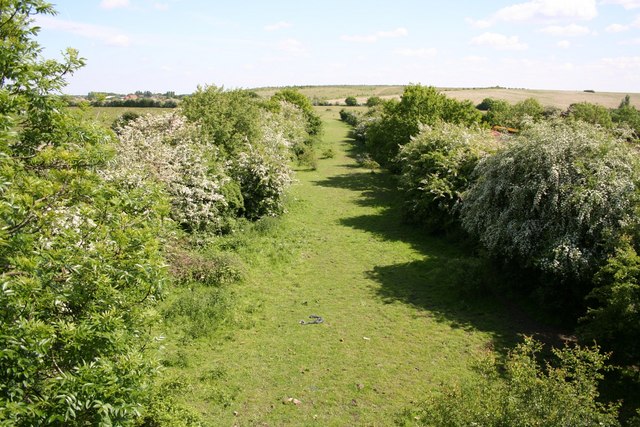
Burghwallis is a small civil parish located in the county of Yorkshire, England. Situated approximately 13 miles to the north of Doncaster, the parish covers an area of around 4 square miles. It is a rural area characterized by its picturesque countryside, with rolling hills, lush green fields, and charming villages.

The population of Burghwallis is relatively small, with just over 200 residents according to the latest census data. The parish is known for its close-knit community and friendly atmosphere, with residents often actively involved in local events and initiatives.

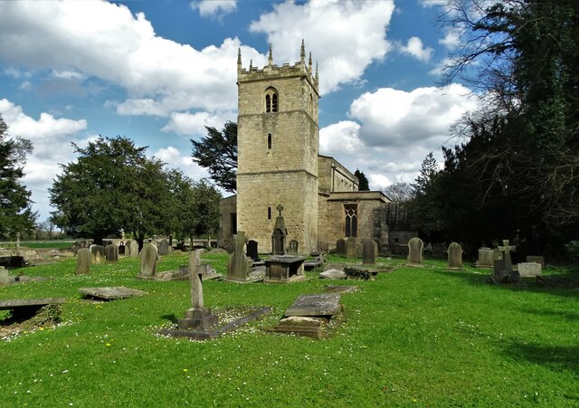
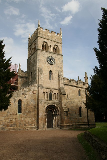
One of the notable landmarks in Burghwallis is the All Saints Church, a Grade I listed building that dates back to the 14th century. The church is renowned for its stunning architecture and beautiful stained glass windows, attracting visitors from near and far.

The surrounding area offers numerous opportunities for outdoor activities, such as hiking, cycling, and horse riding. The nearby countryside provides an ideal setting for nature enthusiasts, with its diverse flora and fauna.

Despite its rural setting, Burghwallis is well-connected to nearby towns and cities. The A1(M) motorway runs close to the parish, providing convenient access to major transport links. The city of Doncaster, with its range of amenities including shopping centers, restaurants, and entertainment venues, is easily accessible by road.

Overall, Burghwallis offers a peaceful and idyllic lifestyle for its residents, with its beautiful surroundings and strong community spirit.

If you have any feedback on the listing, please let us know in the comments section below.
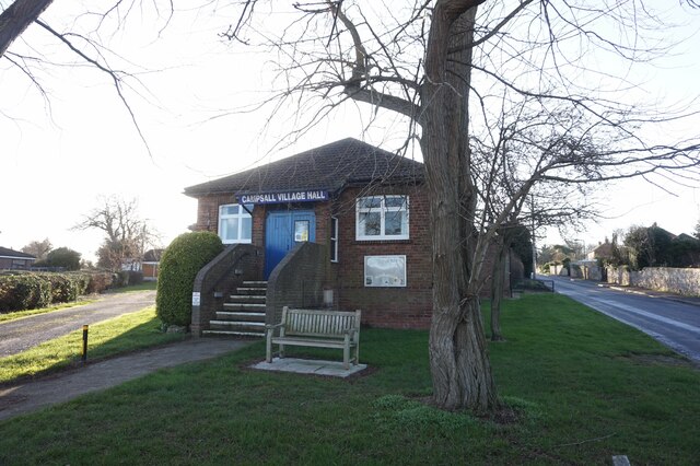
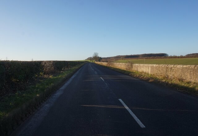
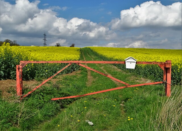
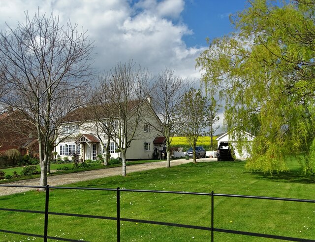
Burghwallis Images

Images are sourced within 2km of 53.600391/-1.193552 or Grid Reference SE5311. Thanks to Geograph Open Source API. All images are credited.

Skellow Services A1 northbound.
Skellow Services
A1 northbound.
Campsall Village Hall
New Road towards the A1 at Barnsdale Bar
Woodfield Road at New Close Lane
Woodfield Road and New Close Lane junction
Track through rapeseed to Summer House Farm
Primrose Cottage on New Close Lane
The A1 passing its junction with Green Lane
Burghwallis seen from Stony Croft Lane
Stony Croft Lane On the way from Burghwallis to Skellow
Stony Croft Lane
On the way from Burghwallis to Skellow
On the northern edge of Skellow Playground equipment and a view north to Burghwallis
On the northern edge of Skellow
Playground equipment and a view north to Burghwallis
Path through Stony Flat Plantation, Skellow
Golfing on Owston Hall Golf Course
Path to North Quarry Plantation
North Quarry Plantation
All Saints Church, Owston Between 1180-1200 the church was a simple structure of nave and chancel. All that remains of that early structure is the west wall showing typical herringbone masonry of the early Norman period. The tower was added in the thirteenth century. Between 1200-1250 the north aisle was added.  Between 1300-1350 a south aisle was added, the nave was extended and a new chancel was built. 

(adapted from the National Churches Trust website)
All Saints Church, Owston
Between 1180-1200 the church was a simple structure of nave and chancel. All that remains of that early structure is the west wall showing typical herringbone masonry of the early Norman period. The tower was added in the thirteenth century. Between 1200-1250 the north aisle was added. Between 1300-1350 a south aisle was added, the nave was extended and a new chancel was built. (adapted from the National Churches Trust website)
Daisies at Owston Church Pushing through a crack in a stone path
Daisies at Owston Church
Pushing through a crack in a stone path
Much Missed A memorial bench in All Saints churchyard, Owston. It has taken on the appearance of a shrine.
Much Missed
A memorial bench in All Saints churchyard, Owston. It has taken on the appearance of a shrine.
Show me another place!

Burghwallis is located at Grid Ref: SE5311 (Lat: 53.600391, Lng: -1.193552)

Division: West Riding

Administrative County: South Yorkshire

District: Doncaster

Police Authority: South Yorkshire

What 3 Words

///rhino.clutter.windows. Near Carcroft, South Yorkshire

Related Wikis

Burghwallis

Burghwallis is a small village and civil parish in rural South Yorkshire, England. The population of the civil parish as of the 2011 census was 300. The...
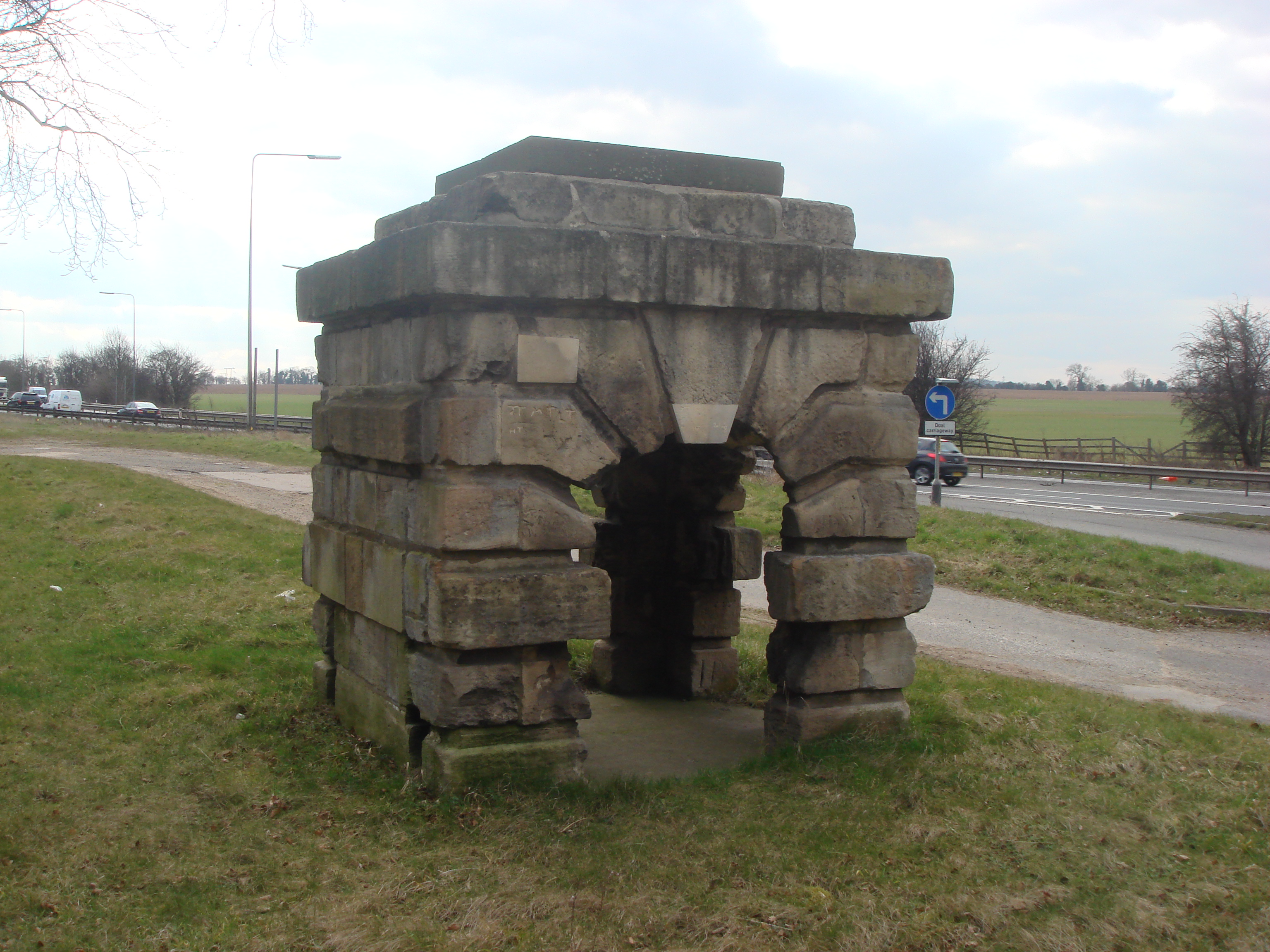
Robin Hood's Well

Robin Hood's Well is a historic structure beside the A1 road near Burghwallis, South Yorkshire, England. It was originally built in 1710 as a well house...

Owston, South Yorkshire

Owston is a small village and civil parish in the City of Doncaster in rural South Yorkshire, England. Historically part of the West Riding of Yorkshire...

Sutton, South Yorkshire

Sutton is a small village and former civil parish, now in the parish of Norton, in the City of Doncaster in South Yorkshire, England. It lies at approximately...

Bullcroft Colliery

Bullcroft Colliery was a coal mine situated by the village of Carcroft north of Doncaster. It operated from 1908 to 1970. == History == The Bullcroft Colliery...

Skellow

Skellow is a village in rural South Yorkshire part of the Metropolitan Borough of Doncaster, England. Historically part of the West Riding of Yorkshire...

Askern Miners F.C.

Askern Miners Football Club is a football club based in Askern, Doncaster, South Yorkshire, England. They are currently members of the Doncaster Saturday...

St Mary Magdalene, Campsall

St Mary Magdalene is a parish church in the Church of England in Campsall in South Yorkshire. It is Grade I listed. There is a service every Sunday at...

Nearby Amenities

Located within 500m of 53.600391,-1.193552
Burghwallis
Place: village
Lat/Long: 53.6004738/-1.1947882
Bus Stop
Grange Lane/Sixrood Lane
Alt Name: Grange Lane/Sixrood Lane
Naptan AltCommonName: Grange Lane/Sixrood Lane
Naptan AtcoCode: 370040653
Naptan Bearing: NE
Naptan CommonName: Grange Lane/Sixrood Lane
Naptan Indicator: 40653
Naptan Landmark: STREETLIGHT NO 07267
Naptan PlusbusZoneRef: ROTHCEN
Naptan Street: Grange Lane
Naptan Verified: no
Source: naptan_import
Lat/Long: 53.6013254/-1.1942266
Bus Stop
Grange Lane/Stony Croft Lane
Alt Name: Grange Lane/Stony Croft Lane
Naptan AltCommonName: Grange Lane/Stony Croft Lane
Naptan AtcoCode: 370041146
Naptan Bearing: NE
Naptan CommonName: Grange Lane/Stony Croft Lane
Naptan Indicator: 41146
Naptan Landmark: 41146
Naptan PlusbusZoneRef: ROTHCEN
Naptan Street: Grange Lane
Naptan Verified: no
Source: naptan_import
Lat/Long: 53.5980535/-1.1995777
Bus Stop
Grange Lane/Scorcher Hills Lane
Naptan AtcoCode: 370040654
Naptan Bearing: SW
Naptan CommonName: Grange Lane/Scorcher Hills Lane
Naptan Indicator: 40654
Naptan Landmark: STREETLIGHT NO 07257
Naptan PlusbusZoneRef: ROTHCEN
Naptan Street: Grange Lane
Naptan Verified: no
Source: naptan_import
Lat/Long: 53.5991721/-1.1974863
Bus Stop
Grange Lane/The Abbes Walk
Alt Name: Grange Lane/The Abbes Walk
Naptan AltCommonName: Grange Lane/The Abbes Walk
Naptan AtcoCode: 370040656
Naptan Bearing: NE
Naptan CommonName: Grange Lane/The Abbes Walk
Naptan Indicator: 40656
Naptan Landmark: STREETLIGHT NO
Naptan PlusbusZoneRef: ROTHCEN
Naptan Street: Grange Lane
Naptan Verified: no
Source: naptan_import
Lat/Long: 53.6034335/-1.1895922
Grange Lane/Sixrood Lane
Alt Name: Grange Lane/Sixrood Lane
Naptan AltCommonName: Grange Lane/Sixrood Lane
Naptan AtcoCode: 370045864
Naptan Bearing: SW
Naptan BusStopType: CUS
Naptan CommonName: Grange Lane/Sixrood Lane
Naptan Indicator: 45864
Naptan Landmark: TELEPHONE BOX/HOME FARM
Naptan PlusbusZoneRef: ROTHCEN
Naptan Street: Grange Lane
Naptan Verified: no
Source: naptan_import
Lat/Long: 53.6012437/-1.1941073
Grange Lane/Scorcher Hills Lane
Naptan AtcoCode: 370045865
Naptan Bearing: NE
Naptan BusStopType: CUS
Naptan CommonName: Grange Lane/Scorcher Hills Lane
Naptan Indicator: 45865
Naptan Landmark: ROAD JUNCTION
Naptan PlusbusZoneRef: ROTHCEN
Naptan Street: Grange Lane
Naptan Verified: no
Source: naptan_import
Lat/Long: 53.5992893/-1.1975445
Grange Lane/Stony Croft Lane
Alt Name: Grange Lane/Stony Croft Lane
Naptan AltCommonName: Grange Lane/Stony Croft Lane
Naptan AtcoCode: 370045908
Naptan Bearing: SW
Naptan BusStopType: CUS
Naptan CommonName: Grange Lane/Stony Croft Lane
Naptan Indicator: 45908
Naptan Landmark: 45908
Naptan PlusbusZoneRef: ROTHCEN
Naptan Street: Grange Lane
Naptan Verified: no
Source: naptan_import
Lat/Long: 53.597981/-1.1994884
Grange Lane/The Abbes Walk
Alt Name: Grange Lane/The Abbes Walk
Naptan AltCommonName: Grange Lane/The Abbes Walk
Naptan AtcoCode: 370045935
Naptan Bearing: SW
Naptan BusStopType: CUS
Naptan CommonName: Grange Lane/The Abbes Walk
Naptan Indicator: 45935
Naptan Landmark: CONVENT/OPPOSITE 27B
Naptan PlusbusZoneRef: ROTHCEN
Naptan Street: Grange Lane
Naptan Verified: no
Source: naptan_import
Lat/Long: 53.603361/-1.189518
Operator: GPSS
Pipeline: marker
Substance: oil
Support: pole
Lat/Long: 53.6013421/-1.2001807
Operator: GPSS
Pipeline: marker
Substance: oil
Support: ground
Lat/Long: 53.6013897/-1.2000248
HE Ref: 1423373
Historic: memorial
Listed Status: Grade II
Memorial: war_memorial
Wikidata: Q26677003
Lat/Long: 53.6003524/-1.1952755
The data included in this document is from www.openstreetmap.org. The data is made available under ODbL.

Have you been to Burghwallis?

Leave your review of Burghwallis below (or comments, questions and feedback).