Burgh and Tuttington

Civil Parish in Norfolk Broadland

England

Burgh and Tuttington

Bure Valley Railway level crossing This level crossing is near Spratt's Green and is seen from a train heading towards Wroxham.
Bure Valley Railway level crossing Credit: Glen Denny

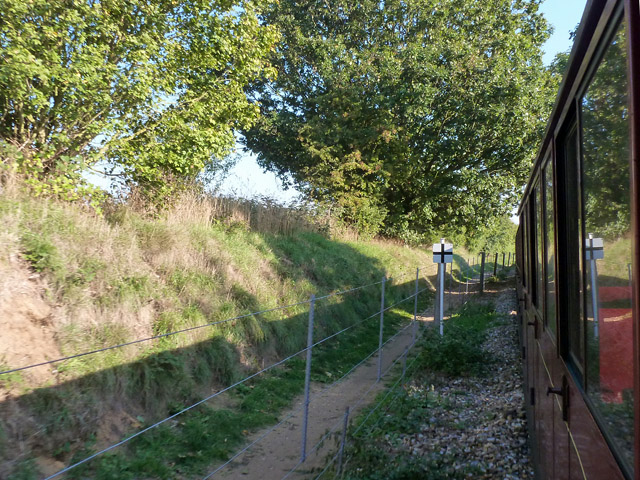
Burgh and Tuttington is a civil parish located in the county of Norfolk, England. It is situated approximately 10 miles north of the city of Norwich and covers an area of about 5 square miles. The parish is made up of the villages of Burgh and Tuttington, which are separated by the River Bure.

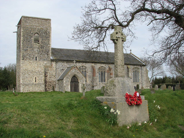
Burgh is the larger of the two villages and has a population of around 500 residents. It is known for its picturesque setting, with charming thatched cottages and a tranquil rural atmosphere. The village features a medieval church, St. Mary's, which dates back to the 14th century and is a prominent landmark in the area. There are also several historic buildings, including Burgh Hall, a Grade II listed manor house.

Tuttington, on the other hand, is a smaller village with a population of approximately 150 residents. It is located to the east of Burgh and is characterized by its open countryside and agricultural fields. The village is home to a 12th-century church, St. Peter and St. Paul's, which showcases beautiful Norman architecture.

Both villages offer a range of amenities, including a village hall, pub, and a primary school. The surrounding area is largely agricultural, with farms and fields dominating the landscape. The parish is well-connected by road, with the A140 passing close by, providing easy access to Norwich and other nearby towns and villages.

Overall, Burgh and Tuttington is a peaceful and idyllic civil parish, perfect for those seeking a rural lifestyle while still being within easy reach of larger towns and cities.

If you have any feedback on the listing, please let us know in the comments section below.

Burgh and Tuttington Images

Images are sourced within 2km of 52.790856/1.296637 or Grid Reference TG2226. Thanks to Geograph Open Source API. All images are credited.

Bure Valley Railway level crossing This level crossing is near Spratt's Green and is seen from a train heading towards Wroxham.
Bure Valley Railway level crossing
This level crossing is near Spratt's Green and is seen from a train heading towards Wroxham.
Approaching the level crossing near Spratt's Green Farm As Bure Valley Railway engine drivers approach this open level crossing they are warned of the 5 MPH speed limit and instructed to use the whistle/horn. On the right is the Bure Valley Path.
Approaching the level crossing near Spratt's Green Farm
As Bure Valley Railway engine drivers approach this open level crossing they are warned of the 5 MPH speed limit and instructed to use the whistle/horn. On the right is the Bure Valley Path.
Minor road near Spratt's Green Farm This is a view of the road from a Bure Valley Railway train passing over the level crossing. Note the give-way symbol on the road surface for vehicle drivers approaching the level crossing.
Minor road near Spratt's Green Farm
This is a view of the road from a Bure Valley Railway train passing over the level crossing. Note the give-way symbol on the road surface for vehicle drivers approaching the level crossing.
Footpath by Bure Valley Railway The path runs beside the railway from end to end, changing sides part way along.
Footpath by Bure Valley Railway
The path runs beside the railway from end to end, changing sides part way along.
View from Bure Valley Railway Looking towards a house on The Street.
View from Bure Valley Railway
Looking towards a house on The Street.
Crossroads at White Cross
Norwich Road at White Cross
Stubble field by Burgh next Aylsham
View along Norwich Road
Stubble field north of Woful Green
Fields by North Farm
Stubble field by North Farm
Fields by North Farm
Lane past North Farm
King's Bridge
King's Bridge
Field horsetail  (Equisetum arvense) Growing by the roadside > <a title="https://www.geograph.org.uk/photo/943907" href="https://www.geograph.org.uk/photo/943907">Link</a>. Field Horsetail contains a number of chemicals with medicinal properties: it is rich in silicon, potassium, and calcium, and can be used to treat cartilage, tendon, and bone problems as well as polyps, epistasis and bleeding, kidney and bladder problems, gastro-enteritis, prostate and urinary infections. Applied externally it can be used for treating chilblains and wounds. The buds are eaten as a vegetable in Japan in spring time. It was also once used as a polish for pewter and wood and to strengthen fingernails.  Hurdy-Gurdy players used the plant to dress the wheels of their instruments.
Field horsetail (Equisetum arvense)
Growing by the roadside > Link. Field Horsetail contains a number of chemicals with medicinal properties: it is rich in silicon, potassium, and calcium, and can be used to treat cartilage, tendon, and bone problems as well as polyps, epistasis and bleeding, kidney and bladder problems, gastro-enteritis, prostate and urinary infections. Applied externally it can be used for treating chilblains and wounds. The buds are eaten as a vegetable in Japan in spring time. It was also once used as a polish for pewter and wood and to strengthen fingernails. Hurdy-Gurdy players used the plant to dress the wheels of their instruments.
Cattle pasture by King's Covert
Show me another place!

Burgh and Tuttington is located at Grid Ref: TG2226 (Lat: 52.790856, Lng: 1.296637)

Administrative County: Norfolk

District: Broadland

Police Authority: Norfolk

What 3 Words

///tearfully.enlarge.argued. Near Aylsham, Norfolk

Nearby Locations

Burgh and Tuttington

Related Wikis

Burgh and Tuttington

Burgh and Tuttington is a civil parish in the English county of Norfolk. It covers an area of 6.70 km2 (2.59 sq mi) and had a population of 255 in 115...

Tuttington

Tuttington is a village and former civil parish, now in the parish of Burgh and Tuttington, in the Broadland district, in the county of Norfolk, England...

Skeyton

Skeyton is a small village and civil parish in the English county of Norfolk. The village and parish of Skeyton had in the 2001 census a population of...

Aylsham Bypass Tunnel

The Aylsham Bypass Tunnel is the only railway tunnel in Norfolk, England currently open to trains. It carries the narrow gauge Bure Valley Railway under...

Have you been to Burgh and Tuttington?

Leave your review of Burgh and Tuttington below (or comments, questions and feedback).