Bunwell

Civil Parish in Norfolk South Norfolk

England

Bunwell

Gilderswood Lane, west from Forncett St Peter Some maps omit the 'Lane', but it is included on its nameplate at the east end.
Gilderswood Lane, west from Forncett St Peter Credit: Robin Webster

Bunwell is a civil parish located in Norfolk, England. It is situated approximately 13 miles south of the city of Norwich and covers an area of around 11 square miles. The parish is predominantly rural and is surrounded by beautiful countryside, offering residents and visitors a picturesque landscape to explore.

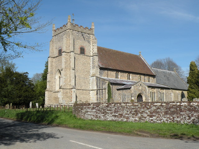
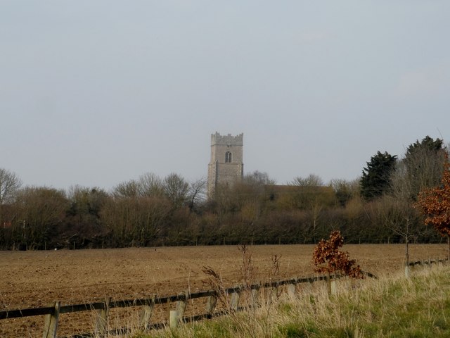
Bunwell is home to a small but close-knit community, with a population of around 1,000 people. The village itself is centered around the historic St. Michael and All Angels Church, which dates back to the 12th century. The church is a prominent feature of the village and adds to its charm and character.

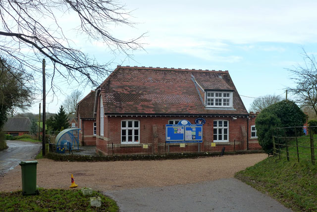
In terms of amenities, Bunwell offers a range of facilities to cater to the needs of its residents. These include a primary school, a village hall, a post office, and a local convenience store. The village also has a pub, providing a social hub for locals to gather and enjoy a drink or a meal.

The surrounding area offers plenty of opportunities for outdoor activities, such as walking, cycling, and horse riding. Bunwell is also well-connected to nearby towns and cities, with good transport links providing easy access to Norwich and other surrounding areas.

Overall, Bunwell is a quiet and peaceful parish that offers a rural lifestyle with a strong sense of community. Its beautiful countryside and range of amenities make it an attractive place to live or visit for those seeking a tranquil environment away from the hustle and bustle of city life.

If you have any feedback on the listing, please let us know in the comments section below.
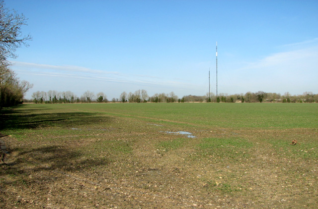
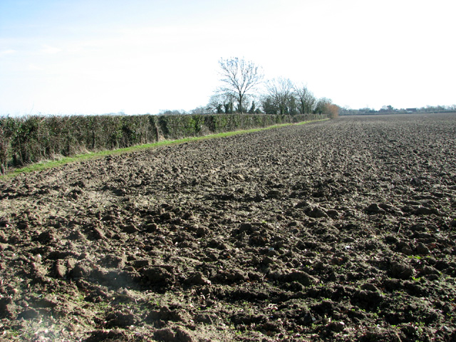
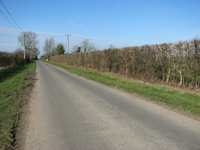
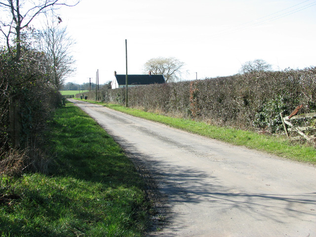
Bunwell Images

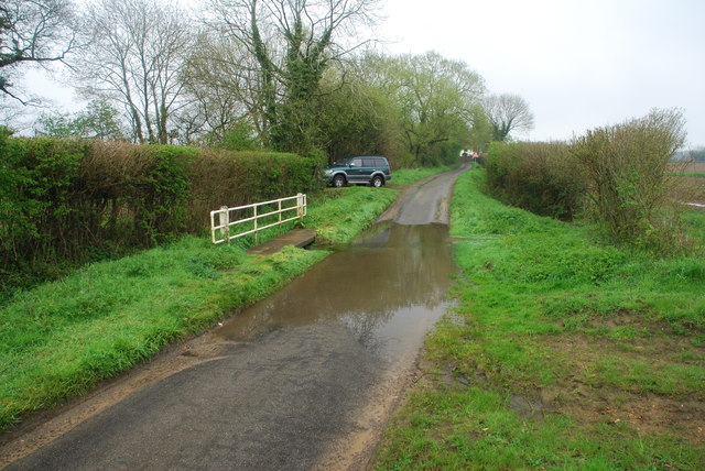
Images are sourced within 2km of 52.493344/1.133146 or Grid Reference TM1293. Thanks to Geograph Open Source API. All images are credited.

Gilderswood Lane, west from Forncett St Peter Some maps omit the 'Lane', but it is included on its nameplate at the east end.
Gilderswood Lane, west from Forncett St Peter
Some maps omit the 'Lane', but it is included on its nameplate at the east end.
Low Common Lane Towards Bunwell Hill.
Low Common Lane
Towards Bunwell Hill.
Bunwell Hill The name of the road as well as the settlement.
Bunwell Hill
The name of the road as well as the settlement.
Ford at Brock's Watering This ford is found on the Forncett Road just south of Brock's Watering.
Ford at Brock's Watering
This ford is found on the Forncett Road just south of Brock's Watering.
Bunwell Ford This ford is found on Barham's Lane just south of Bunwell.
Bunwell Ford
This ford is found on Barham's Lane just south of Bunwell.
All Saints: the parish church of Carleton Rode This church has a very interesting late 13th century chancel.  The rest of the church is of the perpendicular period.  The church stands in the centre of the village.
All Saints: the parish church of Carleton Rode
This church has a very interesting late 13th century chancel. The rest of the church is of the perpendicular period. The church stands in the centre of the village.
Church of St Michael and All Angels, Bunwell
The Jolly Farmers pub Looks like it is made out of lego.
The Jolly Farmers pub
Looks like it is made out of lego.
Bungalows on Norwich Road, Tacolneston
Bunwell Primary School A plaque on the wall commemorates the school centenary: 1879 - 1979.
Bunwell Primary School
A plaque on the wall commemorates the school centenary: 1879 - 1979.
New housing in New Road
New housing in McKee Drive, Tacolneston
Roadworks in New Road
View along Story's Lane
Cereal crop north of Story's Lane The Tacolneston transmitter masts can be seen in the background (in adjacent grid square).
Cereal crop north of Story's Lane
The Tacolneston transmitter masts can be seen in the background (in adjacent grid square).
Field south of Story's Lane
View along Common Road
Access road to Common Farm and Common Cottage
Show me another place!

Bunwell is located at Grid Ref: TM1293 (Lat: 52.493344, Lng: 1.133146)

Administrative County: Norfolk

District: South Norfolk

Police Authority: Norfolk

What 3 Words

///rollover.raced.reserved. Near Long Stratton, Norfolk

Nearby Locations

Little Green Bunwell

Related Wikis

Bunwell

Bunwell is a parish (population 1024) situated in the county of Norfolk, England, approximately 7 miles south-east of Attleborough. The parish includes...

Carleton Rode

Carleton Rode is a village and civil parish in Norfolk, England. It is situated approximately five miles south-east of Attleborough. In the 2011 Census...

Tacolneston

Tacolneston () is a village and civil parish in the South Norfolk District of Norfolk with a population of around 700, measured at the 2011 Census as a...

Tacolneston Hall

Tacolneston Hall, in the village of Tacolneston in the county of Norfolk, has been the home of the Boileau baronets since the baronetcy was created in...

Nearby Amenities

Located within 500m of 52.493344,1.133146
Little Green
Place: hamlet
Source: npe
Lat/Long: 52.4959178/1.1313988
Bunwell
Place: village
Source: npe
Lat/Long: 52.4924406/1.1299637
Ford: yes
Lat/Long: 52.4938256/1.1275403
Entrance: main
Lat/Long: 52.491315/1.1293863
Bunwell
Inscription: 1992 / Bunwell Street / Bunwell Hill / Low Common / Turnpike / Bunwell Bottom / Haddeston / Boseviles / Persehall / Banyards / 1992
Man Made: village_sign
Material: metal
Lat/Long: 52.4910842/1.1309422
hall, adj
Naptan AtcoCode: 2900B592
Naptan Bearing: SW
Naptan BusStopType: CUS
Naptan CommonName: hall
Naptan Indicator: adj
Naptan Landmark: hall
Naptan Locality: Bunwell
Naptan NaptanCode: nfoagpaw
Naptan ShortCommonName: hall
Naptan Street: The Turnpike
Naptan Verified: no
Source: naptan_import
Lat/Long: 52.4914825/1.1322682
hall, opp
Naptan AtcoCode: 2900B595
Naptan Bearing: NE
Naptan BusStopType: CUS
Naptan CommonName: hall
Naptan Indicator: opp
Naptan Landmark: hall
Naptan Locality: Bunwell
Naptan NaptanCode: nfoagpdj
Naptan ShortCommonName: hall
Naptan Street: The Turnpike
Naptan Verified: no
Source: naptan_import
Lat/Long: 52.4917089/1.1325495
Post Box
Collection Times: Mo-Fr 16:45; Sa 09:30
Operator: Royal Mail
Post Box Mounting: pier
Post Box Type: lamp
Ref: NR16 1626
Royal Cypher: EIIR
Royal Cypher Wikidata: Q33102113
Lat/Long: 52.4917021/1.1328773
Fixme: incomplete
Lat/Long: 52.4960763/1.1319136
Telephone
Defibrillator
Booth: K6
Covered: booth
Defibrillator Location: inside red phone box, Bunwell
Emergency: defibrillator
Man Made: telephone_box
Ref GB The Circuit: 8E9C4645-2E43-473B-BB5B-B02700EBA6E7
Lat/Long: 52.4919044/1.1333652
Recycling
Lat/Long: 52.4912709/1.1318388
Power: pole
Lat/Long: 52.4908612/1.12736
Power: pole
Lat/Long: 52.489566/1.1364421
Power: pole
Lat/Long: 52.4898338/1.1347711
Power: pole
Lat/Long: 52.4894745/1.1296052
Power: pole
Lat/Long: 52.4907974/1.1282989
Power: pole
Lat/Long: 52.4905524/1.1300155
Leisure: picnic_table
Lat/Long: 52.4910124/1.1318883
Leisure: picnic_table
Lat/Long: 52.4910524/1.1319768
Board Type: map
Information: board
Tourism: information
Lat/Long: 52.4910883/1.1317749
Bench
Backrest: yes
Material: wood
Seats: 4
Lat/Long: 52.491152/1.1319003
Leisure: picnic_table
Lat/Long: 52.4912132/1.132076
Leisure: picnic_table
Lat/Long: 52.4912761/1.1322711
Power: pole
Lat/Long: 52.4900596/1.1330764
Power: pole
Lat/Long: 52.4903319/1.1313826
Bench
Backrest: yes
Material: wood
Seats: 3
Lat/Long: 52.4913878/1.1292925
Bench
Backrest: yes
Material: wood
Seats: 3
Lat/Long: 52.4914347/1.1292576
Bench
Backrest: yes
Material: wood
Seats: 3
Lat/Long: 52.4916111/1.1297344
Power: pole
Lat/Long: 52.4951879/1.1305886
Power: pole
Lat/Long: 52.4958852/1.1318064
Power: pole
Lat/Long: 52.4963147/1.1290196
Power: pole
Lat/Long: 52.4961105/1.1304089
Bench
Backrest: yes
Material: wood
Seats: 3
Lat/Long: 52.4911338/1.1326177
Power: pole
Transformer: distribution
Lat/Long: 52.4906372/1.1294584
Bench
Backrest: yes
Lat/Long: 52.4910627/1.1309038
Give Way
Lat/Long: 52.4911237/1.131312
Give Way
Lat/Long: 52.4911538/1.1311888
Give Way
Lat/Long: 52.4914286/1.1318372
Give Way
Lat/Long: 52.4934367/1.1373516
Milestone
Colour: white
Distance New Buckenham: 3 mi
Material: stone
Lat/Long: 52.4938594/1.1384448
Entrance: main
Lat/Long: 52.4912236/1.1284955
Defibrillator
Access: yes
Defibrillator Location: On outside wall of Bunwell Primary School, by the entrance at the right of the main building when looking from the road.
Emergency: defibrillator
Indoor: no
Ref GB The Circuit: F92CC08C-D04E-483D-8E31-B02700EE37E8
Lat/Long: 52.4912166/1.1285046
The data included in this document is from www.openstreetmap.org. The data is made available under ODbL.

Have you been to Bunwell?

Leave your review of Bunwell below (or comments, questions and feedback).