Buckerell

Civil Parish in Devon East Devon

England

Buckerell

At Weston Cross, looking south
At Weston Cross, looking south Credit: Rob Purvis

Buckerell is a civil parish located in the county of Devon, England. Situated approximately 5 miles northeast of the city of Exeter, it is part of the East Devon district. The parish covers an area of about 3 square miles and has a population of around 350 people.

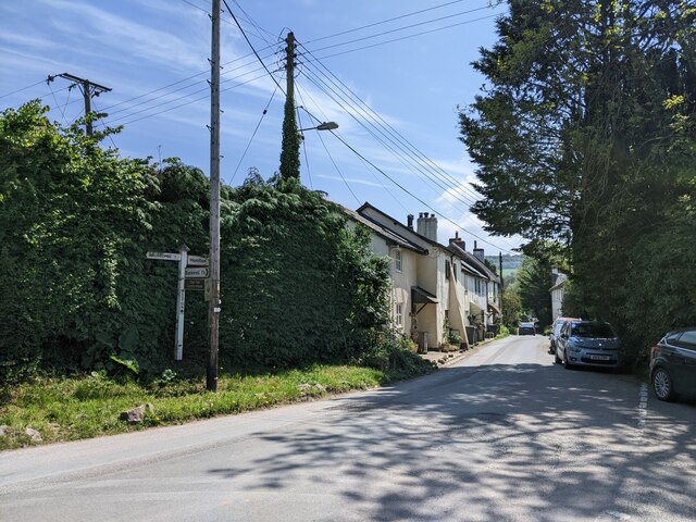
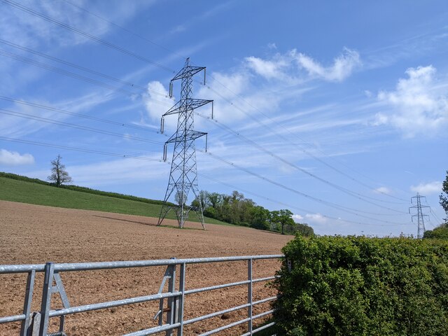
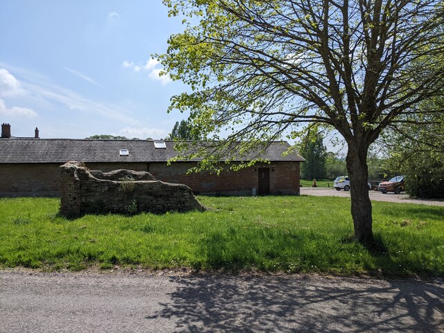
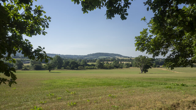
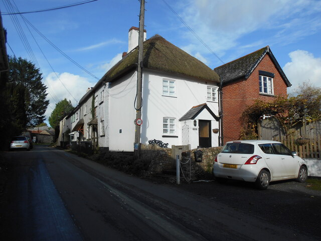
The village of Buckerell is nestled in the picturesque countryside, surrounded by rolling hills and farmlands. The landscape is characterized by lush green fields and charming country lanes, offering a peaceful and idyllic setting. The parish is predominantly rural, with a scattering of houses and farms throughout the area.

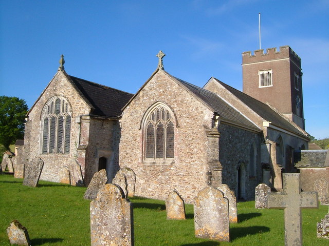
Buckerell is home to St. Mary's Church, a beautiful Grade II listed building that dates back to the 14th century. The church is a focal point of the village and its architectural features and historical significance make it a popular attraction for visitors.

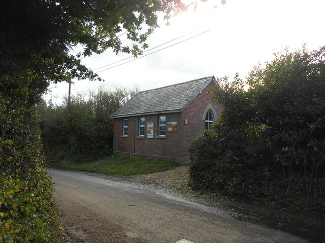
The parish is also known for its vibrant community spirit, with various social and recreational activities taking place throughout the year. The village hall serves as a hub for community events, including local fairs, gatherings, and clubs.

In terms of amenities, Buckerell has a pub that offers a warm and friendly atmosphere, serving traditional food and drinks. However, for more extensive amenities, residents often travel to nearby towns such as Honiton or Exeter.

Overall, Buckerell is a charming and peaceful civil parish, offering a rural retreat for its residents and visitors, with a strong sense of community and an appreciation for its natural surroundings.

If you have any feedback on the listing, please let us know in the comments section below.

Buckerell Images

Images are sourced within 2km of 50.797618/-3.245125 or Grid Reference ST1200. Thanks to Geograph Open Source API. All images are credited.

At Weston Cross, looking south
Field and power lines near Deer Park Farm
Buildings at Deer Park Farm
Fields to the west of Buckerell, viewed over a hedge
Down hill heading south out of Buckerell
The Deer Park Hotel A specialist wedding venue - very good it is too!
The Deer Park Hotel
A specialist wedding venue - very good it is too!
View across the Otter valley Westgate Hill in the distance, viewed from the grounds of The Deer Park Hotel.
View across the Otter valley
Westgate Hill in the distance, viewed from the grounds of The Deer Park Hotel.
Water Lily pond One of the features of the walled garden at The Deer Park Hotel.
Water Lily pond
One of the features of the walled garden at The Deer Park Hotel.
Sunflower and Bumble Bee Within the sun-trap that is the walled garden at The Deer Park Hotel.
Sunflower and Bumble Bee
Within the sun-trap that is the walled garden at The Deer Park Hotel.
Weston Manor Cottage An OS Benchmark can be found close to the base of the telegraph pole.
Weston Manor Cottage
An OS Benchmark can be found close to the base of the telegraph pole.
Weston chapel Apart from the posters there is no indication of the denomination or that the chapel is still in use.
Weston chapel
Apart from the posters there is no indication of the denomination or that the chapel is still in use.
Winnieford ford The farm a short distance up the road is spelt Wynford on a map of a different scale. The River is called the Wolf.
For a reverse view see <a href="https://www.geograph.org.uk/photo/4195144">ST1400 : Ford at Winneford</a>.
Winnieford ford
The farm a short distance up the road is spelt Wynford on a map of a different scale. The River is called the Wolf. For a reverse view see ST1400 : Ford at Winneford.
Power for the people  Looking West from under the electricity pylons as they cross a footpath.
Power for the people
Looking West from under the electricity pylons as they cross a footpath.
Footbridge over the river Wolf The River Wolf feeds into the River Otter.
Footbridge over the river Wolf
The River Wolf feeds into the River Otter.
Awliscombe from Bushy Knap looking towards St Cyres hill in the distance.
Awliscombe from Bushy Knap
looking towards St Cyres hill in the distance.
Otter Inn in Weston A view of the front of the Otter Inn in Weston, near Honiton, Devon. The Inn is next to the River Otter and close to the A30.
Otter Inn in Weston
A view of the front of the Otter Inn in Weston, near Honiton, Devon. The Inn is next to the River Otter and close to the A30.
Otter Inn Sign in Weston A view of the Otter Inn Sign in Weston, near Honiton, Devon. The Inn is next to the River Otter and close to the A30.
Otter Inn Sign in Weston
A view of the Otter Inn Sign in Weston, near Honiton, Devon. The Inn is next to the River Otter and close to the A30.
Bridge over the River A bridge over the River Otter carrying the minor road between Honiton and Weston, in Devon, as seen from the Otter Inn car park in Weston.
Bridge over the River
A bridge over the River Otter carrying the minor road between Honiton and Weston, in Devon, as seen from the Otter Inn car park in Weston.
Show me another place!

Buckerell is located at Grid Ref: ST1200 (Lat: 50.797618, Lng: -3.245125)

Administrative County: Devon

District: East Devon

Police Authority: Devon & Cornwall

What 3 Words

///lectured.airbag.runners. Near Honiton, Devon

Nearby Locations

Buckerell Buckerell

Related Wikis

Buckerell

Buckerell is a small village and civil parish in the East Devon district of Devon, England. The village is about 2.5 miles west of the nearest town, Honiton...

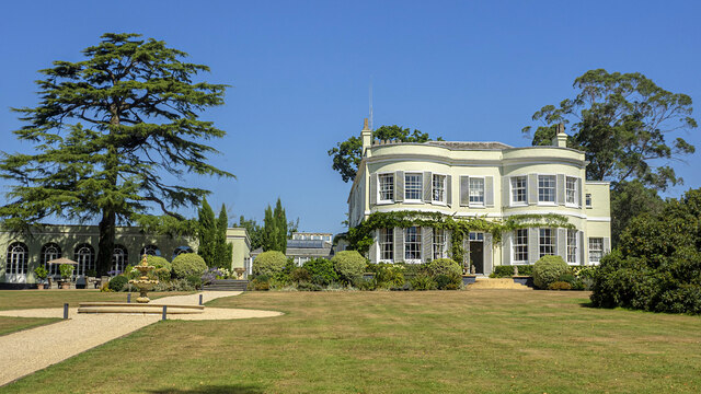
Deer Park Country House, Buckerell

Deer Park Country House near Honiton, Devon is a house of historical significance and is Grade II listed on the English Heritage Register. It was built...

Pomeroy Wood

Pomeroy Wood is the site near Honiton in Devon of a Roman military site of unknown type, probably either a fort or marching camp, though archaeological...

Awliscombe

Awliscombe is a village and civil parish in the East Devon district of Devon, England. The village is about two miles west of Honiton. The 2011 census...

Gittisham

Gittisham is a village and civil parish in East Devon, Devon, England, near Honiton. The village is 3 miles (5 km) from Ottery St Mary and it has a church...

St James and St Anne's Church, Alfington

St James' and St Anne's Church is a Church of England church in Alfington, Devon, England. It was built in 1849 at the expense of Sir John Taylor Coleridge...

Hembury

Hembury is a Neolithic causewayed enclosure and Iron Age hillfort near Honiton in Devon. Its history stretches from the late fifth and early fourth millennia...

Feniton

Feniton is a village and civil parish in East Devon in the English county of Devon. The village lies about 4 miles (6.4 km) west of Honiton, 3 miles (4...

Nearby Amenities

Located within 500m of 50.797618,-3.245125
Buckerell
Place: village
Lat/Long: 50.7972469/-3.2471161
Design: barrel
Power: tower
Lat/Long: 50.8007181/-3.246741
Design: barrel
Power: tower
Lat/Long: 50.8004239/-3.2416012
Barrier: stile
Lat/Long: 50.7985471/-3.2431941
Public Bookcase
Booth: K6
Disused Amenity: telephone
Man Made: telephone_box
Public Bookcase Type: phone_box
Lat/Long: 50.7986964/-3.2472378
Historic: memorial
Memorial: war_memorial
Lat/Long: 50.796032/-3.2448981
Addr City: Honiton
Addr Housename: Bramley Cottage
Addr Village: Buckerell
Lat/Long: 50.7958119/-3.2445294
Addr City: Honiton
Addr Housename: Drullers
Addr Street: Cabbage Lane
Addr Village: Buckerell
Lat/Long: 50.7957207/-3.2444245
Addr City: Honiton
Addr Housename: Rotura
Addr Street: Cabbage Lane
Addr Village: Buckerell
Lat/Long: 50.7956792/-3.2445207
Addr City: Honiton
Addr Housename: Armoury Cottage
Addr Village: Buckerell
Lat/Long: 50.7961454/-3.2450439
Addr City: Bukerell
Addr Housename: The Oaks
Lat/Long: 50.801527/-3.2475547
Generator Method: photovoltaic
Generator Output Electricity: yes
Generator Source: solar
Generator Type: solar_photovoltaic_panel
Location: roof
Power: generator
Lat/Long: 50.7969816/-3.2480973
Generator Method: photovoltaic
Generator Output Electricity: yes
Generator Source: solar
Generator Type: solar_photovoltaic_panel
Location: roof
Power: generator
Lat/Long: 50.7969274/-3.2477379
Generator Method: photovoltaic
Generator Output Electricity: yes
Generator Source: solar
Generator Type: solar_photovoltaic_panel
Location: roof
Power: generator
Lat/Long: 50.7965434/-3.2458862
Generator Method: photovoltaic
Generator Output Electricity: yes
Generator Source: solar
Generator Type: solar_photovoltaic_panel
Location: roof
Power: generator
Lat/Long: 50.7957315/-3.2469815
Generator Method: photovoltaic
Generator Output Electricity: yes
Generator Source: solar
Generator Type: solar_photovoltaic_panel
Location: roof
Power: generator
Lat/Long: 50.7959068/-3.2467402
Generator Method: photovoltaic
Generator Output Electricity: yes
Generator Source: solar
Generator Type: solar_photovoltaic_panel
Location: roof
Power: generator
Lat/Long: 50.7959093/-3.2467885
Generator Method: photovoltaic
Generator Output Electricity: yes
Generator Source: solar
Generator Type: solar_photovoltaic_panel
Location: ground
Power: generator
Lat/Long: 50.7952752/-3.2503599
Power: pole
Source: bing
Lat/Long: 50.7939664/-3.2485601
Power: pole
Source: bing
Lat/Long: 50.794286/-3.2475731
Power: pole
Source: bing
Transformer: distribution
Lat/Long: 50.7945996/-3.2465619
Power: pole
Source: bing
Lat/Long: 50.7948064/-3.24578
Material: wood
Power: pole
Source: bing
Lat/Long: 50.7951243/-3.2445449
Power: pole
Source: bing
Transformer: distribution
Lat/Long: 50.7956135/-3.2426003
Power: pole
Source: bing
Lat/Long: 50.7954397/-3.2432896
Power: pole
Source: bing
Lat/Long: 50.7960195/-3.2410339
Power: pole
Source: bing
Transformer: distribution
Lat/Long: 50.7964349/-3.2394326
Power: pole
Source: bing
Lat/Long: 50.796729/-3.2382873
The data included in this document is from www.openstreetmap.org. The data is made available under ODbL.

Have you been to Buckerell?

Leave your review of Buckerell below (or comments, questions and feedback).