Brushfield
Civil Parish in Derbyshire Derbyshire Dales
England
Brushfield

Brushfield is a civil parish located in the county of Derbyshire, England. It is situated within the Peak District National Park, approximately 2 miles southwest of the market town of Bakewell. The parish covers an area of about 3 square miles and is predominantly rural, characterized by rolling hills, open fields, and woodlands.
The village of Brushfield itself is small, with a population of around 100 people. It is made up of a cluster of stone-built houses and cottages, many of which date back to the 18th and 19th centuries, giving it a charming and traditional feel. The parish church, dedicated to St. Thomas, is a prominent feature of the village, with its distinctive bell tower and stained glass windows.
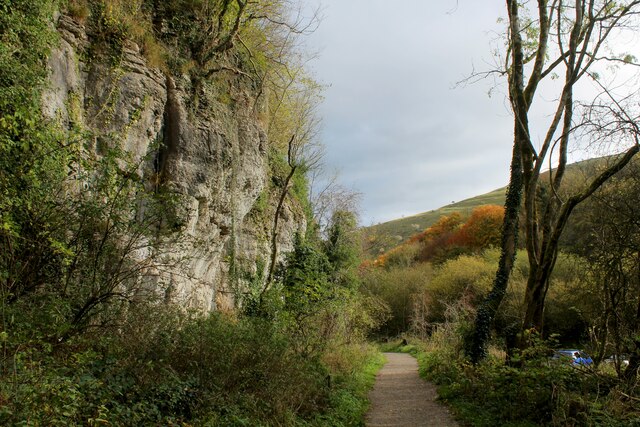
The surrounding countryside offers breathtaking views and is popular with walkers, hikers, and nature enthusiasts. There are several footpaths and trails that crisscross the area, providing opportunities to explore the beautiful landscape, including the nearby Monsal Trail, a former railway line converted into a walking and cycling path.
Despite its small size, Brushfield has a strong community spirit, with various activities and events organized throughout the year. The annual village fete is a highlight, bringing together residents and visitors for a day of fun and entertainment.
In summary, Brushfield is a picturesque and tranquil civil parish nestled within the stunning Peak District National Park. It offers a peaceful retreat for those seeking to escape the hustle and bustle of city life and immerse themselves in the beauty of the English countryside.
If you have any feedback on the listing, please let us know in the comments section below.
Brushfield Images
Images are sourced within 2km of 53.244696/-1.756691 or Grid Reference SK1671. Thanks to Geograph Open Source API. All images are credited.


Brushfield is located at Grid Ref: SK1671 (Lat: 53.244696, Lng: -1.756691)
Administrative County: Derbyshire
District: Derbyshire Dales
Police Authority: Derbyshire
What 3 Words
///plodded.pedicure.snores. Near Tideswell, Derbyshire
Nearby Locations
Related Wikis

Brushfield
Brushfield is a hamlet and civil parish in the Derbyshire Dales district of Derbyshire, England, in the Peak District National Park. It is about 8 miles...

Litton Mill
Litton Mill is a textile mill at Millers Dale, near Tideswell in Derbyshire. The original 19th-century mill became notorious during the Industrial Revolution...

Cressbrook
Cressbrook is a village in the Peak District National Park in Derbyshire. It lies in Water-cum-Jolly Dale at the foot of Cressbrook Dale. Population details...

Monsal Dale railway station
Monsal Dale railway station was opened in 1866 by the Midland Railway on its line from Rowsley, extending the Manchester, Buxton, Matlock and Midlands...

Fin Cop
Fin Cop is a hill and an associated Iron Age hill fort in Monsal Dale, close to Ashford in the Water in Derbyshire, England.The fort shows evidence of...

Monsal Dale
Monsal Dale is a valley in Derbyshire, England, in the White Peak limestone area of the Peak District National Park. It is a Site of Special Scientific...
Monsal Trail
The Monsal Trail is a cycling, horse riding and walking trail in the Derbyshire Peak District. It was constructed from a section of the former Manchester...

Cressbrook Dale
Cressbrook Dale (also called Ravensdale) is a dry carboniferous limestone gorge near Bakewell, Derbyshire, in the Peak District of England. The dale is...
Nearby Amenities
Located within 500m of 53.244696,-1.756691Have you been to Brushfield?
Leave your review of Brushfield below (or comments, questions and feedback).