Broadwell

Civil Parish in Gloucestershire Cotswold

England

Broadwell

Lower Farmhouse Late 18th/early 19th Century farmhouse with later additions.  Grade II listed - see <span class="nowrap"><a title="www.historicengland.org.uk/listing/the-list/list-entry/1154846" rel="nofollow ugc noopener" href="http://www.historicengland.org.uk/listing/the-list/list-entry/1154846">Link</a><img style="margin-left:2px;" alt="External link" title="External link - shift click to open in new window" src="https://s1.geograph.org.uk/img/external.png" width="10" height="10"/></span>.
Lower Farmhouse Credit: Ian Capper

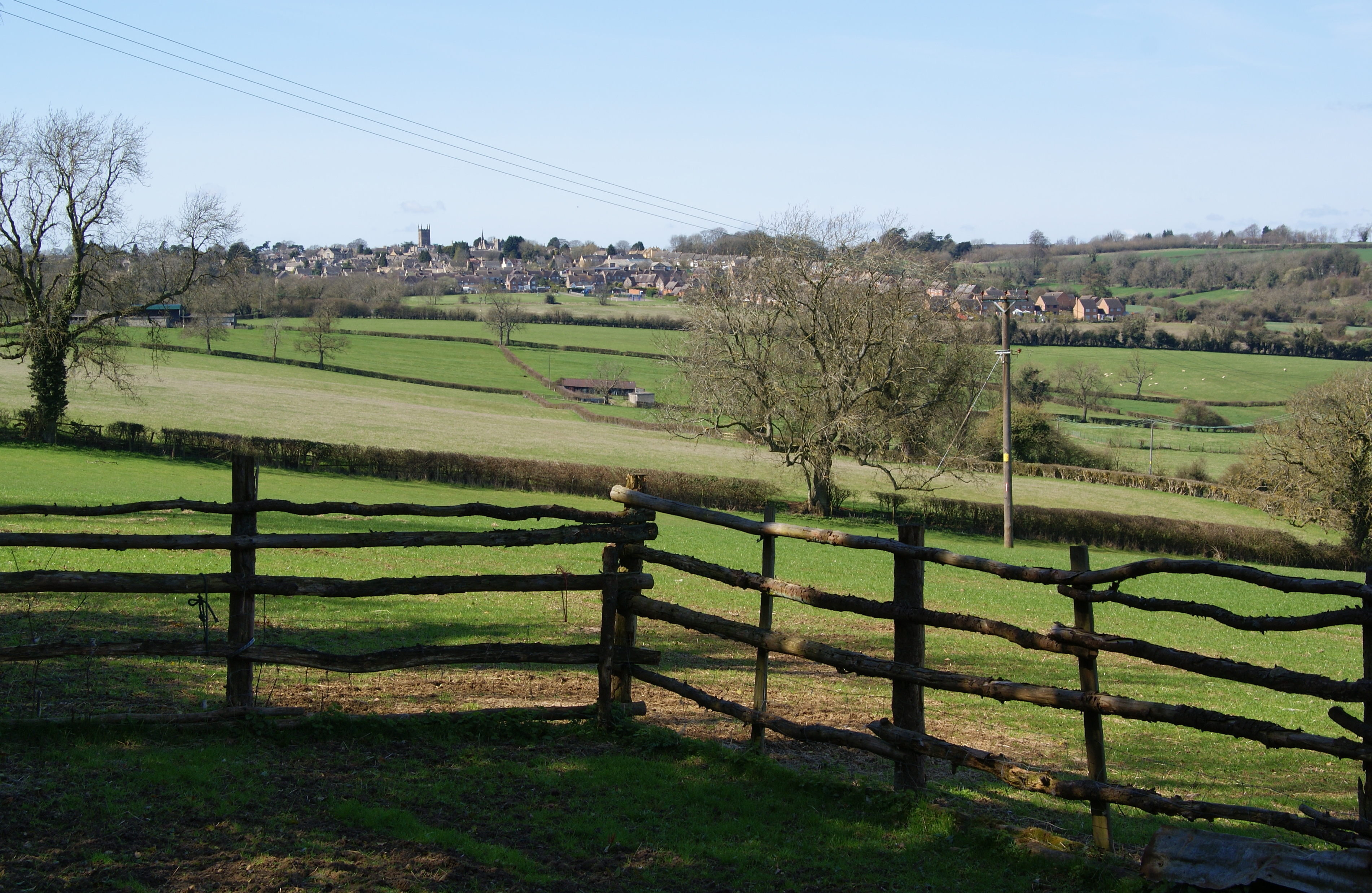
Broadwell is a civil parish located in the Cotswold District of Gloucestershire, England. It is a small village situated about 2.5 miles east of Stow-on-the-Wold and about 19 miles northeast of the city of Gloucester. The parish covers an area of approximately 5.3 square miles.

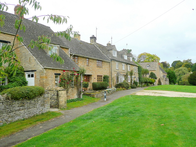
The village of Broadwell is known for its picturesque setting, surrounded by rolling hills and lush countryside. It is a rural community with a population of around 300 residents, and it retains a charming, traditional English village atmosphere.

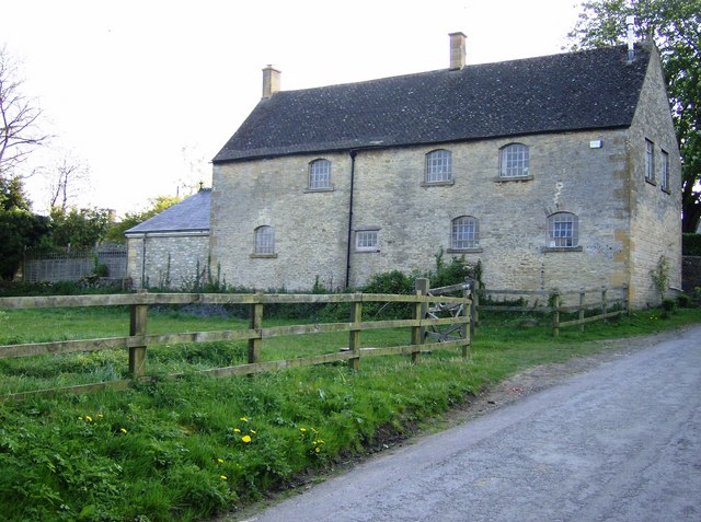
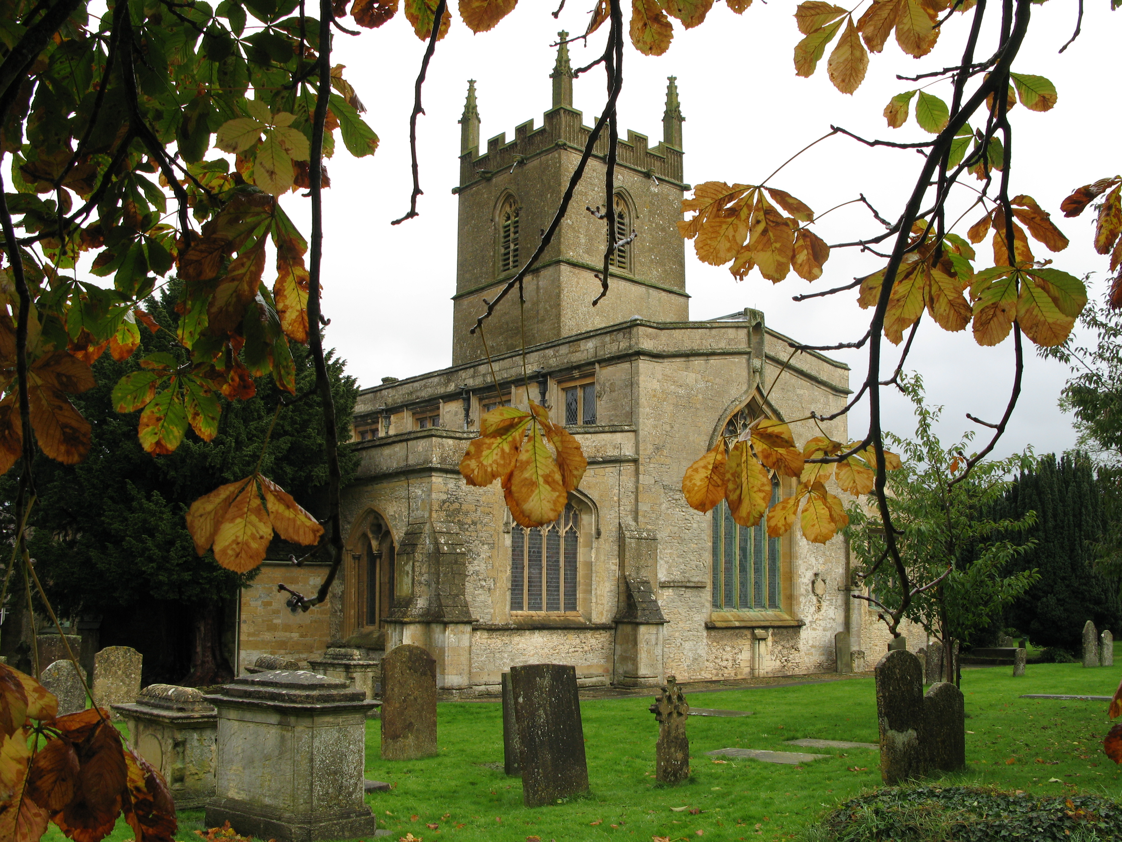
Broadwell is home to the 12th-century Church of St. Paul, a Grade I listed building that is a prominent feature in the village. The church is known for its beautiful stained glass windows and is a popular destination for visitors interested in historical architecture.

The village also has a pub, The Fox Inn, which serves as a social hub for locals and visitors alike. It offers a cozy atmosphere and traditional pub fare.

The surrounding area of Broadwell is predominantly agricultural, with farmland and fields that contribute to the village's scenic beauty. The parish is also close to a number of popular attractions, including the Cotswold Farm Park and Bourton-on-the-Water, both of which are within a short driving distance.

Overall, Broadwell offers a peaceful and idyllic setting for those seeking a rural retreat, while still being within reach of nearby towns and amenities.

If you have any feedback on the listing, please let us know in the comments section below.

Broadwell Images

Images are sourced within 2km of 51.945642/-1.698022 or Grid Reference SP2027. Thanks to Geograph Open Source API. All images are credited.

Lower Farmhouse Late 18th/early 19th Century farmhouse with later additions.  Grade II listed - see <span class="nowrap"><a title="www.historicengland.org.uk/listing/the-list/list-entry/1154846" rel="nofollow ugc noopener" href="http://www.historicengland.org.uk/listing/the-list/list-entry/1154846">Link</a><img style="margin-left:2px;" alt="External link" title="External link - shift click to open in new window" src="https://s1.geograph.org.uk/img/external.png" width="10" height="10"/></span>.
Lower Farmhouse
Late 18th/early 19th Century farmhouse with later additions. Grade II listed - see LinkExternal link.
Broadwell Manor 17th Century manor house rebuilt in 1757 after a fire, then with later additions.  Grade II* listed - see <span class="nowrap"><a title="www.historicengland.org.uk/listing/the-list/list-entry/1089783" rel="nofollow ugc noopener" href="http://www.historicengland.org.uk/listing/the-list/list-entry/1089783">Link</a><img style="margin-left:2px;" alt="External link" title="External link - shift click to open in new window" src="https://s1.geograph.org.uk/img/external.png" width="10" height="10"/></span>.
Broadwell Manor
17th Century manor house rebuilt in 1757 after a fire, then with later additions. Grade II* listed - see LinkExternal link.
Broadwell Farm Early 18th Century farmhouse with attached yard entrance/hay loft.  Grade II listed - see <span class="nowrap"><a title="www.historicengland.org.uk/listing/the-list/list-entry/1341091" rel="nofollow ugc noopener" href="http://www.historicengland.org.uk/listing/the-list/list-entry/1341091">Link</a><img style="margin-left:2px;" alt="External link" title="External link - shift click to open in new window" src="https://s1.geograph.org.uk/img/external.png" width="10" height="10"/></span>.
Broadwell Farm
Early 18th Century farmhouse with attached yard entrance/hay loft. Grade II listed - see LinkExternal link.
Broadwell Farm Looking towards Broadwell Farm.  The farmhouse itself, dating from the early 18th Century, is just visible in the centre of the photo with the later outbuildings on the right.  Both the farmhouse and outbuildings are grade II listed - see <span class="nowrap"><a title="www.historicengland.org.uk/listing/the-list/list-entry/1341091" rel="nofollow ugc noopener" href="http://www.historicengland.org.uk/listing/the-list/list-entry/1341091">Link</a><img style="margin-left:2px;" alt="External link" title="External link - shift click to open in new window" src="https://s1.geograph.org.uk/img/external.png" width="10" height="10"/></span> and <span class="nowrap"><a title="www.historicengland.org.uk/listing/the-list/list-entry/1341110" rel="nofollow ugc noopener" href="http://www.historicengland.org.uk/listing/the-list/list-entry/1341110">Link</a><img style="margin-left:2px;" alt="External link" title="External link - shift click to open in new window" src="https://s1.geograph.org.uk/img/external.png" width="10" height="10"/></span>.
Broadwell Farm
Looking towards Broadwell Farm. The farmhouse itself, dating from the early 18th Century, is just visible in the centre of the photo with the later outbuildings on the right. Both the farmhouse and outbuildings are grade II listed - see LinkExternal link and LinkExternal link.
Broadwell Farm Looking towards Broadwell Farm.  The farmhouse itself, dating from the early 18th Century, is just visible on the left of the photo with the later outbuildings on the right.  Both the farmhouse and outbuildings are grade II listed - see <span class="nowrap"><a title="www.historicengland.org.uk/listing/the-list/list-entry/1341091" rel="nofollow ugc noopener" href="http://www.historicengland.org.uk/listing/the-list/list-entry/1341091">Link</a><img style="margin-left:2px;" alt="External link" title="External link - shift click to open in new window" src="https://s1.geograph.org.uk/img/external.png" width="10" height="10"/></span> and <span class="nowrap"><a title="www.historicengland.org.uk/listing/the-list/list-entry/1341110" rel="nofollow ugc noopener" href="http://www.historicengland.org.uk/listing/the-list/list-entry/1341110">Link</a><img style="margin-left:2px;" alt="External link" title="External link - shift click to open in new window" src="https://s1.geograph.org.uk/img/external.png" width="10" height="10"/></span>.
Broadwell Farm
Looking towards Broadwell Farm. The farmhouse itself, dating from the early 18th Century, is just visible on the left of the photo with the later outbuildings on the right. Both the farmhouse and outbuildings are grade II listed - see LinkExternal link and LinkExternal link.
Timperley, Studio and Pimlico Cottages Row of cottages built in the 1850s.  Grade II listed - see <span class="nowrap"><a title="www.historicengland.org.uk/listing/the-list/list-entry/1303579" rel="nofollow ugc noopener" href="http://www.historicengland.org.uk/listing/the-list/list-entry/1303579">Link</a><img style="margin-left:2px;" alt="External link" title="External link - shift click to open in new window" src="https://s1.geograph.org.uk/img/external.png" width="10" height="10"/></span>.
Timperley, Studio and Pimlico Cottages
Row of cottages built in the 1850s. Grade II listed - see LinkExternal link.
The Fox Inn Pub on the village green with records going back to at least the 1890s.  On the left is Rose's Cottage.
The Fox Inn
Pub on the village green with records going back to at least the 1890s. On the left is Rose's Cottage.
Green Cottage and Wheatsheaf House Two houses on the edge of the village green.  Wheatsheaf House, on the right, originates from the late 17th/early 18th Century and was once a pub, closing in the early 20th Century.  It is grade II listed - see <span class="nowrap"><a title="www.historicengland.org.uk/listing/the-list/list-entry/1089790" rel="nofollow ugc noopener" href="http://www.historicengland.org.uk/listing/the-list/list-entry/1089790">Link</a><img style="margin-left:2px;" alt="External link" title="External link - shift click to open in new window" src="https://s1.geograph.org.uk/img/external.png" width="10" height="10"/></span>.
Green Cottage and Wheatsheaf House
Two houses on the edge of the village green. Wheatsheaf House, on the right, originates from the late 17th/early 18th Century and was once a pub, closing in the early 20th Century. It is grade II listed - see LinkExternal link.
Seat and rock Commemorative seat and rock on the village green, acknowledging the gift of the green to the village by Lord Ashton of Broadwell Hill, who owned around 300 ha of the village.
Seat and rock
Commemorative seat and rock on the village green, acknowledging the gift of the green to the village by Lord Ashton of Broadwell Hill, who owned around 300 ha of the village.
Broadwell Ford Ford across the brook that runs alongside the village green.  In the background, behind the K6 phone box, is the village hall.
Broadwell Ford
Ford across the brook that runs alongside the village green. In the background, behind the K6 phone box, is the village hall.
Defibrillator phone box A K6 phone box in front of the village hall, containing a defibrillator as indicated by the sign on the post above it.  For wider view see <a href="https://www.geograph.org.uk/photo/5434066">SP2027 : Broadwell Ford</a>.
Defibrillator phone box
A K6 phone box in front of the village hall, containing a defibrillator as indicated by the sign on the post above it. For wider view see SP2027 : Broadwell Ford.
Duck race A duck race under way on the brook that runs alongside the village green.  Duck racing is a feature of the Broadwell and Donnington village fete that was due to take place the following weekend.  This particular race was a private event as part of a wedding celebration taking place in the village.
Duck race
A duck race under way on the brook that runs alongside the village green. Duck racing is a feature of the Broadwell and Donnington village fete that was due to take place the following weekend. This particular race was a private event as part of a wedding celebration taking place in the village.
The Church of St Paul at Broadwell Viewed from the south.
The Church of St Paul at Broadwell
Viewed from the south.
Ordnance Survey Cut Mark This mark can be found on the wall of St Paul's Church in Broadwell. The benchmark height is recorded as being 156.18 metres above seal level. For more detail see : <span class="nowrap"><a title="http://www.bench-marks.org.uk/bm59230" rel="nofollow ugc noopener" href="http://www.bench-marks.org.uk/bm59230">Link</a><img style="margin-left:2px;" alt="External link" title="External link - shift click to open in new window" src="https://s1.geograph.org.uk/img/external.png" width="10" height="10"/></span>
Ordnance Survey Cut Mark
This mark can be found on the wall of St Paul's Church in Broadwell. The benchmark height is recorded as being 156.18 metres above seal level. For more detail see : LinkExternal link
Broadwell - St Paul's Church
Broadwell - Manor House
Broadwell Farm View from Chapel Street.
Broadwell Farm
View from Chapel Street.
St Edward's, Evenlode
Show me another place!

Broadwell is located at Grid Ref: SP2027 (Lat: 51.945642, Lng: -1.698022)

Administrative County: Gloucestershire

District: Cotswold

Police Authority: Gloucestershire

What 3 Words

///fragment.situation.dearest. Near Donnington, Gloucestershire

Nearby Locations

Broadwell Broadwell

Related Wikis

Nearby Amenities

Located within 500m of 51.945642,-1.698022
Broadwell
Place: village
Lat/Long: 51.9456693/-1.7046462
Bus Stop
The Green
Bus: yes
Naptan AtcoCode: 1600GL755
Naptan Bearing: NE
Naptan CommonName: The Green
Naptan NaptanCode: glogjgtw
Naptan Street: Oddington Road
Naptan Verified: no
Public Transport: platform
Source: naptan_import
Lat/Long: 51.945045/-1.7038318
Bus Stop
The Green
Bus: yes
Naptan AtcoCode: 1600GL756
Naptan Bearing: SW
Naptan CommonName: The Green
Naptan Indicator: Opp
Naptan NaptanCode: glogjgtp
Naptan Street: Oddington Road
Naptan Verified: no
Public Transport: platform
Source: naptan_import
Lat/Long: 51.9449552/-1.7038615
Bus Stop
Chapel Street
Bus: yes
Naptan AtcoCode: 1600GL759
Naptan Bearing: SE
Naptan CommonName: Chapel Street
Naptan NaptanCode: glogjmdm
Naptan Street: Donnington Road
Naptan Verified: no
Public Transport: platform
Source: naptan_import
Lat/Long: 51.9450013/-1.7007478
Bus Stop
Chapel Street
Bus: yes
Naptan AtcoCode: 1600GL760
Naptan Bearing: NW
Naptan CommonName: Chapel Street
Naptan Indicator: Opp
Naptan NaptanCode: glogjmda
Naptan Street: Donnington Road
Naptan Verified: no
Public Transport: platform
Source: naptan_import
Lat/Long: 51.9451467/-1.7013578
Bus Stop
The Green
Bus: yes
Naptan AtcoCode: 1600GLA36717
Naptan Bearing: NW
Naptan CommonName: The Green
Naptan NaptanCode: glogmjmt
Naptan Street: Red Hill Farm Rd
Naptan Verified: no
Public Transport: platform
Source: naptan_import
Lat/Long: 51.9448674/-1.704706
Bus Stop
The Green
Bus: yes
Naptan AtcoCode: 1600GLA36718
Naptan Bearing: SE
Naptan CommonName: The Green
Naptan NaptanCode: glogmjmw
Naptan Street: Red Hill Farm Rd
Naptan Verified: no
Public Transport: platform
Source: naptan_import
Lat/Long: 51.9449121/-1.7045892
Power: pole
Source: bing
Lat/Long: 51.9486067/-1.6955838
Material: wood
Power: pole
Source: bing
Lat/Long: 51.9459959/-1.6936862
Material: wood
Power: pole
Source: bing
Lat/Long: 51.9453808/-1.6933053
Material: wood
Power: pole
Source: Bing
Lat/Long: 51.9433587/-1.6951024
Material: wood
Power: pole
Source: bing
Lat/Long: 51.9440928/-1.6923987
Material: wood
Power: pole
Source: bing
Lat/Long: 51.9476607/-1.6987663
Material: wood
Power: pole
Source: bing
Lat/Long: 51.9434348/-1.6918623
Power: pole
Source: bing
Lat/Long: 51.9482096/-1.6963818
Material: wood
Power: pole
Source: bing
Lat/Long: 51.9448319/-1.6928708
Material: wood
Power: pole
Source: bing
Lat/Long: 51.9473416/-1.6947001
Material: wood
Power: pole
Source: bing
Lat/Long: 51.9466357/-1.6941904
Material: wood
Power: pole
Source: Bing
Lat/Long: 51.9434116/-1.6931658
Material: wood
Power: pole
Source: bing
Transformer: yes
Lat/Long: 51.9476178/-1.6948717
Material: wood
Power: pole
Source: Bing
Lat/Long: 51.9469547/-1.6936218
Power: pole
Source: bing
Lat/Long: 51.9493743/-1.6958481
Power: pole
Source: bing
Lat/Long: 51.9484212/-1.695439
Ford: yes
Lat/Long: 51.9456592/-1.7039789
Material: wood
Power: pole
Source: bing
Lat/Long: 51.9478937/-1.697754
Broadwell East
Material: wood
Power: pole
Source: bing
Transformer: distribution
Voltage Primary: 11000
Lat/Long: 51.9475153/-1.6973722
Material: wood
Power: pole
Source: bing
Lat/Long: 51.9467003/-1.6970122
Material: wood
Power: pole
Source: bing
Lat/Long: 51.9463661/-1.6976096
Location Transition: yes
Material: wood
Power: pole
Source: bing
Lat/Long: 51.945156/-1.6970524
Material: wood
Power: pole
Source: bing
Lat/Long: 51.9457777/-1.6979349
Material: wood
Power: pole
Source: bing
Lat/Long: 51.9480832/-1.702783
Material: wood
Power: pole
Source: bing
Lat/Long: 51.9477832/-1.701698
Material: wood
Power: pole
Source: bing
Lat/Long: 51.9475004/-1.7005393
Telephone
Defibrillator
Booth: K6
Covered: booth
Defibrillator Location: inside red phone box by village hall, Broadwell
Emergency: defibrillator
Listed Status: Grade II
Man Made: telephone_box
Ref: CHT-RT-1081
Lat/Long: 51.9457242/-1.7040296
Material: wood
Power: pole
Lat/Long: 51.9411796/-1.6975164
Broadwell
Material: wood
Power: pole
Transformer: distribution
Voltage Primary: 11000
Lat/Long: 51.9467242/-1.7011924
Material: wood
Power: pole
Lat/Long: 51.9470136/-1.7013332
Material: wood
Power: pole
Lat/Long: 51.9473616/-1.7000055
Broadwell South
Material: wood
Power: pole
Transformer: distribution
Voltage Primary: 11000
Lat/Long: 51.9440756/-1.7046297
Material: wood
Power: pole
Lat/Long: 51.9438953/-1.7028916
Material: wood
Power: pole
Lat/Long: 51.9436994/-1.7011388
Material: wood
Power: pole
Lat/Long: 51.9435217/-1.6992036
Material: wood
Power: pole
Lat/Long: 51.9433167/-1.6970497
Caudwell
Material: wood
Power: pole
Transformer: distribution
Voltage Primary: 11000
Lat/Long: 51.9473095/-1.6929245
The data included in this document is from www.openstreetmap.org. The data is made available under ODbL.

Have you been to Broadwell?

Leave your review of Broadwell below (or comments, questions and feedback).