Brilley

Civil Parish in Herefordshire

England

Brilley

Eglwys Sant Mihangel Michaelchurch-on-Arrow is Radnorshire's last parish before the border, and the church of St Michael could clearly double up as a fortification if needs be.
Eglwys Sant Mihangel Credit: Mike Parker

Brilley is a small civil parish located in the county of Herefordshire, England. Situated in the west of the county, it is nestled within the scenic countryside of the Welsh Marches. The parish covers an area of approximately 5 square miles and is home to a population of around 300 people.

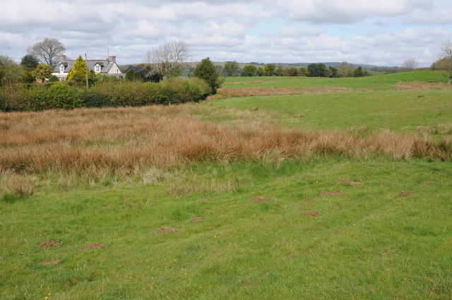
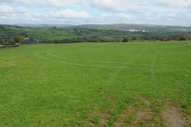
The village of Brilley itself is a charming rural settlement with a rich history dating back to medieval times. It is known for its picturesque landscape, characterized by rolling hills, lush green fields, and meandering streams. The parish is predominantly agricultural, with farming playing a significant role in the local economy.

Brilley boasts a close-knit community, and residents take pride in preserving the area's natural beauty and historic charm. The village features a quaint church, St. Mary's, which dates back to the 12th century and is a prominent landmark in the area. Additionally, there is a village hall that serves as a hub for social events and community gatherings.

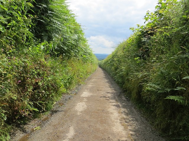
While Brilley may be small in size, it offers a peaceful and idyllic lifestyle for its residents. The surrounding countryside provides ample opportunities for outdoor activities such as hiking, cycling, and horseback riding. The parish is also within easy reach of larger towns and cities, including Hereford and Hay-on-Wye, which offer a wider range of amenities and services.

Overall, Brilley is a quintessential English village, known for its natural beauty, rich history, and strong sense of community. It provides a tranquil and picturesque setting for those seeking a peaceful rural lifestyle.

If you have any feedback on the listing, please let us know in the comments section below.

Brilley Images

Images are sourced within 2km of 52.137838/-3.085941 or Grid Reference SO2549. Thanks to Geograph Open Source API. All images are credited.

Eglwys Sant Mihangel Michaelchurch-on-Arrow is Radnorshire's last parish before the border, and the church of St Michael could clearly double up as a fortification if needs be.
Eglwys Sant Mihangel
Michaelchurch-on-Arrow is Radnorshire's last parish before the border, and the church of St Michael could clearly double up as a fortification if needs be.
Silver jubilee hassock, Michaelchurch-on-Arrow As we gear up for the Queen's Platinum Jubilee, a reminder of her reign's first big milestone, all of 45 years ago.
Silver jubilee hassock, Michaelchurch-on-Arrow
As we gear up for the Queen's Platinum Jubilee, a reminder of her reign's first big milestone, all of 45 years ago.
Bridleway near Brilley This bridleway near Brilley leads to the National Trust property, Cwmmau Farmhouse.
Bridleway near Brilley
This bridleway near Brilley leads to the National Trust property, Cwmmau Farmhouse.
View across the Arrow valley View across the Arrow valley towards Huntington from a footpath to the north of Brilley Mountain.  Black Mixon which at its highest point is just over 2000ft can be seen in the distance.
View across the Arrow valley
View across the Arrow valley towards Huntington from a footpath to the north of Brilley Mountain. Black Mixon which at its highest point is just over 2000ft can be seen in the distance.
On the border The two signs 'Croeso i Gymwu Welcome to Wales' and the 'Powys' sign inform that this is the border between England and Wales at Brilley Mountain.
On the border
The two signs 'Croeso i Gymwu Welcome to Wales' and the 'Powys' sign inform that this is the border between England and Wales at Brilley Mountain.
'Croeso i Gymru Welcome to Wales' Sign at Brilley Mountain welcoming travellers to Wales.
'Croeso i Gymru Welcome to Wales'
Sign at Brilley Mountain welcoming travellers to Wales.
Michaelchurch-on-Arrow church Not surprisingly Michaelchurch-on-Arrow church is dedicated to St Michael.  At the time of my visit part of the churchyard was fenced off with pigwire giving access to sheep to graze the grass.
Michaelchurch-on-Arrow church
Not surprisingly Michaelchurch-on-Arrow church is dedicated to St Michael. At the time of my visit part of the churchyard was fenced off with pigwire giving access to sheep to graze the grass.
Road to Brilley Mountain Narrow country road to Brilley Mountain on the Herefordshire and Powys border.
Road to Brilley Mountain
Narrow country road to Brilley Mountain on the Herefordshire and Powys border.
Crossroads at Brilley Mountain The border between England and Wales runs along this country road, turn left for England or turn right for Wales.
Crossroads at Brilley Mountain
The border between England and Wales runs along this country road, turn left for England or turn right for Wales.
Grazing land near Great Birches Farm Open access grazing land just inside Wales near Great Birches Farm at Brilley Mountain.
Grazing land near Great Birches Farm
Open access grazing land just inside Wales near Great Birches Farm at Brilley Mountain.
Entrance to Great Birches Farm Entrance to Great Birches Farm at Brilley Mountain.
Entrance to Great Birches Farm
Entrance to Great Birches Farm at Brilley Mountain.
View over the Arrow valley View over the Arrow valley and the Welsh border lands to Huntington, with Hergest Ridge in the Middle distance and Black Mixon which rises to just over 2000ft in the distance.
View over the Arrow valley
View over the Arrow valley and the Welsh border lands to Huntington, with Hergest Ridge in the Middle distance and Black Mixon which rises to just over 2000ft in the distance.
Stained-glass window, Michaelchurch-on-Arrow Small pair of stained-glass windows in the south wall of St Michael's church, Michaelchurch-on-Arrow.
Stained-glass window, Michaelchurch-on-Arrow
Small pair of stained-glass windows in the south wall of St Michael's church, Michaelchurch-on-Arrow.
stained-glass windows, Michaelchurch-on-Arrow Small stained-glass window in the north wall of St Michael's church, Michaelchurch-on-Arrow.
stained-glass windows, Michaelchurch-on-Arrow
Small stained-glass window in the north wall of St Michael's church, Michaelchurch-on-Arrow.
Entrance to Brilley
Entrance to Brilley
Footpath sign, Brilley Mountain I had passed west of the edge of my map, so was interested to see the Powys County Council path sign. The road is the Herefordshire/Radnorshire boundary.
Footpath sign, Brilley Mountain
I had passed west of the edge of my map, so was interested to see the Powys County Council path sign. The road is the Herefordshire/Radnorshire boundary.
A very narrow road Descending between steep hedgerows from Brilley Mountain.
A very narrow road
Descending between steep hedgerows from Brilley Mountain.
Sheep, Perryn A rare chance of seeing out of the steep sided, high hedged narrow road which descends from Brilley Mountain.
Sheep, Perryn
A rare chance of seeing out of the steep sided, high hedged narrow road which descends from Brilley Mountain.
Show me another place!

Brilley is located at Grid Ref: SO2549 (Lat: 52.137838, Lng: -3.085941)

Unitary Authority: County of Herefordshire

Police Authority: West Mercia

What 3 Words

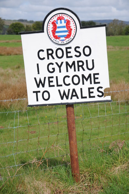
///exporters.waistcoat.play. Near Clifford, Herefordshire

Related Wikis

Brilley

Brilley is a small village and civil parish in Herefordshire, England, close to the border with Wales, and about 8 km (5 mi) north-east of the Welsh border...

Whitney-on-Wye railway station

Whitney-on-Wye railway station was a station in Whitney-on-Wye, Herefordshire, England. The station was opened in 1864 and closed in 1962. == References... ==

Whitney-on-Wye toll bridge

Whitney-on-Wye toll bridge is a single-carriageway, wood- and stone-construction in Herefordshire, England. The toll bridge carries the B4350 south from...

Whitney-on-Wye

Whitney-on-Wye is a village and civil parish in Herefordshire, England, and approximately 1 mile (1.6 km) east from the border with Wales. The village...

Rhydspence Inn

The Rhydspence Inn is a 14th-century inn situated on the Wales-England border and within the Wye Valley overlooking the Welsh hills and Herefordshire countryside...

Baynham Hall

Baynham Hall is a Grade II* listed 17th -century manor house located in Michaelchurch-On-Arrow, Gladestry, Powys, Wales. Originally built circa 1700, the...

Clifford railway station

Clifford railway station was a station in Clifford, Herefordshire, England. The station was opened in 1881, closed to passengers in 1941 and closed completely...

Clifford, Herefordshire

Clifford is a village and civil parish in Herefordshire, England, and 2.5 miles (4.0 km) to the north of Hay-on-Wye. It lies on the south bank of the...

Nearby Amenities

Located within 500m of 52.137838,-3.085941
Brilley
Place: hamlet
Source: NLS - OS 1:25k 1st Series 1937-61
Wikidata: Q262514
Lat/Long: 52.1365977/-3.0817234
Direction: 265
Generator Method: photovoltaic
Generator Output Electricity: yes
Generator Solar Modules: 16
Generator Source: solar
Generator Type: solar_photovoltaic_panel
Location: roof
Power: generator
Lat/Long: 52.1369051/-3.0799108
Direction: 145
Generator Method: photovoltaic
Generator Output Electricity: yes
Generator Solar Modules: 9
Generator Source: solar
Generator Type: solar_photovoltaic_panel
Location: roof
Power: generator
Lat/Long: 52.1352299/-3.0808852
Direction: 125
Generator Method: photovoltaic
Generator Output Electricity: yes
Generator Solar Modules: 16
Generator Source: solar
Generator Type: solar_photovoltaic_panel
Location: roof
Power: generator
Lat/Long: 52.1367066/-3.0817978
Direction: 235
Generator Method: photovoltaic
Generator Output Electricity: yes
Generator Solar Modules: 6
Generator Source: solar
Generator Type: solar_photovoltaic_panel
Location: roof
Power: generator
Lat/Long: 52.1352163/-3.0809522
The data included in this document is from www.openstreetmap.org. The data is made available under ODbL.

Have you been to Brilley?

Leave your review of Brilley below (or comments, questions and feedback).