Brightwell-cum-Sotwell

Civil Parish in Berkshire South Oxfordshire

England

Brightwell-cum-Sotwell

Flag at the Vineyard Brightwell Vineyard was first planted in the 1980's and has been flying the flag for English Wine since then. <span class="nowrap"><a title="https://www.brightwellvineyard.co.uk" rel="nofollow ugc noopener" href="https://www.brightwellvineyard.co.uk">Link</a><img style="margin-left:2px;" alt="External link" title="External link - shift click to open in new window" src="https://s1.geograph.org.uk/img/external.png" width="10" height="10"/></span>
Flag at the Vineyard Credit: Des Blenkinsopp

Brightwell-cum-Sotwell is a civil parish located in the county of Berkshire, England. Situated about 4 miles southeast of the historic town of Wallingford, the parish covers an area of approximately 10 square kilometers and is home to a population of around 1,400 residents.

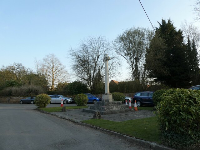
The parish is formed by the villages of Brightwell and Sotwell, which are separated by the River Thames. It is a picturesque area with a rich history dating back to the Roman times, as evidenced by the discovery of Roman pottery and coins in the area. The villages themselves feature a mix of architectural styles, including charming thatched cottages, Georgian houses, and modern developments.

Brightwell-cum-Sotwell is known for its strong community spirit and offers a range of amenities and services to its residents. These include a primary school, a village hall, a public house, a post office, and a local convenience store. The parish also boasts several recreational spaces, including a cricket ground and a children's playground.

The area is surrounded by beautiful countryside, with the nearby Chiltern Hills offering stunning views and opportunities for outdoor activities such as walking and cycling. The River Thames is a prominent feature, providing residents with scenic riverside walks and recreational opportunities such as boating and fishing.

Overall, Brightwell-cum-Sotwell is a peaceful and welcoming parish that offers a high quality of life for its residents, combining the charm of rural village life with convenient access to nearby towns and cities.

If you have any feedback on the listing, please let us know in the comments section below.

Brightwell-cum-Sotwell Images

Images are sourced within 2km of 51.614763/-1.1561 or Grid Reference SU5891. Thanks to Geograph Open Source API. All images are credited.

Flag at the Vineyard Brightwell Vineyard was first planted in the 1980's and has been flying the flag for English Wine since then. <span class="nowrap"><a title="https://www.brightwellvineyard.co.uk" rel="nofollow ugc noopener" href="https://www.brightwellvineyard.co.uk">Link</a><img style="margin-left:2px;" alt="External link" title="External link - shift click to open in new window" src="https://s1.geograph.org.uk/img/external.png" width="10" height="10"/></span>
Flag at the Vineyard
Brightwell Vineyard was first planted in the 1980's and has been flying the flag for English Wine since then. LinkExternal link
Gas Markers at Severall's Farm Gas main signs beside a farm road.
Gas Markers at Severall's Farm
Gas main signs beside a farm road.
Brightwell Vineyard Vines at Brightwell Vineyard, which has been producing wine since the 1980s.
<span class="nowrap"><a title="https://www.brightwellvineyard.co.uk" rel="nofollow ugc noopener" href="https://www.brightwellvineyard.co.uk">Link</a><img style="margin-left:2px;" alt="External link" title="External link - shift click to open in new window" src="https://s1.geograph.org.uk/img/external.png" width="10" height="10"/></span>
Brightwell Vineyard
Vines at Brightwell Vineyard, which has been producing wine since the 1980s. LinkExternal link
Sires Hill at Brightwell Cum Sotwell village boundary
A4130 High Road
A4130 High Road
St Agatha, Brightwell-cum-Sotwell: late March 2022
Brightwell-cum-Sotwell: looking towards the phone box from the pub
The New Cemetery (1)
The New Cemetery (2) The CWGC grave of Sgt Reginald Whichello <span class="nowrap"><a title="https://www.cwgc.org/find-records/find-war-dead/casualty-details/2436266/reginald-whichello/" rel="nofollow ugc noopener" href="https://www.cwgc.org/find-records/find-war-dead/casualty-details/2436266/reginald-whichello/">Link</a><img style="margin-left:2px;" alt="External link" title="External link - shift click to open in new window" src="https://s1.geograph.org.uk/img/external.png" width="10" height="10"/></span>
The New Cemetery (2)
The CWGC grave of Sgt Reginald Whichello LinkExternal link
The New Cemetery (3) The CWGC grave of Reba Joyce Williams <span class="nowrap"><a title="https://www.cwgc.org/find-records/find-war-dead/casualty-details/2436267/reba-joyce-williams/" rel="nofollow ugc noopener" href="https://www.cwgc.org/find-records/find-war-dead/casualty-details/2436267/reba-joyce-williams/">Link</a><img style="margin-left:2px;" alt="External link" title="External link - shift click to open in new window" src="https://s1.geograph.org.uk/img/external.png" width="10" height="10"/></span>
The New Cemetery (3)
The CWGC grave of Reba Joyce Williams LinkExternal link
Brightwell-cum-Sotwell Village Shop: late March 2022
Brightwell-cum-Sotwell War Memorial: late March 2022
St Agatha, Brightwell-cum-Sotwell: churchyard (a)
St Agatha, Brightwell-cum-Sotwell: churchyard (b)
The Red Lion, Brightwell-cum-Sotwell This attractive village pub dates back to the mid 16th-Century.
The Red Lion, Brightwell-cum-Sotwell
This attractive village pub dates back to the mid 16th-Century.
The A4130, Brightwell-cum-Sotwell This bypasses the village.
The A4130, Brightwell-cum-Sotwell
This bypasses the village.
The Lodge, Shillingford Hill Now situated by the entrance to Shillingford Hill Home Park, The Lodge is clearly much older and is one of the buildings associated with Shillingford Hill House, a mansion along a drive on the other side of the trees.
The Lodge, Shillingford Hill
Now situated by the entrance to Shillingford Hill Home Park, The Lodge is clearly much older and is one of the buildings associated with Shillingford Hill House, a mansion along a drive on the other side of the trees.
Bus Shelter, Shillingford Hill Serving the residential park on Shillingford Hill. Buses along here have been cut back to a very sparse service these days.
You could have a long wait.
The signs beyond the shelter warn vehicles to slow down at the top of a steep bit of road with traffic lights at the bottom by the river crossing.
Bus Shelter, Shillingford Hill
Serving the residential park on Shillingford Hill. Buses along here have been cut back to a very sparse service these days. You could have a long wait. The signs beyond the shelter warn vehicles to slow down at the top of a steep bit of road with traffic lights at the bottom by the river crossing.
Show me another place!

Brightwell-cum-Sotwell is located at Grid Ref: SU5891 (Lat: 51.614763, Lng: -1.1561)

Administrative County: Oxfordshire

District: South Oxfordshire

Police Authority: Thames Valley

What 3 Words

///conceals.mills.cutback. Near Wallingford, Oxfordshire

Related Wikis

Brightwell-cum-Sotwell

Brightwell-cum-Sotwell is a twin-village and civil parish in the Upper Thames Valley in South Oxfordshire. It lies between Didcot to the west and the historic...

Brightwell Castle

Brightwell Castle was in the village of Brightwell-cum-Sotwell, between the towns of Didcot and Wallingford (grid reference SU578908), now in Oxfordshire...
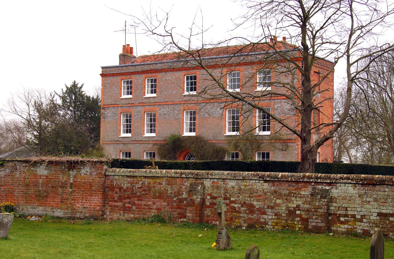
Brightwell Manor

Brightwell Manor is a country house in the village of Brightwell-cum-Sotwell, Oxfordshire, England. The back dates to around the mid-seventeenth century...

Brightwell Barrow

Brightwell Barrow is a Bronze Age round barrow in the civil parish of Brightwell-cum-Sotwell in the English county of Oxfordshire (formerly Berkshire)...

Related Videos

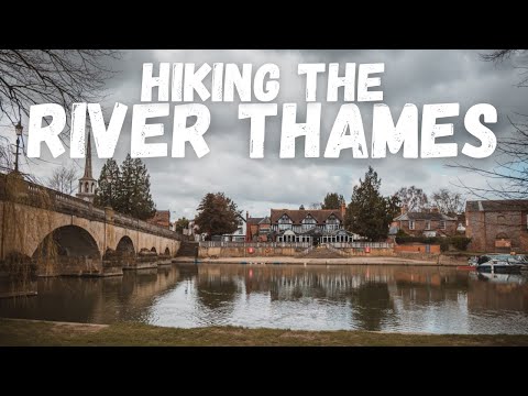
Hiking along the BEAUTIFUL River Thames! | Wallingford circular walk 🥾⛰

Today we decided to explore the area around Wallingford in Oxfordshire, and take on another hike along the River Thames - lived ...

Old English Town Walking Tour - Wallingford, Oxfordshire 4K

Follow Matty as I take you on walking tours around the UK. Walking videos are released every week. village walks, countryside ...

Camping and hiking kit for Wild camping and hiking in -9c very cold for Sourthen England in Autumn.

Filmed 15th tp 16th December 2022 with the DJI MINI 3 PRO @ https://amzn.to/3luGADE Wittenham Clumps is the name for a pair ...

Backwards Walking Uphill…. Let me explain!

Backwards walking video: https://youtu.be/zWTQ9UPsmf4.

Nearby Amenities

Located within 500m of 51.614763,-1.1561
Brightwell-cum-Sotwell
Place: village
Lat/Long: 51.614172/-1.1587216
Pub
The Red Lion
Opening Hours: Mo-Fr 12:00-15:00,18:00-23:00; Sa 12:00-24:00, Su 12:00-22:30
Outdoor Seating: yes
Smoking: outside
Wikidata: Q26312457
Lat/Long: 51.6123918/-1.1607872
Bus Stop
Bell Lane
Bench: no
Naptan AtcoCode: 340002045HRC
Naptan Bearing: W
Naptan CommonName: Bell Lane Garage
Naptan Indicator: Outside
Naptan Landmark: Opp Bus Shelter
Naptan NaptanCode: oxfgjmpd
Naptan Street: Bell Lane
Naptan Verified: no
Public Transport: platform
Shelter: yes
Source: naptan_import
Tactile Paving: no
Lat/Long: 51.6159354/-1.1563763
Bus Stop
Bell Lane
Bench: no
Naptan AtcoCode: 340002045OPP
Naptan Bearing: E
Naptan CommonName: Bell Lane Garage
Naptan Indicator: Opposite
Naptan Landmark: Bus Shelter
Naptan NaptanCode: oxfgjmpt
Naptan Street: Bell Lane
Naptan Verified: no
Public Transport: platform
Shelter: yes
Source: naptan_import
Tactile Paving: no
Lat/Long: 51.6161158/-1.1570537
Bus Stop
Greenmere
Naptan AtcoCode: 340002046CNR
Naptan Bearing: W
Naptan BusStopType: CUS
Naptan CommonName: Greenmere
Naptan Indicator: Corner
Naptan Landmark: Greenmere
Naptan NaptanCode: oxfgjmjm
Naptan Street: High Road
Naptan Verified: no
Public Transport: platform
Source: naptan_import
Lat/Long: 51.6163748/-1.1598964
Bus Stop
Greenmere
Bench: no
Naptan AtcoCode: 340002046OPP
Naptan Bearing: E
Naptan CommonName: Greenmere
Naptan Indicator: Opposite
Naptan Landmark: Greenmere
Naptan NaptanCode: oxfgjmtj
Naptan Street: High Road
Naptan Verified: no
Public Transport: platform
Shelter: no
Source: naptan_import
Tactile Paving: no
Lat/Long: 51.6163663/-1.1592187
Bus Stop
Red Lion PH
Bench: no
Naptan AtcoCode: 340002048OPP
Naptan Bearing: E
Naptan CommonName: Red Lion PH
Naptan Indicator: Opposite
Naptan Landmark: Red Lion
Naptan NaptanCode: oxfawadm
Naptan Street: Brightwell Street
Naptan Verified: no
Shelter: no
Source: naptan_import
Tactile Paving: no
Lat/Long: 51.6125061/-1.1606251
Turning Circle
Turning Circle: knuckle
Lat/Long: 51.6133018/-1.1567589
Turning Circle
Turning Circle: knuckle
Lat/Long: 51.6161089/-1.162442
Turning Circle
Turning Circle: square
Lat/Long: 51.6151124/-1.1576603
Place Of Worship
Brightwell Free Church
Denomination: protestant; nondenominational
Religion: christian
Lat/Long: 51.6117653/-1.1526786
Turning Circle
Turning Circle: square
Lat/Long: 51.6144837/-1.1563341
Cafe
Root One
Cuisine: coffee_shop
Opening Hours: Mo-Sa 09:00-17:00; Su 10:00-16:00
Lat/Long: 51.6153301/-1.1520548
Root One
Opening Hours: Mo-Sa 09:00-17:00; Su 10:00-16:00
Shop: garden_centre
Lat/Long: 51.6151502/-1.1518885
Brightwell Fruit Farm (Pick your own)
Lat/Long: 51.613013/-1.1504394
Material: wood
Power: pole
Source: Bing
Lat/Long: 51.6185396/-1.1571774
Material: wood
Power: pole
Source: Bing
Lat/Long: 51.6182048/-1.1588431
Material: wood
Power: pole
Source: Bing
Lat/Long: 51.617297/-1.1604336
Material: wood
Power: pole
Source: Bing
Lat/Long: 51.6171122/-1.1614422
Material: wood
Power: pole
Source: Bing
Lat/Long: 51.6177569/-1.1596746
Material: wood
Power: pole
Source: Bing
Lat/Long: 51.6186279/-1.1580921
Red Telephone Box
Booth: K6
Description: K6 Telephone Box
Disused Amenity: telephone
Man Made: telephone_box
Note: No telelphone. Used only to display local artist's artwork
Tourism: gallery
Lat/Long: 51.6124401/-1.1605249
Post Box
Collection Times: Mo-Fr 09:00, Sa 07:00
Drive Through: no
Operator: Royal Mail
Operator Wikidata: Q638098
Post Box Mounting: brick_pillar
Post Box Type: wall
Ref: OX10 1101
Royal Cypher: EIIR
Royal Cypher Wikidata: Q33102113
Lat/Long: 51.6162622/-1.1595297
Post Box
Collection Times: Mo-Fr 16:45; Sa 07:00
Operator: Royal Mail
Post Box Mounting: brick_pillar
Post Box Type: wall
Ref: OX10 1100
Royal Cypher: EIIR
Royal Cypher Wikidata: Q33102113
Lat/Long: 51.6123286/-1.1602063
Post Box
Collection Times: Mo-Fr 09:00, Sa 07:00
Operator: Royal Mail
Ref: OX10 1094D
Royal Cypher: VR
Royal Cypher Wikidata: Q33102356
Lat/Long: 51.6118462/-1.1528802
Defibrillator
Booth: K6
Covered: booth
Defibrillator Location: in red phone box at junction of High Road and Greenmere, Britwell-cum-Sotwell
Disused Amenity: telephone
Emergency: defibrillator
Indoor: no
Man Made: telephone_box
Lat/Long: 51.6162756/-1.1595632
Give Way
Lat/Long: 51.6126375/-1.1586948
Give Way
Lat/Long: 51.6121351/-1.1539013
Give Way
Source: Bing
Lat/Long: 51.6123623/-1.160609
Direction: 95
Generator Method: photovoltaic
Generator Output Electricity: yes
Generator Solar Modules: 16
Generator Source: solar
Generator Type: solar_photovoltaic_panel
Location: roof
Power: generator
Lat/Long: 51.6151425/-1.1632386
Fixme: solar panels?
Lat/Long: 51.612404/-1.1584439
Direction: 170
Generator Method: photovoltaic
Generator Output Electricity: yes
Generator Solar Modules: 12
Generator Source: solar
Generator Type: solar_photovoltaic_panel
Location: roof
Power: generator
Lat/Long: 51.6142366/-1.1575949
Direction: 95
Generator Method: photovoltaic
Generator Output Electricity: yes
Generator Solar Modules: 12
Generator Source: solar
Generator Type: solar_photovoltaic_panel
Location: roof
Power: generator
Lat/Long: 51.6159177/-1.157532
Direction: 200
Fixme: survey for panel count
Generator Method: photovoltaic
Generator Output Electricity: yes
Generator Solar Modules: 14
Generator Source: solar
Generator Type: solar_photovoltaic_panel
Location: roof
Power: generator
Lat/Long: 51.6132673/-1.1552409
Direction: 205
Generator Method: photovoltaic
Generator Output Electricity: yes
Generator Solar Modules: 12
Generator Source: solar
Generator Type: solar_photovoltaic_panel
Location: roof
Power: generator
Lat/Long: 51.6125346/-1.154579
Direction: 175
Generator Method: photovoltaic
Generator Output Electricity: yes
Generator Solar Modules: 18
Generator Source: solar
Generator Type: solar_photovoltaic_panel
Location: roof
Power: generator
Lat/Long: 51.6124735/-1.1534824
Direction: 195
Generator Method: photovoltaic
Generator Output Electricity: yes
Generator Solar Modules: 18
Generator Source: solar
Generator Type: solar_photovoltaic_panel
Location: roof
Power: generator
Lat/Long: 51.6118625/-1.1514228
The data included in this document is from www.openstreetmap.org. The data is made available under ODbL.

Have you been to Brightwell-cum-Sotwell?

Leave your review of Brightwell-cum-Sotwell below (or comments, questions and feedback).