Brettenham

Civil Parish in Suffolk Babergh

England

Brettenham

Church of St Mary the Virgin, Brettenham <span class="nowrap"><a title="https://historicengland.org.uk/listing/the-list/list-entry/1037350?section=official-list-entry" rel="nofollow ugc noopener" href="https://historicengland.org.uk/listing/the-list/list-entry/1037350?section=official-list-entry">Link</a><img style="margin-left:2px;" alt="External link" title="External link - shift click to open in new window" src="https://s1.geograph.org.uk/img/external.png" width="10" height="10"/></span>
Church of St Mary the Virgin, Brettenham Credit: Sandy Gerrard

Brettenham is a civil parish located in the county of Suffolk, England. Situated approximately 24 miles southeast of the city of Bury St Edmunds, the parish covers an area of about 10.5 square miles. The village of Brettenham itself is nestled in the heart of the parish and is surrounded by picturesque countryside.

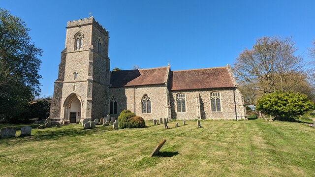
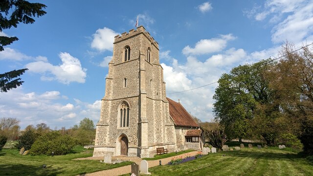
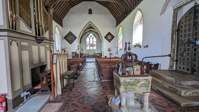
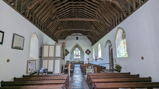
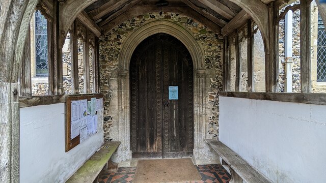
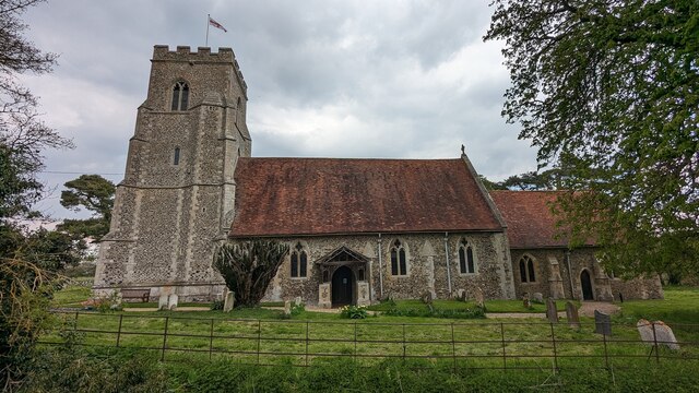
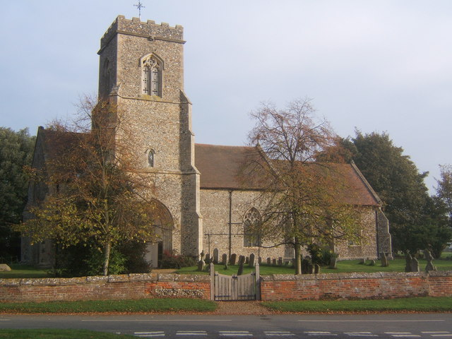
The village boasts a rich history, with evidence of human settlement dating back to the Bronze Age. It is home to several historic buildings, including St. Mary's Church, which dates back to the 14th century and features a striking tower. The village also has a well-preserved medieval moat, known as Brettenham Castle, which once served as a manor house.

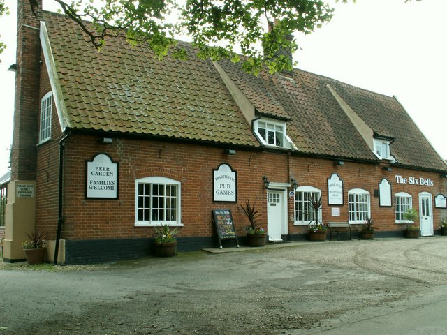
With a population of around 300 residents, Brettenham offers a peaceful and close-knit community atmosphere. The village has a primary school, providing education for local children, and a village hall that serves as a hub for social events and activities. There is also a pub, The Red Lion, which is a popular meeting place for locals and visitors alike.

The surrounding countryside offers ample opportunities for outdoor activities such as walking, cycling, and birdwatching. The landscape is characterized by rolling hills, meadows, and woodland, providing a scenic backdrop for leisurely strolls.

Overall, Brettenham is a charming rural parish that attracts those seeking a tranquil and idyllic setting to live in or visit. Its rich history, community spirit, and natural beauty make it a truly special place within Suffolk.

If you have any feedback on the listing, please let us know in the comments section below.

Brettenham Images

Images are sourced within 2km of 52.146811/0.866094 or Grid Reference TL9653. Thanks to Geograph Open Source API. All images are credited.

Church of St Mary the Virgin, Brettenham <span class="nowrap"><a title="https://historicengland.org.uk/listing/the-list/list-entry/1037350?section=official-list-entry" rel="nofollow ugc noopener" href="https://historicengland.org.uk/listing/the-list/list-entry/1037350?section=official-list-entry">Link</a><img style="margin-left:2px;" alt="External link" title="External link - shift click to open in new window" src="https://s1.geograph.org.uk/img/external.png" width="10" height="10"/></span>
Church of St Mary the Virgin, Brettenham
Church of St Mary the Virgin, Thorpe Morieux <span class="nowrap"><a title="https://historicengland.org.uk/listing/the-list/list-entry/1351578?section=official-list-entry" rel="nofollow ugc noopener" href="https://historicengland.org.uk/listing/the-list/list-entry/1351578?section=official-list-entry">Link</a><img style="margin-left:2px;" alt="External link" title="External link - shift click to open in new window" src="https://s1.geograph.org.uk/img/external.png" width="10" height="10"/></span>
Church of St Mary the Virgin, Thorpe Morieux
Font in Church of St Mary the Virgin, Thorpe Morieux <span class="nowrap"><a title="https://historicengland.org.uk/listing/the-list/list-entry/1351578?section=official-list-entry" rel="nofollow ugc noopener" href="https://historicengland.org.uk/listing/the-list/list-entry/1351578?section=official-list-entry">Link</a><img style="margin-left:2px;" alt="External link" title="External link - shift click to open in new window" src="https://s1.geograph.org.uk/img/external.png" width="10" height="10"/></span>
Font in Church of St Mary the Virgin, Thorpe Morieux
Interior of Church of St Mary the Virgin, Thorpe Morieux <span class="nowrap"><a title="https://historicengland.org.uk/listing/the-list/list-entry/1351578?section=official-list-entry" rel="nofollow ugc noopener" href="https://historicengland.org.uk/listing/the-list/list-entry/1351578?section=official-list-entry">Link</a><img style="margin-left:2px;" alt="External link" title="External link - shift click to open in new window" src="https://s1.geograph.org.uk/img/external.png" width="10" height="10"/></span>
Interior of Church of St Mary the Virgin, Thorpe Morieux
Doorway into Church of St Mary the Virgin, Thorpe Morieux <span class="nowrap"><a title="https://historicengland.org.uk/listing/the-list/list-entry/1351578?section=official-list-entry" rel="nofollow ugc noopener" href="https://historicengland.org.uk/listing/the-list/list-entry/1351578?section=official-list-entry">Link</a><img style="margin-left:2px;" alt="External link" title="External link - shift click to open in new window" src="https://s1.geograph.org.uk/img/external.png" width="10" height="10"/></span>
Doorway into Church of St Mary the Virgin, Thorpe Morieux
Church of St Mary the Virgin, Thorpe Morieux <span class="nowrap"><a title="https://historicengland.org.uk/listing/the-list/list-entry/1351578?section=official-list-entry" rel="nofollow ugc noopener" href="https://historicengland.org.uk/listing/the-list/list-entry/1351578?section=official-list-entry">Link</a><img style="margin-left:2px;" alt="External link" title="External link - shift click to open in new window" src="https://s1.geograph.org.uk/img/external.png" width="10" height="10"/></span>
Church of St Mary the Virgin, Thorpe Morieux
To Thorpe Wood Footpath to Thorpe Wood near to Brettenham, Suffolk.
To Thorpe Wood
Footpath to Thorpe Wood near to Brettenham, Suffolk.
In The Wood Footpath through Thorpe Wood near to Brettenham, Suffolk.
In The Wood
Footpath through Thorpe Wood near to Brettenham, Suffolk.
Forest Clearance Thorpe Wood near to Brettenham, Suffolk.
Forest Clearance
Thorpe Wood near to Brettenham, Suffolk.
Fenced Off Area Fenced off area in Thorpe Wood near to Brettenham, Suffolk.
Fenced Off Area
Fenced off area in Thorpe Wood near to Brettenham, Suffolk.
Footpath to St Mary Thorpe Morieux Footpath from side road to Thorpe Morieux church.
Footpath to St Mary Thorpe Morieux
Footpath from side road to Thorpe Morieux church.
Road Junction Road junction near to Hightown Green, Suffolk.
Road Junction
Road junction near to Hightown Green, Suffolk.
Hightown Green Hightown Green, Suffolk.
Hightown Green
Hightown Green, Suffolk.
Country Road Country road near to Hightown Green, Suffolk.
Country Road
Country road near to Hightown Green, Suffolk.
Footpath Footpath looking west near to Cross Green, Suffolk
Footpath
Footpath looking west near to Cross Green, Suffolk
Signpost at junction of Benton Lane
Entrance to Old Buckenham Hall School, Thorpe Morieux School website: <span class="nowrap"><a title="http://www.obh.co.uk/" rel="nofollow ugc noopener" href="http://www.obh.co.uk/">Link</a><img style="margin-left:2px;" alt="External link" title="External link - shift click to open in new window" src="https://s1.geograph.org.uk/img/external.png" width="10" height="10"/></span>
Entrance to Old Buckenham Hall School, Thorpe Morieux
School website: LinkExternal link
Road junction, village sign and church, Brettenham
Show me another place!

Brettenham is located at Grid Ref: TL9653 (Lat: 52.146811, Lng: 0.866094)

Administrative County: Suffolk

District: Babergh

Police Authority: Suffolk

What 3 Words

///mandolin.surcharge.mixing. Near Bildeston, Suffolk

Nearby Locations

Brettenham

Related Wikis

Brettenham, Suffolk

Brettenham is a village and civil parish in the Babergh district of Suffolk, England. In 2005 it had a population of 270, increasing to 353 at the 2011...

Centre Academy East Anglia

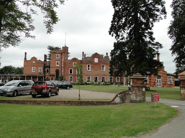
Centre Academy East Anglia, formerly known as The Old Rectory School is a private special school in Brettenham, Suffolk, England, founded in 1981. The...

Old Buckenham Hall School

Old Buckenham Hall School (commonly known as OBH) is a day and boarding preparatory school with pre-prep for boys and girls in the village of Brettenham...

Thorpe Morieux

Thorpe Morieux ( MÉ™-ROO) is a small village and civil parish in Suffolk, England. It is 10 miles south-east of Bury St Edmunds and 10 miles north east...

RAF Rattlesden

Royal Air Force Rattlesden or more simply RAF Rattlesden is a former Royal Air Force station located 9 miles (14 km) south east of Bury St Edmunds, Suffolk...

Thorpe Morieux Woods

Thorpe Morieux Woods is a 45.2-hectare (112-acre) biological Site of Special Scientific Interest north of Thorpe Morieux in Suffolk. Part of it is Bull...

Preston St Mary

Preston St Mary is a village and civil parish in Suffolk, England. Located to the north-east of Lavenham, it is part of the Babergh district. The parish...

Kettlebaston

Kettlebaston is a village and a civil parish with just over 30 inhabitants in the Babergh district of Suffolk, England, located around 3 miles (5 km) east...

Nearby Amenities

Located within 500m of 52.146811,0.866094
Defibrillator
Defibrillator Location: On the front wall of the village hall, towards the left-hand side.
Emergency: defibrillator
Indoor: no
Lat/Long: 52.1457058/0.8661187
The data included in this document is from www.openstreetmap.org. The data is made available under ODbL.

Have you been to Brettenham?

Leave your review of Brettenham below (or comments, questions and feedback).