Brantham

Civil Parish in Suffolk Babergh

England

Brantham

View across the Stour estuary from The Walls at dusk Looking north-northwest.
View across the Stour estuary from The Walls at dusk Credit: Robert Lamb

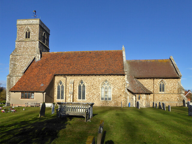
Brantham is a civil parish located in the Babergh district of Suffolk, England. Situated on the southern bank of the River Stour, it is a rural village with a population of around 2,000 residents. The parish is bordered by the neighboring villages of Manningtree and East Bergholt.

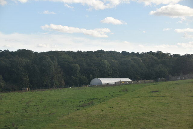
Historically, Brantham was an agricultural community with a strong emphasis on farming. Today, it retains its rural charm with a mix of traditional houses and newer developments. The village is characterized by its picturesque countryside, offering scenic views of rolling hills and meadows.

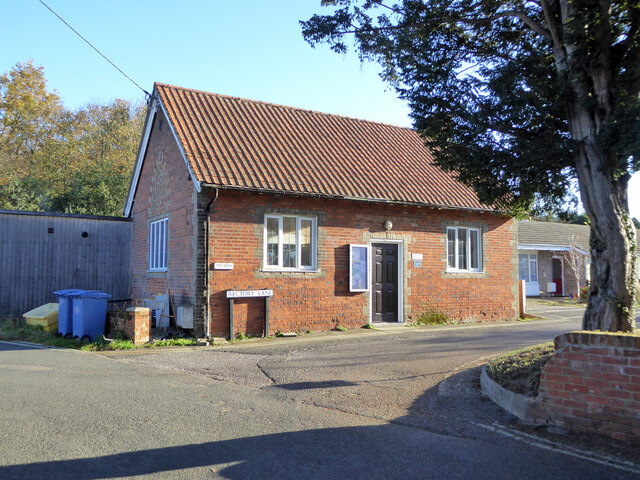
Brantham boasts several amenities to serve its population. These include a primary school, a village hall, a convenience store, and a post office. The village also has a number of local businesses, including shops, pubs, and restaurants, providing essential services and recreational opportunities for both residents and visitors.

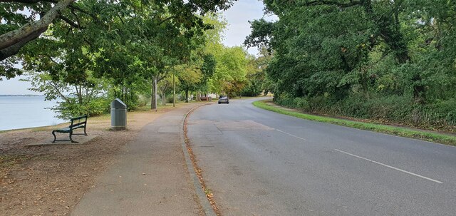
The River Stour plays a significant role in the village's identity and offers various recreational activities. Brantham has a marina and a boatyard, attracting boating enthusiasts and providing opportunities for water sports such as sailing and fishing.

Transport links are well-established in Brantham. The village has its own railway station, providing regular services to Ipswich and London. The A137 road passes through the village, connecting it to nearby towns and cities.

Overall, Brantham is a charming rural village with a strong community spirit and a range of amenities. Its scenic beauty, proximity to the River Stour, and convenient transport links make it an attractive place to live or visit.

If you have any feedback on the listing, please let us know in the comments section below.

Brantham Images

Images are sourced within 2km of 51.961224/1.077823 or Grid Reference TM1133. Thanks to Geograph Open Source API. All images are credited.

View across the Stour estuary from The Walls at dusk Looking north-northwest.
View across the Stour estuary from The Walls at dusk
Looking north-northwest.
View across the River Stour estuary from The Walls Looking north-northwest.
View across the River Stour estuary from The Walls
Looking north-northwest.
View of St. Mary & St. Michael's Church in Mistley from The Walls Looking south-southeast.
View of St. Mary & St. Michael's Church in Mistley from The Walls
Looking south-southeast.
View of Mistley Towers from the village square Looking north-northeast.
View of Mistley Towers from the village square
Looking north-northeast.
View of the EDME Malt Extract chimney towering above a house in Mistley from the village square Looking south-southeast.
View of the EDME Malt Extract chimney towering above a house in Mistley from the village square
Looking south-southeast.
View of the fingerpost sign on a bench in the village square Looks like a vehicle has crashed into the traditional fingerpost sign (as well as a nearby lamp post) on Mistley's village square and, rather ingeniously, the sign has been maintained by someone placing it on the nearby bench. Looking south-southwest.
View of the fingerpost sign on a bench in the village square
Looks like a vehicle has crashed into the traditional fingerpost sign (as well as a nearby lamp post) on Mistley's village square and, rather ingeniously, the sign has been maintained by someone placing it on the nearby bench. Looking south-southwest.
Brantham church The Church of St Michael and All Angels is a grade II*(star) listed building. Medieval with extensive 19th century rebuilding and restorations.
Brantham church
The Church of St Michael and All Angels is a grade II*(star) listed building. Medieval with extensive 19th century rebuilding and restorations.
Gargoyle, Brantham church tower Draining the tower roof at the SW corner.
Gargoyle, Brantham church tower
Draining the tower roof at the SW corner.
Gargoyle, Brantham church tower Draining the tower roof at the NW corner.
Gargoyle, Brantham church tower
Draining the tower roof at the NW corner.
St. Michael's Pre-school, Brantham Mapped as an 'Institute'.
St. Michael's Pre-school, Brantham
Mapped as an 'Institute'.
Mistley, St Mary & St Michael
Old Milestone, B1352, High Street, Mistley The milestone was originally located on the High Street, Mistley at TM 1181 3178. It was later moved against the wall of a building on Mistley Quay, see <a title="https://www.geograph.org.uk/photo/6045295" href="https://www.geograph.org.uk/photo/6045295">Link</a> , then temporarily put in to store during property development, and has now been re-installed in the Swan Basin, High Street. Parish of Mistley (Tendring District), Carved stone post, originally erected in the 19th century. A replacement for the cast iron post that would later have been fitted to the milestone is located close by, see <a title="https://www.geograph.org.uk/photo/7148738" href="https://www.geograph.org.uk/photo/7148738">Link</a>

Inscription reads:-
LXI / Colchester / 10 / Mistley  : : (Harwich / 11)

Milestone Society National ID: EX_COHH61
Old Milestone, B1352, High Street, Mistley
The milestone was originally located on the High Street, Mistley at TM 1181 3178. It was later moved against the wall of a building on Mistley Quay, see Link , then temporarily put in to store during property development, and has now been re-installed in the Swan Basin, High Street. Parish of Mistley (Tendring District), Carved stone post, originally erected in the 19th century. A replacement for the cast iron post that would later have been fitted to the milestone is located close by, see Link Inscription reads:- LXI / Colchester / 10 / Mistley : : (Harwich / 11) Milestone Society National ID: EX_COHH61
Replacement Milestone, B1352, High St, Mistley, Swan Basin This milestone is located in the Swan Basin, against the far wall to the right of the original stone milestone EX_COHH61, <a title="https://www.geograph.org.uk/photo/7148662" href="https://www.geograph.org.uk/photo/7148662">Link</a>. Parish of Mistley (Tendring District). It is a replacement for the original cast iron post, Bendall iron casting design, erected by the Essex Second District turnpike trust in the 19th century. Cast iron posts on this Colchester to Harwich route were made to be bolted on to the original stone milestones.

Inscription reads:-
HARWICH / 11  : : COLCHESTER / 10  : :  MISTLEY / TO / LONDON / 61  :  : BENDALL / IRON AND BRASS / FOUNDERS / PLOUGH AND MACHINE / MAKER / LAWFORD / ESSEX /1834

Milestone Society National ID: EX_COHH61AR
Replacement Milestone, B1352, High St, Mistley, Swan Basin
This milestone is located in the Swan Basin, against the far wall to the right of the original stone milestone EX_COHH61, Link. Parish of Mistley (Tendring District). It is a replacement for the original cast iron post, Bendall iron casting design, erected by the Essex Second District turnpike trust in the 19th century. Cast iron posts on this Colchester to Harwich route were made to be bolted on to the original stone milestones. Inscription reads:- HARWICH / 11 : : COLCHESTER / 10 : : MISTLEY / TO / LONDON / 61 : : BENDALL / IRON AND BRASS / FOUNDERS / PLOUGH AND MACHINE / MAKER / LAWFORD / ESSEX /1834 Milestone Society National ID: EX_COHH61AR
The Walls, Manningtree
Mistley war memorial and Mistley Tower
High Street, Manningtree
Lower Meadows Farm
Lower Meadows Farm
Show me another place!

Brantham is located at Grid Ref: TM1133 (Lat: 51.961224, Lng: 1.077823)

Administrative County: Suffolk

District: Babergh

Police Authority: Suffolk

What 3 Words

///forgotten.drift.darling. Near Manningtree, Essex

Nearby Locations

Brantham

Related Wikis

Brantham

Brantham is a village and civil parish in the Babergh district of Suffolk, England. It is located close to the River Stour and the border with Essex, around...

Brantham Athletic F.C.

Brantham Athletic Football Club is a football club based in Brantham, Suffolk, England. They are currently members of the Eastern Counties League Premier...

Mistley Towers

Mistley Towers are the twin towers of the now demolished Church of St. Mary the Virgin at Mistley in Essex (sometimes known as Mistley Thorn(e) Church...

Mistley

Mistley is a village and civil parish in the Tendring district of northeast Essex, England. It is around 11 miles northeast of Colchester and is east of...

Mistley railway station

Mistley railway station is on the Mayflower Line, a branch of the Great Eastern Main Line in the East of England, serving the village of Mistley, Essex...

Corn Exchange, Manningtree

The Corn Exchange is a commercial building in the High Street in Manningtree, Essex, England. The structure, which is now used as a public library, is...

Cattawade Marshes

Cattawade Marshes is an 88.2-hectare (218-acre) biological Site of Special Scientific Interest between East Bergholt and Manningtree in Essex and Suffolk...

Manningtree

Manningtree is a town and civil parish in the Tendring district of Essex, England, which lies on the River Stour. It is part of the Suffolk Coast and Heaths...

Nearby Amenities

Located within 500m of 51.961224,1.077823
Power: tower
Lat/Long: 51.9639361/1.0809839
Power: tower
Lat/Long: 51.9601215/1.0764027
Power: tower
Lat/Long: 51.9617545/1.0784197
Bench
Lat/Long: 51.9641364/1.0830216
Bench
Backrest: yes
Material: wood
Lat/Long: 51.9610349/1.0724773
Bench
Backrest: yes
Material: wood
Lat/Long: 51.9609027/1.0718496
Bench
Backrest: yes
Material: wood
Lat/Long: 51.9607407/1.0710074
Waste Basket
Lat/Long: 51.9607143/1.0709752
Bench
Lat/Long: 51.9591181/1.0785616
The data included in this document is from www.openstreetmap.org. The data is made available under ODbL.

Have you been to Brantham?

Leave your review of Brantham below (or comments, questions and feedback).