Bramley

Civil Parish in Surrey Waverley

England

Bramley

Downs Link near Cranleigh The Downs Link path follows a dismantled railway line for most of its length.  It also forms part of route 223 of the National Cycle Network.

Here, a bridge carries a road across the former railway.
Downs Link near Cranleigh Credit: Malc McDonald

Bramley is a civil parish located in the county of Surrey, England. Situated about three miles south of Guildford, it covers an area of approximately 18 square kilometers. The parish is predominantly rural, with a charming countryside setting that is highly valued by its residents.

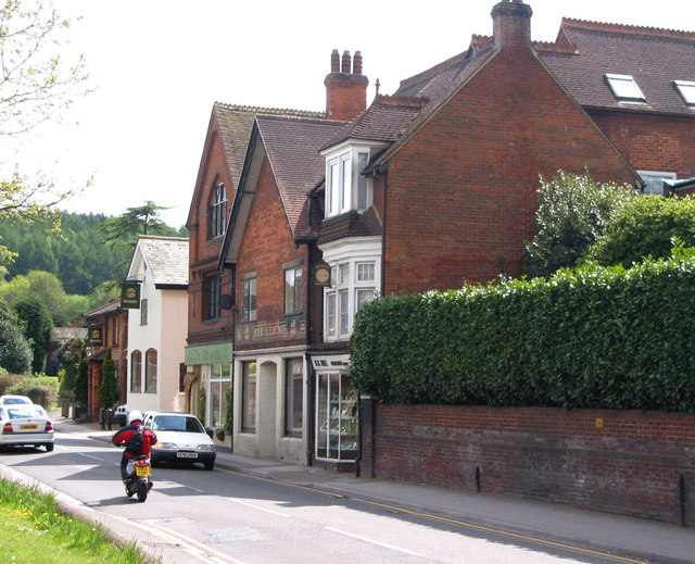
The village of Bramley itself is the main settlement within the parish. It has a population of around 4,000 people and offers a range of amenities and services to cater to the needs of its residents. These include a primary school, a medical center, a post office, and a selection of shops and local businesses.

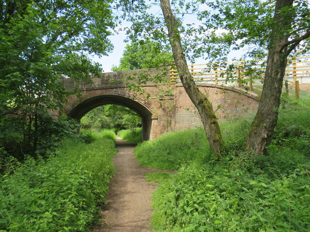
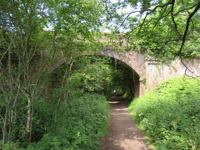
Surrounded by picturesque countryside, Bramley is popular among nature enthusiasts and those seeking a peaceful lifestyle away from the hustle and bustle of city living. The area boasts numerous walking and cycling routes, allowing residents to explore the stunning natural beauty of the Surrey Hills Area of Outstanding Natural Beauty, which lies to the south.

Transport links in Bramley are convenient, with regular bus services connecting the village to nearby towns and cities. The A281 road runs through the parish, providing easy access to Guildford and Horsham, while the nearest railway station is located in nearby Shalford, offering regular services to London and other destinations.

Overall, Bramley, Surrey, is a charming and tranquil civil parish that offers a high quality of life to its residents. With its rural setting and convenient amenities, it provides the perfect balance between countryside living and accessibility to urban areas.

If you have any feedback on the listing, please let us know in the comments section below.

Bramley Images

Images are sourced within 2km of 51.167083/-0.554769 or Grid Reference TQ0141. Thanks to Geograph Open Source API. All images are credited.

Downs Link near Cranleigh The Downs Link path follows a dismantled railway line for most of its length.  It also forms part of route 223 of the National Cycle Network.

Here, a bridge carries a road across the former railway.
Downs Link near Cranleigh
The Downs Link path follows a dismantled railway line for most of its length. It also forms part of route 223 of the National Cycle Network. Here, a bridge carries a road across the former railway.
Downs Link near Cranleigh The Downs Link path follows a dismantled railway line for most of its length.  It also forms part of route 223 of the National Cycle Network.

Here, a bridge carries the path over a farm track.
Downs Link near Cranleigh
The Downs Link path follows a dismantled railway line for most of its length. It also forms part of route 223 of the National Cycle Network. Here, a bridge carries the path over a farm track.
Farm track near Cranleigh A farm track in Surrey countryside, near Cranleigh.
Farm track near Cranleigh
A farm track in Surrey countryside, near Cranleigh.
Downs Link near Cranleigh The Downs Link path follows a dismantled railway line for most of its length.  It also forms part of route 223 of the National Cycle Network.

The bridge ahead carries a farm track over the former railway route.
Downs Link near Cranleigh
The Downs Link path follows a dismantled railway line for most of its length. It also forms part of route 223 of the National Cycle Network. The bridge ahead carries a farm track over the former railway route.
Bridge over the Downs Link path near Cranleigh The Downs Link path follows a dismantled railway line for most of its length.  It also forms part of route 223 of the National Cycle Network.

The bridge was built to carry a farm track over the railway line.
Bridge over the Downs Link path near Cranleigh
The Downs Link path follows a dismantled railway line for most of its length. It also forms part of route 223 of the National Cycle Network. The bridge was built to carry a farm track over the railway line.
Downs Link near Bramley The Downs Link path follows a dismantled railway line for most of its length.  It also forms part of route 223 of the National Cycle Network.

From this point, near Bramley, into Guildford, the path is also on the route of National Cycle Network route 22.
Downs Link near Bramley
The Downs Link path follows a dismantled railway line for most of its length. It also forms part of route 223 of the National Cycle Network. From this point, near Bramley, into Guildford, the path is also on the route of National Cycle Network route 22.
National Cycle Network route 22 near Bramley This path, shared by pedestrians and cyclists, forms part of National Cycle Network route 22.  The bridge ahead carries the Downs Link path, on a former railway alignment, across the path.
National Cycle Network route 22 near Bramley
This path, shared by pedestrians and cyclists, forms part of National Cycle Network route 22. The bridge ahead carries the Downs Link path, on a former railway alignment, across the path.
Wey & Arun Canal near Bramley The Wey and Arun Canal is a 23-mile-long canal in the south of England, between the River Wey at Shalford, Surrey and the River Arun at Pallingham, in West Sussex.
Passing through a rural landscape, there was little freight traffic to justify its continued existence, and the canal was officially abandoned in 1871.
Without maintenance, the canal gradually became derelict over much of its length. However, since 1970, active restoration by The Wey & Arun Canal Trust has resulted in several miles of the waterway being restored to navigable standard. Work is continuing, with the ultimate aim of re-opening the entire canal to navigation.
 <span class="nowrap"><a title="http://www.weyandarun.co.uk/" rel="nofollow ugc noopener" href="http://www.weyandarun.co.uk/">Link</a><img style="margin-left:2px;" alt="External link" title="External link - shift click to open in new window" src="https://s1.geograph.org.uk/img/external.png" width="10" height="10"/></span> 
Part of the River Wey navigations. <span class="nowrap"><a title="http://www.weyandarun.co.uk/hist1.php" rel="nofollow ugc noopener" href="http://www.weyandarun.co.uk/hist1.php">Link</a><img style="margin-left:2px;" alt="External link" title="External link - shift click to open in new window" src="https://s1.geograph.org.uk/img/external.png" width="10" height="10"/></span>  <a title="https://www.geograph.org.uk/snippet/2588" href="https://www.geograph.org.uk/snippet/2588">Link</a>
Wey & Arun Canal near Bramley
The Wey and Arun Canal is a 23-mile-long canal in the south of England, between the River Wey at Shalford, Surrey and the River Arun at Pallingham, in West Sussex. Passing through a rural landscape, there was little freight traffic to justify its continued existence, and the canal was officially abandoned in 1871. Without maintenance, the canal gradually became derelict over much of its length. However, since 1970, active restoration by The Wey & Arun Canal Trust has resulted in several miles of the waterway being restored to navigable standard. Work is continuing, with the ultimate aim of re-opening the entire canal to navigation. LinkExternal link Part of the River Wey navigations. LinkExternal link Link
National Cycle Network route 22 near Bramley This path, shared by people walking and cycling, forms part of National Cycle Network route 22.  The bridge ahead carries another shared path, the Downs Link, which follows the course of a dismantled railway.
National Cycle Network route 22 near Bramley
This path, shared by people walking and cycling, forms part of National Cycle Network route 22. The bridge ahead carries another shared path, the Downs Link, which follows the course of a dismantled railway.
National Cycle Network route 22 near Bramley At this junction, the path to the right forms part of National Cycle Network route 22.  The path is shared by pedestrians and cyclists.  The path to the left is only for pedestrians.
National Cycle Network route 22 near Bramley
At this junction, the path to the right forms part of National Cycle Network route 22. The path is shared by pedestrians and cyclists. The path to the left is only for pedestrians.
Bramley - Canal Restoration Works Excavation in progress by the Wey & Arun Canal Trust south of Bramley and adjacent to the Downslink footpath.
<span class="nowrap"><a title="www.weyarun.org.uk" rel="nofollow ugc noopener" href="http://www.weyarun.org.uk">Link</a><img style="margin-left:2px;" alt="External link" title="External link - shift click to open in new window" src="https://s1.geograph.org.uk/img/external.png" width="10" height="10"/></span>
Bramley - Canal Restoration Works
Excavation in progress by the Wey & Arun Canal Trust south of Bramley and adjacent to the Downslink footpath. LinkExternal link
Birtley Green - Greensand Way Wide path heading from the Downslink towards Rooks Hill Farm.
Birtley Green - Greensand Way
Wide path heading from the Downslink towards Rooks Hill Farm.
Shamley Green - Footbridge This substantial wooden footbridge is losing its supports on the Shamley Green bank of the brook.
Shamley Green - Footbridge
This substantial wooden footbridge is losing its supports on the Shamley Green bank of the brook.
Shamley Green - River Bank Erosion This substantial wooden footbridge is losing its concrete supports on the Shamley Green bank of the brook.
Shamley Green - River Bank Erosion
This substantial wooden footbridge is losing its concrete supports on the Shamley Green bank of the brook.
Bramley - Wey and Arun Canal Section of the old canal which is slowly being restored by the Wey & Arun Canal Trust in sections.
<span class="nowrap"><a title="www.weyarun.org.uk" rel="nofollow ugc noopener" href="http://www.weyarun.org.uk">Link</a><img style="margin-left:2px;" alt="External link" title="External link - shift click to open in new window" src="https://s1.geograph.org.uk/img/external.png" width="10" height="10"/></span>
Bramley - Wey and Arun Canal
Section of the old canal which is slowly being restored by the Wey & Arun Canal Trust in sections. LinkExternal link
Winkworth Arboretum - Snowman Trail "Nine Ladies Dancing", decorated snowman number 9 on the festive trail for Christmas 2022.
<span class="nowrap"><a title="www.nationaltrust.org.uk" rel="nofollow ugc noopener" href="http://www.nationaltrust.org.uk">Link</a><img style="margin-left:2px;" alt="External link" title="External link - shift click to open in new window" src="https://s1.geograph.org.uk/img/external.png" width="10" height="10"/></span>
Winkworth Arboretum - Snowman Trail
"Nine Ladies Dancing", decorated snowman number 9 on the festive trail for Christmas 2022. LinkExternal link
Winkworth - Valleyside View of the hillside to the east of Rowes Flash, an artificial lake in the valley bottom at Winkworth Arboretum.
<span class="nowrap"><a title="www.nationaltrust.org.uk" rel="nofollow ugc noopener" href="http://www.nationaltrust.org.uk">Link</a><img style="margin-left:2px;" alt="External link" title="External link - shift click to open in new window" src="https://s1.geograph.org.uk/img/external.png" width="10" height="10"/></span>
Winkworth - Valleyside
View of the hillside to the east of Rowes Flash, an artificial lake in the valley bottom at Winkworth Arboretum. LinkExternal link
Winkworth Arboretum - Snowman Trail "Ten Lords a-Leaping", decorated snowman number 10 on the festive trail for Christmas 2022 - with a female lord to appease the politically correct folk.
<span class="nowrap"><a title="www.nationaltrust.org.uk" rel="nofollow ugc noopener" href="http://www.nationaltrust.org.uk">Link</a><img style="margin-left:2px;" alt="External link" title="External link - shift click to open in new window" src="https://s1.geograph.org.uk/img/external.png" width="10" height="10"/></span>
Winkworth Arboretum - Snowman Trail
"Ten Lords a-Leaping", decorated snowman number 10 on the festive trail for Christmas 2022 - with a female lord to appease the politically correct folk. LinkExternal link
Show me another place!

Bramley is located at Grid Ref: TQ0141 (Lat: 51.167083, Lng: -0.554769)

Administrative County: Surrey

District: Waverley

Police Authority: Surrey

What 3 Words

///hurray.firm.elbow. Near Bramley, Surrey

Related Wikis

Winkworth Arboretum

Winkworth Arboretum is a National Trust-owned arboretum in the spread-out civil parish of Busbridge between Godalming and Hascombe, south-west Surrey,...

Hascombe

Hascombe is a village and civil parish in Surrey, England. It is around 3 miles (4.8 km) southeast of Godalming in the Borough of Waverley. The settlement...

Orchards, Surrey

Orchards is an Arts and Crafts style house in Bramley in Surrey, England. It is on Bramley's boundary with Busbridge and 1 mile (1.6 km) south-east of...

Hascombe Court

Hascombe Court is a 172-acre (70 ha) estate in Hascombe, Surrey, best known for its vast garden designed by Gertrude Jekyll. Hascombe Court is listed Grade...

Christ Church, Shamley Green

Christ Church is a Church of England parish church in Shamley Green, Surrey, England. It was constructed in 1863 as a chapel of ease and became a parish...

Bramley, Surrey

Bramley is a village and civil parish about three miles (5 km) south of Guildford in the Borough of Waverley in Surrey, south east England. Most of the...

Munstead Wood

Munstead Wood is a Grade I listed house and garden in Munstead Heath, Busbridge on the boundary of the town of Godalming in Surrey, England, 1 mile (1...

Cucknell's Wood

Cucknell's Wood is a 11-hectare (27-acre) nature reserve south-east of Shamley Green in Surrey. It is managed by the Surrey Wildlife Trust.Birds in this...

Nearby Amenities

Located within 500m of 51.167083,-0.554769
Winters Hall
Building: yes
Source: npe
Wikidata: Q26413035
Lat/Long: 51.1628292/-0.5538148
Barrier: stile
Lat/Long: 51.1684189/-0.548168
Barrier: stile
Lat/Long: 51.168244/-0.5491229
Barrier: stile
Foot: yes
Lat/Long: 51.1712085/-0.5560394
Source: survey
Traffic Calming: bump
Lat/Long: 51.1686304/-0.5499686
Addr Housename: The Oast House
Building: yes
Source: survey
Lat/Long: 51.1679876/-0.5499795
Natural: spring
Lat/Long: 51.1686306/-0.5539201
Natural: spring
Lat/Long: 51.1688862/-0.554655
Power: pole
Lat/Long: 51.1656051/-0.5482207
Power: pole
Lat/Long: 51.1665907/-0.5482958
Gate Street Farm
Place: farm
Lat/Long: 51.1670926/-0.5535519
The data included in this document is from www.openstreetmap.org. The data is made available under ODbL.

Have you been to Bramley?

Leave your review of Bramley below (or comments, questions and feedback).