Bradford-on-Avon
Civil Parish in Wiltshire
England
Bradford-on-Avon

Bradford-on-Avon is a charming market town located in the county of Wiltshire, England. Situated on the western edge of the Cotswolds, it lies approximately eight miles southeast of the city of Bath and seven miles southwest of Trowbridge. The town is nestled in the Avon Valley and is surrounded by stunning countryside.
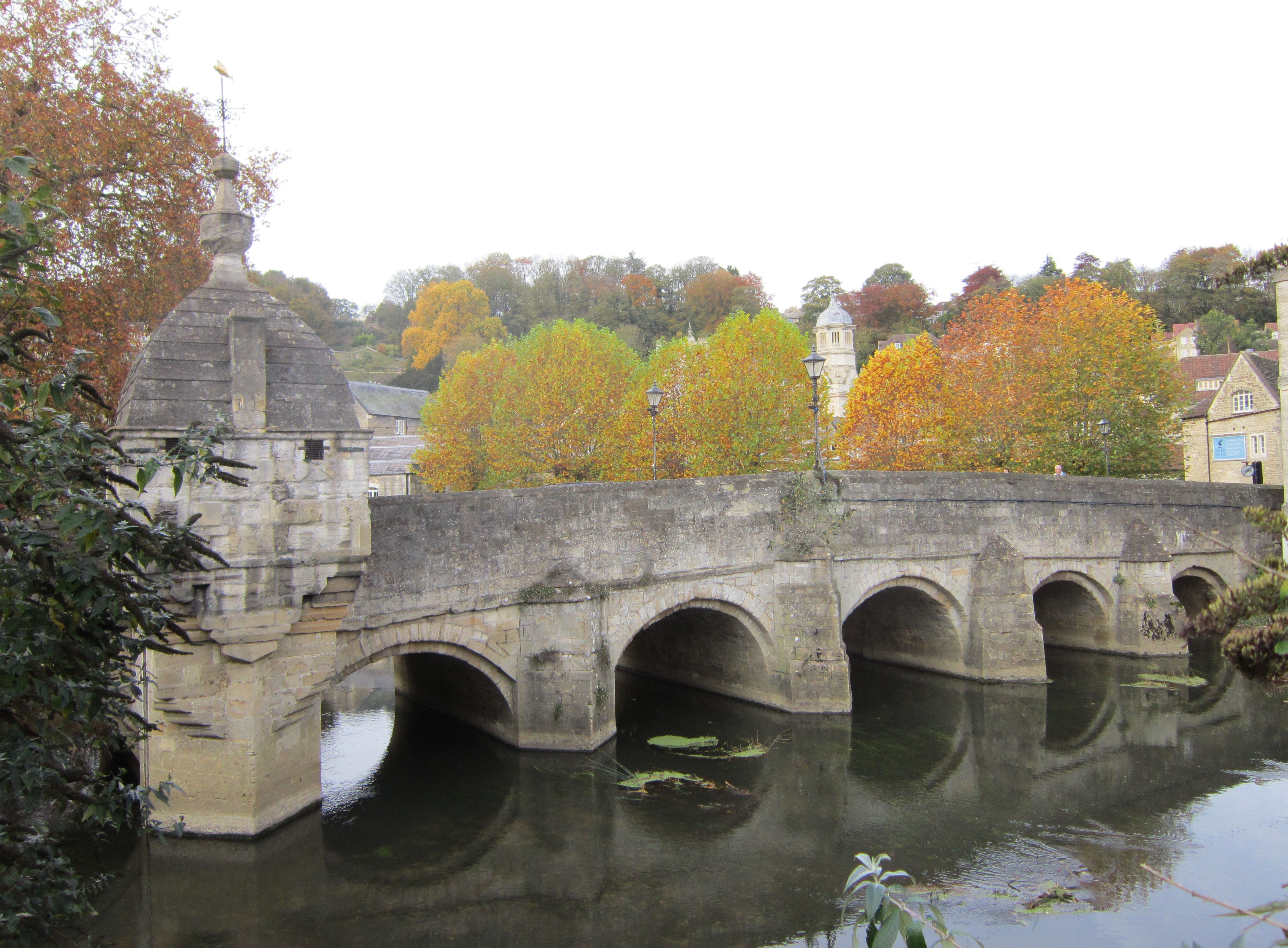
With a population of around 10,000, Bradford-on-Avon has a rich history that dates back to the Roman era. The town's architecture reflects its past, with many well-preserved buildings from the medieval, Tudor, and Georgian periods. Notable landmarks include the 14th-century tithe barn, the 13th-century bridge over the River Avon, and the Saxon church of St. Laurence.
Bradford-on-Avon is a popular tourist destination, attracting visitors with its picturesque streets, quaint shops, and delightful cafes and restaurants. The town also offers a range of cultural and recreational activities, such as art galleries, museums, and the annual Bradford Roots Music Festival.
In addition to its historical and cultural significance, Bradford-on-Avon boasts a thriving community with a range of amenities and services. These include primary and secondary schools, a library, medical facilities, and a variety of sporting clubs and facilities.
The town is well-connected by road and rail, with the A363 providing access to Bath and the M4 motorway. The railway station offers regular services to Bath, Bristol, and London, making Bradford-on-Avon an attractive place to live for commuters.
Overall, Bradford-on-Avon is a picturesque and historic town that offers a blend of history, natural beauty, and modern amenities, making it an attractive place to visit or call home.
If you have any feedback on the listing, please let us know in the comments section below.
Bradford-on-Avon Images
Images are sourced within 2km of 51.346655/-2.249717 or Grid Reference ST8260. Thanks to Geograph Open Source API. All images are credited.


Bradford-on-Avon is located at Grid Ref: ST8260 (Lat: 51.346655, Lng: -2.249717)
Unitary Authority: Wiltshire
Police Authority: Wiltshire
What 3 Words
///clipped.backtrack.evolving. Near Bradford-on-Avon, Wiltshire
Nearby Locations
Related Wikis
Bradford-on-Avon
Bradford-on-Avon (sometimes Bradford on Avon or Bradford upon Avon) is a town and civil parish in west Wiltshire, England, near the border with Somerset...

Swan Hotel, Bradford-on-Avon
The Swan Hotel is a Grade II* listed hotel in Church Street, Bradford-on-Avon, Wiltshire, England. It is of uncertain age but probably dates from the seventeenth...
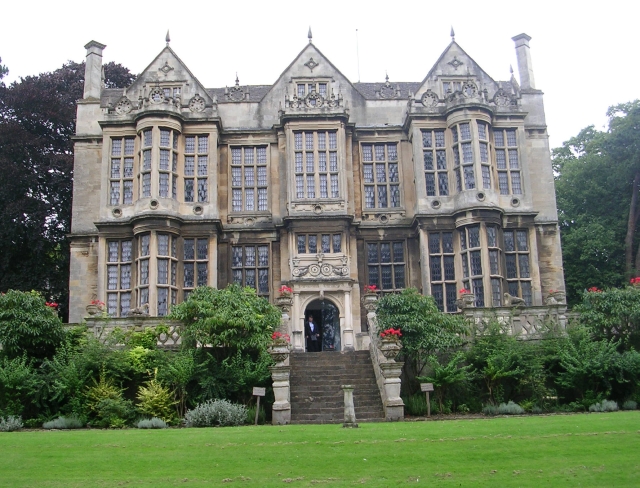
The Hall, Bradford-on-Avon
The Hall, at times known as Kingston House and The Duke's House, is a Grade I listed Jacobean mansion in Bradford-on-Avon, Wiltshire, England. == History... ==

St Thomas More Roman Catholic Church, Bradford-on-Avon
The St Thomas More Roman Catholic Church is in Market Street, Bradford-on-Avon, Wiltshire, England. The structure, which originally served as Bradford...

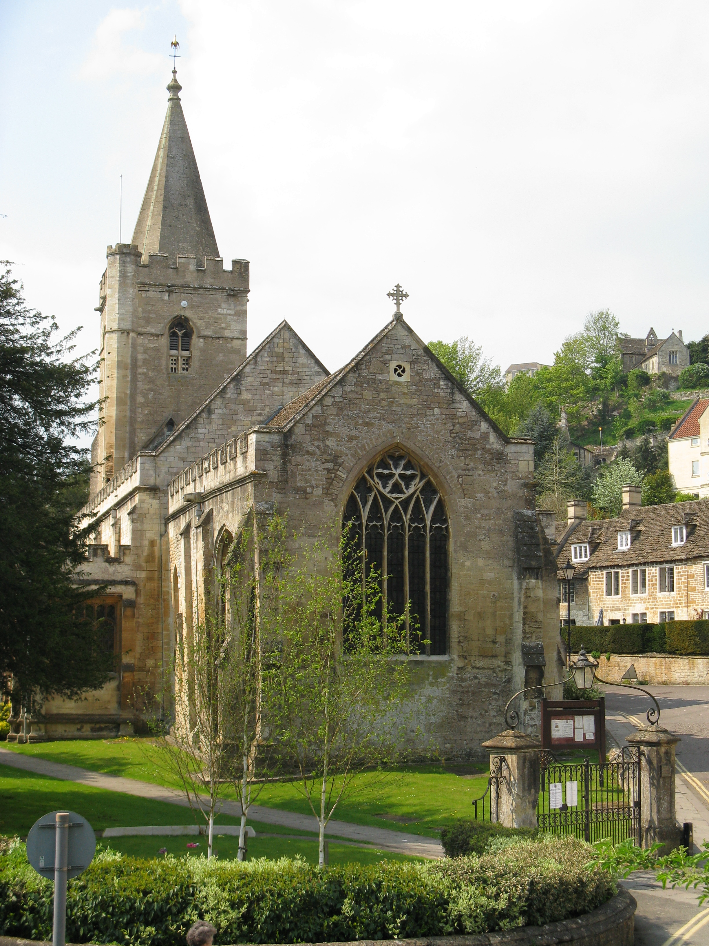
St Laurence's Church, Bradford-on-Avon
St Laurence's Church, Bradford-on-Avon, Wiltshire, is one of very few surviving Anglo-Saxon churches in England that does not show later medieval alteration...
Holy Trinity Church, Bradford-on-Avon
Holy Trinity Church, Bradford-on-Avon is a Grade I listed church in Bradford-on-Avon, Wiltshire, England. It is part of the Church of England within the...

Bradford-on-Avon railway station
Bradford-on-Avon railway station is a railway station on the Wessex Main Line in between Avoncliff and Trowbridge, serving the town of Bradford on Avon...

Fitzmaurice Grammar School
Fitzmaurice Grammar School was a grammar school in Bradford on Avon, Wiltshire, England. The school opened as the County School in 1897 with financial...
Nearby Amenities
Located within 500m of 51.346655,-2.249717Have you been to Bradford-on-Avon?
Leave your review of Bradford-on-Avon below (or comments, questions and feedback).