Brithdir ac Islaw'r-dref

Settlement in Merionethshire

Wales

Brithdir ac Islaw'r-dref

Llywbr uwchben afon Clywedog / Track above the Torrent Walk
Llywbr uwchben afon Clywedog / Track above the Torrent Walk Credit: Mike Parker

Brithdir ac Islaw'r-dref, also known as Brithdir and Islaw'r-dref, is a small rural community located in the county of Merionethshire, Wales. Positioned in the picturesque heart of Snowdonia National Park, this charming village offers breathtaking views, serene surroundings, and a rich history.

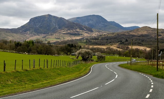
Situated near the banks of River Mawddach, Brithdir ac Islaw'r-dref is enveloped by lush green valleys and towering mountains, making it an ideal destination for nature enthusiasts and hikers. The area is renowned for its stunning landscapes, including Cader Idris, one of the most prominent peaks in Wales.

The village itself is home to a close-knit community, with a population of around 500 residents. Traditional Welsh culture and language remain integral to the local way of life, with many residents speaking Welsh as their first language. The community takes great pride in preserving their heritage, evident in the numerous cultural events, Eisteddfods (Welsh festivals of literature and performance), and traditional celebrations held throughout the year.

While Brithdir ac Islaw'r-dref is primarily a residential area, it offers a range of amenities to cater to the needs of its residents. These include a village hall, a primary school, and a few local businesses, providing essential services to the community.

Overall, Brithdir ac Islaw'r-dref presents a tranquil and idyllic setting for those seeking a peaceful retreat amidst the stunning beauty of Snowdonia National Park. Whether it be hiking the scenic trails, immersing oneself in Welsh culture, or simply enjoying the beauty of nature, visitors to this quaint village will undoubtedly find solace and a warm welcome from its friendly inhabitants.

If you have any feedback on the listing, please let us know in the comments section below.

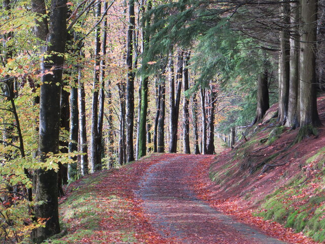
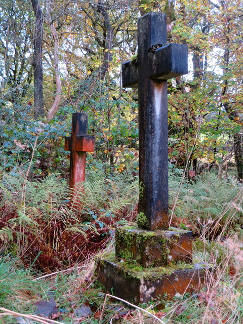
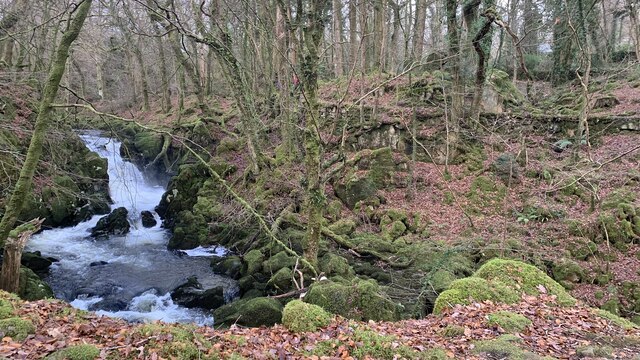
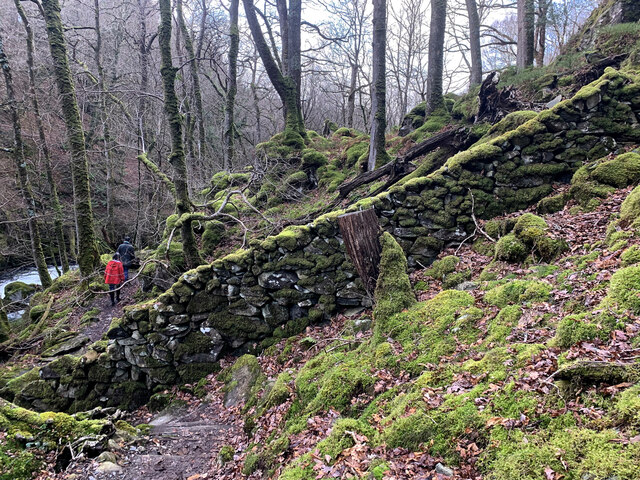
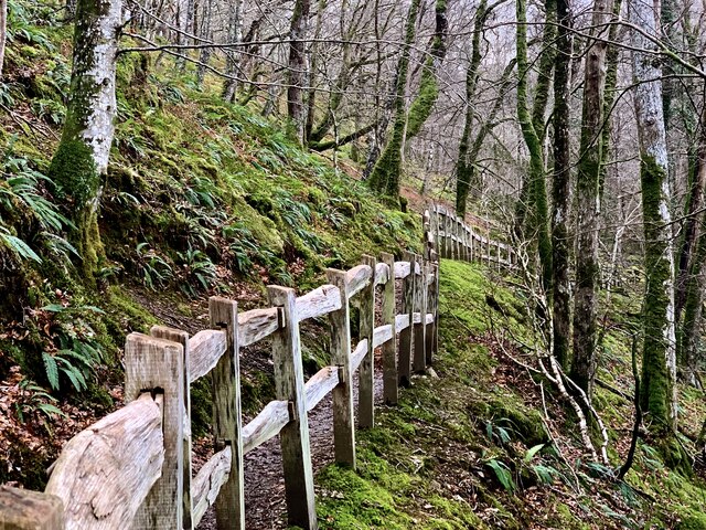
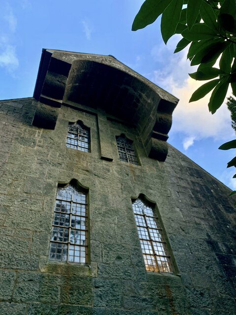
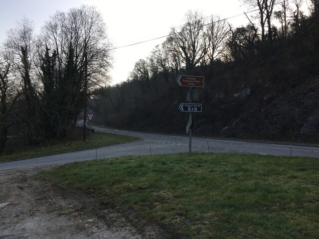
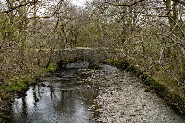
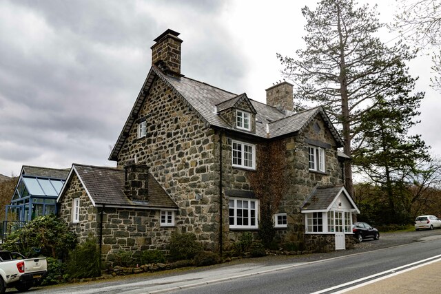
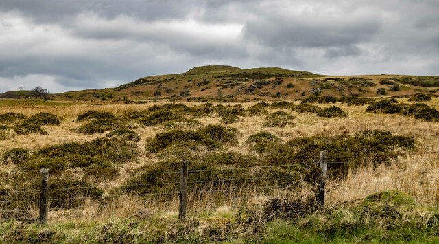
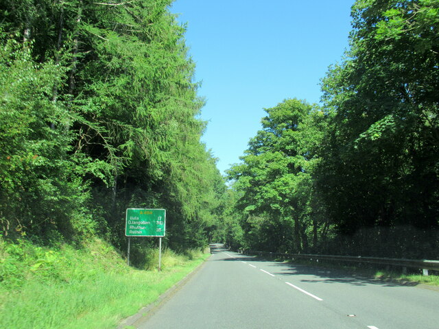
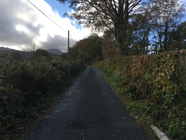
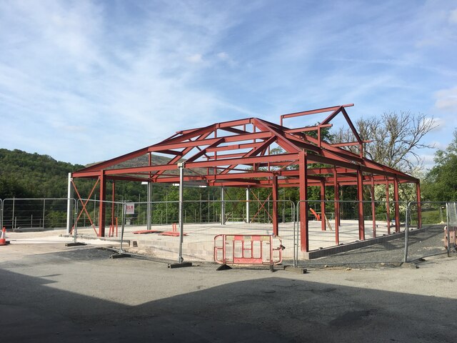
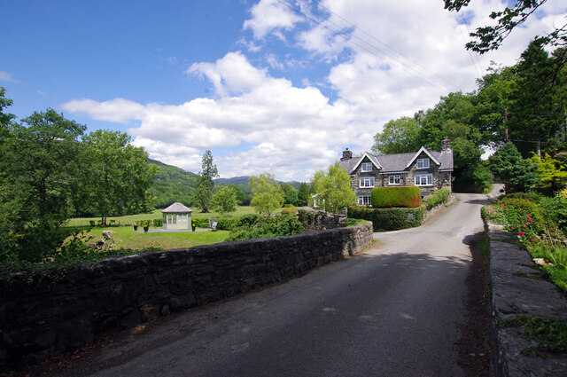
Brithdir ac Islaw'r-dref Images

Images are sourced within 2km of 52.745355/-3.838382 or Grid Reference SH7618. Thanks to Geograph Open Source API. All images are credited.

Llywbr uwchben afon Clywedog / Track above the Torrent Walk
Mynwent eglwys Brithdir / graves at Brithdir church
Llwybr y Torrent newydd From the new footpath on the western side of the Afon Clywedog, looking over to the old path running along the retaining wall.  It means that the Torrent Walk is now a spectacular circular.
Llwybr y Torrent newydd
From the new footpath on the western side of the Afon Clywedog, looking over to the old path running along the retaining wall. It means that the Torrent Walk is now a spectacular circular.
Llwybr newydd, Llwybr y Torrent A wonderful new path has been opened on the opposite side of the Afon Clywedog from the longstanding Torrent Walk. Here it meets and crosses an old wall of the Caerynwch estate.
Llwybr newydd, Llwybr y Torrent
A wonderful new path has been opened on the opposite side of the Afon Clywedog from the longstanding Torrent Walk. Here it meets and crosses an old wall of the Caerynwch estate.
Llwybr newydd, Llwybr y Torrent The new track of the Torrent Walk, with some beautiful fencing.
Llwybr newydd, Llwybr y Torrent
The new track of the Torrent Walk, with some beautiful fencing.
Eglwys Brithdir The stark west wall of St Mark's church, the Arts & Crafts masterpiece built at the very end of the nineteenth century. A massive stone hood hangs over a raised cross.
Eglwys Brithdir
The stark west wall of St Mark's church, the Arts & Crafts masterpiece built at the very end of the nineteenth century. A massive stone hood hangs over a raised cross.
Road junction near Dolgellau
B4416 approaching Brithdir
A470 The A470 with Cadair Idris in the background.
A470
The A470 with Cadair Idris in the background.
Pont Gwanas The old bridge at Pont Gwanas crossing the river Clywedog.
Pont Gwanas
The old bridge at Pont Gwanas crossing the river Clywedog.
Cross Foxes The Cross Foxes public house.
Cross Foxes
The Cross Foxes public house.
The Road Through Brithdir
Farm Track, Path and Gated Fields near Brithdir
The A494 north, 17 miles to Bala
Minor road near Dolgellau
Building under construction, Mile End Service Station
Pont Clywedog The bridge carries what is now a minor road up the Wnion valley over the Afon Clywedog. The house was a lodge for Dolserau Hall.
Pont Clywedog
The bridge carries what is now a minor road up the Wnion valley over the Afon Clywedog. The house was a lodge for Dolserau Hall.
Show me another place!

Brithdir ac Islaw'r-dref is located at Grid Ref: SH7618 (Lat: 52.745355, Lng: -3.838382)

Unitary Authority: Gwynedd

Police Authority: North Wales

What 3 Words

///blotting.rifled.curries. Near Dolgellau, Gwynedd

Related Wikis

St Mark's Church, Brithdir

St Mark's Church, Brithdir, is a redundant church in the hamlet of Brithdir, Gwynedd, Wales. It is designated by Cadw as a Grade I listed building, and...

Brithdir, Gwynedd

Brithdir is a small hamlet on the outskirts of Dolgellau, Gwynedd in the community of Brithdir and Llanfachreth. The Arts and Crafts Movement St Mark's...

Meirionnydd

Meirionnydd is a coastal and mountainous region of Wales. It has been a kingdom, a cantref, a district and, as Merionethshire, a county. == Kingdom... ==

Dolserau Halt railway station

Dolserau Halt (Pron: Dol-seh-rye) in Gwynedd, Wales, was on the Ruabon to Barmouth line. The platform edge was made of timber and was situated on the north...

Nearby Amenities

Located within 500m of 52.745355,-3.838382
Post Box
Operator: Royal Mail
Post Box Type: lamp
Ref: LL40 61
Royal Cypher: EIIR
Royal Cypher Wikidata: Q33102113
Lat/Long: 52.7474455/-3.8356587
Barrier: kissing_gate
Lat/Long: 52.7458961/-3.8367803
Place: farm
Lat/Long: 52.7455491/-3.8439726
Bench
Backrest: yes
Lat/Long: 52.746077/-3.8373667
Bus Stop
Public Transport: platform
Lat/Long: 52.7436609/-3.8386676
Bus Stop
Public Transport: platform
Lat/Long: 52.7436203/-3.8388366
Barrier: bollard
Lat/Long: 52.7434588/-3.8384394
Hiking: yes
Horse: yes
Information: guidepost
Motor Vehicle: no
Tourism: information
Lat/Long: 52.7445312/-3.8379166
Barrier: bollard
Lat/Long: 52.7445377/-3.8379447
Hiking: yes
Information: guidepost
Tourism: information
Lat/Long: 52.7434579/-3.8383645
Hiking: yes
Information: guidepost
Source: GPS survey
Tourism: information
Lat/Long: 52.743164/-3.8410883
Bench
Backrest: no
Lat/Long: 52.74683/-3.8368117
Barrier: stile
Source: GPS survey
Lat/Long: 52.7431381/-3.8411433
Direction: S
Generator Method: photovoltaic
Generator Output Electricity: yes
Generator Solar Modules: 12
Generator Source: solar
Generator Type: solar_photovoltaic_panel
Location: roof
Power: generator
Lat/Long: 52.7455664/-3.8442492
Direction: SSW
Generator Method: photovoltaic
Generator Output Electricity: yes
Generator Solar Modules: 12
Generator Source: solar
Generator Type: solar_photovoltaic_panel
Location: roof
Power: generator
Lat/Long: 52.7469773/-3.8333555
The data included in this document is from www.openstreetmap.org. The data is made available under ODbL.

Have you been to Brithdir ac Islaw'r-dref?

Leave your review of Brithdir ac Islaw'r-dref below (or comments, questions and feedback).