Boughton
Civil Parish in Northamptonshire
England
Boughton

Boughton is a civil parish located in the county of Northamptonshire, England. It is situated approximately three miles northwest of the town of Kettering and covers an area of about 1,860 acres. The parish is bordered by the villages of Mawsley, Weekley, and Great Oakley.
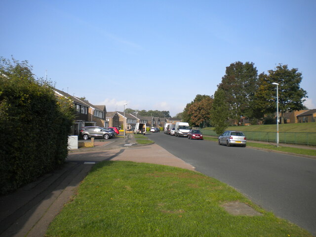
Boughton is a quintessential English village with a rich history dating back to the Domesday Book of 1086. The village is known for its picturesque countryside, charming thatched cottages, and historic buildings. One of the notable landmarks in Boughton is the Church of St. John the Baptist, a Grade I listed building that dates back to the 13th century. The church features a stunning medieval tower and an impressive collection of stained glass windows.
The village also boasts a thriving community with a range of amenities. These include a primary school, a village hall, a post office, a pub, and a convenience store. Boughton is well-connected with good transport links, including a railway station in the nearby town of Kettering.
The surrounding area offers plenty of opportunities for outdoor activities, with beautiful countryside and nature reserves nearby. Boughton Park, a large green space with walking trails and a children's play area, is a popular spot for locals and visitors alike.
Overall, Boughton is a picturesque and vibrant village that offers a peaceful rural lifestyle while still being within easy reach of larger towns and cities.
If you have any feedback on the listing, please let us know in the comments section below.
Boughton Images
Images are sourced within 2km of 52.286542/-0.898751 or Grid Reference SP7565. Thanks to Geograph Open Source API. All images are credited.


Boughton is located at Grid Ref: SP7565 (Lat: 52.286542, Lng: -0.898751)
Unitary Authority: West Northamptonshire
Police Authority: Northamptonshire
What 3 Words
///agenda.even.spell. Near Northampton, Northamptonshire
Nearby Locations
Related Wikis
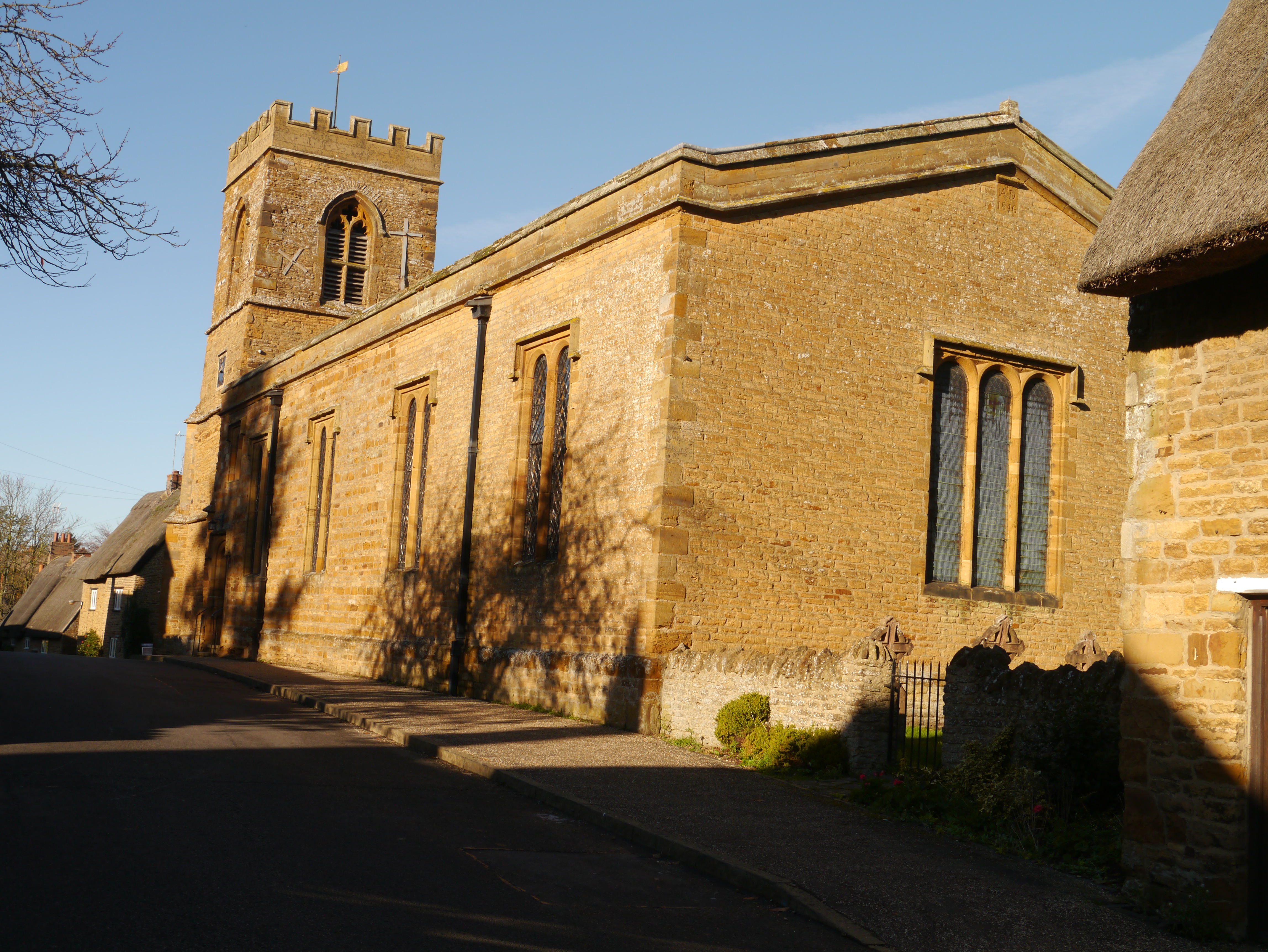
St John the Baptist's Church, Boughton
St John the Baptist's Church is an Anglican Church and the parish church of Boughton. It is a Grade II listed building and stands on the east side of Church...

Boughton, Northamptonshire
Boughton is a village and civil parish in West Northamptonshire, England. It is situated approximately 4 miles (6 km) from Northampton town centre along...

Northamptonshire Football Association
The Northamptonshire Football Association, also simply known as the Northamptonshire FA, is the governing body of football in the English county of Northamptonshire...
White Hills, Northamptonshire
White Hills is a residential district of the town of Northampton, England. It is at the northern limits of the town, north of Kingsthorpe and between the...

Boughton railway station
Boughton is the name of station under construction on the Northampton & Lamport Railway, which is built on the former Northampton to Market Harborough...
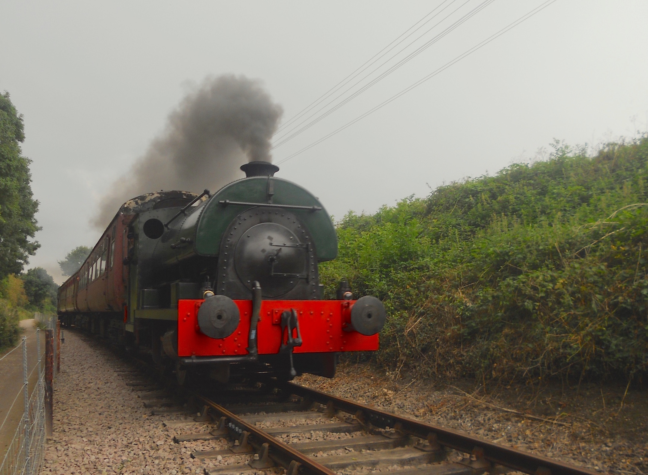
Northampton and Lamport Railway
The Northampton and Lamport Railway is a standard gauge heritage railway in Northamptonshire, England. It is based at Pitsford and Brampton station, near...

Holy Family of Nazareth Convent School
Holy Family of Nazareth Convent School was a girls school in Pitsford Hall in the village of Pitsford, Northamptonshire, England. The convent school was...

Pitsford and Brampton railway station
Pitsford and Brampton railway station is a railway station serving the villages of Pitsford and Chapel Brampton in Northamptonshire, England. The station...
Nearby Amenities
Located within 500m of 52.286542,-0.898751Have you been to Boughton?
Leave your review of Boughton below (or comments, questions and feedback).