Alderminster

Settlement in Warwickshire Stratford-on-Avon

England

Alderminster

The Bell on Shipston Road, Alderminster
The Bell on Shipston Road, Alderminster Credit: David Howard

Alderminster is a small village located in the county of Warwickshire, England. Situated approximately 5 miles south of the historic town of Stratford-upon-Avon, Alderminster is nestled amidst the picturesque countryside of the beautiful Cotswolds.

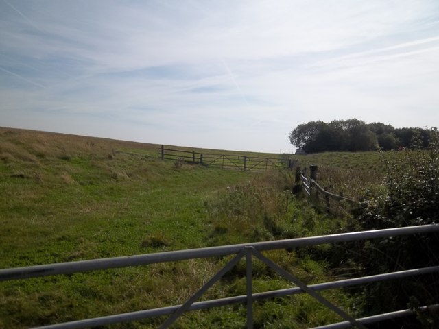
The village is home to a population of around 500 residents and is renowned for its charming and idyllic setting. Surrounded by rolling hills, meandering rivers, and lush green fields, Alderminster offers a peaceful and tranquil atmosphere that attracts both locals and visitors alike.

The village boasts a rich history, with evidence of settlements dating back to Roman times. The centerpiece of Alderminster is its historic church, St. Mary and Holy Cross, which dates back to the 12th century. This stunning medieval church is a prominent feature of the village and attracts those interested in architecture and history.

Although predominantly a residential area, Alderminster offers a range of amenities for its residents. There is a village hall that hosts various community events and activities, providing a hub for social gatherings. Additionally, the village is home to a traditional pub, providing a cozy and welcoming spot for locals and visitors to enjoy a drink or a meal.

Alderminster's location makes it an ideal base for exploring the surrounding areas, including Stratford-upon-Avon and the Cotswolds. The village's close proximity to major transport links ensures easy access to nearby towns and cities, making it a convenient and desirable place to live or visit.

If you have any feedback on the listing, please let us know in the comments section below.

Alderminster Images

Images are sourced within 2km of 52.136452/-1.663859 or Grid Reference SP2348. Thanks to Geograph Open Source API. All images are credited.

The Bell on Shipston Road, Alderminster
Expedition Campers, Alderminster This was a Peugeot dealer a few years ago.
Expedition Campers, Alderminster
This was a Peugeot dealer a few years ago.
Shipston Road, Alderminster
Wimpstone Lane Wimpstone Lane with Meon Hill visible in the distance.
Wimpstone Lane
Wimpstone Lane with Meon Hill visible in the distance.
Barn at Talton The barn is now used as living accommodation by Talton Lodge.  The barn is late 18th century and is a grade II listed building.  On the opposite side of the road is the entrance driveway to Talton House with its impressive gateposts.
Barn at Talton
The barn is now used as living accommodation by Talton Lodge. The barn is late 18th century and is a grade II listed building. On the opposite side of the road is the entrance driveway to Talton House with its impressive gateposts.
Talton House Seen, across the fields from the minor road.  The house is late 17th century with 18th century additions and is a Grade II listed building.
Talton House
Seen, across the fields from the minor road. The house is late 17th century with 18th century additions and is a Grade II listed building.
Talton Lodge The lodge now offers accommodation in various forms.
Talton Lodge
The lodge now offers accommodation in various forms.
Track to Talton Farm Seen from the minor road.
Track to Talton Farm
Seen from the minor road.
Road to Crimscote Some magnificent trees line the road.
Road to Crimscote
Some magnificent trees line the road.
Crimscote Hill House [1] This property replaced an earlier house on the prominent site.  In my opinion the new house is showy and its size is out of keeping with its surroundings.
Crimscote Hill House [1]
This property replaced an earlier house on the prominent site. In my opinion the new house is showy and its size is out of keeping with its surroundings.
River Stour view Seen from the minor road, the view is of the River Stour with Barton Farm in the distance.
River Stour view
Seen from the minor road, the view is of the River Stour with Barton Farm in the distance.
Country road junction Behind the camera to Newbold-on-Stour, right to Wimpstone, left to Admington.
Country road junction
Behind the camera to Newbold-on-Stour, right to Wimpstone, left to Admington.
Manor Farm Cottages These attractive cottages are adjacent to the farm.
Manor Farm Cottages
These attractive cottages are adjacent to the farm.
Driveway to Manor Farm Some replacement fencing has recently been erected.
Driveway to Manor Farm
Some replacement fencing has recently been erected.
Crimscote Hill Seen from the minor road.
Crimscote Hill
Seen from the minor road.
Manor Farmhouse A new farmhouse at Manor Farm.
Manor Farmhouse
A new farmhouse at Manor Farm.
Power line junction The pole carries a pole transformer to provide reticulation to local properties.
Power line junction
The pole carries a pole transformer to provide reticulation to local properties.
Crimscote Fields Farm [1] Seen from the minor road.
Crimscote Fields Farm [1]
Seen from the minor road.
Show me another place!

Alderminster is located at Grid Ref: SP2348 (Lat: 52.136452, Lng: -1.663859)

Administrative County: Warwickshire

District: Stratford-on-Avon

Police Authority: Warwickshire

What 3 Words

///bends.affair.towel. Near Eattington, Warwickshire

Nearby Locations

Alderminster

Related Wikis

Nearby Amenities

Located within 500m of 52.136452,-1.663859
Alderminster
Place: village
Wikidata: Q2792303
Wikipedia: en:Alderminster
Lat/Long: 52.1359122/-1.6663278
Bus Stop
Church
Bus: yes
Naptan AtcoCode: 4200F001200
Naptan Bearing: SE
Naptan CommonName: Church
Naptan Indicator: Opp
Naptan NaptanCode: wardgwdt
Naptan Street: Shipston Road
Naptan Verified: no
Public Transport: platform
Source: naptan_import
Lat/Long: 52.1365425/-1.665562
Bus Stop
Church
Bus: yes
Naptan AtcoCode: 4200F001201
Naptan Bearing: NW
Naptan CommonName: Church
Naptan Indicator: Adj
Naptan NaptanCode: wardjdtm
Naptan Street: Shipston Road
Naptan Verified: no
Public Transport: platform
Source: naptan_import
Lat/Long: 52.1364846/-1.6657389
Bus Stop
Bell
Bus: yes
Naptan AtcoCode: 4200F157102
Naptan Bearing: NW
Naptan CommonName: Bell
Naptan Indicator: Nr
Naptan Landmark: Bell
Naptan NaptanCode: warajapa
Naptan Street: Shipston Road
Naptan Verified: no
Public Transport: platform
Source: naptan_import
Lat/Long: 52.1377893/-1.6683898
Turning Circle
Source: Warwicks CC Aerial Imagery 2013
Lat/Long: 52.1373273/-1.6645147
Post Box
Collection Times: Mo-Fr 16:45; Sa 09:00
Operator: Royal Mail
Operator Wikidata: Q638098
Post Box Type: lamp
Ref: CV37 54
Royal Cypher: EIIR
Royal Cypher Wikidata: Q33102113
Source: survey
Lat/Long: 52.136532/-1.6657955
Generator Method: photovoltaic
Generator Output Electricity: yes
Generator Source: solar
Generator Type: solar_photovoltaic_panel
Power: generator
Lat/Long: 52.1358078/-1.6630028
Generator Method: photovoltaic
Generator Output Electricity: yes
Generator Source: solar
Generator Type: solar_photovoltaic_panel
Power: generator
Lat/Long: 52.1350685/-1.6636061
Generator Method: photovoltaic
Generator Output Electricity: yes
Generator Source: solar
Generator Type: solar_photovoltaic_panel
Power: generator
Lat/Long: 52.1350385/-1.6633345
Generator Method: photovoltaic
Generator Output Electricity: yes
Generator Source: solar
Generator Type: solar_photovoltaic_panel
Power: generator
Lat/Long: 52.1380463/-1.6678403
Telephone
Booth: K6
Covered: booth
Operator: BT
Phone: +44 1789 450220
Lat/Long: 52.1362894/-1.6641182
Power: pole
Ref: 774517
Source: wpd_opendata
Transformer: distribution
Lat/Long: 52.1379743/-1.6697489
Power: pole
Source: bing
Lat/Long: 52.1379232/-1.6707373
Power: pole
Source: bing
Lat/Long: 52.1370408/-1.6710484
Power: pole
Source: bing
Lat/Long: 52.1337779/-1.6652792
Power: pole
Source: bing
Lat/Long: 52.1333135/-1.66454
Power: pole
Source: bing
Lat/Long: 52.1328015/-1.6635624
Power: pole
Source: bing
Lat/Long: 52.1324615/-1.6626853
Power: pole
Ref: 774510
Source: wpd_opendata
Transformer: distribution
Lat/Long: 52.1323528/-1.6621287
Power: pole
Ref: 774509
Source: wpd_opendata
Transformer: distribution
Lat/Long: 52.1337292/-1.6648136
Power: pole
Source: bing
Lat/Long: 52.1338181/-1.6656639
Power: pole
Source: bing
Lat/Long: 52.134131/-1.6662768
Power: pole
Source: bing
Lat/Long: 52.1347171/-1.6674301
Power: pole
Source: bing
Lat/Long: 52.1352949/-1.6685633
Power: pole
Source: bing
Lat/Long: 52.1358753/-1.6697127
Power: pole
Source: bing
Lat/Long: 52.1368363/-1.6669419
Power: pole
Source: bing
Lat/Long: 52.136675/-1.6682495
Power: pole
Source: bing
Lat/Long: 52.1364766/-1.6697221
Power: pole
Source: bing
Lat/Long: 52.1363012/-1.6704932
Power: pole
Ref: 774512
Source: wpd_opendata
Transformer: distribution
Lat/Long: 52.1353073/-1.6628704
Power: pole
Source: bing
Lat/Long: 52.1359658/-1.6619638
Power: pole
Source: bing
Lat/Long: 52.1364663/-1.6616258
Power: pole
Source: bing
Lat/Long: 52.1383348/-1.6658758
Power: pole
Source: bing
Lat/Long: 52.1380895/-1.6653635
Power: pole
Ref: 774514
Source: wpd_opendata
Transformer: distribution
Lat/Long: 52.1378689/-1.6592293
Power: pole
Source: bing
Lat/Long: 52.1374277/-1.6602471
Power: pole
Source: bing
Lat/Long: 52.136961/-1.6612905
Power: pole
Source: bing
Lat/Long: 52.1369956/-1.6626142
Power: pole
Source: bing
Lat/Long: 52.1369972/-1.6634162
Power: pole
Ref: 774515
Source: wpd_opendata
Transformer: distribution
Lat/Long: 52.1371692/-1.6637675
Power: pole
Source: bing
Lat/Long: 52.1375833/-1.6643201
Power: pole
Source: bing
Lat/Long: 52.1386525/-1.6665731
Power: pole
Source: bing
Lat/Long: 52.1389571/-1.6680014
Power: pole
Source: bing
Lat/Long: 52.139339/-1.6691977
The data included in this document is from www.openstreetmap.org. The data is made available under ODbL.

Have you been to Alderminster?

Leave your review of Alderminster below (or comments, questions and feedback).