Boltons

Civil Parish in Cumberland Allerdale

England

Boltons

The north slopes of Sandale Hill
The north slopes of Sandale Hill Credit: David Purchase

Boltons is a civil parish located in the county of Cumberland, England. Situated in the picturesque Lake District National Park, it is surrounded by stunning natural beauty and offers a tranquil and idyllic setting.

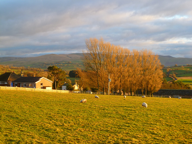
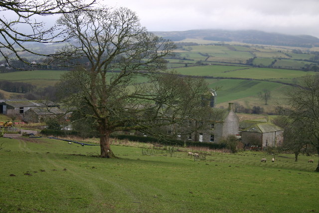
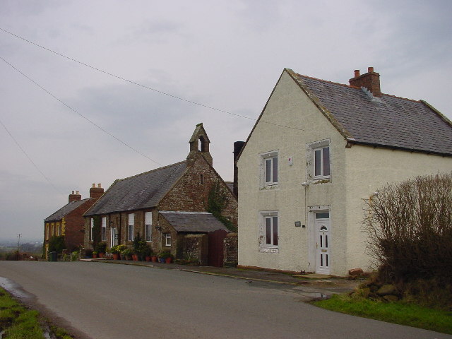
The parish covers an area of approximately 10 square kilometers and is home to a small population. The village of Boltons itself is charming and retains its traditional character with its stone-built houses and quaint streets. The local community is close-knit and friendly, with a strong sense of pride in their rural heritage.

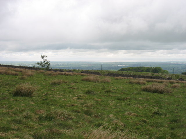
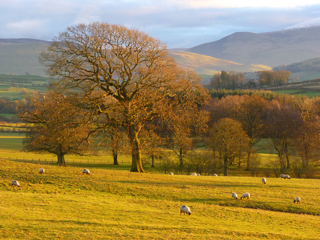
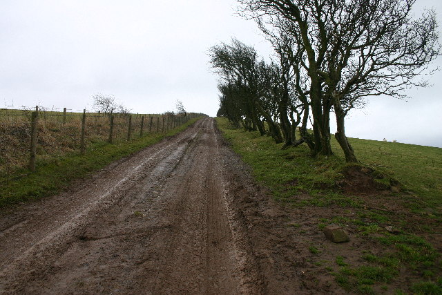
The landscape of Boltons is dominated by rolling hills, lush green fields, and scattered woodlands. The area is renowned for its scenic walks and hiking trails, attracting outdoor enthusiasts and nature lovers. The nearby fells and mountains provide breathtaking views and opportunities for activities such as mountain biking, climbing, and bird watching.

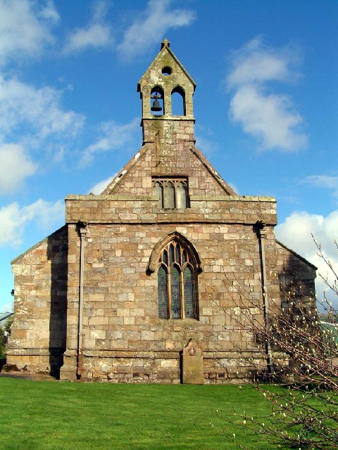
Boltons is also rich in history, with evidence of human settlement dating back to the Roman times. The parish boasts several historic landmarks, including St. Michael's Church, a beautiful medieval structure that adds to the charm of the village.

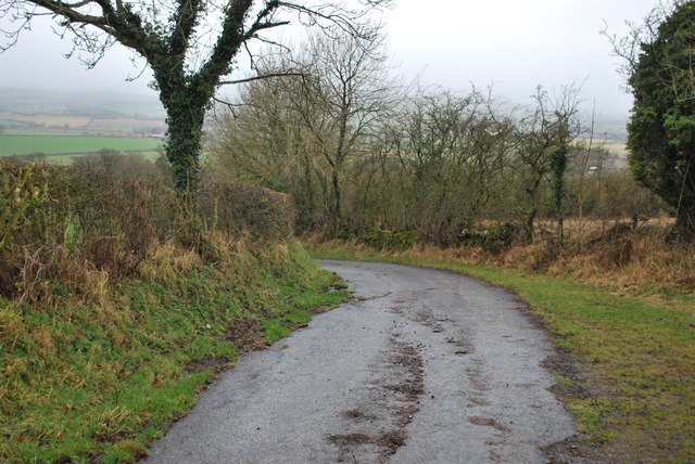
Although small in size, Boltons offers a range of amenities and services for its residents and visitors. There are local shops, pubs, and cafes, providing essential goods and a place to socialize. The parish also benefits from good transport links, connecting it to nearby towns and cities.

In summary, Boltons is a tranquil and picturesque civil parish in Cumberland, with a close-knit community, stunning natural surroundings, and a rich history. It is an ideal destination for those seeking a peaceful retreat in the heart of the Lake District.

If you have any feedback on the listing, please let us know in the comments section below.

Boltons Images

Images are sourced within 2km of 54.751964/-3.171767 or Grid Reference NY2440. Thanks to Geograph Open Source API. All images are credited.

The north slopes of Sandale Hill
Looking up Carlisegate Lane Lane going North away from Boltongate.
Looking up Carlisegate Lane
Lane going North away from Boltongate.
Lane leading away from Boltongate
Lane North of Boltongate looking back towards Boltongate
Disused Quarry North of Boltongate The grass clearing leads up to the disused quarry shown on the OS map.
Disused Quarry North of Boltongate
The grass clearing leads up to the disused quarry shown on the OS map.
Headend Quarry at Sandale Cumbria This disused quarry is now an excellent place to practise rock climbing and enjoy the 360 degree views of the Solway Coast and Northern Fells of the Lake District National Park.
Headend Quarry at Sandale Cumbria
This disused quarry is now an excellent place to practise rock climbing and enjoy the 360 degree views of the Solway Coast and Northern Fells of the Lake District National Park.
Pasture, Boltons A view from the road to the east of Boltongate. Bakestall is the small peak in the background, just below Skiddaw's snow-line.
Pasture, Boltons
A view from the road to the east of Boltongate. Bakestall is the small peak in the background, just below Skiddaw's snow-line.
Pasture, Boltons With evening sunshine picking out the Caldbeck Fells.
Pasture, Boltons
With evening sunshine picking out the Caldbeck Fells.
Pasture, Boltons A view towards the Caldbeck Fells from Boltongate.
Pasture, Boltons
A view towards the Caldbeck Fells from Boltongate.
Boltongate Church This little church  looks very similar to small parish churches across Cumbria, but is unique, possessing the only stone tunnel-vaulted church roof in England.
Boltongate Church
This little church looks very similar to small parish churches across Cumbria, but is unique, possessing the only stone tunnel-vaulted church roof in England.
Pow Gill Overgrown and difficult to see from the road.
Pow Gill
Overgrown and difficult to see from the road.
Catlands Hill Looking north, over the Solway Plain.
Catlands Hill
Looking north, over the Solway Plain.
Headend Quarry Also known as Sandale Quarry, this has become a designated County Wildlife Site. A joint initiative has implemented cleaning up vandalism and fly tipping and erecting seating and information boards. Interesting wildflowers are found here, along with a wide range of birds.
Headend Quarry
Also known as Sandale Quarry, this has become a designated County Wildlife Site. A joint initiative has implemented cleaning up vandalism and fly tipping and erecting seating and information boards. Interesting wildflowers are found here, along with a wide range of birds.
Track to Powhead Plantation The ancient hedge and dyke to the right is replaced by modern wire on the left.
Track to Powhead Plantation
The ancient hedge and dyke to the right is replaced by modern wire on the left.
Ellen Bank Farm
Ellen Bank Farm
Carlislegate Lane Mis-spelt on OS map. Connects Boltongate with Carlislegate.
Carlislegate Lane
Mis-spelt on OS map. Connects Boltongate with Carlislegate.
Farm track and footpath. Coy farmer did not know of a footpath up here?
Farm track and footpath.
Coy farmer did not know of a footpath up here?
Catlands Hill A view towards Knott Great Calva and Skiddaw.
Catlands Hill
A view towards Knott Great Calva and Skiddaw.
Show me another place!

Boltons is located at Grid Ref: NY2440 (Lat: 54.751964, Lng: -3.171767)

Administrative County: Cumbria

District: Allerdale

Police Authority: Cumbria

What 3 Words

///songbook.boost.asks. Near Wigton, Cumbria

Related Wikis

Boltons

Boltons is a civil parish in Cumbria, England. According to the 2001 census it had a population of 585, increasing to 629 at the 2011 Census. Settlements...

Ireby, Cumbria

Ireby is a village in Cumbria, England with a population of around 180. Between 1974 and 2023, it was in Allerdale district, Cumbria. Since April 2023...

All Saints Church, Boltongate

All Saints' Church is in the village of Boltongate, Cumbria, England. It is an active Anglican parish church in the deanery of Solway, the archdeaconry...

Boltongate

Boltongate is a village in Cumbria, England. It is situated about 10 miles (16 km) north-east of Cockermouth. It is located just outside the Lake District...

Sandale transmitting station

The Sandale transmitting station is the main radio transmitting station for the county of Cumbria, including the Lake District, and eastern Dumfries and...

Ireby Old Church

Ireby Old Church is a redundant Anglican church, of which only the chancel remains. It stands in an isolated position 1 mile (2 km) to the west of the...

Aughertree

Aughertree ( AF-ər-tree) is a village in northern Cumbria, England. It is situated near to the villages of Caldbeck and Torpenhow, but closer to the main...

Ireby and Uldale

Ireby and Uldale is a civil parish in the English county of Cumbria forming part of the district of Allerdale. The population, including Bewaldeth and...

Nearby Amenities

Located within 500m of 54.751964,-3.171767
Post Box
Ref: CA7 384
Lat/Long: 54.7518535/-3.1701714
Sandale
Place: hamlet
Lat/Long: 54.7523495/-3.169506
Power: pole
Lat/Long: 54.7484059/-3.1680951
Power: pole
Lat/Long: 54.7488676/-3.1691234
Power: pole
Lat/Long: 54.7493316/-3.1701279
Power: pole
Lat/Long: 54.7498768/-3.1713826
Power: pole
Lat/Long: 54.750441/-3.1726826
Power: pole
Lat/Long: 54.750299/-3.1703615
Power: pole
Lat/Long: 54.750713/-3.1693839
Power: pole
Lat/Long: 54.7509909/-3.1739228
Power: pole
Lat/Long: 54.7514311/-3.1749356
Power: pole
Lat/Long: 54.7518593/-3.1759173
Power: pole
Lat/Long: 54.7523031/-3.1769074
Power: pole
Lat/Long: 54.7528446/-3.1781289
The data included in this document is from www.openstreetmap.org. The data is made available under ODbL.

Have you been to Boltons?

Leave your review of Boltons below (or comments, questions and feedback).