Bolstone

Civil Parish in Herefordshire

England

Bolstone

River Wye near Shepherd's Rough Looking north-east at the sweeping bend with Haugh Wood on the horizon. A tranquil scene on an August evening.
River Wye near Shepherd's Rough Credit: Trevor Rickard

Bolstone is a civil parish located in the county of Herefordshire, in the West Midlands region of England. It is situated approximately 14 kilometers southwest of the city of Hereford, the county town. The parish covers an area of about 6 square kilometers and has a population of around 150 residents.

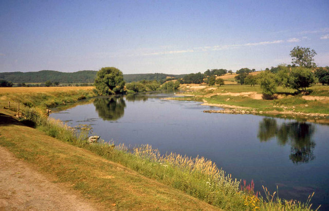
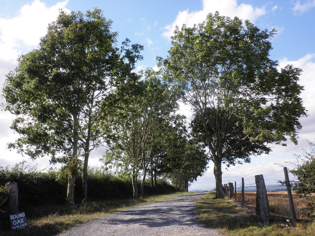
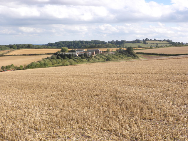
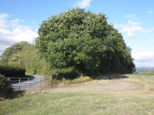
Bolstone is a predominantly rural area, characterized by its picturesque countryside landscapes and charming traditional architecture. The parish is surrounded by rolling hills, lush green fields, and meandering streams, creating a serene and idyllic setting. The Herefordshire Trail, a popular walking route, passes through Bolstone, offering visitors the opportunity to explore the area's natural beauty.

In terms of amenities, Bolstone is a small and close-knit community. It has a village hall that serves as a gathering place for local events and social activities. However, there are limited facilities within the parish itself, with residents typically relying on nearby towns for services such as schools, shops, and healthcare.

Historically, Bolstone was part of the ancient manor of Dewsall, mentioned in the Domesday Book of 1086. The parish's name is derived from the Old English words "bol" meaning house or dwelling, and "stan" meaning stone, suggesting a settlement with stone-built houses.

Overall, Bolstone offers a tranquil and scenic countryside experience, making it an attractive destination for nature lovers and those seeking a peaceful retreat away from the hustle and bustle of urban life.

If you have any feedback on the listing, please let us know in the comments section below.
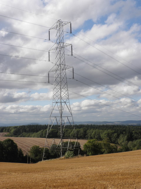
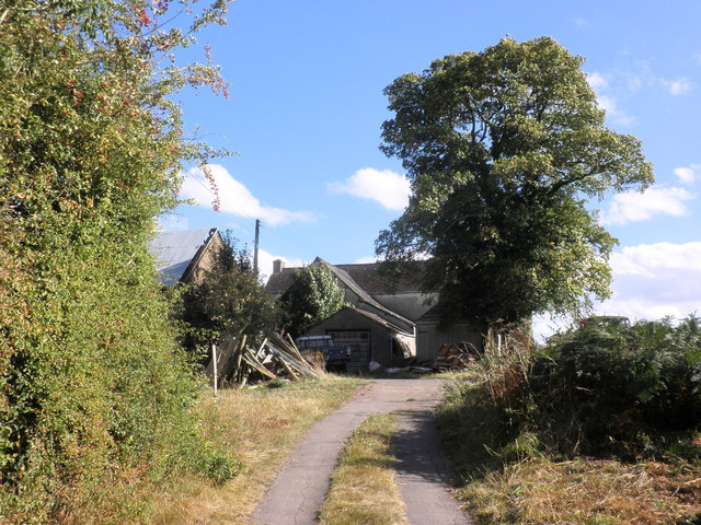
Bolstone Images

Images are sourced within 2km of 51.991461/-2.662034 or Grid Reference SO5432. Thanks to Geograph Open Source API. All images are credited.

River Wye near Shepherd's Rough Looking north-east at the sweeping bend with Haugh Wood on the horizon. A tranquil scene on an August evening.
River Wye near Shepherd's Rough
Looking north-east at the sweeping bend with Haugh Wood on the horizon. A tranquil scene on an August evening.
Thatched cottage, Bogmarsh
Upper Bogmarsh
Upper Bogmarsh
Track to Ramsden Farm
View towards Billingsley
Newtown Grove
Newtown Grove
Electricity pylon, near Newtown
Canondale Farm
Canondale Farm
Barns at Bolstone Court The farmhouse is being renovated and the barns will follow. Work was in progress on the day of my visit. The guys kindly let me into the churchyard next door.
Barns at Bolstone Court
The farmhouse is being renovated and the barns will follow. Work was in progress on the day of my visit. The guys kindly let me into the churchyard next door.
Bolstone Court The 17th  century farmhouse is being skilfully renovated. The disused church of St John of Jerusalem peeps over the wall beyond the farmyard.
Bolstone Court
The 17th century farmhouse is being skilfully renovated. The disused church of St John of Jerusalem peeps over the wall beyond the farmyard.
St John of Jerusalem, Bolstone The 17th century Bolstone Court farmhouse is being skilfully renovated. The east end of the disused church of St John of Jerusalem peeps over the wall beyond the farmyard.
St John of Jerusalem, Bolstone
The 17th century Bolstone Court farmhouse is being skilfully renovated. The east end of the disused church of St John of Jerusalem peeps over the wall beyond the farmyard.
St John of Jerusalem, Bolstone Disused in an impenetrable overgrown church yard. The orthodox entrance on the North side is swathed in barbed wire. Restored heavily in 1876-7 by William Martin, the church still shows some notable ancient features. I gained access through the kindness of the builder restoring the adjacent Bolstone Court.
St John of Jerusalem, Bolstone
Disused in an impenetrable overgrown church yard. The orthodox entrance on the North side is swathed in barbed wire. Restored heavily in 1876-7 by William Martin, the church still shows some notable ancient features. I gained access through the kindness of the builder restoring the adjacent Bolstone Court.
St John of Jerusalem, Bolstone Disused in an impenetrable overgrown church yard. The orthodox entrance on the North side is swathed in barbed wire, but there is an easier way in of the South side. Restored heavily in 1876-7 by William Martin, the church still shows some notable ancient features. I gained access via a gate to the East through the kindness of the builder restoring the adjacent Bolstone Court.
St John of Jerusalem, Bolstone
Disused in an impenetrable overgrown church yard. The orthodox entrance on the North side is swathed in barbed wire, but there is an easier way in of the South side. Restored heavily in 1876-7 by William Martin, the church still shows some notable ancient features. I gained access via a gate to the East through the kindness of the builder restoring the adjacent Bolstone Court.
St John of Jerusalem Disused in an impenetrable overgrown church yard. The orthodox entrance on the North side is swathed in barbed wire. Restored heavily in 1876-7 by William Martin, the church still shows some notable ancient features, such as the blocked North Norman doorway.
St John of Jerusalem
Disused in an impenetrable overgrown church yard. The orthodox entrance on the North side is swathed in barbed wire. Restored heavily in 1876-7 by William Martin, the church still shows some notable ancient features, such as the blocked North Norman doorway.
Three in a Row, Bolstone The church of St John of Jerusalem is disused in an impenetrable overgrown church yard. The orthodox entrance on the North side is swathed in barbed wire. Restored heavily in 1876-7 by William Martin, the church still shows some notable ancient features and some interesting churchyard memorials.
Three in a Row, Bolstone
The church of St John of Jerusalem is disused in an impenetrable overgrown church yard. The orthodox entrance on the North side is swathed in barbed wire. Restored heavily in 1876-7 by William Martin, the church still shows some notable ancient features and some interesting churchyard memorials.
St John of Jerusalem, Bolstone The church of St John of Jerusalem is disused in an impenetrable overgrown church yard. The orthodox entrance on the North side is swathed in barbed wire. Restored heavily in 1876-7 by William Martin, the church still shows some notable ancient features such as this ogee-headed 14th century window on the South side of the chancel.
St John of Jerusalem, Bolstone
The church of St John of Jerusalem is disused in an impenetrable overgrown church yard. The orthodox entrance on the North side is swathed in barbed wire. Restored heavily in 1876-7 by William Martin, the church still shows some notable ancient features such as this ogee-headed 14th century window on the South side of the chancel.
Lower Bolstone Wood The morning frost lingers on the shaded section of the crop.
I last photographed this woodland edge in July 2008 - <a href="https://www.geograph.org.uk/photo/877994">SO5533 : View to Lower Bolstone Wood</a>.
Lower Bolstone Wood
The morning frost lingers on the shaded section of the crop. I last photographed this woodland edge in July 2008 - SO5533 : View to Lower Bolstone Wood.
Colourful woodland, Bolstone Lane, 1 Looking east along the lane in a colourful late-November 2013.
Colourful woodland, Bolstone Lane, 1
Looking east along the lane in a colourful late-November 2013.
Show me another place!

Bolstone is located at Grid Ref: SO5432 (Lat: 51.991461, Lng: -2.662034)

Unitary Authority: County of Herefordshire

Police Authority: West Mercia

What 3 Words

///pampered.hunches.legs. Near Much Birch, Herefordshire

Related Wikis

Bolstone

Bolstone is a village and civil parish in Herefordshire, England, 9 km (5.6 mi) south of Hereford. According to the 2001 census, it had a population of...

Little Dewchurch

Little Dewchurch Welsh: Llanddewi is a village in Herefordshire, England. The population of the village was 402 as taken at the 2011 census. == Etymology... ==
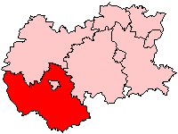
South Herefordshire

South Herefordshire was one of nine local government districts of the English county of Hereford and Worcester from 1974 to 1998. == History == South Herefordshire...

Ballingham railway station

Ballingham railway station is a disused stone built railway station that served the villages of Ballingham and Carey in Herefordshire on the Hereford,...

Nearby Amenities

Located within 500m of 51.991461,-2.662034
Power: pole
Lat/Long: 51.9886851/-2.6671578
Power: pole
Lat/Long: 51.9892252/-2.6659669
The Moors Bolstone
Power: pole
Transformer: distribution
Voltage Primary: 11000
Lat/Long: 51.9888618/-2.6646707
Power: pole
Lat/Long: 51.989129/-2.6649054
Power: pole
Lat/Long: 51.9894127/-2.6651596
Power: pole
Lat/Long: 51.9895854/-2.6643991
Power: pole
Lat/Long: 51.995567/-2.662647
Power: pole
Lat/Long: 51.9946281/-2.6628052
Power: pole
Lat/Long: 51.9937194/-2.6629427
Power: pole
Lat/Long: 51.9928102/-2.6630875
Power: pole
Lat/Long: 51.9920678/-2.6631922
Glenside
Power: pole
Transformer: distribution
Voltage Primary: 11000
Lat/Long: 51.9915054/-2.6632746
Power: pole
Lat/Long: 51.9907654/-2.6633926
Power: pole
Lat/Long: 51.9898516/-2.6635214
Power: pole
Lat/Long: 51.9897988/-2.6634597
Power: pole
Lat/Long: 51.9901461/-2.6625089
Power: pole
Lat/Long: 51.9904979/-2.6614782
Power: pole
Lat/Long: 51.9907737/-2.6606601
Power: pole
Lat/Long: 51.9908468/-2.6589315
Power: pole
Lat/Long: 51.9909083/-2.6574616
Power: pole
Lat/Long: 51.9909773/-2.6558463
Power: pole
Lat/Long: 51.9909983/-2.655334
The data included in this document is from www.openstreetmap.org. The data is made available under ODbL.

Have you been to Bolstone?

Leave your review of Bolstone below (or comments, questions and feedback).