Bold
Civil Parish in Lancashire St. Helens
England
Bold

Bold is a civil parish located in the county of Lancashire, England. It is situated approximately 2 miles east of the town of St Helens and lies within the Metropolitan Borough of St Helens. The parish covers an area of around 1.5 square miles and has a population of approximately 2,000 residents.
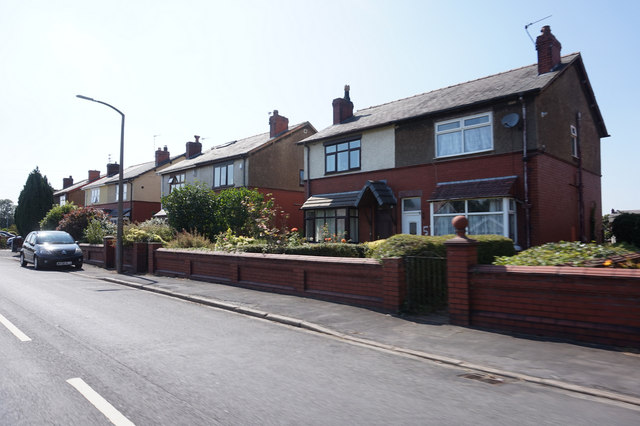
Bold is a predominantly residential area with a mix of housing types, including detached houses, semi-detached houses, and terraced houses. The architecture in the parish varies, with some properties dating back to the Victorian era, while others are more modern in design.
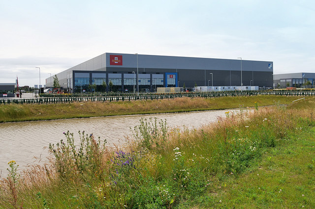
The parish is well-connected to surrounding areas by road, with the A570 passing through the area, providing access to nearby towns such as St Helens, Wigan, and Liverpool. Additionally, there are several bus services that serve the parish, providing convenient transportation options for residents.
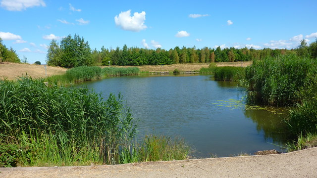
Bold is home to several amenities and facilities, including a primary school, a community center, and a local pub. The area is also surrounded by green spaces, such as Bold Forest Park, which offers opportunities for outdoor activities and nature exploration.
Overall, Bold is a peaceful and pleasant residential area, offering a range of amenities and convenient transport links. Its proximity to larger towns and cities makes it an attractive place to live for those looking for a quieter suburban lifestyle while still having access to urban amenities.
If you have any feedback on the listing, please let us know in the comments section below.
Bold Images
Images are sourced within 2km of 53.409955/-2.694744 or Grid Reference SJ5390. Thanks to Geograph Open Source API. All images are credited.


Bold is located at Grid Ref: SJ5390 (Lat: 53.409955, Lng: -2.694744)
Administrative County: Merseyside
District: St. Helens
Police Authority: Merseyside
What 3 Words
///locked.prove.forwarded. Near Burtonwood, Cheshire
Nearby Locations
Related Wikis

Clock Face, St Helens
Clock Face is a village and area of St Helens, England, 5.6 km (3.5 mi) south of the town centre. It is a ward within the Metropolitan Borough of St Helens...
Bold Heath
Bold Heath is a hamlet and rural area in the civil parish of Bold in St Helens, Merseyside. Historically part of Lancashire, Bold Heath lies on the A57...

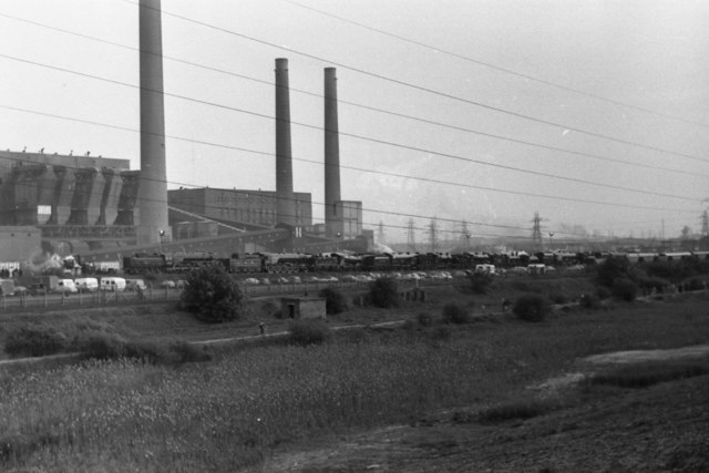
Clock Face railway station
Clock Face railway station served the colliery village of Clock Face south of St Helens, England. The station was on the southern section of the St Helens...
Bold, St Helens
Bold is a civil parish in the Metropolitan Borough of St Helens in Merseyside, England. Bold itself is situated to the south east of St Helens, near to...
Union Bank Farm Halt railway station
Union Bank Farm Halt railway station was on the southern section of the St Helens and Runcorn Gap line of the London and North Western Railway. == History... ==
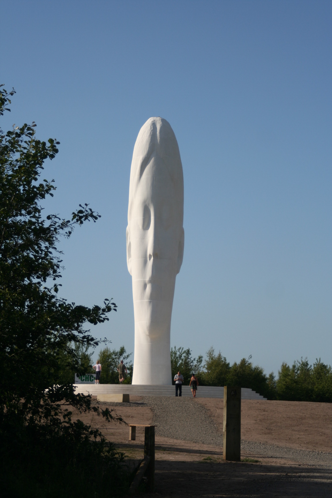
Dream (sculpture)
Dream is a 2009 sculpture and a piece of public art by Jaume Plensa in Sutton, St Helens, Merseyside. Costing approximately £1.8m (equivalent to £2.57...
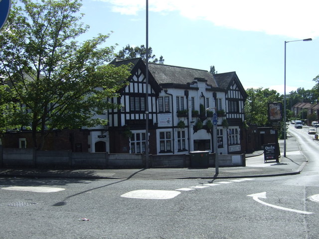
The Wheatsheaf, St Helens
The Wheatsheaf is a public house at Mill Lane, St Helens, Merseyside WA9 4HN, England. It was built in 1936–1938 by the brewery Greenall Whitley & Co....
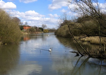
Sutton Mill Dam
The Sutton Mill Dam is a wildlife nature park and area of open water located in Sutton in the south of St Helens in Merseyside, England. Sandwiched between...
Nearby Amenities
Located within 500m of 53.409955,-2.694744Have you been to Bold?
Leave your review of Bold below (or comments, questions and feedback).