Bobbing
Civil Parish in Kent Swale
England
Bobbing

Bobbing is a civil parish located in the Swale district of Kent, England. It is situated approximately 2 miles south of Sittingbourne and covers an area of around 4 square miles. The parish is predominantly rural, with a population of just over 1,100 residents.
Bobbing is a historic village, mentioned in the Domesday Book of 1086. The village has a rich heritage, with several listed buildings dating back to the medieval period. One of the notable landmarks is the Church of St. Bartholomew, a Grade I listed building that dates back to the 12th century. The church features a Norman doorway and a 14th-century tower, making it an important historical site.
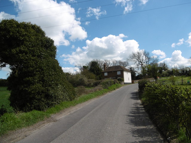
The village is surrounded by picturesque countryside, with fields and farmland stretching out in all directions. The landscape is dotted with small cottages and farmhouses, giving the area a charming and traditional feel. Agriculture plays a significant role in the local economy, with many residents involved in farming and livestock rearing.
Bobbing benefits from its proximity to Sittingbourne, a larger town that offers a range of amenities and services. The village itself has a primary school, a village hall, and a local pub, providing essential facilities for the community. There are also several walking and cycling routes in the area, allowing residents and visitors to explore the beautiful countryside.
Overall, Bobbing is a small and peaceful parish with a strong sense of history and a close-knit community. It offers a tranquil rural lifestyle while still providing easy access to nearby towns and amenities.
If you have any feedback on the listing, please let us know in the comments section below.
Bobbing Images
Images are sourced within 2km of 51.357299/0.704378 or Grid Reference TQ8865. Thanks to Geograph Open Source API. All images are credited.


Bobbing is located at Grid Ref: TQ8865 (Lat: 51.357299, Lng: 0.704378)
Administrative County: Kent
District: Swale
Police Authority: Kent
What 3 Words
///drain.confining.parts. Near Newington, Kent
Nearby Locations
Related Wikis

Bobbing, Kent
Bobbing is a village and civil parish in the Swale district of Kent, England, about a mile north-west of Sittingbourne, and forming part of its urban area...

Keycol
Keycol is a village near Sittingbourne in Kent, England. At the 2011 Census the population of the village was recorded in the civil parish of Bobbing....
Westlands School, Sittingbourne
Westlands School is a coeducational secondary school and sixth form with academy status, located in Sittingbourne in the English county of Kent.Previously...

A249 road
The A249 is a road in Kent, England, running from Maidstone to Sheerness on the Isle of Sheppey. It mainly functions as a link between the M2 and M20 motorways...
Sittingbourne and Milton Urban District
Sittingbourne and Milton was an urban district in Kent, England, consisting of the settlements of Sittingbourne and Milton Regis. It was abolished in...
Chestnut Street, Kent
Chestnut Street is a settlement to the west of Sittingbourne in the Borough of Swale, Kent, England. It is located on the former A249 road alignment, between...
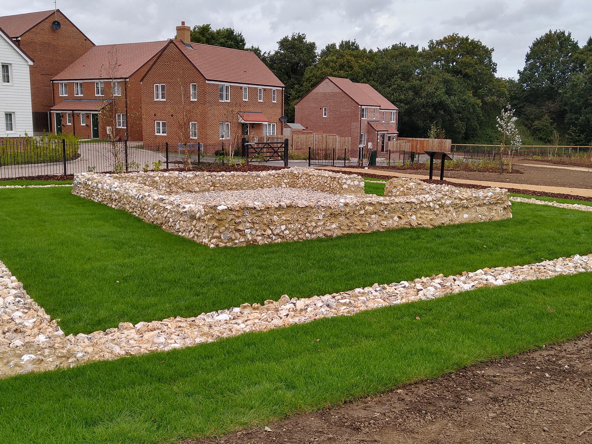
Watling Temple
Watling Temple is the name given to the temple within a Roman town next to the modern A2 road in Newington, near Sittingbourne in Kent, England.The town...
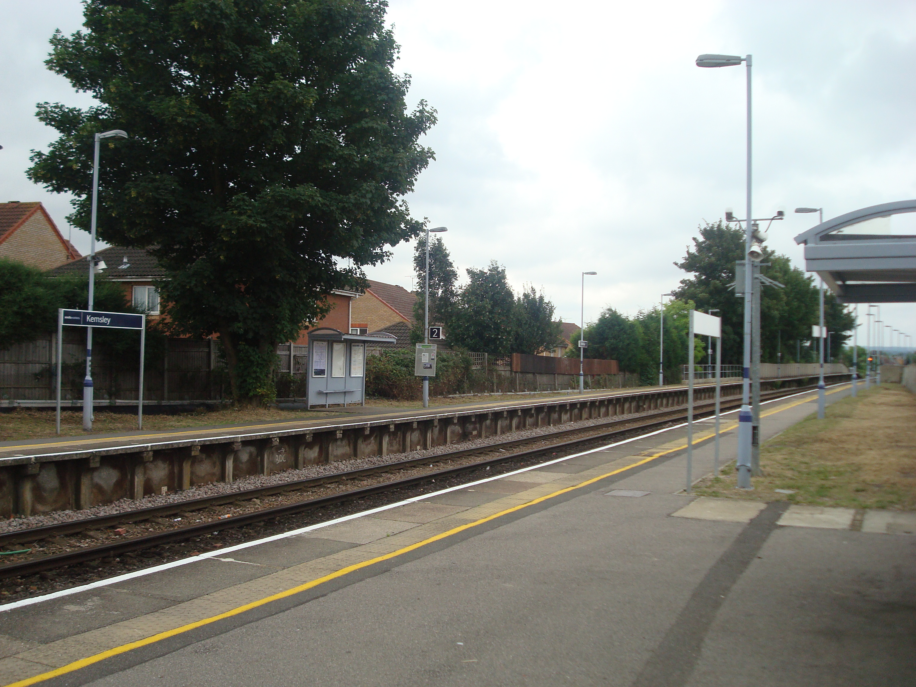
Kemsley railway station
Kemsley railway station is on the Sheerness Line in north Kent, England, and serves the village of Kemsley. It is 45 miles 20 chains (72.8 km) down the...
Related Videos

Walking with @BeMoreWild
Walking with @BeMoreWild around Milton creek. Nothing like nature to relieve anxiety and stress. #livingmybestlife #sittingbourne ...


Hypnosis and Holiday Stress
A short video on how Hypnosis can help with many different aspects of the holiday season. Anxiety, Stress, Debt, Depression, ...
Nearby Amenities
Located within 500m of 51.357299,0.704378Have you been to Bobbing?
Leave your review of Bobbing below (or comments, questions and feedback).