Blawith and Subberthwaite

Civil Parish in Lancashire South Lakeland

England

Blawith and Subberthwaite

A glimpse of Coniston Water Towards the southern end of the lake. Boon Wood on the left
A glimpse of Coniston Water Credit: Eirian Evans

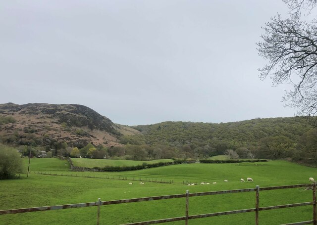
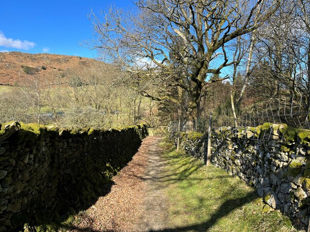
Blawith and Subberthwaite is a civil parish located in the county of Lancashire, England. It is situated in the southern part of the Lake District National Park and covers an area of approximately 10 square miles. The parish is a rural area characterized by its picturesque landscapes, rolling hills, and tranquil surroundings.

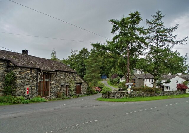
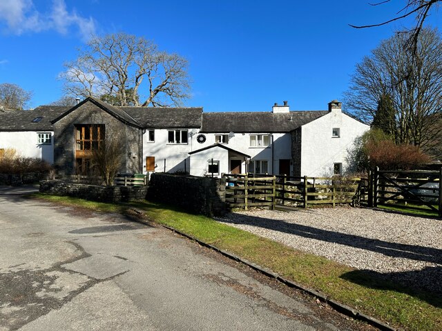
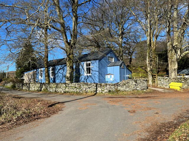
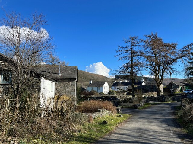
Blawith and Subberthwaite is home to a small population, with only a handful of households scattered across the parish. The main settlement in the area is the village of Blawith, which consists of a few residential properties and a small church. Subberthwaite, on the other hand, is a hamlet within the parish, featuring a collection of traditional stone-built houses.

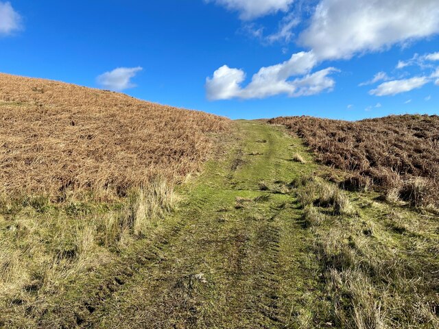
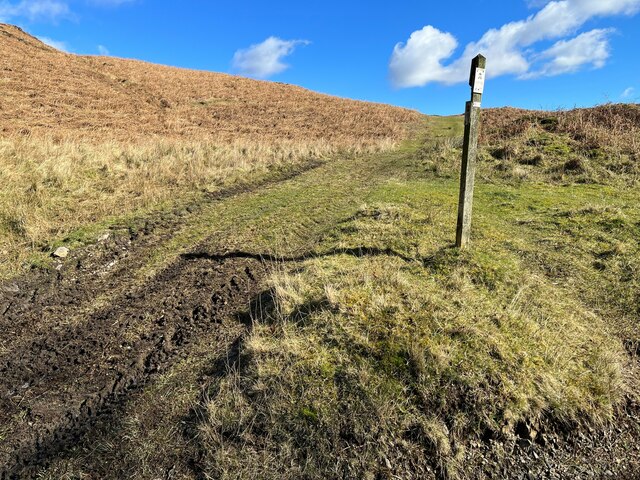
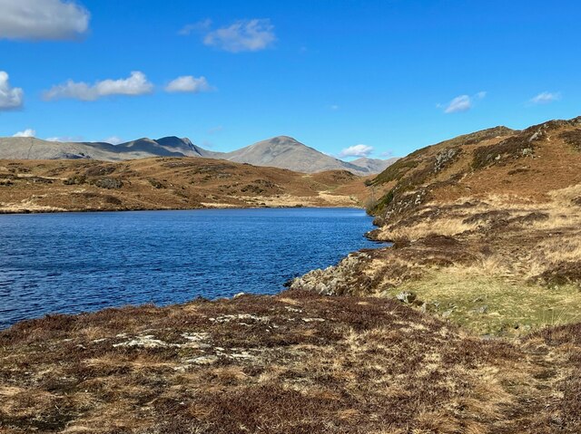
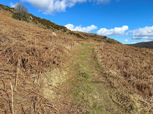
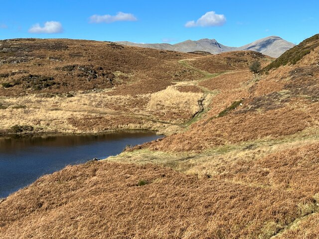
The parish is renowned for its natural beauty and offers ample opportunities for outdoor activities, such as hiking, cycling, and birdwatching. It is surrounded by stunning natural landmarks, including Coniston Water, which is located to the east, and the beautiful Grizedale Forest to the west.

Despite its small size, Blawith and Subberthwaite boasts a rich history. The area is known for its agricultural heritage, with farming playing a significant role in the local economy. Visitors can also explore historical landmarks, such as ancient stone circles and remnants of old mining activities.

In conclusion, Blawith and Subberthwaite is a charming civil parish in Lancashire, offering a peaceful retreat for nature enthusiasts and those seeking a rural escape. With its breathtaking landscapes and historical significance, it is a hidden gem within the Lake District National Park.

If you have any feedback on the listing, please let us know in the comments section below.

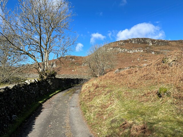
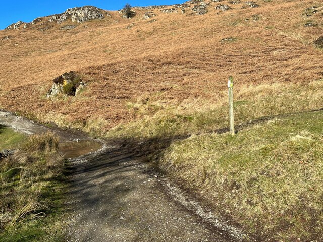
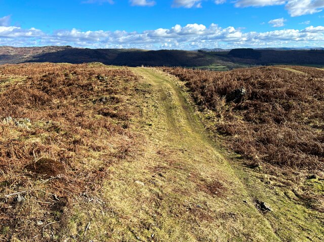
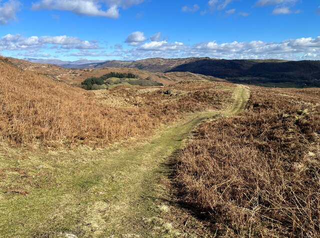
Blawith and Subberthwaite Images

Images are sourced within 2km of 54.28963/-3.113881 or Grid Reference SD2788. Thanks to Geograph Open Source API. All images are credited.

A glimpse of Coniston Water Towards the southern end of the lake. Boon Wood on the left
A glimpse of Coniston Water
Towards the southern end of the lake. Boon Wood on the left
Farmland at High Nibthwaite South of Coniston Water. The crag on the left is Brook Barrow
Farmland at High Nibthwaite
South of Coniston Water. The crag on the left is Brook Barrow
Wide valley of the River Crake
Former Blawith church Formerly this was the Church of St John the Baptist but it became redundant in 1988 and was sold to be converted in 2012
Former Blawith church
Formerly this was the Church of St John the Baptist but it became redundant in 1988 and was sold to be converted in 2012
Road junction in Water Yeat
Water Yeat Mill This former corn mill was supplied with water power by Greenholme Beck, fed by Beacon Tarn.  It was converted in the mid-1960s into sheltered accommodation for elderly people and now, much altered, it is partly residential with the remainder let for holidays.
Water Yeat Mill
This former corn mill was supplied with water power by Greenholme Beck, fed by Beacon Tarn. It was converted in the mid-1960s into sheltered accommodation for elderly people and now, much altered, it is partly residential with the remainder let for holidays.
Blawith and Nibthwaite Village Hall This small, wooden village hall is located in Water Yeat.  It is run as a charity by and for the benefit of the local community.
Blawith and Nibthwaite Village Hall
This small, wooden village hall is located in Water Yeat. It is run as a charity by and for the benefit of the local community.
The road to Greenholme Farm Bowder Knott is the hill in the right background.
The road to Greenholme Farm
Bowder Knott is the hill in the right background.
The Cumbria Way, Tottlebank The main track is the public bridleway from Tottlebank to Heathwaite; the track to the right is a public footpath to Cockenskell.
Northbound walkers following The Cumbria Way turn right here to follow the footpath up the hill (next photograph <a href="https://www.geograph.org.uk/photo/7428087">SD2688 : The Cumbria Way, Tottlebank</a>).
The Cumbria Way, Tottlebank
The main track is the public bridleway from Tottlebank to Heathwaite; the track to the right is a public footpath to Cockenskell. Northbound walkers following The Cumbria Way turn right here to follow the footpath up the hill (next photograph SD2688 : The Cumbria Way, Tottlebank).
Path on Tottlebank Height This path is the route of The Cumbria Way over the open fell between Tottlebank Farm and Cockenskell (next photograph <a href="https://www.geograph.org.uk/photo/7432096">SD2788 : The Cumbria Way near The Low</a>).
Path on Tottlebank Height
This path is the route of The Cumbria Way over the open fell between Tottlebank Farm and Cockenskell (next photograph SD2788 : The Cumbria Way near The Low).
Path on Tottlebank Height This undulating path is the route of The Cumbria Way over the open fell between Tottlebank Farm and Cockenskell (next photograph <a href="https://www.geograph.org.uk/photo/7427169">SD2788 : Path on Tottlebank Height</a>).
Path on Tottlebank Height
This undulating path is the route of The Cumbria Way over the open fell between Tottlebank Farm and Cockenskell (next photograph SD2788 : Path on Tottlebank Height).
Public footpath near Tottlebank This footpath is the route of The Cumbria Way over the open fell between Tottlebank Farm and Cockenskell (next photograph <a href="https://www.geograph.org.uk/photo/7432849">SD2788 : Public footpath near Tottlebank</a>).
Public footpath near Tottlebank
This footpath is the route of The Cumbria Way over the open fell between Tottlebank Farm and Cockenskell (next photograph SD2788 : Public footpath near Tottlebank).
The Cumbria Way, Tottlebank This Cumbria Way leaves a public bridleway by Tottlebank Farm and follows the public footpath to Cockenskell up the hill (next photograph <a href="https://www.geograph.org.uk/photo/7428052">SD2788 : Public footpath near Tottlebank</a>).
The Cumbria Way, Tottlebank
This Cumbria Way leaves a public bridleway by Tottlebank Farm and follows the public footpath to Cockenskell up the hill (next photograph SD2788 : Public footpath near Tottlebank).
Beacon Tarn The Cumbria Way long distance path follows the far shore of the tarn; Dow Crag and Coniston Old Man form an impressive backdrop.
Beacon Tarn
The Cumbria Way long distance path follows the far shore of the tarn; Dow Crag and Coniston Old Man form an impressive backdrop.
Water Yeat The building on the left is a former corn mill, supplied with water power by Greenholme Beck.
Water Yeat
The building on the left is a former corn mill, supplied with water power by Greenholme Beck.
Track near Greenholme Farm
Beacon Tarn and the Coniston Fells Beacon Tarn lies in a hollow in the Blawith Fells; in the background are Dow Crag and Coniston Old Man.  The steep gorse covered bank to the right is the western slope of Beacon Fell and the path leading through the col behind the solitary hawthorn tree is The Cumbria Way.
Beacon Tarn and the Coniston Fells
Beacon Tarn lies in a hollow in the Blawith Fells; in the background are Dow Crag and Coniston Old Man. The steep gorse covered bank to the right is the western slope of Beacon Fell and the path leading through the col behind the solitary hawthorn tree is The Cumbria Way.
Lane near Cockenskell The Tottlebank Farm to Beacon Tarn public footpath passes through a walled lane near Cockenskell. This is the route of The Cumbria Way long distance path (next photograph <a href="https://www.geograph.org.uk/photo/6884736">SD2789 : Gate on The Cumbria Way near Cockenskell</a>).
Lane near Cockenskell
The Tottlebank Farm to Beacon Tarn public footpath passes through a walled lane near Cockenskell. This is the route of The Cumbria Way long distance path (next photograph SD2789 : Gate on The Cumbria Way near Cockenskell).
Show me another place!

Blawith and Subberthwaite is located at Grid Ref: SD2788 (Lat: 54.28963, Lng: -3.113881)

Administrative County: Cumbria

District: South Lakeland

Police Authority: Cumbria

What 3 Words

///waxes.handicaps.hobble. Near Ulverston, Cumbria

Nearby Locations

Blawith and Subberthwaite

Related Wikis

Woodland Fell

Woodland Fell is an upland area in the south of the English Lake District, south of Torver, Cumbria. It is the subject of a chapter of Wainwright's book...

Blawith and Subberthwaite

Blawith and Subberthwaite is a civil parish in the South Lakeland district of Cumbria, England. It is situated in the Lake District National Park, and...

St John the Baptist's Church, Blawith

St John the Baptist's Church is a redundant Anglican church in the settlement of Blawith, Cumbria, England. It is located to the east of the A5084 road...

Blawith Knott

Blawith Knott is a hill in the south of the English Lake District, near Woodland, Cumbria. It is the subject of a chapter of Wainwright's book The Outlying...

Nearby Amenities

Located within 500m of 54.28963,-3.113881
Appletree Holme
Place: locality
Lat/Long: 54.2884931/-3.1117623
Barrier: stile
Lat/Long: 54.2924338/-3.1096198
Place: farm
Lat/Long: 54.2885128/-3.1124424
Ford: yes
Lat/Long: 54.29191/-3.119214
Ford: yes
Lat/Long: 54.2927752/-3.1086909
Round Haw
Place: locality
Lat/Long: 54.2898097/-3.1215436
The Low
Place: locality
Lat/Long: 54.2863725/-3.1168513
Caws
Place: locality
Lat/Long: 54.2912034/-3.1067846
Barrier: stile
Lat/Long: 54.2916785/-3.1126714
Barrier: stile
Lat/Long: 54.2882468/-3.1121134
Barrier: stile
Lat/Long: 54.2877649/-3.1101814
Information: guidepost
Tourism: information
Lat/Long: 54.2927099/-3.1087453
Information: guidepost
Tourism: information
Lat/Long: 54.2901338/-3.111702
Barrier: cattle_grid
Lat/Long: 54.2918979/-3.1141951
Ford: yes
Lat/Long: 54.292231/-3.1199468
Power: pole
Lat/Long: 54.2878006/-3.1073599
Power: pole
Lat/Long: 54.288051/-3.1090748
Power: pole
Lat/Long: 54.2882383/-3.1106899
Power: pole
Lat/Long: 54.292428/-3.1140911
Power: pole
Lat/Long: 54.2917538/-3.1129574
Power: pole
Lat/Long: 54.2908826/-3.1118284
The data included in this document is from www.openstreetmap.org. The data is made available under ODbL.

Have you been to Blawith and Subberthwaite?

Leave your review of Blawith and Subberthwaite below (or comments, questions and feedback).