Blackwater and Hawley

Civil Parish in Hampshire Hart

England

Blackwater and Hawley

Blackwater The major roundabout, almost mid-square, looking east-northeast towards Blackwater and Camberley.
Blackwater Credit: Brendan and Ruth McCartney

Blackwater and Hawley is a civil parish located in the county of Hampshire, England. Situated in the Hart district, it covers an area of approximately 7 square kilometers. The parish is made up of two small villages, Blackwater and Hawley, which are separated by the Blackwater River.

Blackwater, the larger of the two villages, is situated on the A30 road, providing easy access to nearby towns such as Farnborough and Camberley. It has a range of amenities, including shops, pubs, a post office, and a primary school. The village also benefits from a train station, offering connections to London and other major towns in the region.

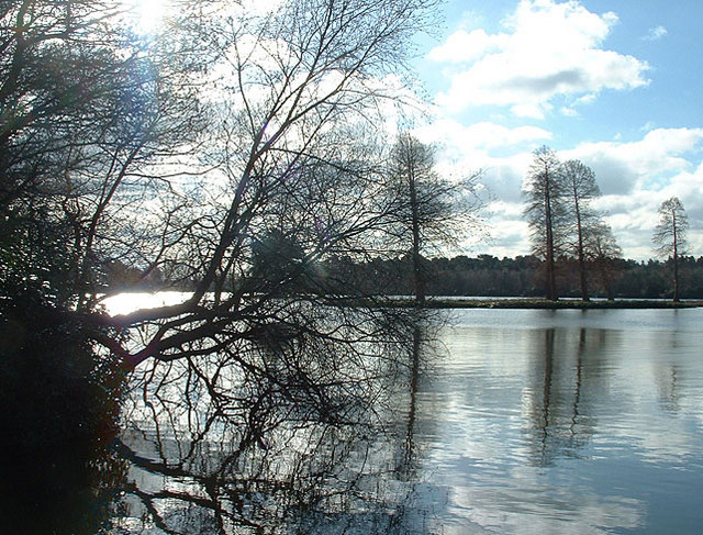
Hawley, a smaller village, is located to the north of Blackwater and is primarily residential. It is known for its beautiful woodland areas and proximity to Hawley Lake, which is a popular spot for water sports and outdoor activities.

Both villages are surrounded by picturesque countryside, offering opportunities for walking, cycling, and enjoying the outdoors. The area is also home to several nature reserves, including Hawley Meadows and Blackwater Valley Site of Special Scientific Interest (SSSI), which are known for their diverse wildlife and natural beauty.

Overall, Blackwater and Hawley provide a peaceful and scenic environment for residents and visitors alike, with a range of amenities and easy access to larger towns and cities in the region.

If you have any feedback on the listing, please let us know in the comments section below.

Blackwater and Hawley Images

Images are sourced within 2km of 51.315895/-0.804601 or Grid Reference SU8358. Thanks to Geograph Open Source API. All images are credited.

Blackwater The major roundabout, almost mid-square, looking east-northeast towards Blackwater and Camberley.
Blackwater
The major roundabout, almost mid-square, looking east-northeast towards Blackwater and Camberley.
Yateley Much of this square is heathland. This picture was taken from the A30, midway along the northern edge, looking south over Yateley Common - an excellent spot for Dartford Warblers!
Yateley
Much of this square is heathland. This picture was taken from the A30, midway along the northern edge, looking south over Yateley Common - an excellent spot for Dartford Warblers!
Hawley From the road bridge at J4A in the M3, looking southwest across the middle of the square.
Hawley
From the road bridge at J4A in the M3, looking southwest across the middle of the square.
Hawley Looking northeast from the top of Hawley Hill near the Trig Point. This square is mainly woodland.
Hawley
Looking northeast from the top of Hawley Hill near the Trig Point. This square is mainly woodland.
Hawley Henry Randell's Almshouses and Garth Cottages.
Hawley
Henry Randell's Almshouses and Garth Cottages.
Haywards Cottage Haywards Cottage is one of the very few properties built on Yateley Common. This photo shows it and its gardens on a glorius sunny August day in 2004.
Haywards Cottage
Haywards Cottage is one of the very few properties built on Yateley Common. This photo shows it and its gardens on a glorius sunny August day in 2004.
Minley Road Closed For RTA Christmas Eve 2004. I personally would have preferred this picture if the police hadn't closed the road for a car accident, mind you they were sweeping up the remains of my car!

Photograph taken with Sony Cybershot DSC-U30.
Minley Road Closed For RTA
Christmas Eve 2004. I personally would have preferred this picture if the police hadn't closed the road for a car accident, mind you they were sweeping up the remains of my car! Photograph taken with Sony Cybershot DSC-U30.
Bridleway through the woodland of Hawley Common, Hampshire This is the one that starts as Woodlands Walk off Fernhill Road, and then goes straight down to Hawley Lake.
Bridleway through the woodland of Hawley Common, Hampshire
This is the one that starts as Woodlands Walk off Fernhill Road, and then goes straight down to Hawley Lake.
Fernhill Road, Hawley, Hampshire This is taken from a layby just north of Hawley School, handy for walking in the woods of Hawley Common.  The wood over the road (on the east side) is private.
Fernhill Road, Hawley, Hampshire
This is taken from a layby just north of Hawley School, handy for walking in the woods of Hawley Common. The wood over the road (on the east side) is private.
Hawley Place, Woodlands Walk, Hawley, Hampshire The gate leads to a (plant) nursery.  The building to the right looks like a lodge, but has no windows overlooking the road.  The building on the left is boarded-up at present.  It has outside stairs to, probably, a first-floor flat.  Beyond it is the bridleway through the woodland of Hawley Common.
Hawley Place, Woodlands Walk, Hawley, Hampshire
The gate leads to a (plant) nursery. The building to the right looks like a lodge, but has no windows overlooking the road. The building on the left is boarded-up at present. It has outside stairs to, probably, a first-floor flat. Beyond it is the bridleway through the woodland of Hawley Common.
Woodland on Hawley Common, Hampshire This area is MOD land, with managed access.  It is mixed woodland, here, beyond the conifers, are a group of birches.
Woodland on Hawley Common, Hampshire
This area is MOD land, with managed access. It is mixed woodland, here, beyond the conifers, are a group of birches.
Bridleway on Hawley Common, Hampshire This is looking NW on the bridleway from West Heath to Minley.
Bridleway on Hawley Common, Hampshire
This is looking NW on the bridleway from West Heath to Minley.
Bridleway on Hawley Common, Hampshire This is looking SE on the bridleway from West Heath to Minley.
Bridleway on Hawley Common, Hampshire
This is looking SE on the bridleway from West Heath to Minley.
Forestry track on Hawley Common This is taken looking west from a crossing of tracks, which are indistinguishable from the bridleways; careful mapreading is required!  The white dots in the distance are dogs, being taken for a walk by a man on a bicycle at quite a speed; they were supposed to be middle of the picture, but I was too slow switching the camera on.
Forestry track on Hawley Common
This is taken looking west from a crossing of tracks, which are indistinguishable from the bridleways; careful mapreading is required! The white dots in the distance are dogs, being taken for a walk by a man on a bicycle at quite a speed; they were supposed to be middle of the picture, but I was too slow switching the camera on.
Woodland on Hawley Common Here there are many tall slender saplings, which will presumably be thinned out before long.
Woodland on Hawley Common
Here there are many tall slender saplings, which will presumably be thinned out before long.
Hawley Lake and sailing club near M3J4a A bleak winter's day at the lake; a cormorant stretches its wings, optimistic ducks stay close.
Hawley Lake and sailing club near M3J4a
A bleak winter's day at the lake; a cormorant stretches its wings, optimistic ducks stay close.
Hawley Lake in Winter, 2006 Wonderful place for dog-walking (unless yours leaps into water) but look out for any soldiers in camouflage or you might not even notice them!
Hawley Lake in Winter, 2006
Wonderful place for dog-walking (unless yours leaps into water) but look out for any soldiers in camouflage or you might not even notice them!
Jean and Charlie near Hawley Lake Winter, dog-walking in the pine trees beside Hawley Lake
Jean and Charlie near Hawley Lake
Winter, dog-walking in the pine trees beside Hawley Lake
Show me another place!

Blackwater and Hawley is located at Grid Ref: SU8358 (Lat: 51.315895, Lng: -0.804601)

Administrative County: Hampshire

District: Hart

Police Authority: Hampshire

What 3 Words

///single.cheaply.schematic. Near Sandhurst, Berkshire

Nearby Locations

Blackwater and Hawley

Related Wikis

Blackwater and Hawley

Blackwater and Hawley is a civil parish in the Hart district of Hampshire, England, on the border with Surrey. According to the 2001 census it had a population...

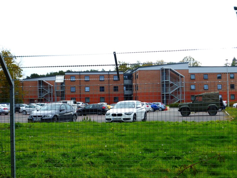
Gibraltar Barracks, Minley

Gibraltar Barracks is a British Army installation at Minley in Hampshire. == History == The Royal Engineers first arrived at Minley with an engineer brigade...

Minley Manor

Minley Manor is a Grade II* listed country manor house, located within a Grade II registered garden, built in the French Gothic style by Henry Clutton...

Guillemont Barracks

Guillemont Barracks, located just off of junction 4a of the M3, on the Minley Road (A327), was a military installation at Minley in Hampshire. == History... ==

Foxlease and Ancells Meadows

Foxlease and Ancells Meadows is a 68.8-hectare (170-acre) biological Site of Special Scientific Interest on the western outskirts of Farnborough in Hampshire...

Darby Green

Darby Green is a village in the parish of Yateley, North East Hampshire, England. The electoral ward of Frogmore and Darby Green is separated from the...

South East England

South East England is one of the nine official regions of England in the United Kingdom at the first level of ITL for statistical purposes. It consists...

Minley

Minley is a slightly depopulated rural, well-wooded village in the Hart District of Hampshire, England. It has the only church of the C of E ecclesiastical...

Nearby Amenities

Located within 500m of 51.315895,-0.804601
Barrier: cattle_grid
Lat/Long: 51.3129029/-0.7999372
The data included in this document is from www.openstreetmap.org. The data is made available under ODbL.

Have you been to Blackwater and Hawley?

Leave your review of Blackwater and Hawley below (or comments, questions and feedback).