Bishop Middleham

Civil Parish in Durham

England

Bishop Middleham

Road to Fishburn Un-numbered road to Fishburn off the A177.
Road to Fishburn Credit: David Robinson

Bishop Middleham is a civil parish located in County Durham, England. It is situated approximately 6 miles southeast of Durham City. The parish covers an area of around 7 square miles and is home to a population of around 1,000 residents.

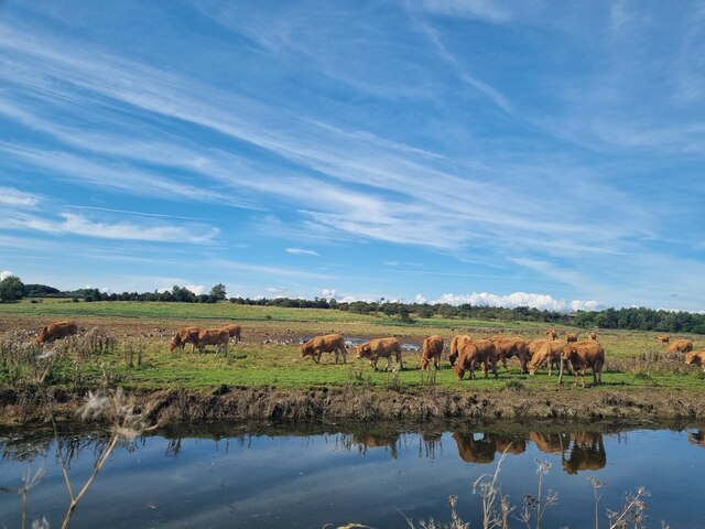
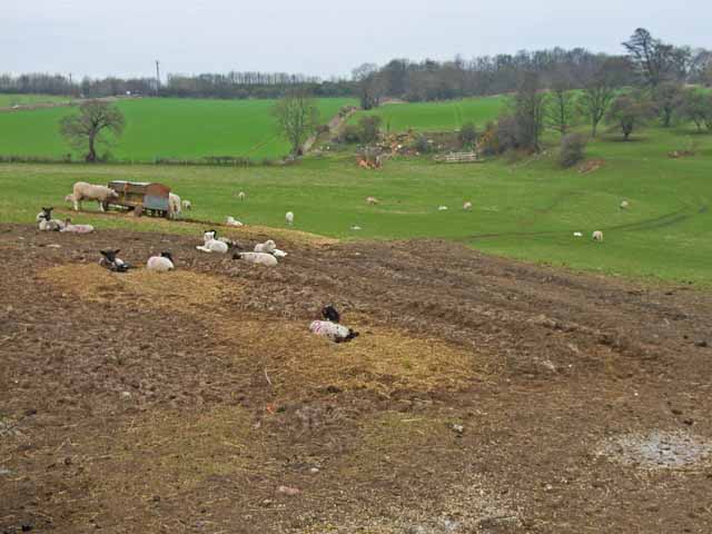
The village of Bishop Middleham is nestled in a rural setting, surrounded by beautiful countryside and farmland. It has a long and rich history, with evidence of human settlement dating back to the Bronze Age. The village is named after the Bishop of Durham, who owned the land in medieval times.

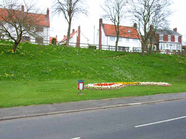
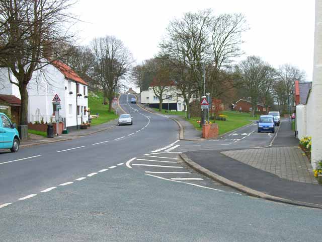
The heart of the village is characterized by its charming stone-built houses and cottages. St. Michael and All Angels Church, which dates back to the 12th century, is a prominent feature in the community. The church is known for its stunning stained glass windows and historic architecture.

Bishop Middleham offers a range of amenities and facilities to its residents. These include a primary school, a village hall, a community center, and a local pub. The village is also home to various sports clubs and recreational activities, providing opportunities for residents to engage in leisure pursuits.

The surrounding countryside offers picturesque walking and cycling routes, allowing residents and visitors to explore the natural beauty of the area. The nearby Castle Eden Dene National Nature Reserve provides a haven for wildlife and is a popular destination for nature enthusiasts.

Overall, Bishop Middleham is a peaceful and scenic civil parish that combines a rich historical heritage with modern amenities, making it an attractive place to live or visit.

If you have any feedback on the listing, please let us know in the comments section below.

Bishop Middleham Images

Images are sourced within 2km of 54.678514/-1.49095 or Grid Reference NZ3231. Thanks to Geograph Open Source API. All images are credited.

Road to Fishburn Un-numbered road to Fishburn off the A177.
Road to Fishburn
Un-numbered road to Fishburn off the A177.
Re-working Bishop Middleham Quarry The quarries closed in the 1930s and were designated SSSI in 1968. The boundaries of the SSSI were revised in 1982 to omit areas of minimal wildlife interest. At the time the image was taken in 2021, a portion of the southern part of the quarries is being reworked for aggregates and agricultural lime by Thompsons of Prudhoe.
Re-working Bishop Middleham Quarry
The quarries closed in the 1930s and were designated SSSI in 1968. The boundaries of the SSSI were revised in 1982 to omit areas of minimal wildlife interest. At the time the image was taken in 2021, a portion of the southern part of the quarries is being reworked for aggregates and agricultural lime by Thompsons of Prudhoe.
Cattle and Geese A herd of Cattle and noisy flock of geese on the Carrs south of Bishop Middleham. Photograph taken from Fourmarts Lane.
Cattle and Geese
A herd of Cattle and noisy flock of geese on the Carrs south of Bishop Middleham. Photograph taken from Fourmarts Lane.
Knotty Hill Golf Course Knotty Hill Golf Course
Knotty Hill Golf Course
Spring flowers on the road to Mainsforth
Cottages at Mainsforth
Farmland at Thrislington
Bishop Middleham village centre
Spring flowers at Bishop Middleham
The Old Dun Cow at Bishop Middleham This sign is above the door on what is now a private house
The Old Dun Cow at Bishop Middleham
This sign is above the door on what is now a private house
The old road from Bishop Middleham to Cornforth This old road, complete with centre white line and the remains of catseyes is clearly shown on the 1940s map, but has now been truncated by the A1(M) and abandoned.
The old road from Bishop Middleham to Cornforth
This old road, complete with centre white line and the remains of catseyes is clearly shown on the 1940s map, but has now been truncated by the A1(M) and abandoned.
High Road Avenue, Bishop Middleham A short unadopted road, off High Road
High Road Avenue, Bishop Middleham
A short unadopted road, off High Road
New lake at Bishop Middleham This lake has obviously formed recently, as witness the trees standing in water, and the fact that the lake does not appear on any map
New lake at Bishop Middleham
This lake has obviously formed recently, as witness the trees standing in water, and the fact that the lake does not appear on any map
Bishop Middleham Quarry
East House Farm, near Bishop Middleham
Holdforth Farm, near Fishburn
Sign for the use of this single track lane The footpath skirts the edge of Fishburn airfield.
Sign for the use of this single track lane
The footpath skirts the edge of Fishburn airfield.
Camp House on the A177 The name of this house is associated with the Roman road to the north west. There was a reservoir in the area called Camp House reservoir which the Romans used to keep water in an aqueduct.
Camp House on the A177
The name of this house is associated with the Roman road to the north west. There was a reservoir in the area called Camp House reservoir which the Romans used to keep water in an aqueduct.
Show me another place!

Bishop Middleham is located at Grid Ref: NZ3231 (Lat: 54.678514, Lng: -1.49095)

Unitary Authority: County Durham

Police Authority: Durham

What 3 Words

///unspoiled.spearing.farm. Near Bishop Middleham, Co. Durham

Nearby Locations

Bishop Middleham

Related Wikis

Bishop Middleham

Bishop Middleham is a village in County Durham, in England. The population of the parish as taken at the 2011 census was 1,275 It is close to Sedgefield...

Bishop Middleham Quarry

Bishop Middleham Quarry is a disused quarry, about 4 kilometres (2.5 mi) north-west of Sedgefield, County Durham, England. Quarry-working here ceased in...

Mainsforth

Mainsforth is a small village and former civil parish, now in the parish of Bishop Middleham, in the County Durham district, in the ceremonial county of...

Thrislington Plantation

Thrislington Plantation is a Site of Special Scientific Interest and a national nature reserve in the Sedgefield district of County Durham, England. It...

Fishburn Airfield

Fishburn Airfield is a small grass strip airfield in Fishburn, County Durham. The airfield was opened on 30 June 1995 by the then local MP and Leader of...

Chilton Lane

Chilton Lane is situated a short distance to the south-east of Ferryhill, and immediately to the south of Ferryhill Station. Nearby are Great Chilton,...

Ferryhill railway station

Ferryhill railway station was located in Ferryhill, County Durham, Northeast England. It was located on what became the East Coast Main Line between Darlington...

Ferryhill Station

Ferryhill Station is situated to the south east of Ferryhill, next to Chilton Lane and near the site of Ferryhill railway station, a few miles south of...

Nearby Amenities

Located within 500m of 54.678514,-1.49095
Give Way
Direction: backward
Lat/Long: 54.6819137/-1.4904718
Bishop Middleham
Note: Can be used by customers of Farnless Farm Park, where they sell home reared venison and bison
Place: village
Source: NPE
Wikidata: Q4917659
Lat/Long: 54.677802/-1.4889504
Bus Stop
The Green
Naptan AtcoCode: 13006000D
Naptan Bearing: SE
Naptan CommonName: The Green
Naptan Indicator: south east bound
Naptan Landmark: Entrance to The Green
Naptan NaptanCode: durdmpmw
Naptan Street: West View
Naptan Verified: no
Source: naptan_import
Lat/Long: 54.678532/-1.4858771
Bus Stop
The Green
Naptan AtcoCode: 13006000H
Naptan Bearing: NW
Naptan CommonName: The Green
Naptan Indicator: north west bound
Naptan Landmark: Outside 2 Perm Ter
Naptan NaptanCode: durdmptd
Naptan Street: Perm Ter
Naptan Verified: no
Source: naptan_import
Lat/Long: 54.6780823/-1.4857897
Bus Stop
Front Street
Naptan AtcoCode: 13006725C
Naptan Bearing: E
Naptan BusStopType: MKD
Naptan CommonName: Front Street
Naptan Indicator: E-bound
Naptan Landmark: 5m W of W edge of 5 Front St
Naptan NaptanCode: durdptpj
Naptan RevisionNumber: 3
Naptan Street: Front Street
Naptan Verified: no
Old Name: Dun Cow
Source: naptan_import
Lat/Long: 54.677055/-1.4915254
Bus Stop
Front Street
Naptan AtcoCode: 13006725G
Naptan Bearing: W
Naptan BusStopType: MKD
Naptan CommonName: Front Street
Naptan Indicator: W-bound
Naptan Landmark: opposite 16m E of E edge of 7 Front St
Naptan NaptanCode: durdptpm
Naptan RevisionNumber: 3
Naptan Street: Front Street
Naptan Verified: no
Old Name: Dun Cow
Source: naptan_import
Lat/Long: 54.6769712/-1.490844
Bus Stop
Cross Keys
Naptan AtcoCode: 13006726C
Naptan Bearing: E
Naptan CommonName: Cross Keys
Naptan Indicator: east bound
Naptan Landmark: Outside Boundary of 6-7 High St
Naptan NaptanCode: durdptpt
Naptan Street: High street
Naptan Verified: no
Source: naptan_import
Lat/Long: 54.6773398/-1.4879912
Bus Stop
Cross Keys
Naptan AtcoCode: 13006726G
Naptan Bearing: W
Naptan CommonName: Cross Keys
Naptan Indicator: west bound
Naptan Landmark: 4m E of E edge of Bishop Ct
Naptan NaptanCode: durdptpw
Naptan Street: High Street
Naptan Verified: no
Source: naptan_import
Lat/Long: 54.6775008/-1.4864174
Bus Stop
Stoneybeck
Naptan AtcoCode: 13006727B
Naptan Bearing: NE
Naptan CommonName: Stoneybeck
Naptan Indicator: north east bound
Naptan Landmark: On boundary of 13-14 Hawthorn Ter
Naptan NaptanCode: durdptwd
Naptan Street: Hawthorn Ter
Naptan Verified: no
Source: naptan_import
Lat/Long: 54.6797379/-1.4862651
Bus Stop
Stoneybeck
Naptan AtcoCode: 13006727G
Naptan Bearing: W
Naptan CommonName: Stoneybeck
Naptan Indicator: west bound
Naptan Landmark: Outside 13 High Rd
Naptan NaptanCode: durdptwm
Naptan Street: High Road
Naptan Verified: no
Source: naptan_import
Lat/Long: 54.6797968/-1.4853183
Turning Circle
Lat/Long: 54.6764017/-1.4935719
Turning Circle
Lat/Long: 54.6769074/-1.4923748
Barrier: stile
Foot: yes
Lat/Long: 54.6774308/-1.4834303
Parking
Fee: no
Parking: surface
Lat/Long: 54.6753965/-1.4910235
Post Box
Ref: DL17 178
Lat/Long: 54.6772747/-1.489275
Leisure: playground
Lat/Long: 54.6749433/-1.4905245
Bicycle Parking
Capacity: 8
Lat/Long: 54.6753242/-1.4911326
Noexit: yes
Lat/Long: 54.678968/-1.4835347
Give Way
Direction: backward
Lat/Long: 54.6819742/-1.4904375
Entrance: yes
Lat/Long: 54.676233/-1.4886917
Entrance: main
Lat/Long: 54.6763434/-1.4886233
Entrance: yes
Lat/Long: 54.6762334/-1.4888077
Bicycle Parking
Bicycle Parking: stands
Covered: yes
Lat/Long: 54.6761999/-1.4879829
Clock
Display: sundial
Lat/Long: 54.6771148/-1.4882705
Barrier: stile
Foot: yes
Material: wood
Stile: stepover
Lat/Long: 54.6758926/-1.4871924
Barrier: kissing_gate
Foot: yes
Lat/Long: 54.6746165/-1.4911713
Exploring Bishop Middleham
Hiking: yes
Information: map
Tourism: information
Lat/Long: 54.6754098/-1.493753
Historic: memorial
Memorial: war_memorial
Wikidata: Q26677938
Lat/Long: 54.6755145/-1.492947
Entrance: main
Lat/Long: 54.6753899/-1.4930022
Power: pole
Lat/Long: 54.6828952/-1.4918768
Power: pole
Lat/Long: 54.6826254/-1.4938349
Crossing
Crossing: uncontrolled
Crossing Ref: zebra
Lat/Long: 54.6765272/-1.4890847
Turning Circle
Lat/Long: 54.6763806/-1.4925581
Post Office
Bishop Middleham Post Office
Branch: Bishop Middleham
Brand: Post Office
Brand Wikidata: Q1783168
Check Date: 2020-02-20
Contact Website: https://www.postoffice.co.uk/branch-finder/1563092/bishop-middleham
Ref Pol Id: 3306
Lat/Long: 54.6773177/-1.4892597
The data included in this document is from www.openstreetmap.org. The data is made available under ODbL.

Have you been to Bishop Middleham?

Leave your review of Bishop Middleham below (or comments, questions and feedback).