Birchington
Civil Parish in Kent Thanet
England
Birchington
Birchington is a civil parish located on the northeast coast of Kent, England. It is situated within the Thanet district and lies between the towns of Margate and Herne Bay. With a population of around 10,000 people, Birchington is a bustling community that offers a mix of rural charm and seaside living.
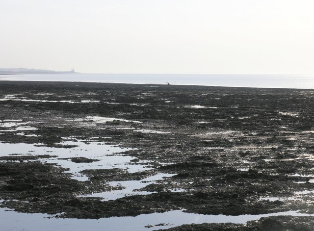
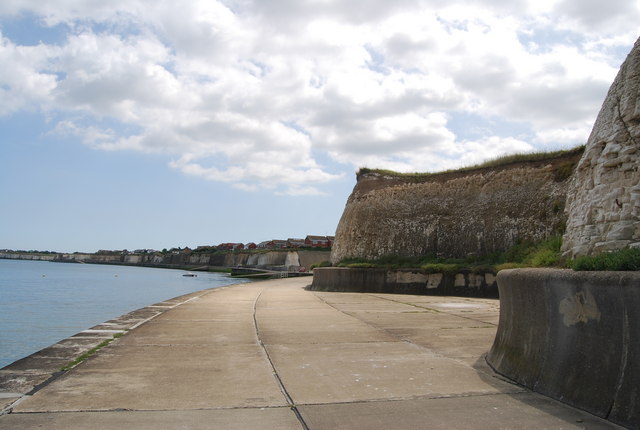
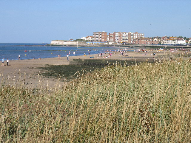
The parish is known for its beautiful sandy beaches, particularly Minnis Bay, which attracts locals and tourists alike during the summer months. The stunning coastline provides opportunities for various water sports and leisure activities, making Birchington a popular destination for beachgoers.
The village itself has a rich history and retains much of its traditional charm. The parish church, All Saints, is a prominent feature and dates back to the 13th century. Birchington also boasts a number of historic buildings, including the Quex House and Gardens, which is a popular tourist attraction.
In terms of amenities, Birchington offers a range of shops, cafes, and restaurants to cater to both residents and visitors. The village has good transport links, with a train station providing regular services to London and other major towns in Kent. There are also several schools in the area, making Birchington an attractive place for families.
Overall, Birchington is a vibrant coastal village with a strong sense of community. Its picturesque surroundings, historical landmarks, and convenient location make it a desirable place to live or visit in Kent.
If you have any feedback on the listing, please let us know in the comments section below.
Birchington Images
Images are sourced within 2km of 51.37352/1.299477 or Grid Reference TR2969. Thanks to Geograph Open Source API. All images are credited.


Birchington is located at Grid Ref: TR2969 (Lat: 51.37352, Lng: 1.299477)
Administrative County: Kent
District: Thanet
Police Authority: Kent
What 3 Words
///savers.proposes.showcases. Near Birchington-on-Sea, Kent
Nearby Locations
Related Wikis
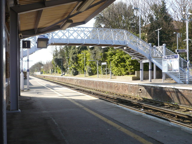
Birchington-on-Sea railway station
Birchington-on-Sea railway station is on the Chatham Main Line in England, serving the village of Birchington-on-Sea, Kent. It is 70 miles 56 chains (113...
Birchington-on-Sea
Birchington-on-Sea is a village in the Thanet district in Kent, England, with a population of 9,961. The village forms part of the civil parish of Birchington...

Brooks End
Brooks End is a hamlet assimilated with Birchington, in Kent, England, and 1 mile (2 km) southwest of the village's centre. It is in the Thanet local government...

Powell-Cotton Museum
The Powell-Cotton Museum is situated in Quex Park, Birchington, Kent and houses the diverse personal collections of hunter and explorer Percy Powell-Cotton...

Thanet Coast
Thanet Coast is an 816.9-hectare (2,019-acre) biological and geological Site of Special Scientific Interest which stretches along the coast between Whitstable...
King Ethelbert School
King Ethelbert School is a mixed secondary school located in Birchington-on-Sea, Kent, England. A wide variety of subjects are available at GCSE level...
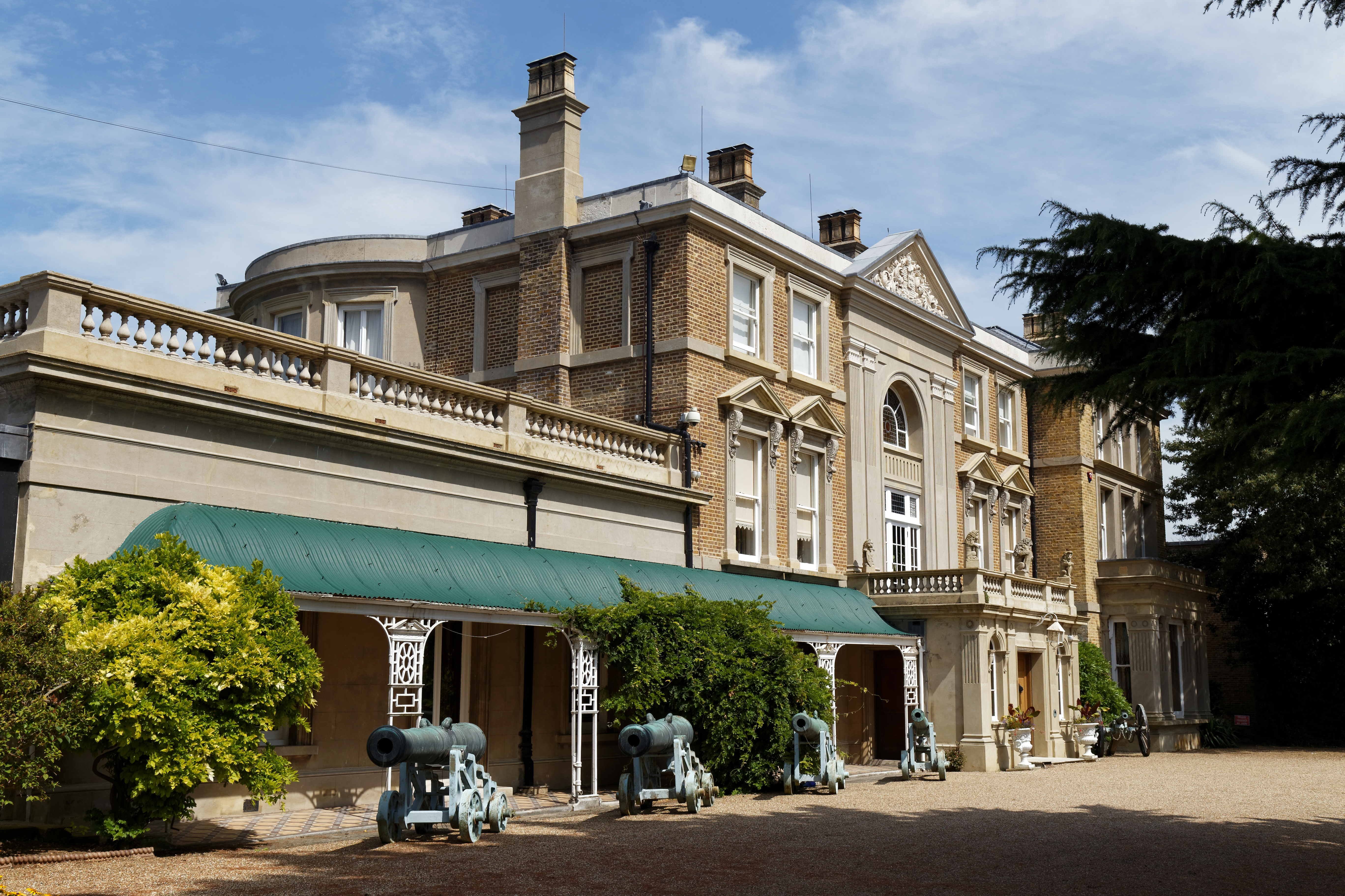
Quex Park
Quex Park itself is 250 acres (1.0 km2) of parkland and gardens plus a further 1500 acres of farmed land, with Quex House and other buildings situated...

Acol, Kent
Acol (formerly Acholt) is a hamlet and civil parish in the Thanet District of Kent, England, about 1.5 miles (2.4 km) south of Birchington. It is one of...
Nearby Amenities
Located within 500m of 51.37352,1.299477Have you been to Birchington?
Leave your review of Birchington below (or comments, questions and feedback).