Bingham
Civil Parish in Nottinghamshire Rushcliffe
England
Bingham
Bingham is a civil parish located in the Rushcliffe borough of Nottinghamshire, England. It is situated on the eastern bank of the River Trent, approximately 9 miles east of Nottingham city center. The parish covers an area of about 9.5 square kilometers and has a population of around 9,000 people.
The town of Bingham has a rich history dating back to Roman times, and evidence of its past can still be seen today. The most notable historical landmark is Bingham Old Hall, a Grade I listed building that dates back to the 15th century. The town also has a number of other historic buildings, including the Buttercross, a stone market cross, and the Church of St. Mary and All Saints, a medieval church with a tall spire.
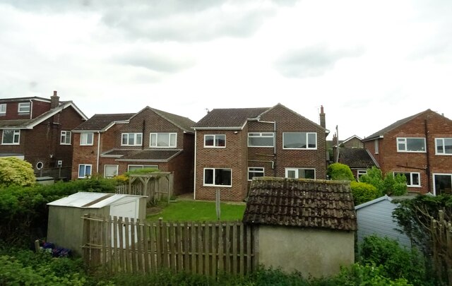
Bingham is a vibrant and thriving community with a range of amenities and services. It has a variety of shops, including both independent retailers and national chains, as well as several supermarkets. The town also has a leisure center, library, medical center, and a number of restaurants, pubs, and cafes.
In terms of transportation, Bingham is well-connected to nearby towns and cities. It has its own railway station, providing regular services to Nottingham, Grantham, and Skegness. The nearby A52 road offers easy access to Nottingham and Leicester, while the A46 provides a link to Newark-on-Trent.
Overall, Bingham is a picturesque and historic parish that offers a high quality of life for its residents, with a good range of amenities and excellent transport links.
If you have any feedback on the listing, please let us know in the comments section below.
Bingham Images
Images are sourced within 2km of 52.946604/-0.951223 or Grid Reference SK7039. Thanks to Geograph Open Source API. All images are credited.


Bingham is located at Grid Ref: SK7039 (Lat: 52.946604, Lng: -0.951223)
Administrative County: Nottinghamshire
District: Rushcliffe
Police Authority: Nottinghamshire
What 3 Words
///included.unclaimed.shack. Near Bingham, Nottinghamshire
Related Wikis

Toot Hill School
Toot Hill School is a coeducational secondary school and sixth form, located in Bingham in the English county of Nottinghamshire, built in 1969. The school...

Bingham Rural District
Bingham was a rural district in Nottinghamshire, England from 1894 to 1974. It was created under the Local Government Act 1894 from the Bingham rural sanitary...

Church of St. Mary and All Saints, Bingham
The Church of St. Mary and All Saints, Bingham, is the parish church of Bingham in the Rushcliffe borough of Nottinghamshire, England. The church, in the...

Bingham, Nottinghamshire
Bingham is a market town and civil parish in the Rushcliffe borough of Nottinghamshire, England, 9 miles (14 km) east of Nottingham, 12 miles (18.8 km...
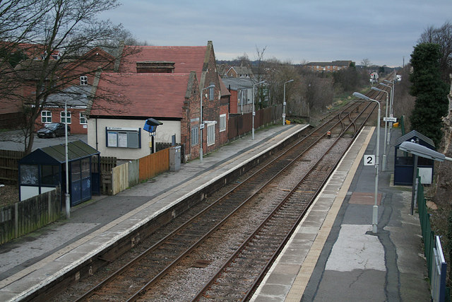
Bingham railway station
Bingham railway station serves the market town of Bingham, Nottinghamshire, England. The station is 8½ miles (14 km) east of Nottingham on the Nottingham...

Bingham Road railway station (Nottinghamshire)
Bingham Road railway station, on the Great Northern and London and North Western Joint Railway, was one of two stations serving the town of Bingham, Nottinghamshire...
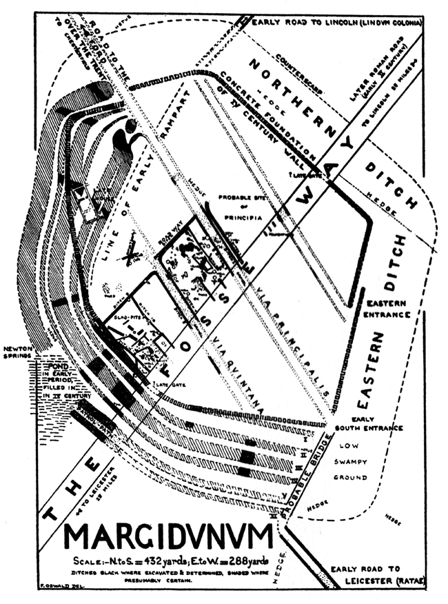
Margidunum
Margidunum was a Roman settlement on the Fosse Way at Castle Hill near present-day Bingham, in Nottinghamshire, England. The site is a protected Scheduled...
Saxondale, Nottinghamshire
Saxondale is a small hamlet and civil parish in the Rushcliffe borough of Nottinghamshire, England, situated just off the A52 road near to its junction...
Nearby Amenities
Located within 500m of 52.946604,-0.951223Have you been to Bingham?
Leave your review of Bingham below (or comments, questions and feedback).