Bilsby

Civil Parish in Lincolnshire East Lindsey

England

Bilsby

Footpath to Thurlby
Footpath to Thurlby Credit: Jonathan Thacker

Bilsby is a small civil parish located in the East Lindsey district of Lincolnshire, England. It is situated approximately 6 miles northeast of Alford and 10 miles southwest of Mablethorpe. The parish is predominantly rural, with a population of around 200 residents.

The village of Bilsby itself is characterized by its charming and picturesque setting, surrounded by rolling farmland and offering stunning views of the Lincolnshire Wolds. The area is known for its peaceful and tranquil atmosphere, making it a popular destination for those seeking a quiet retreat.

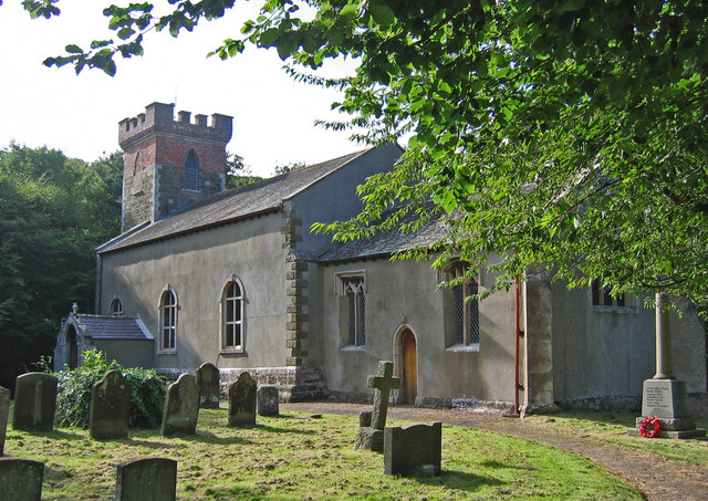
The parish is dotted with traditional, well-preserved cottages and farmhouses, reflecting its historical roots. Bilsby is also home to the Grade II listed St. Margaret's Church, which dates back to the 12th century and boasts a beautiful Norman tower.

While Bilsby is primarily an agricultural community, it offers a range of amenities and services to its residents. These include a village hall, a primary school, and a small convenience store. The parish is well-connected to nearby towns and villages via a reliable bus service, providing easy access to additional amenities, such as shops, restaurants, and healthcare facilities.

In terms of recreational activities, Bilsby benefits from its proximity to the Lincolnshire Wolds, an Area of Outstanding Natural Beauty. This provides ample opportunities for outdoor pursuits, including walking, cycling, and horse riding. The nearby coastline also offers access to beautiful sandy beaches and a variety of water sports activities.

Overall, Bilsby is a charming and idyllic parish, offering a peaceful rural lifestyle, stunning natural beauty, and a strong sense of community spirit.

If you have any feedback on the listing, please let us know in the comments section below.
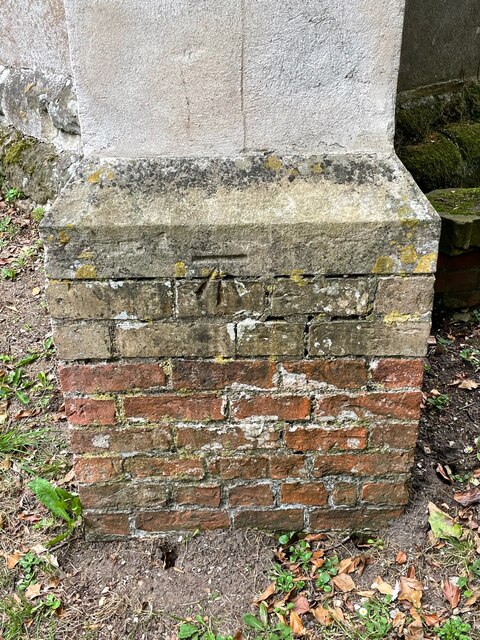
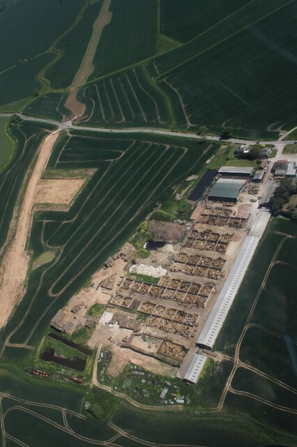
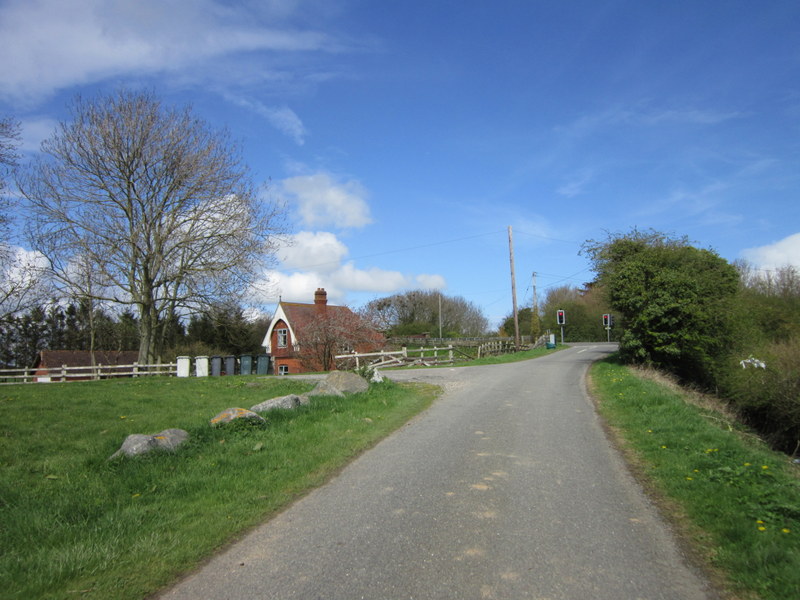
Bilsby Images

Images are sourced within 2km of 53.265728/0.220775 or Grid Reference TF4876. Thanks to Geograph Open Source API. All images are credited.

Footpath to Thurlby
Footpath to Thurlby
Wheat field near Huttoft
Cut Mark: Bilsby, Holy Trinity Church Cut bench mark on the outward face of the buttress at the north-east angle of the church.  See <span class="nowrap"><a title="https://www.bench-marks.org.uk/bm83274" rel="nofollow ugc noopener" href="https://www.bench-marks.org.uk/bm83274">Link</a><img style="margin-left:2px;" alt="External link" title="External link - shift click to open in new window" src="https://s1.geograph.org.uk/img/external.png" width="10" height="10"/></span> for details of the mark.
Cut Mark: Bilsby, Holy Trinity Church
Cut bench mark on the outward face of the buttress at the north-east angle of the church. See LinkExternal link for details of the mark.
Cattle pens, Furze Hill, south of Markby: aerial 2023
Site of Thurlby DMV: aerial 2023 See: <span class="nowrap"><a title="https://www.heritagegateway.org.uk/Gateway/Results_Single.aspx?uid=MLI41486&resourceID=1006" rel="nofollow ugc noopener" href="https://www.heritagegateway.org.uk/Gateway/Results_Single.aspx?uid=MLI41486&resourceID=1006">Link</a><img style="margin-left:2px;" alt="External link" title="External link - shift click to open in new window" src="https://s1.geograph.org.uk/img/external.png" width="10" height="10"/></span>
Site of Thurlby DMV: aerial 2023
See: LinkExternal link
Free range hen farm at Asserby Turn, Bilsby: aerial 2023
Seagull Farm The warm summer has led to a bumper crop of seagulls in this field.
Seagull Farm
The warm summer has led to a bumper crop of seagulls in this field.
South Fen Drain from Huttoft Road
Big Asbestos Barn Asbestos the building material of the future, at least it was until the effects it had on the human body were discovered.  This example is part of Willow Farm in Asserby.
Big Asbestos Barn
Asbestos the building material of the future, at least it was until the effects it had on the human body were discovered. This example is part of Willow Farm in Asserby.
Road Under Mud This is a public road and not a farm track.  The road joins Asserby with Asserby Turn.
Road Under Mud
This is a public road and not a farm track. The road joins Asserby with Asserby Turn.
Wolds Foothills This slightly rolling landscape is the first ripple in the flat former marshland before the climb up to the Lincolnshire Wolds.
Wolds Foothills
This slightly rolling landscape is the first ripple in the flat former marshland before the climb up to the Lincolnshire Wolds.
Extended Windmill The red brickwork on the top of this former mill is an extension that was required to raise the sails after they were replaced with the newly invented patent sails.  Before patent sails were installed the sails had to be nearer the ground to allow canvas to be fitted to them.  The low sweeping sails often resulted in the death of forgetful millers.
Extended Windmill
The red brickwork on the top of this former mill is an extension that was required to raise the sails after they were replaced with the newly invented patent sails. Before patent sails were installed the sails had to be nearer the ground to allow canvas to be fitted to them. The low sweeping sails often resulted in the death of forgetful millers.
Former Chapel This former Wesleyan chapel was established in 1835.  The front wall was clearly home to the entrance door.
Former Chapel
This former Wesleyan chapel was established in 1835. The front wall was clearly home to the entrance door.
Off to Harvest These two harvesters were almost filling the road as they travel between fields.  The shadow in the ditch is a footpath sign and someone taking photographs.
Off to Harvest
These two harvesters were almost filling the road as they travel between fields. The shadow in the ditch is a footpath sign and someone taking photographs.
Pylons and Track This row of wooden pylons follow the line of this farm access track.
Pylons and Track
This row of wooden pylons follow the line of this farm access track.
Caravans and Trees This caravan site is on a former railway line to Sutton on Sea.
Caravans and Trees
This caravan site is on a former railway line to Sutton on Sea.
Field and Cars By the side of this huge field of wheat is the back of the Vauxhall dealership in Thurlby.  The building on the right of the picture is one of theirs.
Field and Cars
By the side of this huge field of wheat is the back of the Vauxhall dealership in Thurlby. The building on the right of the picture is one of theirs.
Holy Trinity Church, Bilsby
Show me another place!

Bilsby is located at Grid Ref: TF4876 (Lat: 53.265728, Lng: 0.220775)

Administrative County: Lincolnshire

District: East Lindsey

Police Authority: Lincolnshire

What 3 Words

///camp.detail.galloped. Near Alford, Lincolnshire

Nearby Locations

Bilsby

Related Wikis

Bilsby

Bilsby is a village and civil parish in the East Lindsey district of Lincolnshire, England. It lies on the main A1111 road between Alford and Sutton-on...

Mumby Road railway station

Mumby Road railway station was a station on the Great Northern Railway's Mablethorpe Loop line between Willoughby, Mablethorpe and Louth. It served the...

Markby Priory

Markby Priory was a priory in the village of Markby, Lincolnshire, England. It is believed the Augustinian Priory was founded during the reign of Henry...

Markby

Markby is a village and civil parish in the East Lindsey district of Lincolnshire, England. It is situated approximately 4 miles (6 km) north-east from...

Alford Windmill

Alford Windmill is a five-sailed windmill in Alford, Lincolnshire and the only surviving windmill out of four. Though the windmill has been restored to...

Farlesthorpe

Farlesthorpe is a hamlet in the East Lindsey district of Lincolnshire, England. It is situated approximately 2 miles (3 km) south-east from Alford, and...

Alford and Sutton Tramway

The Alford and Sutton Tramway was a steam 2 ft 6 in (762 mm) narrow gauge street tramway between the seaside town of Sutton-on-Sea and the nearby Great...

John Spendluffe Technology College

John Spendluffe Technology College is a secondary school with academy status situated on Hanby Lane in the rural market town of Alford, Lincolnshire, England...

Nearby Amenities

Located within 500m of 53.265728,0.220775
Dryby Farm
Place: farm
Source: Bing
Lat/Long: 53.2640707/0.2253682
Hollutrix Farm
Place: farm
Source: Bing
Lat/Long: 53.2624007/0.2167886
Rose Cottage
Place: isolated_dwelling
Source: Bing
Lat/Long: 53.2628584/0.2153773
The data included in this document is from www.openstreetmap.org. The data is made available under ODbL.

Have you been to Bilsby?

Leave your review of Bilsby below (or comments, questions and feedback).