Billington and Langho

Civil Parish in Lancashire Ribble Valley

England

Billington and Langho

Ebenezer Baptist Church, Billington
Ebenezer Baptist Church, Billington Credit: Greum

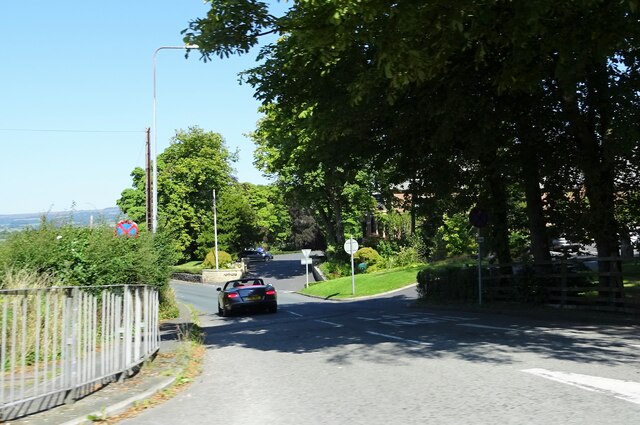
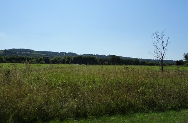
Billington and Langho is a civil parish located in the county of Lancashire, England. It is situated in the Ribble Valley district and covers an area of approximately 7.5 square miles. The parish includes the villages of Billington, Langho, and the surrounding rural areas.

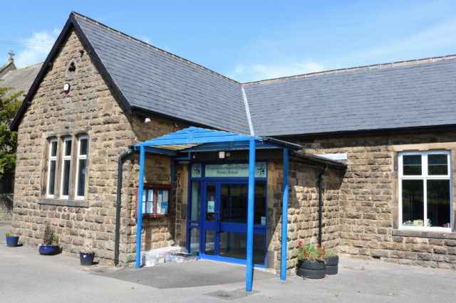
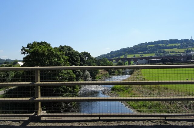
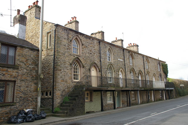
Billington is a small village located on the banks of the River Ribble. It is known for its picturesque surroundings and charming countryside. The village features a mix of traditional stone-built houses and more modern developments. Amenities in Billington include a primary school, a parish church, a pub, and a few local shops.

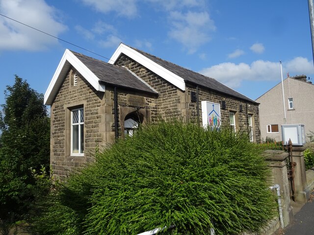
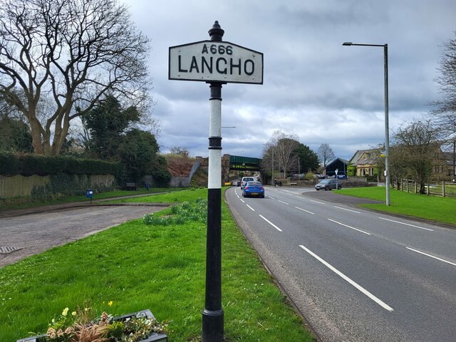
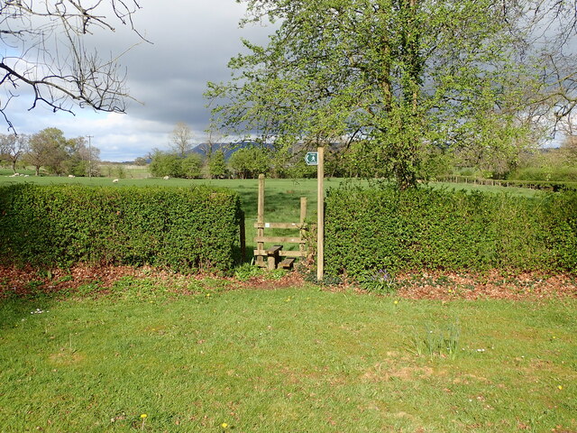
Langho, another village within the civil parish, is located slightly to the north of Billington. It is a peaceful and residential area with a close-knit community. Langho also has its own primary school, a church, a village hall, and a few local businesses. The village is surrounded by beautiful countryside and offers opportunities for outdoor activities such as walking and cycling.

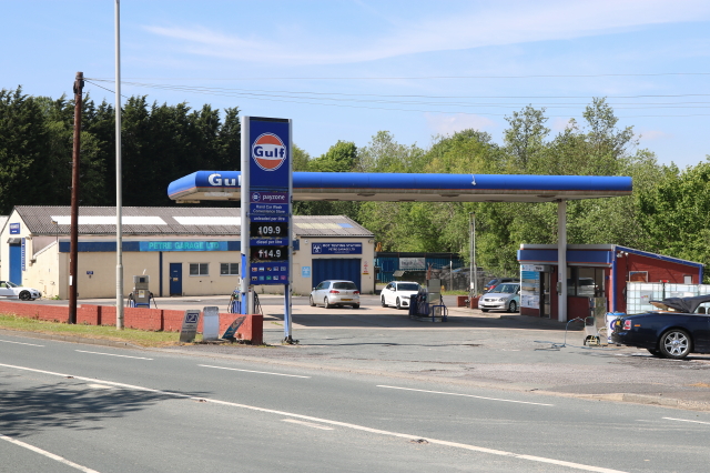
The civil parish of Billington and Langho is well-connected to nearby towns and cities. The A59 road runs through the area, providing easy access to Blackburn, Preston, and the wider Lancashire region. The parish also benefits from good public transport links, with regular bus services connecting it with neighboring towns.

Overall, Billington and Langho offer a tranquil and idyllic setting for residents and visitors alike. With its charming villages, stunning countryside, and convenient location, the civil parish has become a desirable place to live in Lancashire.

If you have any feedback on the listing, please let us know in the comments section below.

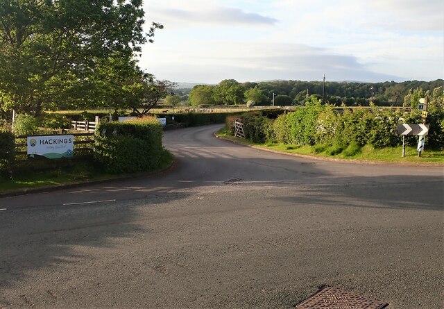
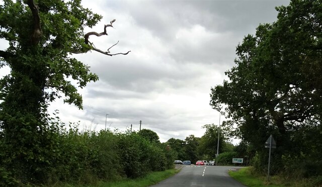
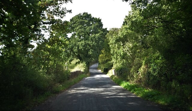
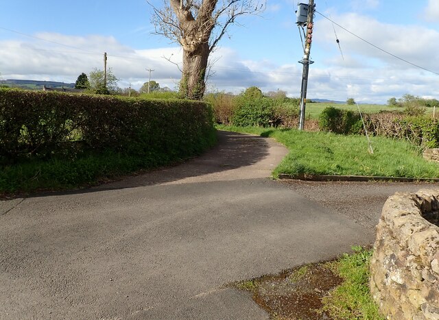
Billington and Langho Images

Images are sourced within 2km of 53.812545/-2.442831 or Grid Reference SD7035. Thanks to Geograph Open Source API. All images are credited.

Ebenezer Baptist Church, Billington
Petre Petrol Station and Garage Petrol Station, Car Wash and Garage
Petre Petrol Station and Garage
Petrol Station, Car Wash and Garage
St Leonard's C of E Primary School Main entrance - original building
St Leonard's C of E Primary School
Main entrance - original building
Clitheroe to Rochdale service (150004)
Northcote Road At its junction with the A59.
Northcote Road
At its junction with the A59.
River Calder from A59 Whalley Viaduct is in the background.
River Calder from A59
Whalley Viaduct is in the background.
Farmland off the A59 Near Billington.
Farmland off the A59
Near Billington.
Village Signpost on the A666 in Langho Located on the east side of the A666 south of its junction with Whalley Road in Billington and Langho parish. 

Milestone Society National ID: LA_SD7034V
Village Signpost on the A666 in Langho
Located on the east side of the A666 south of its junction with Whalley Road in Billington and Langho parish. Milestone Society National ID: LA_SD7034V
Stile Old Nab Road The stile on Old Nab Road just out of York Village. The style provides access to more than one path.
Stile Old Nab Road
The stile on Old Nab Road just out of York Village. The style provides access to more than one path.
Stile on Moor Lane at Nab Top The stile provides access to a footpath that leads across the field towards Shawcliffe Lane.
Stile on Moor Lane at Nab Top
The stile provides access to a footpath that leads across the field towards Shawcliffe Lane.
Stile at Briercliffe Farm The stile situated at the Junction of Moor lane and Shawclffe Lane next to the entrance to Briercliffe Farm.
Stile at Briercliffe Farm
The stile situated at the Junction of Moor lane and Shawclffe Lane next to the entrance to Briercliffe Farm.
Building off Moor Lane Entrance to Buildings at Miles Hill off Moor Lane.
Building off Moor Lane
Entrance to Buildings at Miles Hill off Moor Lane.
Footpath from Larkhill Cottages The stile for the footpath at Larkhill Cottages leading across the fields towards Hacking Hall.
Footpath from Larkhill Cottages
The stile for the footpath at Larkhill Cottages leading across the fields towards Hacking Hall.
Entrance Hackings Holiday Park The entrance for Hackings Holiday Home Park at the junction of Old Langho Road and Pashmire Brow.
Entrance Hackings Holiday Park
The entrance for Hackings Holiday Home Park at the junction of Old Langho Road and Pashmire Brow.
Road junction Chapel Lane meets the A59 south of Dinckley.
Road junction
Chapel Lane meets the A59 south of Dinckley.
Dinckley Bridge Carrying Ribchester Road over Dinckley Brook.
Dinckley Bridge
Carrying Ribchester Road over Dinckley Brook.
Bend in Moorgate Lane The lane bends off to the left at this point and becomes a very narrow single track road leading off towards Craven Fold Farm.
Bend in Moorgate Lane
The lane bends off to the left at this point and becomes a very narrow single track road leading off towards Craven Fold Farm.
Wade Platts Farm
Wade Platts Farm
Show me another place!

Billington and Langho is located at Grid Ref: SD7035 (Lat: 53.812545, Lng: -2.442831)

Administrative County: Lancashire

District: Ribble Valley

Police Authority: Lancashire

What 3 Words

///ditching.coached.parkway. Near Billington, Lancashire

Related Wikis

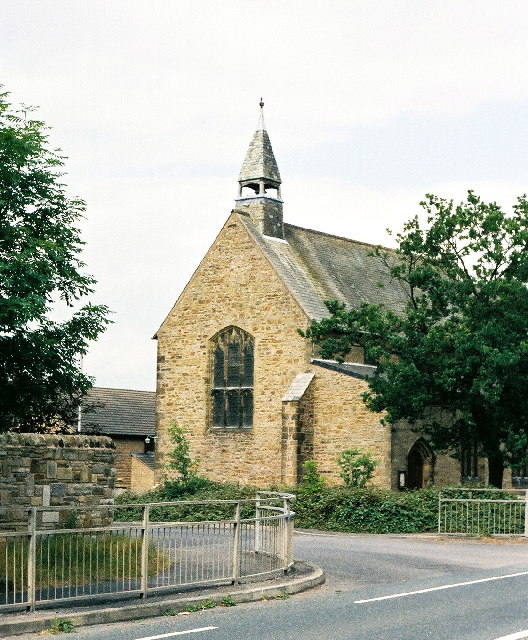
New St Leonard's Church, Langho

New St Leonard's Church is in Whalley New Road, between the villages of Langho and Billington in Lancashire, England. It is an active Anglican parish...

Northcote, Langho

Northcote is a hotel and restaurant in a 19th-century manor house in Langho, Lancashire, England. The restaurant has held a Michelin star since the 1996...

Billington and Langho

Billington and Langho is a civil parish in the Ribble Valley district of Lancashire, England, covering the villages of Billington and Langho and the hamlets...

Langho railway station

Langho railway station serves the village of Langho in the Ribble Valley in Lancashire, England. The station is 5+1⁄4 miles (8.4 km) north of Blackburn...

Langho

Langho is a small rural village 5 miles (8 km) north of Blackburn in the Ribble Valley, Lancashire, England. It is part of the parish of Billington and...

Old St Leonard's Church, Langho

Old St Leonard's Church is a redundant Anglican church 1 mile (1.6 km) northwest of the village of Langho, Lancashire, England. It is recorded in the...

St Augustine's Roman Catholic High School, Billington

St Augustine's RC High School is a coeducational Roman Catholic secondary school located in Billington, Lancashire, England. == History == The school opened...

Brockhall Village

Brockhall Village is a gated community in the Ribble Valley, Lancashire, England. The village is in the civil parish of Billington and Langho and is 7...

Nearby Amenities

Located within 500m of 53.812545,-2.442831
Bus Stop
Bus: yes
Public Transport: platform
Lat/Long: 53.8095234/-2.4411568
Crossing
Crossing: unmarked
Lat/Long: 53.8107755/-2.4429386
Turning Circle
Lat/Long: 53.8095185/-2.4427579
Bus Stop
Bus: yes
Public Transport: platform
Lat/Long: 53.8087078/-2.4421332
Petre Garage
Opening Hours: Mo-Fr 08:30-17:30, Sa 08:30-12:00
Payment Cash: yes
Payment Cheque: yes
Phone: +44 1254 248136
Service Vehicle Car Repair: yes
Service Vehicle Inspection: yes
Service Vehicle Mot: yes
Service Vehicle Tyres: yes
Shop: car_repair
Website: http://petregarage.co.uk/
Lat/Long: 53.8089468/-2.4422842
Generator Method: photovoltaic
Generator Output Electricity: yes
Generator Source: solar
Generator Type: solar_photovoltaic_panel
Location: roof
Power: generator
Lat/Long: 53.8098061/-2.443114
Generator Method: photovoltaic
Generator Output Electricity: yes
Generator Source: solar
Generator Type: solar_photovoltaic_panel
Location: roof
Power: generator
Lat/Long: 53.8098202/-2.4429948
Generator Method: photovoltaic
Generator Output Electricity: yes
Generator Source: solar
Generator Type: solar_photovoltaic_panel
Location: roof
Power: generator
Lat/Long: 53.8098259/-2.4429224
Generator Method: photovoltaic
Generator Output Electricity: yes
Generator Source: solar
Generator Type: solar_photovoltaic_panel
Location: roof
Power: generator
Lat/Long: 53.8098331/-2.44278
Generator Method: photovoltaic
Generator Output Electricity: yes
Generator Source: solar
Generator Type: solar_photovoltaic_panel
Location: roof
Power: generator
Lat/Long: 53.8093241/-2.4428309
Generator Method: photovoltaic
Generator Output Electricity: yes
Generator Source: solar
Generator Type: solar_photovoltaic_panel
Location: roof
Power: generator
Lat/Long: 53.8093368/-2.4427451
Generator Method: photovoltaic
Generator Output Electricity: yes
Generator Source: solar
Generator Type: solar_photovoltaic_panel
Location: roof
Power: generator
Lat/Long: 53.8093479/-2.4426592
Generator Method: photovoltaic
Generator Output Electricity: yes
Generator Source: solar
Generator Type: solar_photovoltaic_panel
Location: roof
Power: generator
Lat/Long: 53.8093637/-2.4425868
Generator Method: photovoltaic
Generator Output Electricity: yes
Generator Source: solar
Generator Type: solar_photovoltaic_panel
Location: roof
Power: generator
Lat/Long: 53.8097685/-2.4422696
Generator Method: photovoltaic
Generator Output Electricity: yes
Generator Source: solar
Generator Type: solar_photovoltaic_panel
Location: roof
Power: generator
Lat/Long: 53.8097863/-2.4423414
Generator Method: photovoltaic
Generator Output Electricity: yes
Generator Source: solar
Generator Type: solar_photovoltaic_panel
Location: roof
Power: generator
Lat/Long: 53.8098124/-2.4424823
Generator Method: photovoltaic
Generator Output Electricity: yes
Generator Source: solar
Generator Type: solar_photovoltaic_panel
Location: roof
Power: generator
Lat/Long: 53.8098254/-2.4425639
Generator Method: photovoltaic
Generator Output Electricity: yes
Generator Source: solar
Generator Type: solar_photovoltaic_panel
Location: roof
Power: generator
Lat/Long: 53.8096985/-2.4421584
Generator Method: photovoltaic
Generator Output Electricity: yes
Generator Source: solar
Generator Type: solar_photovoltaic_panel
Location: roof
Power: generator
Lat/Long: 53.8096679/-2.4420842
Generator Method: photovoltaic
Generator Output Electricity: yes
Generator Source: solar
Generator Type: solar_photovoltaic_panel
Location: roof
Power: generator
Lat/Long: 53.8095905/-2.4419582
Generator Method: photovoltaic
Generator Output Electricity: yes
Generator Source: solar
Generator Type: solar_photovoltaic_panel
Location: roof
Power: generator
Lat/Long: 53.8095521/-2.4419033
Generator Method: photovoltaic
Generator Output Electricity: yes
Generator Source: solar
Generator Type: solar_photovoltaic_panel
Location: roof
Power: generator
Lat/Long: 53.8098342/-2.4427052
Turning Circle
Lat/Long: 53.8115562/-2.440207
The data included in this document is from www.openstreetmap.org. The data is made available under ODbL.

Have you been to Billington and Langho?

Leave your review of Billington and Langho below (or comments, questions and feedback).