Bierton with Broughton

Civil Parish in Buckinghamshire

England

Bierton with Broughton

Aylesbury High Street station entrance, 1953 The terminus of the ex-LNWR branch from Cheddington, seen on the Last Day (31/1/53) of passenger services; freight traffic continued over 10 more years, until 2/12/63. The 'vintage' cars will be noticed
Aylesbury High Street station entrance, 1953 Credit: Ben Brooksbank

Bierton with Broughton is a civil parish located in the county of Buckinghamshire, England. The parish is situated approximately 2 miles northwest of the town of Aylesbury, the county's administrative capital. It encompasses the villages of Bierton and Broughton, along with the surrounding countryside.

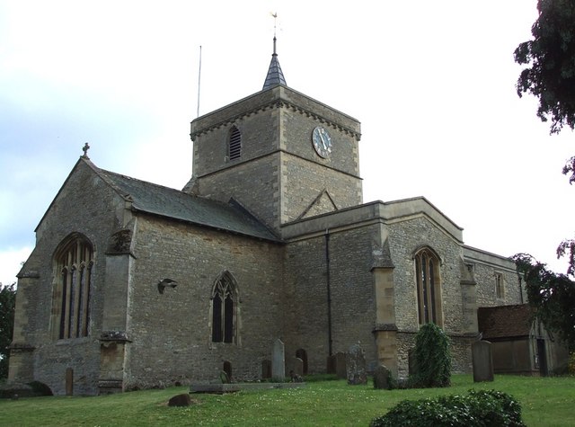
Bierton is the larger of the two villages and is home to a range of amenities, including a primary school, a village hall, and several local shops and pubs. The village also boasts a historic church, St. James the Great, which dates back to the 13th century and is known for its unique architecture.

Broughton, on the other hand, is a smaller village with a more rural character. It is known for its picturesque countryside, with rolling hills and open fields that offer scenic views. The village has a close-knit community and a peaceful atmosphere, making it an ideal place for those seeking a quieter lifestyle.

Both villages benefit from their proximity to the larger town of Aylesbury, which provides a wider range of services, including shopping centers, leisure facilities, and healthcare services. The area is well-connected by road, with the A41 running through the parish, providing easy access to other towns and cities in the region.

Overall, Bierton with Broughton offers a blend of rural charm and convenient access to urban amenities, making it an attractive place to live for those seeking a balance between a peaceful countryside setting and the conveniences of modern life.

If you have any feedback on the listing, please let us know in the comments section below.

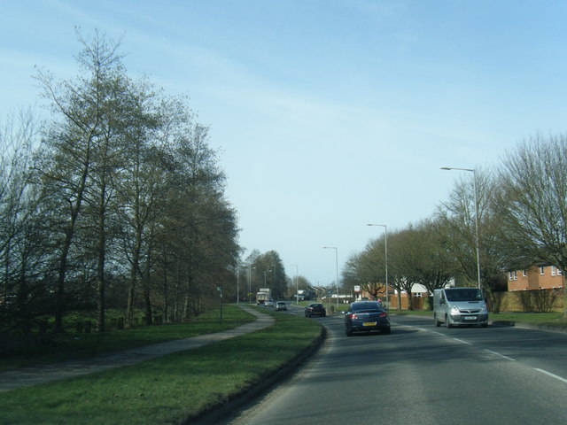
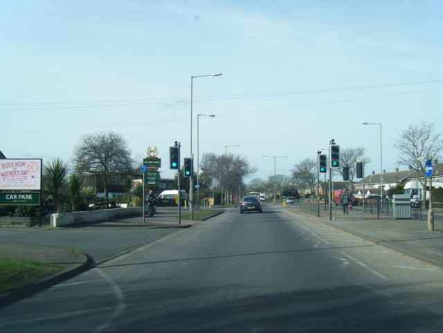
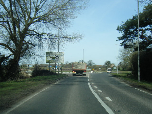
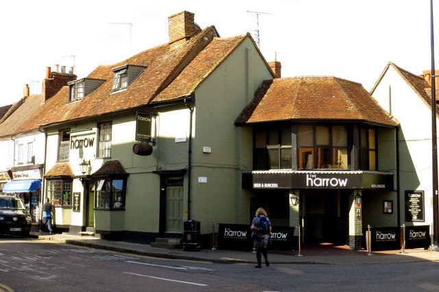
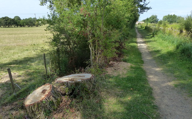
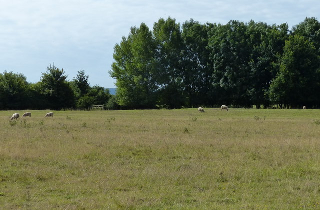
Bierton with Broughton Images

Images are sourced within 2km of 51.82658/-0.796034 or Grid Reference SP8314. Thanks to Geograph Open Source API. All images are credited.

Aylesbury High Street station entrance, 1953 The terminus of the ex-LNWR branch from Cheddington, seen on the Last Day (31/1/53) of passenger services; freight traffic continued over 10 more years, until 2/12/63. The 'vintage' cars will be noticed
Aylesbury High Street station entrance, 1953
The terminus of the ex-LNWR branch from Cheddington, seen on the Last Day (31/1/53) of passenger services; freight traffic continued over 10 more years, until 2/12/63. The 'vintage' cars will be noticed
The clock tower in the Market Square
The alley to the Kings Head The Kings Head is a National Trust property.
The alley to the Kings Head
The Kings Head is a National Trust property.
The Kings Head in Aylesbury The Kings Head is a National Trust property.
The Kings Head in Aylesbury
The Kings Head is a National Trust property.
Buildings at the rear of the Kings Head's courtyard The Kings Head is a National Trust property.
Buildings at the rear of the Kings Head's courtyard
The Kings Head is a National Trust property.
The courtyard of the Kings Head The Kings Head is a National Trust property.
The courtyard of the Kings Head
The Kings Head is a National Trust property.
The courtyard of the Kings Head The Kings Head is a National Trust property.
The courtyard of the Kings Head
The Kings Head is a National Trust property.
A41 Tring Road
A41 Tring Road
A4157 Douglas Road
A4157 Douglas Road
A4157 Elmhurst Road at The Dairy Maid public house
A413 Buckingham Road leaving Aylesbury
The Harrow on Cambridge Street
The statue of John Hampden The statue is in the Market Square.
The statue of John Hampden
The statue is in the Market Square.
The statue of Benjamin Disraeli The statue is in the Market Square.
The statue of Benjamin Disraeli
The statue is in the Market Square.
The War Memorial in the Market Square
Towpath along the Aylesbury Arm of the Grand Union Canal The Aylesbury Arm is six and a quarter miles long and has sixteen locks. It runs west from Marsworth Junction to the centre of Aylesbury.
Towpath along the Aylesbury Arm of the Grand Union Canal
The Aylesbury Arm is six and a quarter miles long and has sixteen locks. It runs west from Marsworth Junction to the centre of Aylesbury.
Sheep and pasture next to the Aylesbury Arm The Aylesbury Arm of the Grand Union Canal is six and a quarter miles long and has sixteen locks. It runs west from Marsworth Junction to the centre of Aylesbury.
Sheep and pasture next to the Aylesbury Arm
The Aylesbury Arm of the Grand Union Canal is six and a quarter miles long and has sixteen locks. It runs west from Marsworth Junction to the centre of Aylesbury.
Aston Clinton Field Bridge No 14 Crossing the Aylesbury Arm of the Grand Union Canal.
The Aylesbury Arm is six and a quarter miles long and has sixteen locks. It runs west from Marsworth Junction to the centre of Aylesbury.
Aston Clinton Field Bridge No 14
Crossing the Aylesbury Arm of the Grand Union Canal. The Aylesbury Arm is six and a quarter miles long and has sixteen locks. It runs west from Marsworth Junction to the centre of Aylesbury.
Show me another place!

Bierton with Broughton is located at Grid Ref: SP8314 (Lat: 51.82658, Lng: -0.796034)

Unitary Authority: Buckinghamshire

Police Authority: Thames Valley

What 3 Words

///racing.soak.civic. Near Aylesbury, Buckinghamshire

Nearby Locations

Bierton with Broughton

Related Wikis

HM Prison Aylesbury

His Majesty's Prison Aylesbury is a category C training prison situated in Aylesbury, Buckinghamshire, England. It is located on the north side of the...

Tindal Centre

The Tindal Centre (formerly Tindal Hospital) was a centre for the treatment of mental disorders in Aylesbury, Buckinghamshire, England. It was managed...

Bierton

Bierton is a village and civil parish in Buckinghamshire, England, about half a mile northeast of the town of Aylesbury. It is mainly a farming parish...

Elmhurst, Aylesbury

Elmhurst is a neighbourhood in north Aylesbury in Buckinghamshire, England. It occupies the area to the north and south of Elmhurst Road, now a section...

Nearby Amenities

Located within 500m of 51.82658,-0.796034
Source: survey
Lat/Long: 51.8296193/-0.8013796
Source: survey
Lat/Long: 51.829384/-0.8016867
Source: survey
Lat/Long: 51.8297286/-0.8011405
Source: survey
Lat/Long: 51.829321/-0.8006685
Source: survey
Lat/Long: 51.8290385/-0.8008377
Source: survey
Lat/Long: 51.8298423/-0.8008747
Dearing Close
Lat/Long: 51.8263364/-0.7983475
Source: survey
Lat/Long: 51.8247655/-0.7958465
Source: survey
Lat/Long: 51.8246436/-0.7955878
Source: survey
Lat/Long: 51.8235744/-0.79624
Source: survey
Lat/Long: 51.8236952/-0.7964654
Place Of Worship
The Salvation Army Aylesbury Corps
Addr City: Aylesbury
Addr Country: GB
Addr Postcode: HP20 1XS
Addr Street: Meadow Way
Denomination: salvation_army
Email: aylesbury@salvationarmy.org.uk
Phone: 01296 398 336
Religion: christian
Source: survey
Website: https://www.salvationarmy.org.uk/aylesbury
Lat/Long: 51.8227864/-0.7934087
Pharmacy
Rowlands Pharmacy
Brand: Rowlands Pharmacy
Brand Wikidata: Q62663235
Dispensing: yes
Healthcare: pharmacy
Website: https://rowlandspharmacy.co.uk/find-local-pharmacy#!/l/aylesbury/meadow-way/1450
Lat/Long: 51.8226341/-0.7939093
Turning Circle
Lat/Long: 51.8231632/-0.7986886
Turning Circle
Lat/Long: 51.8226103/-0.7974894
Coppice
Is In: Aylesbury
Place: suburb
Lat/Long: 51.8243857/-0.7948821
Fixme: ?buildings?
Source: npe
Lat/Long: 51.8269565/-0.7928629
Fixme: ?buildings?
Source: npe
Lat/Long: 51.8275045/-0.7922479
Post Box
Brand: Royal Mail
Brand Wikidata: Q638098
Brand Wikipedia: en:Royal Mail
Collection Times: Mo-Fr 17:15; Sa 12:00
Operator: Royal Mail
Operator Wikidata: Q638098
Post Box Type: lamp
Ref: HP20 52
Royal Cypher: EIIR
Royal Cypher Wikidata: Q33102113
Source: survey
Lat/Long: 51.825675/-0.7956532
Turning Circle
Lat/Long: 51.823542/-0.7960877
Tesco Express
Addr Postcode: HP20 1XB
Addr Street: Meadoway
Brand: Tesco Express
Brand Wikidata: Q98456772
Contact Website: https://www.tesco.com/store-locator/buckinghamshire/aylesbury-meadow
Fhrs Id: 1227754
Shop: convenience
Lat/Long: 51.8225426/-0.7937849
Power: pole
Lat/Long: 51.8285242/-0.8025344
Power: pole
Lat/Long: 51.8287091/-0.8019295
Power: pole
Lat/Long: 51.8287563/-0.8001915
Power: pole
Lat/Long: 51.8287812/-0.7990006
Power: pole
Lat/Long: 51.8288077/-0.7977212
Power: pole
Lat/Long: 51.8285089/-0.7998106
Power: pole
Lat/Long: 51.8285524/-0.800854
Power: pole
Lat/Long: 51.8284538/-0.7985728
Power: pole
Lat/Long: 51.828603/-0.8018839
Power: pole
Lat/Long: 51.8284297/-0.8024016
Crossing
Bicycle: yes
Button Operated: yes
Crossing: traffic_signals
Crossing Island: no
Crossing Ref: toucan
Kerb: lowered
Tactile Paving: yes
Traffic Signals Sound: no
Lat/Long: 51.8234833/-0.8002346
Crossing
Bicycle: yes
Button Operated: yes
Crossing: traffic_signals
Crossing Island: no
Crossing Ref: toucan
Kerb: lowered
Lat/Long: 51.8237125/-0.7983515
Barrier: kissing_gate
Lat/Long: 51.8299161/-0.7971276
Source: survey
Lat/Long: 51.8294328/-0.8004334
Direction: 235
Generator Method: photovoltaic
Generator Output Electricity: yes
Generator Solar Modules: 13
Generator Source: solar
Generator Type: solar_photovoltaic_panel
Location: roof
Power: generator
Lat/Long: 51.8235801/-0.7967559
Direction: 215
Generator Method: photovoltaic
Generator Output Electricity: yes
Generator Solar Modules: 10
Generator Source: solar
Generator Type: solar_photovoltaic_panel
Location: roof
Power: generator
Lat/Long: 51.8229668/-0.7986887
Direction: 105
Generator Method: photovoltaic
Generator Output Electricity: yes
Generator Solar Modules: 5
Generator Source: solar
Generator Type: solar_photovoltaic_panel
Location: roof
Power: generator
Lat/Long: 51.8223611/-0.794421
Direction: 195
Generator Method: photovoltaic
Generator Output Electricity: yes
Generator Solar Modules: 8
Generator Source: solar
Generator Type: solar_photovoltaic_panel
Location: roof
Power: generator
Lat/Long: 51.8223439/-0.7945
Direction: 145
Generator Method: photovoltaic
Generator Output Electricity: yes
Generator Solar Modules: 15
Generator Source: solar
Generator Type: solar_photovoltaic_panel
Location: roof
Power: generator
Lat/Long: 51.8221453/-0.7970023
Direction: 145
Generator Method: photovoltaic
Generator Output Electricity: yes
Generator Solar Modules: 50
Generator Source: solar
Generator Type: solar_photovoltaic_panel
Location: roof
Power: generator
Lat/Long: 51.8226966/-0.7943321
Direction: 235
Generator Method: photovoltaic
Generator Output Electricity: yes
Generator Solar Modules: 6
Generator Source: solar
Generator Type: solar_photovoltaic_panel
Location: roof
Power: generator
Lat/Long: 51.8226538/-0.7944917
Direction: 145
Generator Method: photovoltaic
Generator Output Electricity: yes
Generator Solar Modules: 15
Generator Source: solar
Generator Type: solar_photovoltaic_panel
Location: roof
Power: generator
Lat/Long: 51.8222646/-0.7967074
Direction: 195
Generator Method: photovoltaic
Generator Output Electricity: yes
Generator Solar Modules: 46
Generator Source: solar
Generator Type: solar_photovoltaic_panel
Location: roof
Power: generator
Lat/Long: 51.8223821/-0.7943762
Direction: 105
Generator Method: photovoltaic
Generator Output Electricity: yes
Generator Solar Modules: 5
Generator Source: solar
Generator Type: solar_photovoltaic_panel
Location: roof
Power: generator
Lat/Long: 51.8223836/-0.7941826
Direction: 145
Generator Method: photovoltaic
Generator Output Electricity: yes
Generator Solar Modules: 17
Generator Source: solar
Generator Type: solar_photovoltaic_panel
Location: roof
Power: generator
Lat/Long: 51.8222349/-0.7967856
Direction: 55
Generator Method: photovoltaic
Generator Output Electricity: yes
Generator Solar Modules: 4
Generator Source: solar
Generator Type: solar_photovoltaic_panel
Location: roof
Power: generator
Lat/Long: 51.8244544/-0.797503
Direction: 145
Generator Method: photovoltaic
Generator Output Electricity: yes
Generator Solar Modules: 14
Generator Source: solar
Generator Type: solar_photovoltaic_panel
Location: roof
Power: generator
Lat/Long: 51.8240904/-0.7974104
Direction: 145
Generator Method: photovoltaic
Generator Output Electricity: yes
Generator Solar Modules: 12
Generator Source: solar
Generator Type: solar_photovoltaic_panel
Location: roof
Power: generator
Lat/Long: 51.824442/-0.7975263
Direction: 55
Generator Method: photovoltaic
Generator Output Electricity: yes
Generator Solar Modules: 6
Generator Source: solar
Generator Type: solar_photovoltaic_panel
Location: roof
Power: generator
Lat/Long: 51.8246242/-0.7952504
Direction: 235
Generator Method: photovoltaic
Generator Output Electricity: yes
Generator Solar Modules: 6
Generator Source: solar
Generator Type: solar_photovoltaic_panel
Location: roof
Power: generator
Lat/Long: 51.8246145/-0.7952879
Direction: 235
Generator Method: photovoltaic
Generator Output Electricity: yes
Generator Solar Modules: 5
Generator Source: solar
Generator Type: solar_photovoltaic_panel
Location: roof
Power: generator
Lat/Long: 51.8264337/-0.7941573
Direction: 145
Generator Method: photovoltaic
Generator Output Electricity: yes
Generator Solar Modules: 7
Generator Source: solar
Generator Type: solar_photovoltaic_panel
Location: roof
Power: generator
Lat/Long: 51.8264346/-0.7941067
Crossing
Crossing: unmarked
Crossing Island: no
Crossing Markings: no
Tactile Paving: no
Lat/Long: 51.8255612/-0.8017397
Crossing
Crossing: unmarked
Crossing Island: no
Crossing Markings: no
Tactile Paving: no
Lat/Long: 51.8255136/-0.8017912
Crossing
Bicycle: yes
Crossing: marked
Crossing Island: no
Crossing Markings: yes
Tactile Paving: yes
Lat/Long: 51.8256111/-0.7957579
Crossing
Crossing: zebra
Lat/Long: 51.8256697/-0.8005837
Crossing
Crossing: unmarked
Crossing Markings: no
Tactile Paving: yes
Lat/Long: 51.8226519/-0.7957454
Crossing
Crossing: unmarked
Crossing Island: no
Crossing Markings: no
Tactile Paving: yes
Lat/Long: 51.8233645/-0.797947
Leisure: playground
Lat/Long: 51.8246344/-0.7905151
Hoops: 1
Leisure: pitch
Sport: basketball
Lat/Long: 51.8243788/-0.7907686
Bench
Lat/Long: 51.8251981/-0.7920705
Barrier: bollard
Bicycle: yes
Foot: yes
Motor Vehicle: no
Lat/Long: 51.8239217/-0.7970831
Direction: 135
Generator Method: photovoltaic
Generator Output Electricity: yes
Generator Solar Modules: 4
Generator Source: solar
Generator Type: solar_photovoltaic_panel
Location: roof
Power: generator
Lat/Long: 51.8276035/-0.7918555
Direction: 225
Generator Method: photovoltaic
Generator Output Electricity: yes
Generator Solar Modules: 4
Generator Source: solar
Generator Type: solar_photovoltaic_panel
Location: roof
Power: generator
Lat/Long: 51.8276434/-0.7918861
Bus Stop
Bus: yes
Naptan AtcoCode: 040000004203
Naptan NaptanCode: bucdtpmw
Public Transport: platform
Shelter: no
Lat/Long: 51.8275638/-0.7927619
Crossing
Lat/Long: 51.8267342/-0.794019
Power: pole
Lat/Long: 51.8292918/-0.7984479
Power: pole
Lat/Long: 51.8296777/-0.7989522
Crossing
Crossing: unmarked
Crossing Island: no
Crossing Markings: no
Tactile Paving: no
Lat/Long: 51.8227358/-0.7929383
Crossing
Lat/Long: 51.8228052/-0.7937958
Direction: 230
Generator Method: photovoltaic
Generator Output Electricity: yes
Generator Source: solar
Generator Type: solar_photovoltaic_panel
Location: roof
Power: generator
Lat/Long: 51.8293788/-0.7906881
Crossing
Lat/Long: 51.8248036/-0.8002397
Crossing
Crossing: unmarked
Crossing Island: no
Crossing Markings: no
Tactile Paving: yes
Lat/Long: 51.8251459/-0.800774
Turning Circle
Lat/Long: 51.8262563/-0.7959174
Direction: 175
Generator Method: photovoltaic
Generator Output Electricity: yes
Generator Source: solar
Generator Type: solar_photovoltaic_panel
Location: roof
Power: generator
Lat/Long: 51.8234454/-0.7997339
Generator Method: photovoltaic
Generator Output Electricity: yes
Generator Source: solar
Generator Type: solar_photovoltaic_panel
Location: roof
Power: generator
Lat/Long: 51.8234593/-0.7996404
Crossing
Crossing: unmarked
Crossing Island: no
Crossing Markings: no
Tactile Paving: yes
Lat/Long: 51.824533/-0.8001598
Crossing
Crossing: unmarked
Crossing Island: no
Crossing Markings: no
Tactile Paving: yes
Lat/Long: 51.8248732/-0.8006716
Crossing
Crossing: unmarked
Crossing Island: no
Crossing Markings: no
Tactile Paving: yes
Lat/Long: 51.8251914/-0.8012263
Crossing
Crossing: unmarked
Crossing Island: no
Crossing Markings: no
Tactile Paving: yes
Lat/Long: 51.8266825/-0.8027871
Direction: 230
Generator Method: photovoltaic
Generator Output Electricity: yes
Generator Source: solar
Generator Type: solar_photovoltaic_panel
Location: roof
Power: generator
Lat/Long: 51.8243628/-0.8015372
Direction: 220
Generator Method: photovoltaic
Generator Output Electricity: yes
Generator Source: solar
Generator Type: solar_photovoltaic_panel
Location: roof
Power: generator
Lat/Long: 51.8234277/-0.7914882
The data included in this document is from www.openstreetmap.org. The data is made available under ODbL.

Have you been to Bierton with Broughton?

Leave your review of Bierton with Broughton below (or comments, questions and feedback).