Biddlestone

Civil Parish in Northumberland

England

Biddlestone

A peek into Harden Quarry The source of red roadstone.  'Harden Red' is a red volcanic felsite.  It is used for cycleways, bus lanes and, famously, for surfacing The Mall.
A peek into Harden Quarry Credit: Leanmeanmo

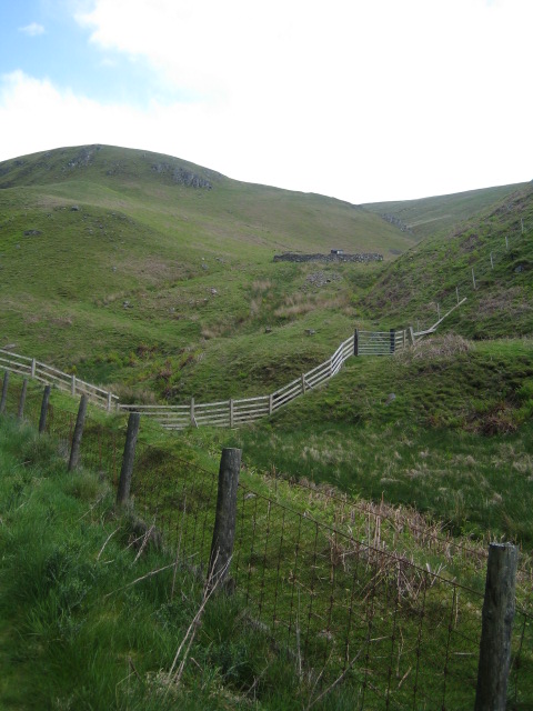
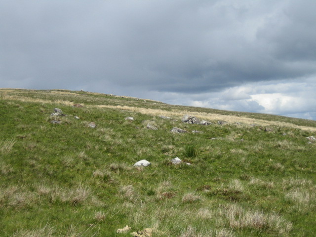
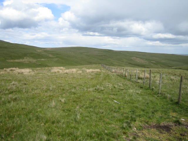
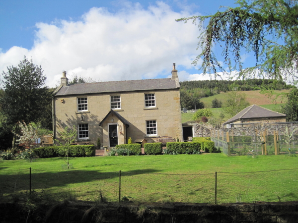
Biddlestone is a small civil parish located in the county of Northumberland, England. Situated in the stunning countryside of Northumberland National Park, it covers an area of approximately 5 square miles. The parish is nestled between the picturesque towns of Rothbury and Alwinton, offering residents and visitors alike a tranquil retreat from urban life.

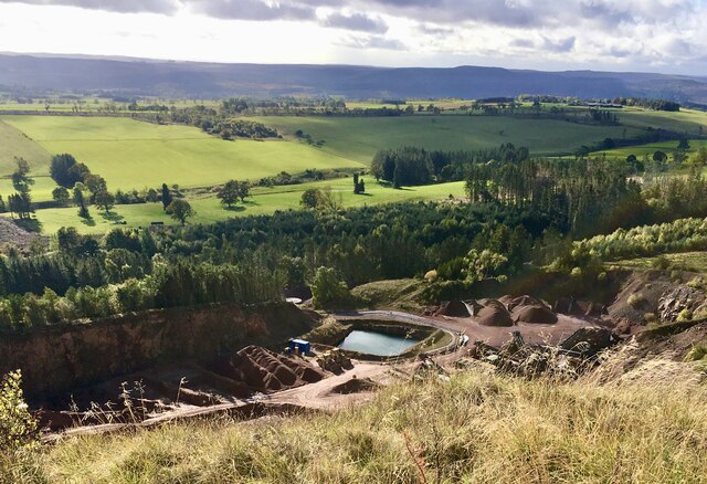
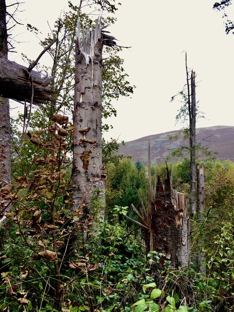
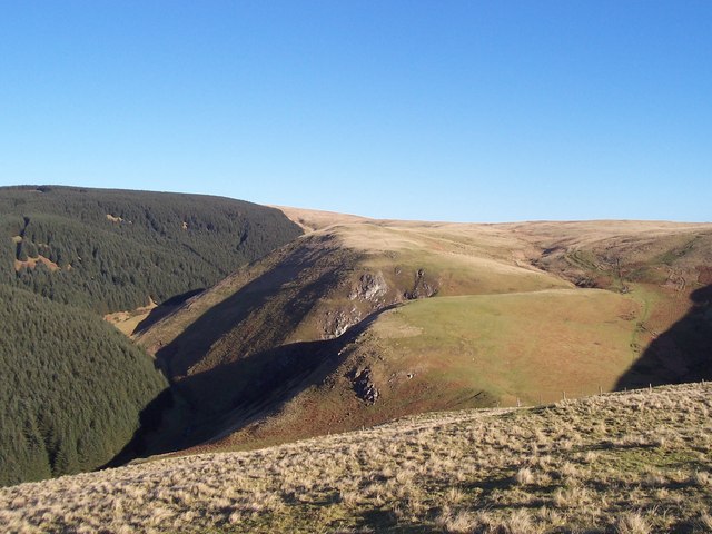
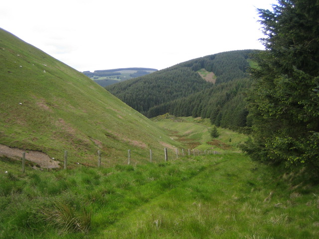
Biddlestone is home to a close-knit community, with a population of around 100 people. The parish consists mainly of agricultural land, with scattered farms and a few residential properties. The landscape is characterized by rolling hills, meandering rivers, and lush greenery, providing breathtaking views and ample opportunities for outdoor activities such as hiking and cycling.

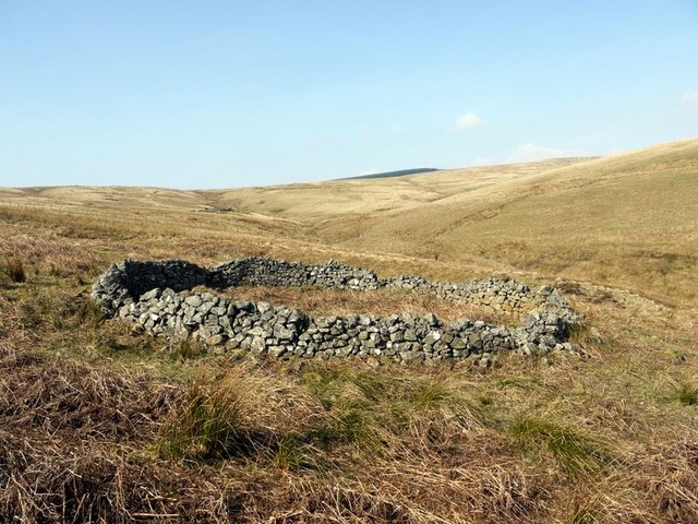
Historically, Biddlestone was known for its lead mining industry, which flourished in the 18th and 19th centuries. Today, remnants of this industrial past can still be seen in the form of old mine shafts and buildings. The area is also rich in archaeological sites, including prehistoric burial mounds and stone circles, adding to its historical significance.

Despite its small size, Biddlestone offers some amenities to its residents. These include a village hall, where community events and gatherings take place, and a small church, which serves as a place of worship for locals. Limited services and facilities are available within the parish, with more comprehensive amenities found in nearby towns.

Overall, Biddlestone is a charming and idyllic rural parish, appealing to those seeking a peaceful retreat in the heart of Northumberland's stunning countryside.

If you have any feedback on the listing, please let us know in the comments section below.

Biddlestone Images

Images are sourced within 2km of 55.376731/-2.094476 or Grid Reference NT9409. Thanks to Geograph Open Source API. All images are credited.

A peek into Harden Quarry The source of red roadstone.  'Harden Red' is a red volcanic felsite.  It is used for cycleways, bus lanes and, famously, for surfacing The Mall.
A peek into Harden Quarry
The source of red roadstone. 'Harden Red' is a red volcanic felsite. It is used for cycleways, bus lanes and, famously, for surfacing The Mall.
The violence of Storm Arwen One can't help but be impressed by the ferocity of a wind that can snap mature tree trunks like a child snaps twigs.
The violence of Storm Arwen
One can't help but be impressed by the ferocity of a wind that can snap mature tree trunks like a child snaps twigs.
Ravens Crag above the Allerhope Burn The edge of the Kidland Forest lies to the left of the Crag and hides the summit of Wether Cairn. For free detailed walking routes in the area visit <span class="nowrap"><a title="www.cheviotwalks.co.uk" rel="nofollow ugc noopener" href="http://www.cheviotwalks.co.uk">Link</a><img style="margin-left:2px;" alt="External link" title="External link - shift click to open in new window" src="https://s1.geograph.org.uk/img/external.png" width="10" height="10"/></span>
Ravens Crag above the Allerhope Burn
The edge of the Kidland Forest lies to the left of the Crag and hides the summit of Wether Cairn. For free detailed walking routes in the area visit LinkExternal link
Allerhope Burn valley near Clennell 2 This view is looking west down the valley from near where a stream, Cat Cleugh, joins Allerhope Burn, at a height of about 360m. To the right of the picture is the Kidland Forest. For more information about the valley see <a href="https://www.geograph.org.uk/photo/450527">NT9210 : Allerhope Burn valley near Clennell</a>.
Allerhope Burn valley near Clennell 2
This view is looking west down the valley from near where a stream, Cat Cleugh, joins Allerhope Burn, at a height of about 360m. To the right of the picture is the Kidland Forest. For more information about the valley see NT9210 : Allerhope Burn valley near Clennell.
Sheepfold, Allerhope Burn valley, near Clennell This sheepfold is high on the south side of this remote valley below Puncherton Hill. In the Borders area, these circular stone sheepfolds or sheep pens are known locally as sheep stells.
Sheepfold, Allerhope Burn valley, near Clennell
This sheepfold is high on the south side of this remote valley below Puncherton Hill. In the Borders area, these circular stone sheepfolds or sheep pens are known locally as sheep stells.
Ravens Crag, Allerhope Burn valley near Clennell Ravens Crag is a south-west facing crag overlooking the Allerhope Burn which is hidden in the dip between the fence and the boulders in the foreground.
Ravens Crag, Allerhope Burn valley near Clennell
Ravens Crag is a south-west facing crag overlooking the Allerhope Burn which is hidden in the dip between the fence and the boulders in the foreground.
Allerhope Burn valley near Clennell 1 This view is looking north-east from a point about half way up this remote valley at a height of about 300m. In the background is Kidland Forest. Towards the top left of the picture but hidden amongst the gorse bushes, the tiny Wholhope Burn runs down to join the Allerhope Burn. For more information about the valley see <a href="https://www.geograph.org.uk/photo/450527">NT9210 : Allerhope Burn valley near Clennell</a>.
Allerhope Burn valley near Clennell 1
This view is looking north-east from a point about half way up this remote valley at a height of about 300m. In the background is Kidland Forest. Towards the top left of the picture but hidden amongst the gorse bushes, the tiny Wholhope Burn runs down to join the Allerhope Burn. For more information about the valley see NT9210 : Allerhope Burn valley near Clennell.
White Stones near Wether Cairn These loose boulders scattered randomly on the surface of an otherwise rough and featureless moor at a height of about 500m south-east of Wether Cairn are marked as 'White Stones' on the OS 1:25,000 map. Unlike 'white stone' sites found in the Lake District and the Peak District, these stones appear to have no historic significance and are natural features.
White Stones near Wether Cairn
These loose boulders scattered randomly on the surface of an otherwise rough and featureless moor at a height of about 500m south-east of Wether Cairn are marked as 'White Stones' on the OS 1:25,000 map. Unlike 'white stone' sites found in the Lake District and the Peak District, these stones appear to have no historic significance and are natural features.
Moorland near Puncherton This view at the top of the Allerhope Burn valley at about 470m is of the featureless moor above Puncherton farm. The farm though is out of sight over the hill in the middle distance. Behind the camera, the ground rises to Wether Cairn at 563m. The hills in the far distance are in the Otterburn army training area.
Moorland near Puncherton
This view at the top of the Allerhope Burn valley at about 470m is of the featureless moor above Puncherton farm. The farm though is out of sight over the hill in the middle distance. Behind the camera, the ground rises to Wether Cairn at 563m. The hills in the far distance are in the Otterburn army training area.
Moorland near Wether Cairn 1 This view looking south-west is of featureless moorland dropping down to the Allerhope Burn valley with the eastern edge of the Kidland Forest on the right. The boulders in the foreground are some of the 'White Stones', see <a href="https://www.geograph.org.uk/photo/451424">NT9411 : White Stones near Wether Cairn</a>. The Kidland Forest extends across the hills in the middle distance, with the farms and cottages of Kidlandlee in the clearing in the middle.
Moorland near Wether Cairn 1
This view looking south-west is of featureless moorland dropping down to the Allerhope Burn valley with the eastern edge of the Kidland Forest on the right. The boulders in the foreground are some of the 'White Stones', see NT9411 : White Stones near Wether Cairn. The Kidland Forest extends across the hills in the middle distance, with the farms and cottages of Kidlandlee in the clearing in the middle.
Spring near Wether Burn This moorland spring, which is marked on the OS 1:25,000 map, is south of Wether Cairn at about 470m on the eastern edge of the Kidland Forest. It is one of several sources of the Allerhope Burn which flows south-west to join the River Alwin about 2km away.
Spring near Wether Burn
This moorland spring, which is marked on the OS 1:25,000 map, is south of Wether Cairn at about 470m on the eastern edge of the Kidland Forest. It is one of several sources of the Allerhope Burn which flows south-west to join the River Alwin about 2km away.
Firebreak, Wholhope Hill near Wether Cairn This firebreak in spruce pine on Wholhope Hill is at the eastern edge of the Kidland Forest. Before the forest was planted during the 1950s to 1980s, this area would have been moorland.
Firebreak, Wholhope Hill near Wether Cairn
This firebreak in spruce pine on Wholhope Hill is at the eastern edge of the Kidland Forest. Before the forest was planted during the 1950s to 1980s, this area would have been moorland.
Moorland near Puncherton 1 This view looking north is of featureless moorland that rises to Wether Cairn at 563m but which is just over the horizon to the right of the forest edge. The forest is the eastern edge of the Kidland Forest.
Moorland near Puncherton 1
This view looking north is of featureless moorland that rises to Wether Cairn at 563m but which is just over the horizon to the right of the forest edge. The forest is the eastern edge of the Kidland Forest.
Bridleway stile and gate near Puncherton This stile and gate on moorland about 1km north-east of Puncherton farm lie on a semi-circular bridleway between Clennell in the south-west and Biddlestone in the south-east. Either side of this point however as far as can be seen there is no evidence of a bridleway suggesting that it is little used.
Bridleway stile and gate near Puncherton
This stile and gate on moorland about 1km north-east of Puncherton farm lie on a semi-circular bridleway between Clennell in the south-west and Biddlestone in the south-east. Either side of this point however as far as can be seen there is no evidence of a bridleway suggesting that it is little used.
Moorland near Puncherton 2 This view looking north-east is of featureless moorland gently rising to Bleak Law. Behind the camera there is a gate in the fence for the semi-circular bridleway that comes up from Clennell and then continues up the hill to the left and then runs along the side of the hills before descending to Biddlestone. On the ground however there is little evidence of the bridleway, at least at this point.
Moorland near Puncherton 2
This view looking north-east is of featureless moorland gently rising to Bleak Law. Behind the camera there is a gate in the fence for the semi-circular bridleway that comes up from Clennell and then continues up the hill to the left and then runs along the side of the hills before descending to Biddlestone. On the ground however there is little evidence of the bridleway, at least at this point.
The slopes of Wether Cairn Looking towards Raven`s Crag and the Kidland Forest. For free detailed walking routes in the area visit <span class="nowrap"><a title="www.cheviotwalks.co.uk" rel="nofollow ugc noopener" href="http://www.cheviotwalks.co.uk">Link</a><img style="margin-left:2px;" alt="External link" title="External link - shift click to open in new window" src="https://s1.geograph.org.uk/img/external.png" width="10" height="10"/></span>
The slopes of Wether Cairn
Looking towards Raven`s Crag and the Kidland Forest. For free detailed walking routes in the area visit LinkExternal link
Sheep Stell next to Iving Cleugh On the slopes of Bleak Law. For free detailed walking routes in the area visit <span class="nowrap"><a title="www.cheviotwalks.co.uk" rel="nofollow ugc noopener" href="http://www.cheviotwalks.co.uk">Link</a><img style="margin-left:2px;" alt="External link" title="External link - shift click to open in new window" src="https://s1.geograph.org.uk/img/external.png" width="10" height="10"/></span>
Sheep Stell next to Iving Cleugh
On the slopes of Bleak Law. For free detailed walking routes in the area visit LinkExternal link
Sheepfold by Biddlestone Burn
Show me another place!

Biddlestone is located at Grid Ref: NT9409 (Lat: 55.376731, Lng: -2.094476)

Unitary Authority: Northumberland

Police Authority: Northumbria

What 3 Words

///majoring.edicts.pots. Near Whittingham, Northumberland

Nearby Locations

Gills Law Biddlestone

Related Wikis

Biddlestone Hall

Biddlestone Hall was a large country house at Biddlestone in Northumberland. == History == The Georgian style mansion was built for the Selby family about...

Biddlestone Chapel

Biddlestone Chapel is a redundant Roman Catholic chapel in Biddlestone, Northumberland, England. It is recorded in the National Heritage List for England...

Clennell, Northumberland

Clennell is a small village and as Clennel, a former civil parish, now in the parish of Alwinton, in Northumberland, England. It is about 1 mile (1.6 km...

Clennell Hall

Clennell Hall is an historic manor house, now operated as a country hotel, situated at Clennell, near Alwinton, Northumberland, England. It is a Grade...

Biddlestone

Biddlestone is a village and civil parish in Northumberland, England. It is about 14 miles (23 km) to the west of Alnwick. In the early 21st Century several...

Alwinton

Alwinton (previously named "Allenton" and sometimes still referred to as this) is a village and former parish in Northumberland, England. Alwinton is named...

Barrow Meadow

Barrow Meadow is a Site of Special Scientific Interest (SSSI) in north Northumberland, England. The site is a species-rich hay meadow of a sort now rare...

River Alwin

The River Alwin is a short, steep upland river that drains the Kidland Forest on the southern flanks of the Cheviot Hills, in the Northumberland National...

Nearby Amenities

Located within 500m of 55.376731,-2.094476
Gills Law
Ele: 412
Natural: peak
Lat/Long: 55.3793396/-2.0889937
The data included in this document is from www.openstreetmap.org. The data is made available under ODbL.

Have you been to Biddlestone?

Leave your review of Biddlestone below (or comments, questions and feedback).