Biddenham

Civil Parish in Bedfordshire

England

Biddenham

Thatched cottage on West End Road, Box End
Thatched cottage on West End Road, Box End Credit: David Howard

Biddenham is a civil parish located in the county of Bedfordshire, England. It is situated on the western outskirts of the town of Bedford, approximately 2 miles away from its center. The parish covers an area of around 2.5 square miles and is home to a population of approximately 2,500 residents.

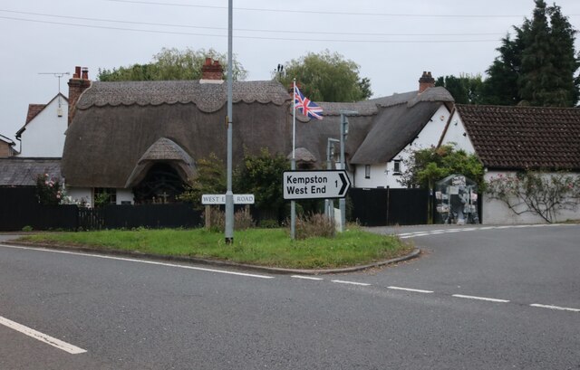
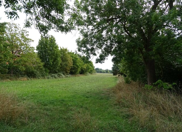
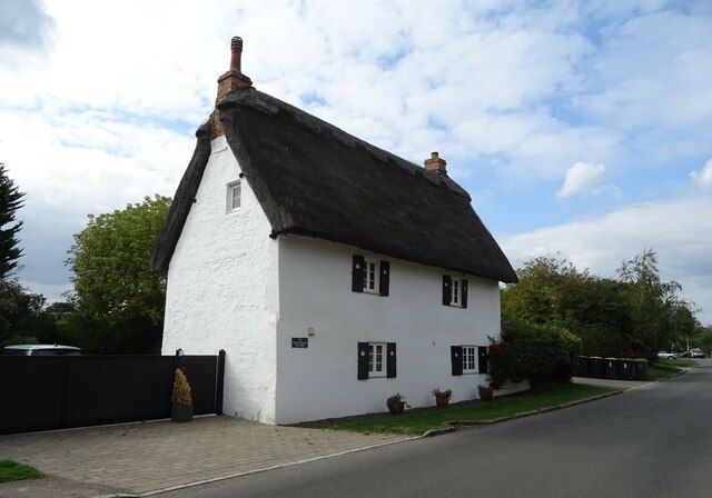
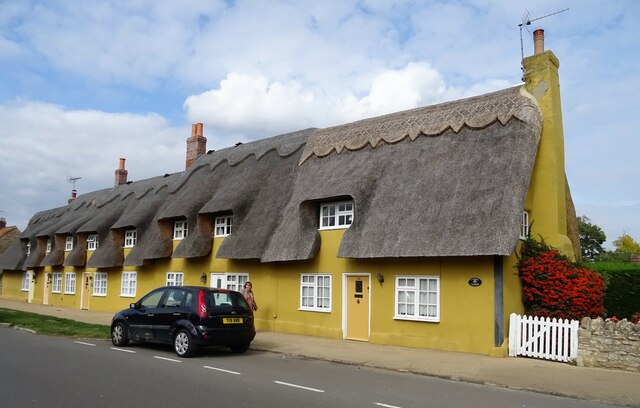
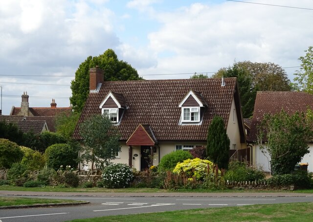
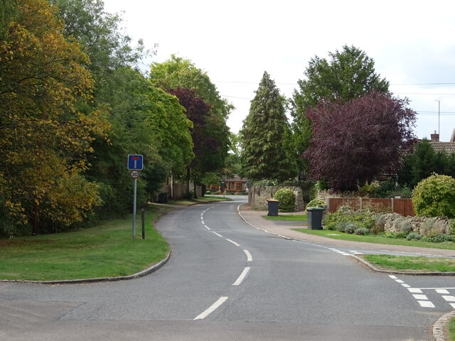
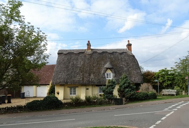
Biddenham is known for its picturesque setting, with much of the area being surrounded by open countryside and green spaces. The village itself is characterized by its charming historic buildings, including St. James Church, which dates back to the 14th century. The church is a prominent landmark and is often visited for its architectural beauty and historical significance.

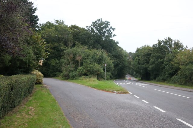
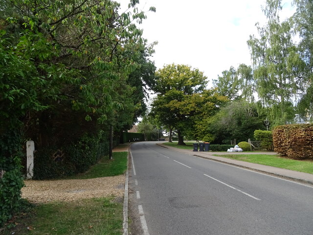
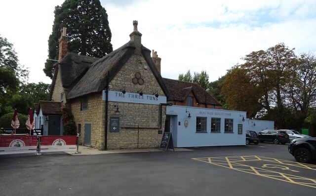
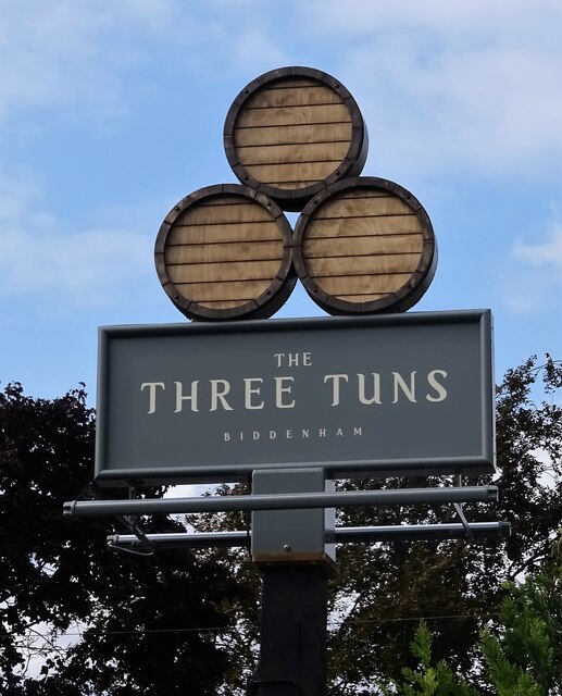
The village also boasts a vibrant community, with several local amenities and facilities available to residents. These include a primary school, a village hall, a pub, and a small selection of shops. Biddenham is well-connected to the surrounding areas, with regular bus services providing easy access to nearby towns and villages.

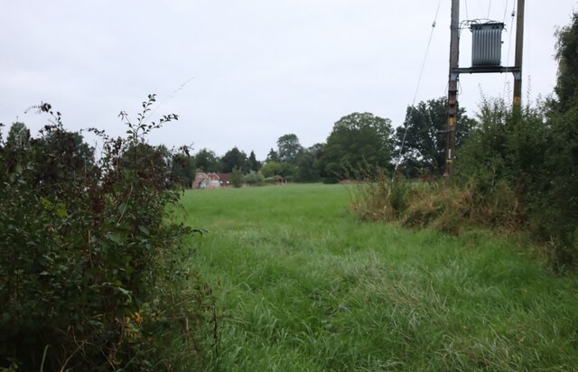
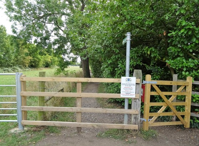
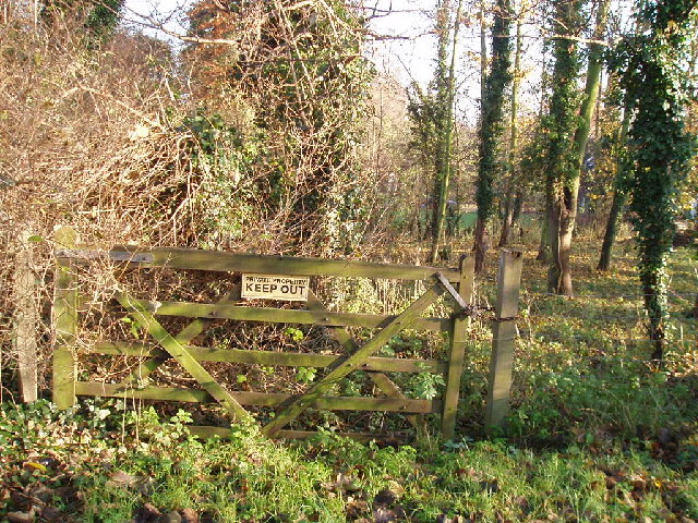
Nature lovers will appreciate the abundance of outdoor spaces in Biddenham. The village is surrounded by beautiful countryside, making it an ideal location for walking, cycling, and other outdoor activities. The nearby River Great Ouse also offers opportunities for boating and fishing.

Overall, Biddenham offers a peaceful and scenic setting, with a strong sense of community and access to a range of amenities. It is a desirable location for those seeking a countryside lifestyle while still being within easy reach of urban conveniences.

If you have any feedback on the listing, please let us know in the comments section below.

Biddenham Images

Images are sourced within 2km of 52.143117/-0.508519 or Grid Reference TL0250. Thanks to Geograph Open Source API. All images are credited.

Thatched cottage on West End Road, Box End
Field by Box End Road
Electricity transformer by Box End Road It's probably up there to keep the children and vandals away, although there's probably a technical reason.
Electricity transformer by Box End Road
It's probably up there to keep the children and vandals away, although there's probably a technical reason.
Parking area off Box End Road
Houses on Hurst Grove
Hurst Grove
Hurst Grove
Footpath off Main Road
Grazing off Main Road
Main Road
Main Road
Penny Black Cottage
Penny Black Cottage
Thatched cottages on Main Road
The Three Tuns
The Three Tuns
Sign for the Three Tuns
War Memorial, Biddenham
Cottage, Biddenham
Cottage, Biddenham
Main Road
Main Road
Thatched cottage, Biddenham
New noticeboard for St Owen's Church, Bromham It replaced a small red traditional type.
New noticeboard for St Owen's Church, Bromham
It replaced a small red traditional type.
Show me another place!

Biddenham is located at Grid Ref: TL0250 (Lat: 52.143117, Lng: -0.508519)

Unitary Authority: Bedford

Police Authority: Bedfordshire

What 3 Words

///spans.groomed.lipstick. Near Biddenham, Bedfordshire

Nearby Locations

Deep Spinney Biddenham

Related Wikis

Biddenham Pit

Biddenham Pit is a gravel pit and Site of Special Scientific Interest (SSSI), 0.41 hectares in size located in Biddenham, Bedfordshire. The pit was notified...

Biddenham

Biddenham is a village and civil parish in the Borough of Bedford in Bedfordshire, England, located around 2 miles (3.2 km) west of Bedford town centre...

Biddenham Dovecote

The Biddenham dovecote was a structure located in Biddenham, a village in Bedfordshire, England. Built on the order of Elizabeth Boteler in 1706, in a...

Church of St James, Biddenham

Church of St James is a Grade I listed church in Biddenham, Bedfordshire, England. It became a listed building on 13 July 1964. The Church has a website...

Great Denham

Great Denham is a village and civil parish located in Bedfordshire, England, on the western outskirts of Bedford. The village is the location of Bedford...

Biddenham International School and Sports College

Biddenham International School and Sports College (formerly John Howard Upper School) is a mixed secondary school and sixth form located in Biddenham in...

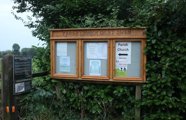
Church of St Owen, Bromham, Bedfordshire

Church of St Owen is a Grade I listed church in Bromham, Bedfordshire, England. It became a listed building on 13 July 1964.The church is a 17th-century...

Bromham Lake

Bromham Lake is a 10.9 hectare Local Nature Reserve east of Bromham in Bedfordshire. It is owned and managed by Bedford Borough Council.The lake was formed...

Nearby Amenities

Located within 500m of 52.143117,-0.508519
Traffic Signals
Bicycle: yes
Crossing: traffic_signals
Crossing Ref: toucan
Lat/Long: 52.1429854/-0.503748
026
Source: GPS waypoint
Upload Tag: ojw_2006-11-26
Lat/Long: 52.1399764/-0.5098239
028
Created By: xybot
Source: GPS waypoint
Upload Tag: ojw_2006-11-26
Lat/Long: 52.141078/-0.512331
029
Created By: xybot
Source: GPS waypoint
Upload Tag: ojw_2006-11-26
Lat/Long: 52.141771/-0.512048
030
Created By: xybot
Source: GPS waypoint
Upload Tag: ojw_2006-11-26
Lat/Long: 52.141568/-0.510635
031
Created By: Potlatch 0.4a
Source: GPS waypoint
Upload Tag: ojw_2006-11-26
Lat/Long: 52.1424436/-0.5105405
032
Created By: xybot
Source: GPS waypoint
Upload Tag: ojw_2006-11-26
Lat/Long: 52.141884/-0.51055
033
Created By: xybot
Source: GPS waypoint
Upload Tag: ojw_2006-11-26
Lat/Long: 52.141422/-0.509845
034
Created By: xybot
Source: GPS waypoint
Upload Tag: ojw_2006-11-26
Lat/Long: 52.141485/-0.508954
035
Created By: almien_upload
Source: GPS waypoint
Upload Tag: ojw_2006-11-26
Lat/Long: 52.1420043/-0.5092588
036
Created By: xybot
Source: GPS waypoint
Upload Tag: ojw_2006-11-26
Lat/Long: 52.142306/-0.508167
037
Created By: xybot
Source: GPS waypoint
Upload Tag: ojw_2006-11-26
Lat/Long: 52.141204/-0.50827
038
Created By: xybot
Source: GPS waypoint
Upload Tag: ojw_2006-11-26
Lat/Long: 52.141566/-0.507496
039
Created By: xybot
Source: GPS waypoint
Upload Tag: ojw_2006-11-26
Lat/Long: 52.141559/-0.506656
040
Created By: xybot
Source: GPS waypoint
Upload Tag: ojw_2006-11-26
Lat/Long: 52.141229/-0.505495
041
Created By: xybot
Source: GPS waypoint
Upload Tag: ojw_2006-11-26
Lat/Long: 52.141296/-0.505238
042
Created By: xybot
Source: GPS waypoint
Upload Tag: ojw_2006-11-26
Lat/Long: 52.14124/-0.504758
043
Created By: xybot
Source: GPS waypoint
Upload Tag: ojw_2006-11-26
Lat/Long: 52.141466/-0.504253
044
Created By: xybot
Source: GPS waypoint
Upload Tag: ojw_2006-11-26
Lat/Long: 52.14146/-0.503951
Crossing
Crossing: unmarked
Kerb: lowered
Tactile Paving: yes
Lat/Long: 52.1433978/-0.5115471
Only You
Shop: hairdresser
Lat/Long: 52.1412444/-0.5084043
Leisure: playground
Lat/Long: 52.1404551/-0.5078602
Post Box
Brand: Royal Mail
Brand Wikidata: Q638098
Collection Times: Mo-Fr 17:45; Sa 11:00
Operator: Royal Mail
Operator Wikidata: Q638098
Post Box Type: lamp
Ref: MK40 414
Royal Cypher: EIIR
Royal Cypher Wikidata: Q33102113
Source: survey
Survey Date: 2015-08-15
Lat/Long: 52.141675/-0.5113595
Biddenham
Place: village
Wikidata: Q731179
Wikipedia: en:Biddenham
Lat/Long: 52.1404805/-0.5051656
Crossing
Lat/Long: 52.1438333/-0.5121011
Crossing
Crossing: unmarked
Kerb: lowered
Tactile Paving: yes
Lat/Long: 52.143479/-0.5114843
Crossing
Lat/Long: 52.1438181/-0.5122216
Generator Method: photovoltaic
Generator Output Electricity: yes
Generator Source: solar
Generator Type: solar_photovoltaic_panel
Location: roof
Power: generator
Lat/Long: 52.1425575/-0.5016594
Generator Method: photovoltaic
Generator Output Electricity: yes
Generator Source: solar
Generator Type: solar_photovoltaic_panel
Location: roof
Power: generator
Lat/Long: 52.1401061/-0.5121249
Generator Method: photovoltaic
Generator Output Electricity: yes
Generator Source: solar
Generator Type: solar_photovoltaic_panel
Location: roof
Power: generator
Lat/Long: 52.1400699/-0.5113685
Generator Method: photovoltaic
Generator Output Electricity: yes
Generator Source: solar
Generator Type: solar_photovoltaic_panel
Location: roof
Power: generator
Lat/Long: 52.1400567/-0.5109635
Generator Method: photovoltaic
Generator Output Electricity: yes
Generator Source: solar
Generator Type: solar_photovoltaic_panel
Location: roof
Power: generator
Lat/Long: 52.1390295/-0.5065486
Generator Method: photovoltaic
Generator Output Electricity: yes
Generator Source: solar
Generator Type: solar_photovoltaic_panel
Location: roof
Power: generator
Lat/Long: 52.1411728/-0.5044565
Generator Method: photovoltaic
Generator Output Electricity: yes
Generator Source: solar
Generator Type: solar_photovoltaic_panel
Location: roof
Power: generator
Lat/Long: 52.1413078/-0.5040327
Generator Method: photovoltaic
Generator Output Electricity: yes
Generator Source: solar
Generator Type: solar_photovoltaic_panel
Location: roof
Power: generator
Lat/Long: 52.1411975/-0.5042258
Generator Method: photovoltaic
Generator Output Electricity: yes
Generator Source: solar
Generator Type: solar_photovoltaic_panel
Location: roof
Power: generator
Lat/Long: 52.1425423/-0.5028069
Generator Method: photovoltaic
Generator Output Electricity: yes
Generator Source: solar
Generator Type: solar_photovoltaic_panel
Location: roof
Power: generator
Lat/Long: 52.1412798/-0.5093274
Generator Method: photovoltaic
Generator Output Electricity: yes
Generator Source: solar
Generator Type: solar_photovoltaic_panel
Location: roof
Power: generator
Lat/Long: 52.1413753/-0.5063742
Generator Method: photovoltaic
Generator Output Electricity: yes
Generator Source: solar
Generator Type: solar_photovoltaic_panel
Location: roof
Power: generator
Lat/Long: 52.1414115/-0.5074605
Generator Method: photovoltaic
Generator Output Electricity: yes
Generator Source: solar
Generator Type: solar_photovoltaic_panel
Location: roof
Power: generator
Lat/Long: 52.1418197/-0.5094534
Generator Method: photovoltaic
Generator Output Electricity: yes
Generator Source: solar
Generator Type: solar_photovoltaic_panel
Location: roof
Power: generator
Lat/Long: 52.1424419/-0.5087963
Access: no
Barrier: block
Lat/Long: 52.1456303/-0.5030387
Waste Basket
Lat/Long: 52.1386495/-0.5082868
Historic: memorial
Memorial: war_memorial
Lat/Long: 52.138741/-0.5100026
The data included in this document is from www.openstreetmap.org. The data is made available under ODbL.

Have you been to Biddenham?

Leave your review of Biddenham below (or comments, questions and feedback).