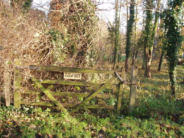
Deep Spinney

Wood, Forest in Bedfordshire

England

Deep Spinney

Field by Box End Road
Field by Box End Road Credit: David Howard

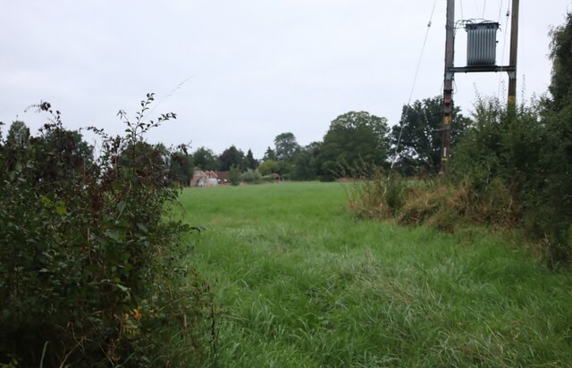
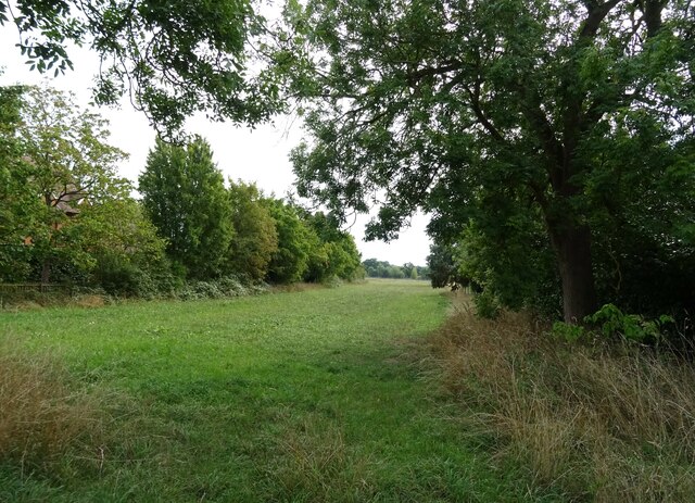
Deep Spinney is a tranquil woodland area located in the county of Bedfordshire, England. Situated near the village of Wood, this forested haven covers a substantial area of approximately 40 hectares. It is a popular destination for nature enthusiasts and outdoor adventurers alike.

The woodland is characterized by its dense canopy of trees, predominantly consisting of native species like oak, beech, and hawthorn. The towering trees provide ample shade during the summer months and create a vibrant display of colors during the autumn season. The forest floor is covered with a thick carpet of moss and ferns, offering a picturesque and serene setting for visitors.

Deep Spinney is home to a rich diversity of wildlife. Birdwatchers can spot numerous species, including woodpeckers, song thrushes, and tawny owls. Squirrels, foxes, and badgers are also commonly seen, adding to the natural charm of the area. The forest is carefully managed to protect and enhance its biodiversity, providing a habitat for various flora and fauna.

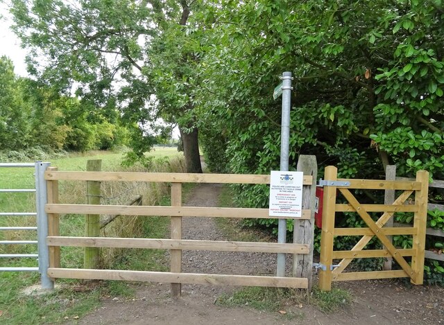
Several footpaths and trails wind through the woodland, allowing visitors to explore the area at their leisure. These pathways are well-maintained and offer a range of difficulty levels, making them suitable for both casual strolls and more challenging hikes. Along the way, visitors can enjoy breathtaking views of the surrounding countryside and take advantage of designated picnic areas.

Deep Spinney is a true haven for those seeking a peaceful escape into nature. Its idyllic setting, diverse wildlife, and well-maintained trails make it an ideal destination for nature lovers, walkers, and families alike.

If you have any feedback on the listing, please let us know in the comments section below.
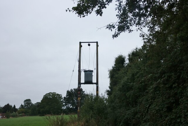
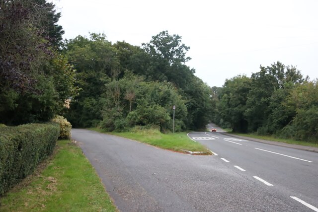
Deep Spinney Images

Images are sourced within 2km of 52.142423/-0.50595851 or Grid Reference TL0250. Thanks to Geograph Open Source API. All images are credited.

Field by Box End Road
Electricity transformer by Box End Road It's probably up there to keep the children and vandals away, although there's probably a technical reason.
Electricity transformer by Box End Road
It's probably up there to keep the children and vandals away, although there's probably a technical reason.
Parking area off Box End Road
Bedford Railway Station From the footbridge.
Bedford Railway Station
From the footbridge.
Footbridge, Bedford Railway Station
Bedford Railway Station
Car park, Bedford Railway Station
Flats on Ashburnham Road
Houses on Hurst Grove
Hurst Grove
Hurst Grove
Footpath off Main Road
Grazing off Main Road
Main Road
Main Road
Penny Black Cottage
Penny Black Cottage
Thatched cottages on Main Road
The Three Tuns
The Three Tuns
Sign for the Three Tuns
War Memorial, Biddenham
Show me another place!

Deep Spinney is located at Grid Ref: TL0250 (Lat: 52.142423, Lng: -0.50595851)

Unitary Authority: Bedford

Police Authority: Bedfordshire

What 3 Words

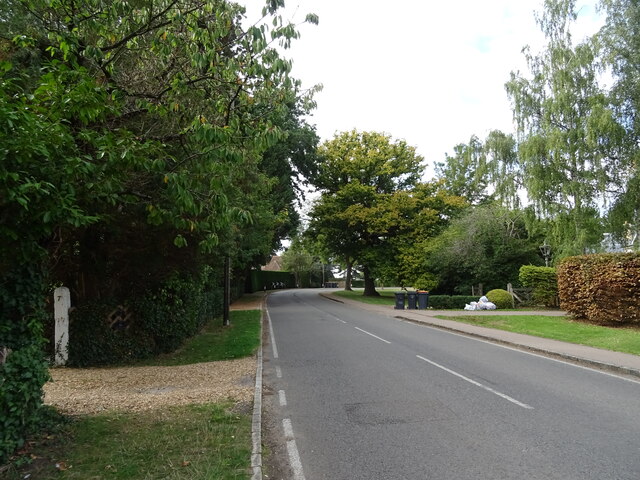
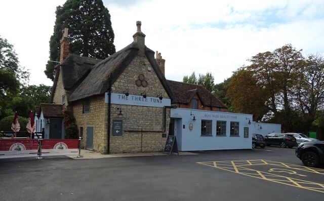
///blunt.equipment.highways. Near Biddenham, Bedfordshire

Nearby Locations

Deep Spinney Biddenham

Related Wikis

Biddenham Pit

Biddenham Pit is a gravel pit and Site of Special Scientific Interest (SSSI), 0.41 hectares in size located in Biddenham, Bedfordshire. The pit was notified...

Biddenham

Biddenham is a village and civil parish in the Borough of Bedford in Bedfordshire, England, located around 2 miles (3.2 km) west of Bedford town centre...

Biddenham Dovecote

The Biddenham dovecote was a structure located in Biddenham, a village in Bedfordshire, England. Built on the order of Elizabeth Boteler in 1706, in a...

Biddenham International School and Sports College

Biddenham International School and Sports College (formerly John Howard Upper School) is a mixed secondary school and sixth form located in Biddenham in...

Church of St James, Biddenham

Church of St James is a Grade I listed church in Biddenham, Bedfordshire, England. It became a listed building on 13 July 1964. The Church has a website...

Great Denham

Great Denham is a village and civil parish located in Bedfordshire, England, on the western outskirts of Bedford. The village is the location of Bedford...

Bromham Lake

Bromham Lake is a 10.9 hectare Local Nature Reserve east of Bromham in Bedfordshire. It is owned and managed by Bedford Borough Council.The lake was formed...

Church of St Owen, Bromham, Bedfordshire

Church of St Owen is a Grade I listed church in Bromham, Bedfordshire, England. It became a listed building on 13 July 1964.The church is a 17th-century...

Nearby Amenities

Located within 500m of 52.142423,-0.50595851
Traffic Signals
Bicycle: yes
Crossing: traffic_signals
Crossing Ref: toucan
Lat/Long: 52.1429854/-0.503748
012
Created By: xybot
Source: GPS waypoint
Upload Tag: ojw_2006-11-26
Lat/Long: 52.142241/-0.499509
013
Created By: xybot
Source: GPS waypoint
Upload Tag: ojw_2006-11-26
Lat/Long: 52.142396/-0.498897
014
Created By: xybot
Source: GPS waypoint
Upload Tag: ojw_2006-11-26
Lat/Long: 52.139028/-0.505412
Pub
The Three Tuns
Addr City: Biddenham
Addr Country: GB
Addr Housenumber: 57
Addr Postcode: MK40 4BD
Addr Street: Main Road
Fhrs Authority: Bedford
Fhrs Id: 1526185
Fhrs Local Authority Id: 133854
Source: GPS waypoint
Upload Tag: ojw_2006-11-26
Wikidata: Q26598115
Lat/Long: 52.1383079/-0.5082981
026
Source: GPS waypoint
Upload Tag: ojw_2006-11-26
Lat/Long: 52.1399764/-0.5098239
028
Created By: xybot
Source: GPS waypoint
Upload Tag: ojw_2006-11-26
Lat/Long: 52.141078/-0.512331
029
Created By: xybot
Source: GPS waypoint
Upload Tag: ojw_2006-11-26
Lat/Long: 52.141771/-0.512048
030
Created By: xybot
Source: GPS waypoint
Upload Tag: ojw_2006-11-26
Lat/Long: 52.141568/-0.510635
031
Created By: Potlatch 0.4a
Source: GPS waypoint
Upload Tag: ojw_2006-11-26
Lat/Long: 52.1424436/-0.5105405
032
Created By: xybot
Source: GPS waypoint
Upload Tag: ojw_2006-11-26
Lat/Long: 52.141884/-0.51055
033
Created By: xybot
Source: GPS waypoint
Upload Tag: ojw_2006-11-26
Lat/Long: 52.141422/-0.509845
034
Created By: xybot
Source: GPS waypoint
Upload Tag: ojw_2006-11-26
Lat/Long: 52.141485/-0.508954
035
Created By: almien_upload
Source: GPS waypoint
Upload Tag: ojw_2006-11-26
Lat/Long: 52.1420043/-0.5092588
036
Created By: xybot
Source: GPS waypoint
Upload Tag: ojw_2006-11-26
Lat/Long: 52.142306/-0.508167
037
Created By: xybot
Source: GPS waypoint
Upload Tag: ojw_2006-11-26
Lat/Long: 52.141204/-0.50827
038
Created By: xybot
Source: GPS waypoint
Upload Tag: ojw_2006-11-26
Lat/Long: 52.141566/-0.507496
039
Created By: xybot
Source: GPS waypoint
Upload Tag: ojw_2006-11-26
Lat/Long: 52.141559/-0.506656
040
Created By: xybot
Source: GPS waypoint
Upload Tag: ojw_2006-11-26
Lat/Long: 52.141229/-0.505495
041
Created By: xybot
Source: GPS waypoint
Upload Tag: ojw_2006-11-26
Lat/Long: 52.141296/-0.505238
042
Created By: xybot
Source: GPS waypoint
Upload Tag: ojw_2006-11-26
Lat/Long: 52.14124/-0.504758
043
Created By: xybot
Source: GPS waypoint
Upload Tag: ojw_2006-11-26
Lat/Long: 52.141466/-0.504253
044
Created By: xybot
Source: GPS waypoint
Upload Tag: ojw_2006-11-26
Lat/Long: 52.14146/-0.503951
Crossing
Crossing: unmarked
Kerb: lowered
Tactile Paving: yes
Lat/Long: 52.1433978/-0.5115471
Post Box
Brand: Royal Mail
Brand Wikidata: Q638098
Collection Times: Mo-Fr 18:00; Sa 10:45
Operator: Royal Mail
Operator Wikidata: Q638098
Post Box Type: lamp
Ref: MK40 226
Royal Cypher: EIIR
Royal Cypher Wikidata: Q33102113
Source: survey
Survey Date: 2015-08-15
Lat/Long: 52.1382592/-0.5059914
Only You
Shop: hairdresser
Lat/Long: 52.1412444/-0.5084043
Bus Stop
Bench: no
Bin: no
Bus: yes
Public Transport: platform
Shelter: no
Lat/Long: 52.1426614/-0.4991886
Leisure: playground
Lat/Long: 52.1404551/-0.5078602
Post Box
Brand: Royal Mail
Brand Wikidata: Q638098
Collection Times: Mo-Fr 09:00; Sa 07:00
Operator: Royal Mail
Operator Wikidata: Q638098
Post Box Type: lamp
Ref: MK40 117D
Royal Cypher: EIIR
Royal Cypher Wikidata: Q33102113
Source: Bing;survey
Survey Date: 2015-08-15
Lat/Long: 52.1427387/-0.4990175
Post Box
Brand: Royal Mail
Brand Wikidata: Q638098
Collection Times: Mo-Fr 17:45; Sa 11:00
Operator: Royal Mail
Operator Wikidata: Q638098
Post Box Type: lamp
Ref: MK40 414
Royal Cypher: EIIR
Royal Cypher Wikidata: Q33102113
Source: survey
Survey Date: 2015-08-15
Lat/Long: 52.141675/-0.5113595
Biddenham
Place: village
Wikidata: Q731179
Wikipedia: en:Biddenham
Lat/Long: 52.1404805/-0.5051656
Crossing
Lat/Long: 52.1438333/-0.5121011
Crossing
Crossing: unmarked
Kerb: lowered
Tactile Paving: yes
Lat/Long: 52.143479/-0.5114843
Crossing
Lat/Long: 52.1438181/-0.5122216
Generator Method: photovoltaic
Generator Output Electricity: yes
Generator Source: solar
Generator Type: solar_photovoltaic_panel
Location: roof
Power: generator
Lat/Long: 52.1425575/-0.5016594
Generator Method: photovoltaic
Generator Output Electricity: yes
Generator Source: solar
Generator Type: solar_photovoltaic_panel
Location: roof
Power: generator
Lat/Long: 52.1401061/-0.5121249
Generator Method: photovoltaic
Generator Output Electricity: yes
Generator Source: solar
Generator Type: solar_photovoltaic_panel
Location: roof
Power: generator
Lat/Long: 52.1400699/-0.5113685
Generator Method: photovoltaic
Generator Output Electricity: yes
Generator Source: solar
Generator Type: solar_photovoltaic_panel
Location: roof
Power: generator
Lat/Long: 52.1400567/-0.5109635
Generator Method: photovoltaic
Generator Output Electricity: yes
Generator Source: solar
Generator Type: solar_photovoltaic_panel
Location: roof
Power: generator
Lat/Long: 52.1390295/-0.5065486
Generator Method: photovoltaic
Generator Output Electricity: yes
Generator Source: solar
Generator Type: solar_photovoltaic_panel
Location: roof
Power: generator
Lat/Long: 52.1396929/-0.5033112
Generator Method: photovoltaic
Generator Output Electricity: yes
Generator Source: solar
Generator Type: solar_photovoltaic_panel
Location: roof
Power: generator
Lat/Long: 52.1403629/-0.5018467
Generator Method: photovoltaic
Generator Output Electricity: yes
Generator Source: solar
Generator Type: solar_photovoltaic_panel
Location: roof
Power: generator
Lat/Long: 52.1411728/-0.5044565
Generator Method: photovoltaic
Generator Output Electricity: yes
Generator Source: solar
Generator Type: solar_photovoltaic_panel
Location: roof
Power: generator
Lat/Long: 52.1413078/-0.5040327
Generator Method: photovoltaic
Generator Output Electricity: yes
Generator Source: solar
Generator Type: solar_photovoltaic_panel
Location: roof
Power: generator
Lat/Long: 52.1411975/-0.5042258
Generator Method: photovoltaic
Generator Output Electricity: yes
Generator Source: solar
Generator Type: solar_photovoltaic_panel
Location: roof
Power: generator
Lat/Long: 52.1425423/-0.5028069
Generator Method: photovoltaic
Generator Output Electricity: yes
Generator Source: solar
Generator Type: solar_photovoltaic_panel
Location: roof
Power: generator
Lat/Long: 52.1412798/-0.5093274
Generator Method: photovoltaic
Generator Output Electricity: yes
Generator Source: solar
Generator Type: solar_photovoltaic_panel
Location: roof
Power: generator
Lat/Long: 52.1413753/-0.5063742
Generator Method: photovoltaic
Generator Output Electricity: yes
Generator Source: solar
Generator Type: solar_photovoltaic_panel
Location: roof
Power: generator
Lat/Long: 52.1414115/-0.5074605
Generator Method: photovoltaic
Generator Output Electricity: yes
Generator Source: solar
Generator Type: solar_photovoltaic_panel
Location: roof
Power: generator
Lat/Long: 52.1418197/-0.5094534
Generator Method: photovoltaic
Generator Output Electricity: yes
Generator Source: solar
Generator Type: solar_photovoltaic_panel
Location: roof
Power: generator
Lat/Long: 52.1424419/-0.5087963
Access: no
Barrier: block
Lat/Long: 52.1456303/-0.5030387
Waste Basket
Lat/Long: 52.1386495/-0.5082868
Historic: memorial
Memorial: war_memorial
Lat/Long: 52.138741/-0.5100026
The data included in this document is from www.openstreetmap.org. The data is made available under ODbL.

Have you been to Deep Spinney?

Leave your review of Deep Spinney below (or comments, questions and feedback).