Berrick Salome
Civil Parish in Oxfordshire South Oxfordshire
England
Berrick Salome
Berrick Salome is a civil parish located in the district of South Oxfordshire, in the county of Oxfordshire, England. It is situated approximately six miles northeast of Wallingford and 14 miles southeast of Oxford. The parish covers an area of approximately 1.71 square miles.
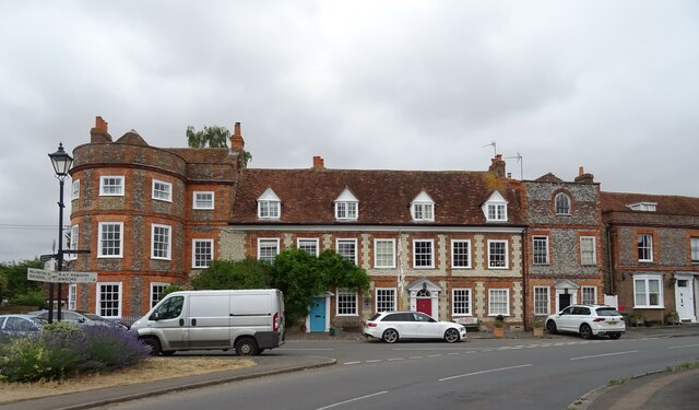
Berrick Salome is a small village with a population of around 200 residents. The village is predominantly rural, surrounded by farmland and beautiful countryside views. It is characterized by its picturesque landscapes, charming thatched cottages, and historic buildings.
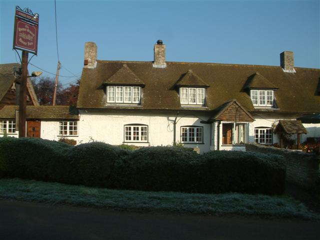
The village is known for its tight-knit community and friendly atmosphere. It has a local pub, The Chequers Inn, which serves as a social hub for residents and visitors alike. The pub offers a range of traditional pub food and beverages, making it a popular spot for locals to gather and enjoy a meal or a drink.
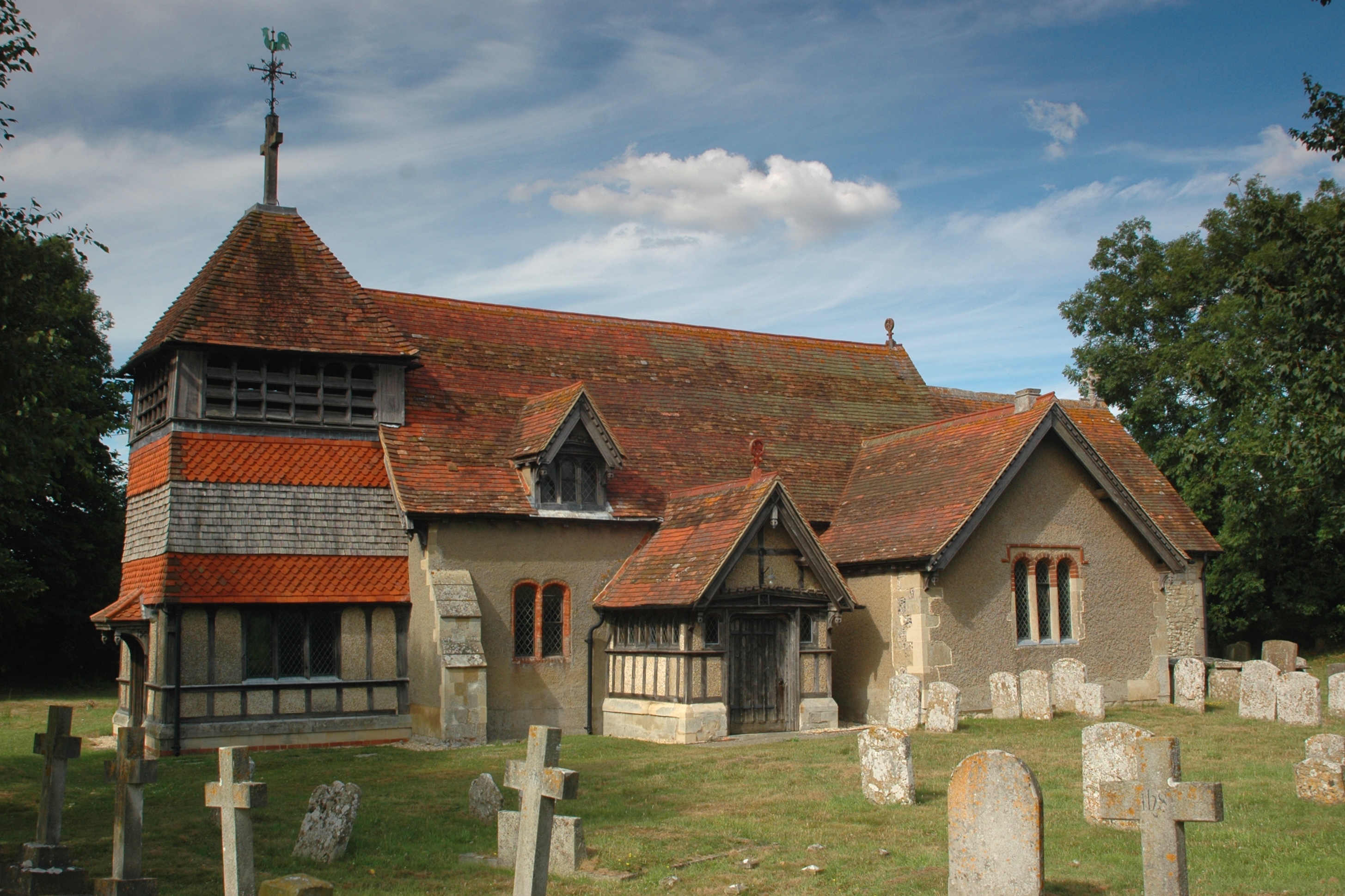
Berrick Salome is also home to the Church of Saint Helen, a Grade II* listed building dating back to the 12th century. The church is well-preserved and features a Norman tower and a beautifully maintained churchyard.
The surrounding area offers plenty of opportunities for outdoor activities, including walking, cycling, and horse riding. The nearby Chiltern Hills provide stunning views and a variety of trails for nature enthusiasts to explore.
Overall, Berrick Salome is a peaceful and idyllic village that offers a tranquil escape from the hustle and bustle of city life. Its rich history, natural beauty, and strong sense of community make it a desirable place to live or visit.
If you have any feedback on the listing, please let us know in the comments section below.
Berrick Salome Images
Images are sourced within 2km of 51.638322/-1.101646 or Grid Reference SU6293. Thanks to Geograph Open Source API. All images are credited.


Berrick Salome is located at Grid Ref: SU6293 (Lat: 51.638322, Lng: -1.101646)
Administrative County: Oxfordshire
District: South Oxfordshire
Police Authority: Thames Valley
What 3 Words
///vegans.aquatics.pans. Near Benson, Oxfordshire
Nearby Locations
Related Wikis
Roke
Roke is a hamlet in South Oxfordshire, about 3 miles (4.8 km) north of Wallingford. It has a sixteenth-century public house, the Home Sweet Home. It is...
Berrick Salome
Berrick Salome is a village and civil parish in South Oxfordshire, England, about 3 miles (5 km) north of Wallingford. Since the 1992 boundary changes...

Benson Veteran Cycle Museum
Benson Veteran Cycle Museum is a private museum of veteran cycles in the village of Benson near Wallingford in Oxfordshire, England.The museum has over...
Benson, Oxfordshire
Benson is a village and civil parish in South Oxfordshire, England. The 2011 Census gave the parish population as 4,754. It lies about a mile and a half...

Warborough
Warborough is a village and civil parish in South Oxfordshire, about 2.5 miles (4 km) north of Wallingford and about 9 miles (14 km) south of Oxford. The...
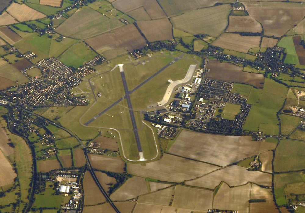
RAF Benson
Royal Air Force Benson or RAF Benson (IATA: BEX, ICAO: EGUB) is a Royal Air Force (RAF) station located at Benson, near Wallingford, in South Oxfordshire...
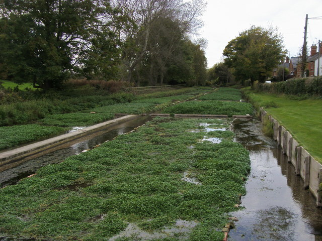
Ewelme Watercress Beds
Ewelme Watercress Beds is a 2.6-hectare (6.4-acre) Local Nature Reserve in Ewelme in Oxfordshire. It is owned and managed by the Chiltern Society.A stream...
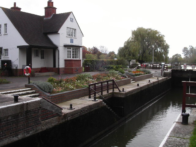
Benson Lock
Benson Lock is a lock on the River Thames in England, close to Benson, Oxfordshire but on the opposite bank of the river. The first pound lock here was...
Related Videos
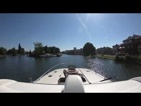
Le Boat Thames Holiday 2021
Heading down stream on the Thames on the Caprice 13 from Le Boat base in Benson Video starts upriver of Abingdon Lock and ...
Post holiday allotment
Allotment after 10 days absence. Did it survive? harvesting and planting potatoes for Christmas.

How to pack for a flying adventure around Norway...
Stop motion video of packing for a flying adventure around Norway. We managed to pack camping gear, clothes, food, maritime ...
May Bank Holiday on the allotment. Small tasks completed.
May Bank holiday small tasks completed on the allotment. Staking the trees, sowing salads and radishes in asparagus beds, first ...
Nearby Amenities
Located within 500m of 51.638322,-1.101646Have you been to Berrick Salome?
Leave your review of Berrick Salome below (or comments, questions and feedback).